
Sydney weather: Huge storm with rain, hail hits NSW
A mammoth supercell that’s struck NSW this afternoon has unleashed golf-ball sized hail in the state’s north west, clobbering towns like Tamworth and leaving locals stunned. SEE THE VIDEO
NSW
Don't miss out on the headlines from NSW. Followed categories will be added to My News.
A mammoth supercell that’s struck NSW this afternoon has unleashed golf-ball sized hail in the state’s north west, clobbering towns like Tamworth and leaving locals stunned.
Parts of the state are this evening expected to cop a battering of heavy rain, flash flooding and 90km/h winds just days after a huge storm struck earlier in the week.
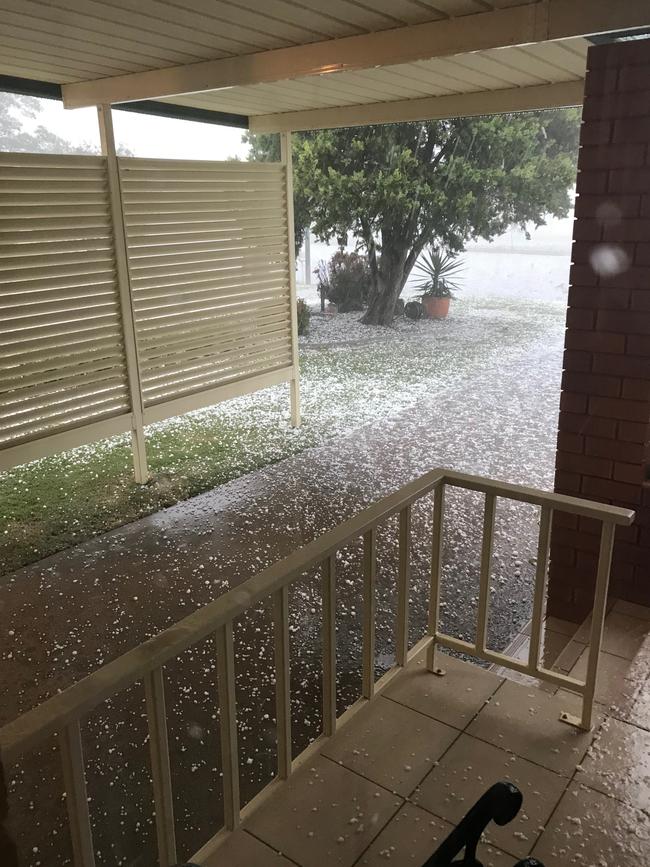
South Tamworth resident Gerda Fitzgibbon said the storm hit around 3pm and dumped 30mm of rain in her backyard in the space of 30 minutes.
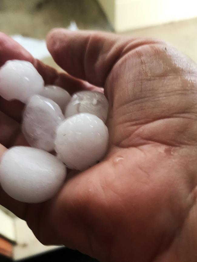
“It was unbelievable, the hailstones were the size of bonker marbles,” Mrs Fitzgibbon said.
“Everything is white - it’s like it has snowed hailstones.
“My house is leaking like a sieve, my gutters are overflowing and my skylight is leaking.
“I’m 71 and it has been a long time since I have seen rain like this.”
Mrs Fitzgibbon said that while the rain was welcome in the drought-ravaged region, it may be devastating for local farmers who are currently harvesting crops.
The NSW SES has responded to a number of calls in the Tamworth region already, including to a childcare centre and an aged care facility.
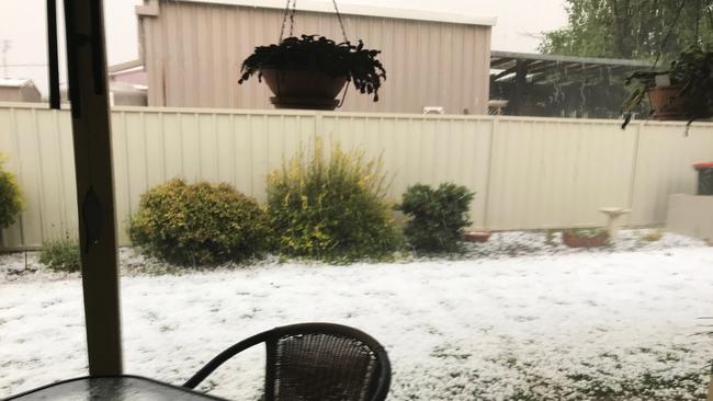
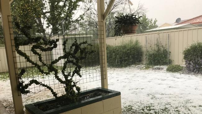
Ian Long filmed the hail hitting Tamworth which ended up blanketing the ground in white.
“When it swept through I was hoping our farmers’ crops would get through it,” he said.
“It was also a pain to the ears for a solid 5 minutes.
“Surprisingly (there was) no damage apart from stripped trees and it momentarily made the roads feel like you were driving on marbles.”
Bureau of Meteorology duty forecaster Aberar Shabran said the hail was widespread around the area.
“We have had large hail reports around the Tamworth and Gilgandra area, where we have seen 2cm plus sized hail, very large hail,” he said.
“Thunderstorms are continuing in most parts of the Northern and Central Tablelands, the Riverina and Mid North Coast, that will continue for much of the afternoon.
“In the last hour we have had a significant amount of rainfall in areas such as Nundle, which is an area prone to localised flash flooding.
“Most areas which will be hit by the heavy rainfall could also be affected by flash flooding.”
The storm is tracking along Lismore and down through Coonabarabran, Dubbo and Griffith.
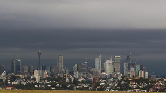
In Sydney, residents are expected to see milder conditions with a high chance of showers and the possibility of a mild storm in the west.
The wild weather is expected to subside towards the evening.
HAIL, FLOODING ON WAY AS SUPERSTROM TRACKS TOWARDS NSW
A supercell tipped to hit NSW this afternoon could unleash golf-ball sized hail, heavy rain, flash flooding and 90km/h winds just days after the state was battered by a huge storm.
The Bureau of Meteorology is set to issue a severe weather warning just after lunch as a thunderstorm barrels towards the state’s north east and the central tablelands.
Duty forecaster Aberar Shabran said the storm has the potential to be severe, with 2-5cm hailstones, torrential rain, gale-force winds and lightning.
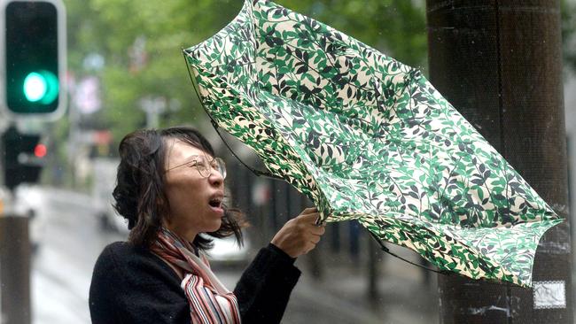
“We will get heavy, torrential rainfall in short, sharp bursts which could cause flash flooding as well as damaging winds,” he said.
In Sydney, residents are expected to see milder conditions with a high chance of showers and the possibility of a storm in the west.
MORE NEWS
‘It’s a furphy’: Former Lib leader alleges ACA aired false statements
‘We didn’t murder him’: Soldier denies ABC story
Australian Museum scraps entry fees for grand reopening
The cell is part of the same system which wreaked havoc across the state on Monday, sending mud flowing into homes and forcing commuters to evacuate from their cars due to flash flooding.
“There’s still a lot of moisture in the air and the inland trough helps lift the atmosphere which is a good recipe for thunderstorms,” duty forecaster Helen Reid said.
The huge storm sparked hundreds of calls for help to the State Emergency Services and resulted in a string of suburbs losing power.

Parts of the state received an absolute drenching on Monday as the storm swept through with Wallis Lake in the south coast recording 284mm of rain.
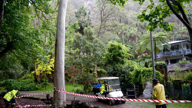
The downpour caused a landslide near Great Mackerel Beach in Sydney’s northern beaches, sending mud and debris into homes and prompting the evacuation of 25 people.
Residents are being told to brace for more severe storms in coming months as a La Nina is declared for this coming summer, meaning there is a high risk of heavy rainfall across the state.
Conditions are expected to remain wet and grey for the rest of the week before the mercury begins to rise on Saturday.

1000 jobs slashed at Transport for NSW
Nearly 1000 staff will be cut from Transport for NSW, in a move that sent shockwaves through the department on Wednesday morning. The RTBU warned the cuts would impact frontline services.

Liberals at odds over Latham co-operation
Mark Latham’s bad behaviour in parliament has exposed a rift in the Liberal Party, while Premier Chris Minns and other senior Labor figures are putting pressure on the Opposition to cut ties.