
Severe thunderstorm warning, flood alert for inland, southern NSW
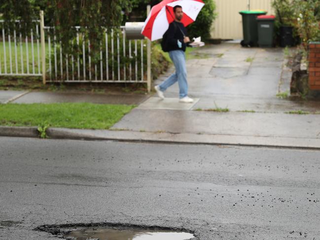
NSW is bracing for more flash flooding on Friday after record-breaking rain fell in the north of the state and the SES responded to more than 250 calls for help overnight.
NSW
Don't miss out on the headlines from NSW. Followed categories will be added to My News.
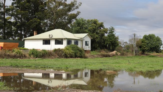
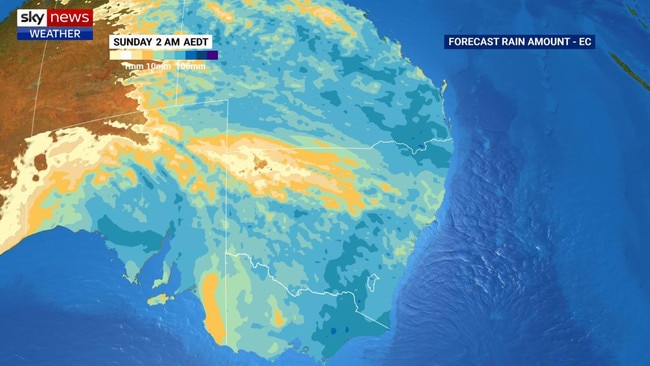
New flood warnings have been issued to towns across the state’s central west and south as the weather system which has battered the northern regions and Hunter moves down through NSW.
The Bureau of Meteorology issued floods warnings for the Lachlan River in the state’s central west shortly after midday on Friday, with moderate flooding deemed likely at Forbes, Cowra and Cottons Weir.
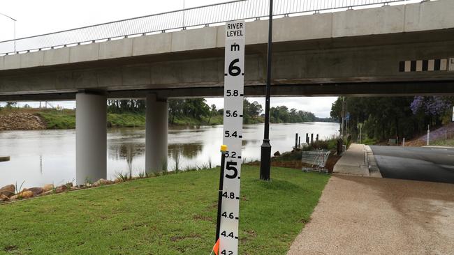
Communities along the Upper Murray River and Snowy River have also been placed on flood watch over the weekend, with a low pressure system moving into the area.
The central west town of Orange has recorded its wettest day this year – with 77.2mm of rain dumped on the town in the 24 hours leading up to 9am Friday.
The SES responded to more than 250 calls overnight as more than 100mm of rain was recorded in parts of the northern inland and coastal areas over the 24 hours to 9am Friday.
While the south of the state prepares to batten down the hatches, farmers in NSW’s north have breathed a sigh of relief after dodging more than 100mm of rain predicted on Thursday, with just 2.6mm falling in the 24 hours to 9am Friday.
It’s welcome news for farmers in the midst of harvest.
Rebecca Reardon has already had to stop harvesting on her farm south of Moree, with deluges this week making it impossible for heavy farm equipment to get onto paddocks.
She said dodging the forecast 100mm of rainfall means harvesting will be able to resume much sooner than expected.
#NSWWeather: A #wet and stormy night for many areas, rain is expected to gradually ease over the north this morning. In the south, severe thunderstorms âš¡ are active over parts of the inland.
— Bureau of Meteorology, New South Wales (@BOM_NSW) November 11, 2021
Warnings: https://t.co/rWnTuaiz5x pic.twitter.com/CM2wyNfhwp
“The rain wasn’t nearly as much as we thought it would be,” she said, while warning the delay could still prove costly.
“The 60-80mls we’ve got over the last week has pulled us up. The ground is extremely wet and our biggest problem is the grain will probably be ripe before we can even get on to the ground. We’ll probably have a go on Monday.”
However the Hunter and central west were lashed with rain overnight.
“Bunnan in the Hunter Region received 99mm over 24 hours to 9am Friday and Mount Palmer received 95mm,” Bureau of Meteorology duty forecaster Hugh McDowell said.
“Where it’s a bit more populated down the coast, Merewether had 88mm and Broadmeadow had 86mm.”
The SES this morning said it had conducted 10 flood rescues across the state in the past 24 hours, mostly around Singleton, Bathurst, Wellington and Moree.
“There have been 260 calls for help across NSW so far in the past day … mostly for sandbagging and roof leaks,” a SES spokesman said.
“At Georges Plain, 10km south of Bathurst, we’re evacuating a village of 15 homes.
“There’s 350 volunteers in the field today helping the community during this weather event.”


Revealed: Why Sydney homes are so cold
Why Sydney homes are dangerously cold has been revealed, as well as some surprising nations that have warmer homes than us.

Sussan Who? Embarrassing result for Libs leader
We took to the streets armed with photos of the Prime Minister and Opposition Leader, asking people to identify them. You’ll be shocked by the results.