
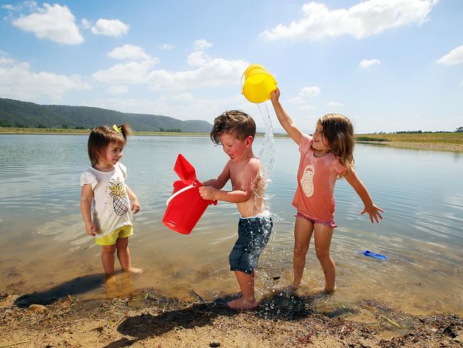
Public denied access to ‘secret beaches’ at Penrith Lakes due to flood danger rulings
IT was to be a jewel in the western Sydney landscape — a waterworld of lakes, beaches, parkland and thousands of homes created from a former quarry site. But public access to Penrith Lake is now in doubt.
NSW
Don't miss out on the headlines from NSW. Followed categories will be added to My News.
IT was to be a jewel in the western Sydney landscape, a waterworld of lakes, beaches, and parkland — and thousands of homes — created from a former quarry site.
But public access to Penrith Lake, is in doubt with the landowner refusing to hand over the site to the State government as they are locked in a stalemate over flood danger rulings.
Under a 1987 agreement struck with the then Labor State government, the Penrith Lakes Development Corporation would rehabilitate and develop the almost 2000ha former quarry.
The cost of creating lakes, beaches and parks would be recouped by one quarter of the land set aside for a new suburb with up to 5000 homes, a school, shops and tourism and water-sport businesses.
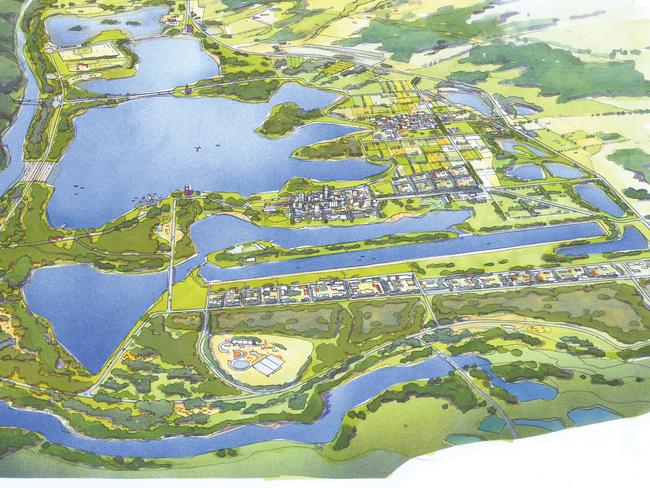

Artist impressions depict homes lining idyllic tree-lined streets, with beaches, lakes, wetlands and water-based recreational zones.
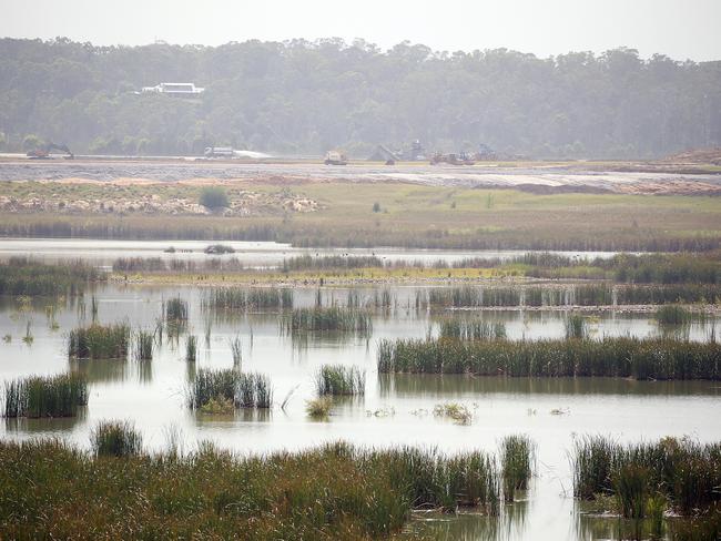
The last quarry truck left the site three years ago, and the Penrith Lakes Development Corporation ramped up its rehabilitation works, spending more than $1 billion infilling the proposed urban development area, creating six beaches, 10km of walking trails, a 290ha wildlife refuge and planting more than 170,000 trees.
Penrith MP Stuart Ayres dubbed the site “a jewel in the Crown” for western Sydney where there would be homes “as far as the eye can see”.
MORE: Wildlife return to ongoing rehabilitated Penrith Lakes
MORE: Penrith Lakes scheme won’t come at a cost of Nepean River
But The Hawkesbury-Nepean Flood Risk Management Taskforce has ruled there was “no ability” for intensive urban development because of evacuation concerns for any residents in a flood.
The Corporation is now refusing to hand over the site to the state government after development planning controls were changed.
It argues its remedial work has mitigated the risk, with five access bridges, four major weirs and a regional road providing flood evacuation capability for residents.
An environmental consultants report commissioned by the Corporation found the site posed less of a threat to life than the neighbouring established suburbs of Richmond, Windsor and Bligh Park.
Corporation chairman Keith Carew said the agreement was for the ownership of all the lakes, beaches and flood infrastructure to be transferred to the Government for public benefit on the condition a portion of the site was zoned for residential development.
FAMILY LEFT ‘HOMELESS’ AS LAKES DREAM PROPERTY IS REZONED
He said land levels in the proposed residential area had been built up with millions of tonnes of sandstone to heights specified in State government legislation, with people able to walk to higher ground “in the worst case event”.
Mr Carew said hydrology experts had confirmed there was no danger to anyone living in the scheme, except in a catastrophic flood event.
“We have an agreement with the NSW Government. A binding Deed of Agreement,” he said.
“Our responsibility was to build this vast scheme of lakes, beaches, bushland, wetlands and wildlife sanctuaries, over 30 years. This has cost in excess of a $1 billion.
“Now the government is suggesting it cannot accept future residential development within the Scheme. The issue of flood evacuation is in our view untested.”
He said the Corporation had suggested the government set up an independent team of experts to “review the science and evidence”.
Planning Minister Anthony Roberts said the planning control changes still allowed for more than 80 hectares of urban zonings for “new tourism and employment land”.
He said Infrastructure NSW, the State Emergency Service and Roads and Maritime Services had also identified the risk to life in a flood.
“These floods could see depths of at least six metres for more than two weeks and can’t be managed by simply filling the floodplain,” he said.
Mr Roberts said there had been regular discussions with the Corporation on how to resolve the issue, “but have found difficulties in making the severity of the flooding issue understood by the quarrying company”.

Meet the six men fighting to fill Karen Webb’s shoes as top cop
Who will replace Karen Webb? The NSW Police chief race is heating up, with six contenders vying to become the most powerful police officer in the state. See who they are.

‘It’s banana bread!’: Mobile phone fine excuses hard to swallow
The banana bread and Kit Kat defence are among the bizarre excuses NSW drivers are using to fight mobile phone camera fines in the courts.