
NSW bushfires: Weather warning as temperatures set to hit 43C
Temperatures are forecast to reach 43C on Tuesday in parts of Sydney where fires are already burning, with renewed calls for residents to prepare their homes. SEE WHERE NSW RESIDENTS NEED TO BE ALERT
NSW
Don't miss out on the headlines from NSW. Followed categories will be added to My News.
- ‘Super lucky’: Southerly saves homes at last minute
- Homes lost, fireys injured as bushfires rage across NSW
- Cancer-stricken firefighter left speechless after donations
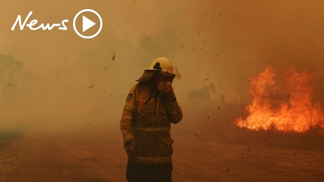
Temperatures are forecast to reach 43C on Tuesday in parts of Sydney where fires are already burning, with renewed calls for residents to prepare their homes.
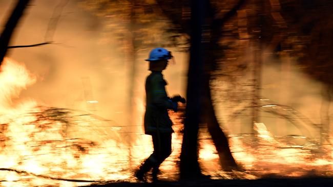
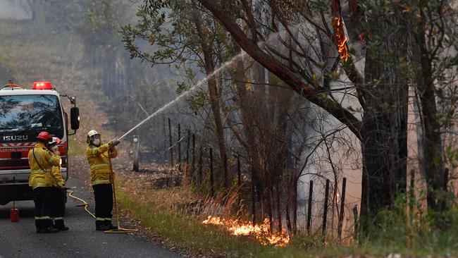
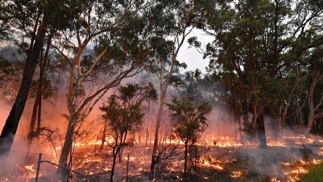
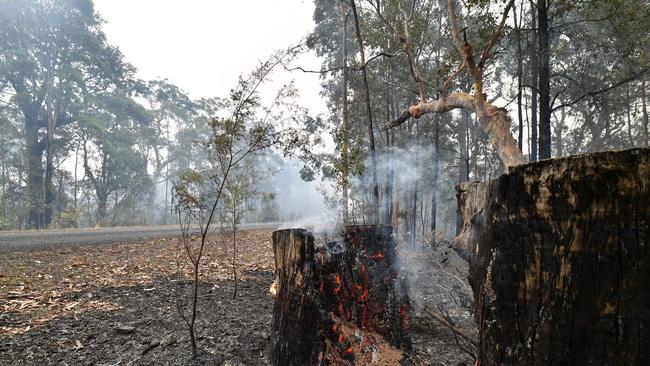
More than 1700 firefighters were on Sunday battling 88 blazes — including six listed as Watch and Act fires that covered more than half a million hectares alone.
The Daily Telegraph is today publishing a list of suburbs and localities where homeowners should be particularly vigilant of blazes in their areas and take steps to prepare their properties.
The fires, named after localities where they began, are now often hundreds of kilometres from their ignition point, creating confusion for some residents in their path who are unlikely to recognise the fires by name.
AREAS ON ALERT
The biggest fire, the Gospers Mountain blaze, is named after a little-known area of the Wollemi National Park which is inaccessible by road.
Despite the name of the fire, it now burns hundreds of kilometres away from its original start point, prompting warnings to communities to remain vigilant and engage with local alert services.
Residents in the Glen Alice, Wolgan Valley, Olinda Valley, Lower Portland, Boree, Wallabadah, Mountain Lagoon, Upper Macdonald, Perrys Crossing, Fernances, Mogo Creek, Blaxlands Ridge East, East Kurrajong and Colo areas have been advised by the NSW RFS to “monitor conditions” and “prepare to take action in case conditions change”.
The Three Mile fire is burning on the Central Coast, and is affecting the areas of Lower Macdonald, Central Macdonald, Lower Mangrove, Greengrove, Mangrove Creek, Mangrove Mountain Central Mangrove, Kulnura, Gunderman, Spencer, Peats Ridge, Calga, Mount White and Glenworth Valley, Bucketty, St Albans, Mogo Creek and Higher Macdonald.
The Currowan fire, burning north of Bateman’s Bay, is affecting the areas of
Mongarlowe, Charleys Forest, Kioloa, Bawley Point, Pretty Beach, Pebbly Beach, Depot Beach, Durras North, South Durras, Termeil, Flat Rock, North Batemans Bay, Long Beach, Surfside, Maloneys Beach and Nelligen.
West of the Currowan fire is the North Black Range, Palerang blaze. Be on alert if you live near Warri, Manar, Braidwood, Bombay, Little Bombay, Mount Elrington, Farringdon, Wallaces Gap, Jembaicumbene Creek, Bendoura, Majors Creek, Reidsdale, Hoskinstown/Rossi, Forbes Creek, Mongarlowe and Buttmaroo.
NSW RFS spokesman Greg Allan said fires were named after their starting location, and the names were used to keep track of a continued blaze, changing only if multiple fires merge.
The Paddock Run fire burning in the vicinity of Putty is named after a location which does not come up in Google Maps.
The Kerry Ridge fire near Musswellbrook is also tied to a locality not easily available in online maps.
The Crown Mountain fire near Glenn Innes is named for another inaccessible, little known landmark on the edge of Guy Fawkes River National Park.
“Not all times will a fire be named after a suburb, town or road so it’s very important people stay up to date with the web, radio or other media,” Mr Allan said.
He said families in bushfire-prone areas, which can be found on local council websites, needed to have a serious conversation about what they would do in the event of an emergency.
“Things like, will a fire affect you on a weekend when the kids are at sport, or a parent is down at Bunnings, what is the plan,” he said.
“If you can’t make one of the information meetings organised by local brigades you can call your nearby fire control centre, or access resources online.”

Tuesday is looming as a major threat, Mr Allan said, with a combination of high temperatures and westerly winds with a potential southerly change, meaning new fires could start and spread.
“The forecast for that southerly change means any fires currently burning would change direction, which is when conditions become very dangerous because you have that large fire front,” he said.
“Hopefully Monday’s conditions will be similar to the weekend and enable crews to strengthen containment lines before the change.”
More than 577 vehicles and about 100 aircraft were being used to fight fires on the weekend, with more to come if the conditions worsen.
The massive Gospers Mountain blaze is a worry for Hawkesbury City Council mayor Barry Calvert, who said the area had recently welcomed volunteer firefighters from Canada.
“I’m concerned about the conditions on Tuesday, but I know we’re doing everything we can,” he said.
“In Richmond they’re expecting temperatures of about 43C and the wind will be coming from the west or northwest toward Blaxlands Ridge and East Kurrajong, where there are a lot of properties to defend.”
Nearby Wollondilly Council mayor Matthew Deeth said social media had been an “amazing tool” to alert residents impacted by the Green Wattle Creek fire.
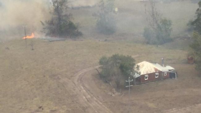
The Green Wattle Creek fire has destroyed property on the outskirts of Sydney around Lake Burragorang.
It is named after a little-known, inaccessible watercourse which feeds the lake.
“There have been a number of properties that have been impacted with damage. We know that the risk of fire is still there and we’re particularly grateful to the Rural Fire Service,” Mr Deeth said.
“It’s quite amazing the role social media has played in ensuring critical information gets to people immediately.”
Farmer Stephen Grima, 23, from The Oaks, said that it had been a “nerve-racking” few days.
“We’ve been watching our mates put out fires and it has just gotten closer and closer to our place,” he said.
“We will stay and protect the house if the fire does get too close. If they lose the house they’ve got nothing.”
FIREYS ALL ON SONG AS THEY SAVE SLIM’S PLACE
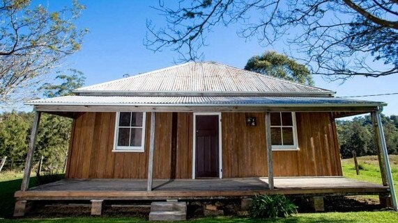
The house where Aussie country music legend Slim Dusty grew up came within metres of bushfires as crews fought desperately to save the iconic landmark.
NSW Rural Fire Service, Fire and Rescue NSW and the state’s national parks team worked together to protect properties near the Kempsey-Armidale Rd as the Carrai East blaze burned out of control on the weekend.
Dusty’s childhood house, known as “Homewood Farm” at Nulla Nulla 50km west of Kempsey was among several properties in the line of fire.
A firebreak was created around the cottage using heavy machinery in an effort to protect the popular tourist attraction, often referred to as the birthplace of Australian country music.
The heritage-listed house is where Dusty wrote songs such as “When the Rain Tumbles Down in July” during the Macleay Valley floods of 1945.
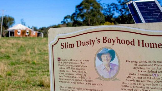
Nearby Kempsey is the home of the Slim Dusty Museum.
The Carrai East fire broke its containment lines on Friday and was escalated to an Emergency Warning level but has since been downgraded to Advice status.
It remained out of control on Sunday night having burned through more than 139,000 hectares.
BOATIES TO THE RESCUE TO RELIEVE ISOLATED TOWNS
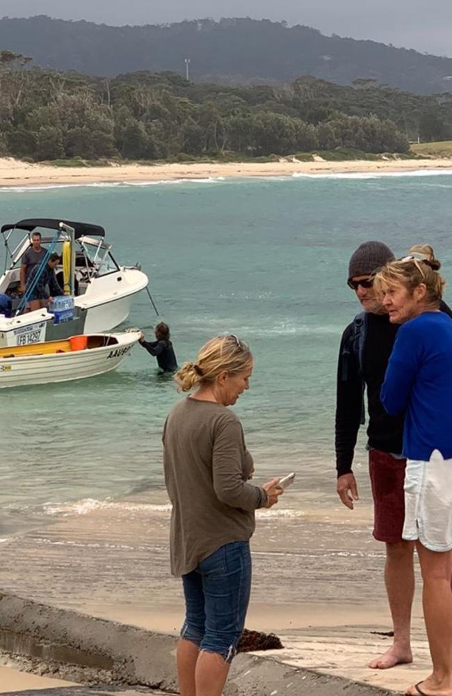
Residents on the South Coast risked rough seas to ferry food and critical medicines into towns cut off for days by raging fires.
The small coastal communities of Bawley Point and Kioloa resorted to using small private boats to make trips to Ulladulla to get scripts filled and collect food for the volunteer firefighters and other residents.
The Currowan fire was yesterday burning out of control across more than 77,800ha, closing roads and temporarily preventing the transport of diesel fuel used for water pumps into Termeil.
The fires burned north, mainly to the west of the Princes Hwy, which was closed between Burrill Lake and the Kings Hwy turn-off.
Bawley Point local Liza Butler helped organise the boating ventures to collect supplies after volunteering to help out at the fire station while firefighters were off battling the blaze.
“We were really struggling to get things through on the highway, so we ended up making at least one boat trip a day all week,” she said.
“I set it up so people that needed a prescription filled could drop it off at the fire station in the morning.”
Ms Butler said a core group of about eight residents have co-ordinated meals, welfare check-ups on neighbours and other support for those who needed it.
“Thursday when it was extremely bad we were organising eye drops, throat lozenges and Hydralight for the fire crews,” she said.