
NSW winter 2020: Cold front brings snow and sudden chill as temperatures drop
It was an icy start to winter on Monday but the second day of June is continuing to bring snow and freezing temperatures across the state, with some parts experiencing a good snowfall. SEE THE PICTURES AND WEEK’S FORECAST

NSW
Don't miss out on the headlines from NSW. Followed categories will be added to My News.
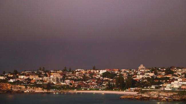
Sydney shivered through an icy start to winter on Monday, but the second day of June continued to bring freezing temperatures with parts of the state experiencing good snowfall as the cold front passed.
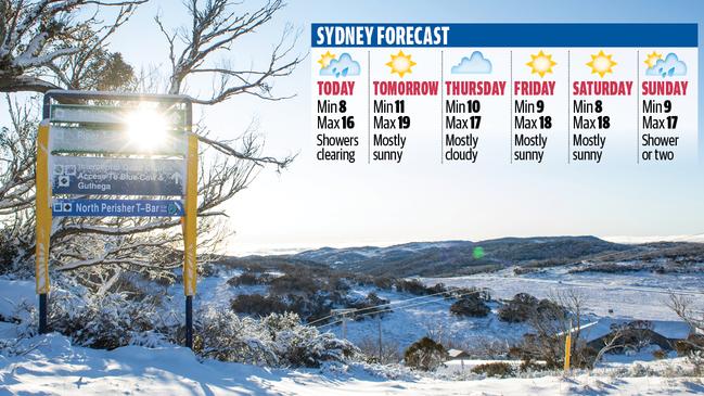
Temperatures struggled to get above 10C across Sydney on Tuesday and the Bureau of Meteorology has forecast temperatures to stay cooler until the end of the week.

MORE NEWS:
Date set: Gyms, dance studios to reopen this month
RBA rates on hold: Best time to fix your home loan
BOM spokesman Alex Majchrowski said Sydney should stay relatively dry for the rest of the week.
“We had a strong cold front move through (Monday) with significant cold air which has led to those lower temperatures stick around and those minimum temperatures are expected to stay for the next few days,” he said.
“Although we should see a return to average temperatures towards the end of the week.”

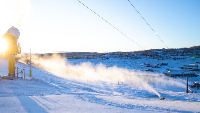
The Snowy Mountains had already seen snow by Tuesday morning, the BOM said, while Moss Vale got a dose of sleet with snowfall expected for other areas of the state, including Cabaramurra and Orange, overnight.
“We did get snow in places like Thredbo and a touch in the Northern Tablelands and Armidale, but it disappeared pretty quickly and it was more of a flurry in the morning,” Mr Majchrowski.
Such falls would normally herald a strong start to the official opening of the ski season during the first weekend in June.
But the coronavirus pandemic has stalled the opening, although major sites including Perisher in NSW and Mt Buller in Victoria are working towards opening before the end of June.
The BOM warns that once the windy and cloudy conditions ease, the state’s inland areas will experience some frost later in the week.
“Across the state we saw widespread minimum temperatures … especially in coastal areas as a result of the cold front moving up the coast, Mr Majchrowski said.
The BOM has also issued a warning to sheep graziers that cold temperatures, westerly winds and possible showers Tuesday and overnight could be fatal to livestock exposed to the conditions.
Areas likely to be affected include the Northern Tablelands, Central Tablelands, Southern Tablelands, South West Slopes, Snowy Mountains, Australian Capital Territory, Mid North Coast, Hunter, Illawarra, North West Slopes and Plains, Central West Slopes and Plains and Riverina forecast districts.