
NSW facing the most torrential downpour since the late 1990s
Flood warnings have been issued for NSW, with hundreds of millimetres of rain expected to fall in coming days, as an east coast low brings one of the most torrential downpours the state has seen in decades.
NSW
Don't miss out on the headlines from NSW. Followed categories will be added to My News.
Hundreds of millimetres of rain is set to lash Sydney and the surrounding regions, with NSW facing the most torrential downpour since the late 1990s.
Flash flooding, monster waves and high winds are expected to batter the state over the weekend as emergency services brace for the worst.
The Bureau of Meteorology said about 100mm of rain is expected across parts of the state on Saturday — and double that could fall on Sunday — because of an east coast low.
“The rainfall will be variable but hundreds of millimetres. It’s not something we see that often,” BOM acting NSW state manager Jane Golding.
“The multi-day rainfall from this event looks like much more than what we had during the June 2016 east coast low which was our last significant east coast low.
“Potentially we haven’t seen anything like this since the late 1990s.”
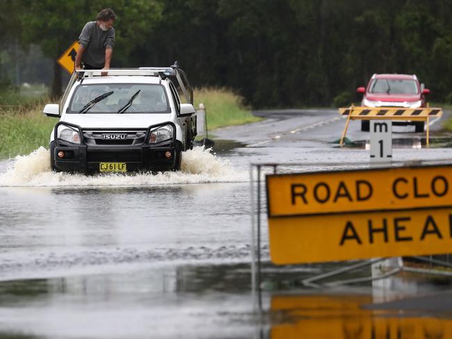
The deluge is likely to cause significant overland flooding, flash flooding of creeks and rivers and landslips along the Illawarra escarpment and southern and central NSW where fires have burned out much of the landscape.
Severe thunderstorm warnings are also in place for the North West Slopes and Plains, Northern Tablelands and parts of the Hunter, Central Tablelands, Central West Slopes and Plains and Upper Western.
Severe Weather Update: widespread heavy rain & flood risk along the east coast. Video current 2 pm AEDT 8 February 2020.
— Bureau of Meteorology, Australia (@BOM_au) February 8, 2020
For the latest forecasts & warnings visit https://t.co/Qs1ZcX4YTb; follow advice from emergency services @NSWSES @QldFES #NSWfloods #Qldweather pic.twitter.com/pV1ormV9hS
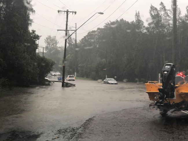
Parts of the state already received more than 200mm of rain on Friday and falls of 100mm-plus are expected today with rain expected to intensify over the next 24-36 hours.
The NSW SES have rescued 13 carloads of people, mostly motorists driving into floodwaters, after rain battered the Central Coast on Friday night.
Rain bucketed the region, with Mt Elliot receiving 184mm, Toukley 159mm, Kangy Angy 140mm and Wyong 125mm from 9pm Friday to 4am Saturday.

READ MORE
Heavy rain forces Sydney A-League derby cancellation
Relief as torrential rain starts to douse fires
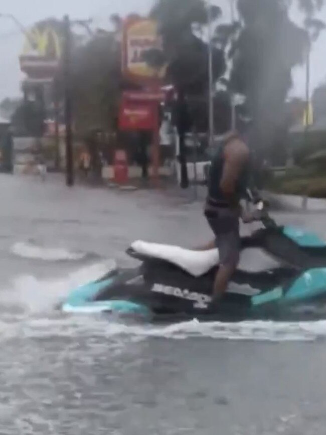
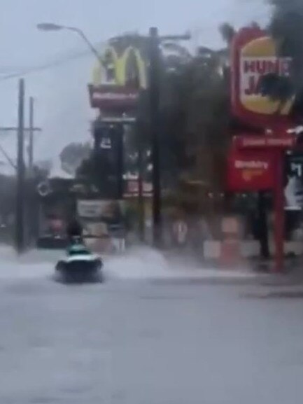
A video posted online of a man driving his jetski past a McDonald’s down a flooded street in Tuggerah on the Central Coast drew strong condemnation from NSW Police Minister David Elliott, who labelled the driver a “boofhead” and asked police to investigate.
“I would implore the community, motorists and anybody else who seems to think risking their own lives is something that is funny or could be made entertainment, it’s just not on,” he said.
“We have emergency services deployed during a difficult job under difficult circumstances, and for them to have to divert their resources … it’s just not good enough,” Mr Elliott said.
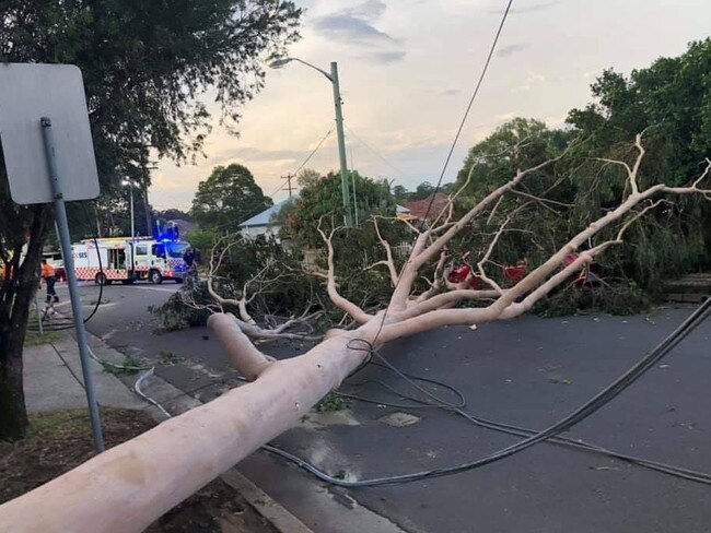
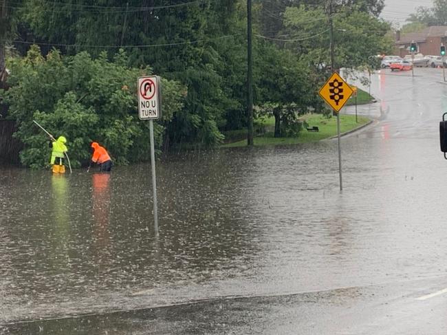
The SES has more than 600 volunteers on the ground preparing for flash flooding with a severe weather warning current from Coffs Harbour in the north to Moruya in the south.
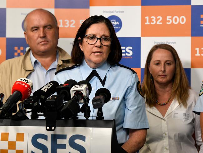
NSW SES Commissioner Carlene York said the SES had received numerous calls for assistance including from the Sydney and Blue Mountains area in the past four days.
“These jobs range from impact on homes and businesses, fallen trees across major roads and lifesaving flood rescues,” she said.
With weather expected to worsen, high tides and heavy rain will bring additional risks, she said, with the Yarramundi, North Windsor and Richmond bridges likely to become inaccessible in coming days.
Flood warnings have also been issued for the Hawkesbury- Nepean catchment.
“We are asking for communities to work with us. Again, a lot of sandbagging has taken place and a lot of preventive work, but we are looking at underlying areas being impacted tomorrow in the south of the Blue Mountains.

Ferries and road could be affected and people should stay up to date via livetraffic.com and the SES website and be prepared to adjust travel arrangements over the coming days.
“Depending on what happens on Sunday, it could impact your travel on Monday when it will return to work and school.”
The low is expected to bring damaging winds of more than 90km/h and abnormally high tides along the coastal fringe between Ulladulla and Forster later today.
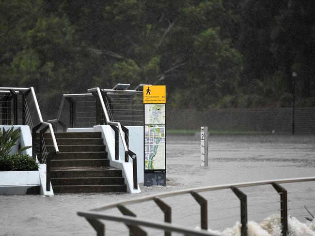
The Bureau of Meteorology is warning of flooding on the Central Coast, greater Sydney and Illawarra regions, Central Tablelands and Blue Mountains.
A Severe #Thunderstorm Warning issued for heavy rainfall for the Northern Rivers, North West Slopes and Plains, Northern Tablelands and parts of Central West Slopes and Plains and Upper Western. Full warning: https://t.co/ufIHzpphLQ #SES StormSafe info: https://t.co/kXBIXWStiz pic.twitter.com/JjMTJpjMnO
— Bureau of Meteorology, New South Wales (@BOM_NSW) February 8, 2020
Heavy rain and flash flooding is also expected in the mid-north coast and lower Hunter regions including in the fire-ravaged south coast from late Saturday.
Ms Golding said the system was expected to intensify this afternoon and tomorrow.
“It will be variable, but in general terms, up to 200mm today and 1.5 or two times more than that tomorrow,” she said. “It isn’t something we see that often.”
The Bureau warned that the burned out landscape and loss of vegetation across affected areas had left it vulnerable to landslips.
“There is an elevated risk for things like landslips occurring,” Ms Golding said.
“There is also a lot of debris around at the moment because of the fires and that tends to get washed into creeks.
“It’s a hazard either by flying down the creeks into the rivers but we also think there will be points where it will get blocked and then at some point the energy of the water will push it down the stream and exacerbate the risk of flash flooding.”
The BOM has warnings in place for the Brunswick, upper Nepean, Orara, Moruya, Clyde and Colo rivers, Wollembi Creek, Tuggerah Lake and St Georges Basin, with moderate to major flooding expected.
Strong winds were also forecast, with waves of between five to six metres set to batter the coast between Batemans Bay and the Central Coast. After being ravaged by recent fires, the state’s south coast is now set to be lashed by heavy rain from late Saturday.