
NSW weather: Severe thunderstorm warning as Lismore, Bowral flooded
Storms continue to move across central and eastern NSW with heavy rain causing severe flooding in Lismore and Bowral.
NSW
Don't miss out on the headlines from NSW. Followed categories will be added to My News.
Severe thunderstorms continue to threaten central and eastern NSW with severe flooding affecting Lismore and Bowral.
A severe thunderstorm warning from the Bureau of Meteorology for heavy and locally intense rainfall and flash flooding remains current for many regions in NSW as storms rage across the state.
The south coast and Northern Rivers are expected to see the highest falls, with 80mm recorded at Moss Vale between 4:30pm to 7pm, and 49mm recorded at Rockly in 1hr to 6pm.
It comes as the rain refused to let up in the Northern Rivers, with 217mm at Tuckurimba, 199mm at Lismore, 177mm in Kunghur, 143mm at Tuncester, 129mm at Bodalla and 103mm in Goolmangar the highest rainfalls recorded between 9am and 5pm on Wednesday.
Authorities are warning residents in Newcastle, Gosford, Sydney, Wollongong, Armidale, Orange, Canberra, Goulburn, Tamworth, Moree, Dubbo and Wagga Wagga to brace for the worst of the weather.
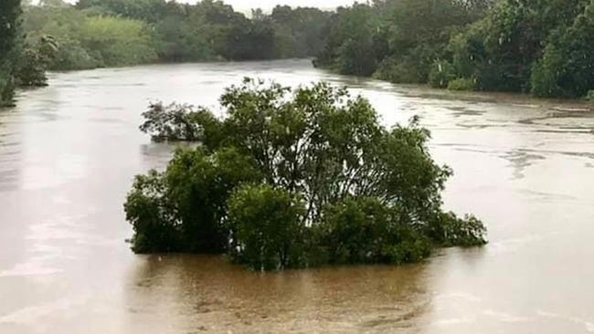
Floodwaters are rising at Coutts Crossing with a warning for major flooding and a moderate warning is in place for the Tweed River with minor flooding expected at Murwillumbah.
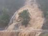
Lismore recorded more than 200mm from 9am on Wednesday with over 90mm of rain in the hours before sunset but images taken on Wednesday reveal the town’s CBD was already underwater.
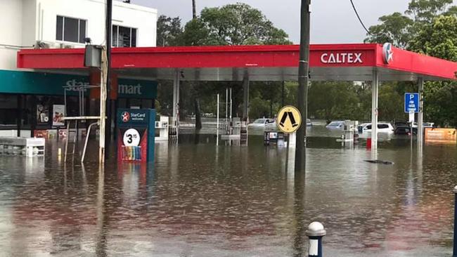
Pictures obtained by The Daily Telegraph show a Caltex at Lismore Airport with water nearing the petrol nozzles and the tops of cars after the nearby Wilsons River broke its banks during the unrelenting rainfall.
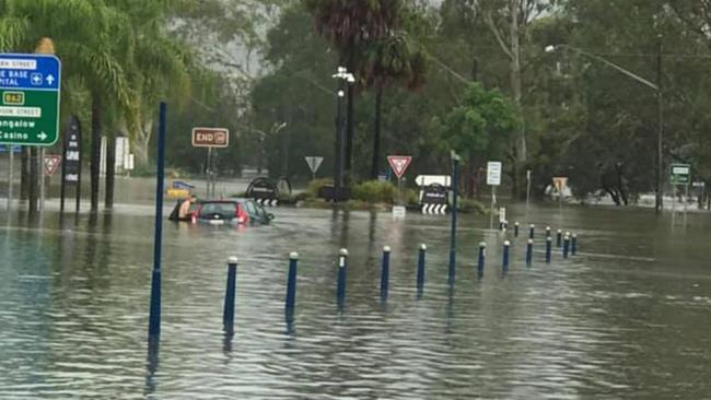
A pedestrian crossing is all but lost beneath the current at a roundabout in the town, with water levels almost completely submerging a black hatchback nearby.
âš ï¸SEVERE WEATHER WARNING UPDATEâš ï¸ For HEAVY RAINFALL that may lead to FLASH FLOODING for the South Coast and Northern Rivers districts. 92mm of rainfall recorded at Lismore in the 2 hours to 1:15pm.
— Bureau of Meteorology, New South Wales (@BOM_NSW) December 16, 2020
âš ï¸Warnings: https://t.co/LuNlylglBB#ifitsfloodedforgetit pic.twitter.com/BNlOGNCNjm
It comes as Lismore’s water levels along the Wilsons River peaked at 6.8m at 8:00pm Wednesday.
Bowral in the Southern Highlands also saw waters rising, with Mittagong Creek bursting its banks and flooding nearby Rose St and Mittagong Rd late on Wednesday evening.
SES crews were onsite as the creek levels rose and saw cars become trapped in floodwaters nearby.
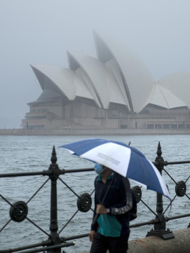
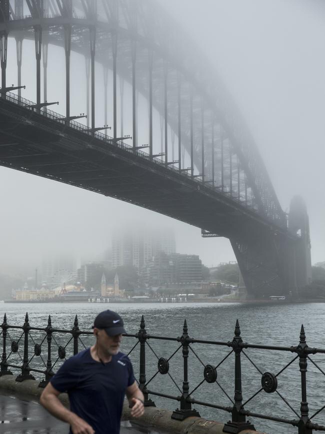
Bureau of Meteorology forecaster Stephen Stefano said that in Sydney – which was on alert for severe thunderstorms – might receive as much as 100mm of rain.
“We can’t rule out 100mm of rain in Sydney,” he said.
“We may see 25mm or 50mm.
“And there is also a slight risk of up to a 100mm this afternoon because of the conditions, but it’s probably more likely to be several millimetres.”
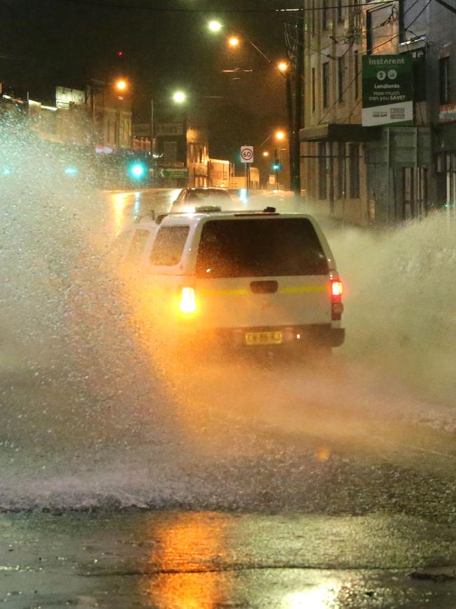
The wild weather has also promoted the closure of many busy roadways across the state.
In Lismore, Dawson Street is closed in both directions between Magellan Street and Leycester Street. Motorists are advised to use the Bruxner Highway, Richmond Hill Road and Bangalow Road instead.
Waterfall Way remains closed in both directions between Boggy Creek Road at Bellingen and Maynards Plains Road at Dorrigo Mountain.
The road is currently open between Raleigh and Bellingen. Motorists who need to travel between the Pacific Highway and the New England Highway can use the Gwydir Highway or the Oxley Highway instead.
And Tweed Valley Way remains closed in both directions between Cudgen Road at Stotts Creek and Riverside Drive at Tumbulgum.
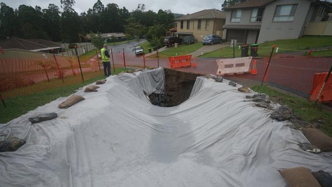
Elsewhere across the state a giant sinkhole has opened up on a suburban street in Coffs Harbour, as a severe warning for heavy rainfall and abnormally high tides is issued for Northern NSW residents.
Coffs Harbour City Council said a pipe under the pathway collapsed from the weight of the sodden soil.
It comes as intense weather continues to batter the east coast for the sixth day, with rainfall rates expected to ease slightly today as the trough weakens and extends south.
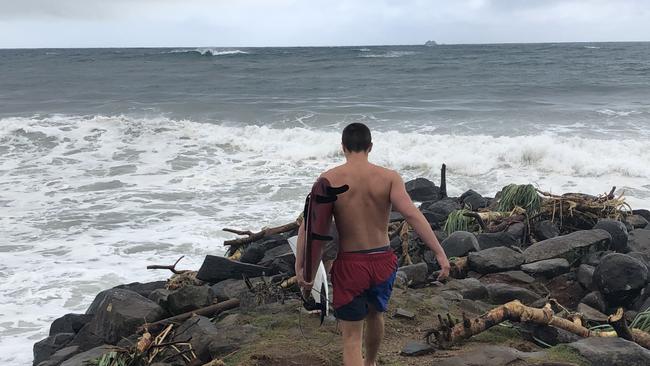
The Bureau of Meteorology kept severe weather warnings in place today for the Northern Rivers, Mid North Coast and Northern Tablelands in place as heavy rain, abnormally high tides and hazardous surf continue.
Authorities say the conditions have not been seen since Cyclone Debbie in 2017.
In Queensland, Bribie Island could be one storm away from being torn apart, after a week of cyclonic weather accelerated a decade-long erosion problem.
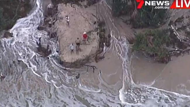
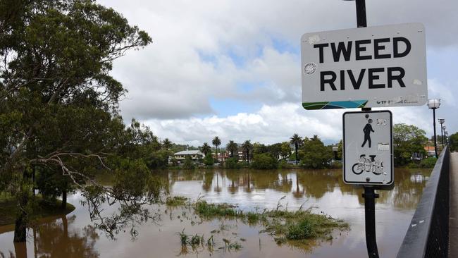
In NSW, an evacuation order is in place for Condong, Tumbulgum, Tygalah and surrounding areas along the Tweed River.
The SES says it’s the final flood warning for the Tweed, with waters likely to begin receding today allowing for a clearer picture of the damage below.
A series of minor flood warnings have been issued for other rivers in the region, which is threatening thousands of homes.
Minor flooding has already been seen at Bellingen while flooding is expected on the McLeay River at Kempsey.
The rain system is then due to head south towards Sydney.

BOM meteorologist Shuang Wang said despite the low pressure system causing chaos moving south and “weakening” with milder 30km/h winds, ongoing rain, flooding and erosion was to be expected.
She said residents should brace for further wet conditions over the next three days.
“The low pressure system is tracking south and further inland, where it is weakening around the Mid North Coast … but there have still been very heavy falls,” Ms Wang said.
“Wednesday to Friday, we will see more rainfall, potentially up to 100mm, and possibly severe thunderstorms.”
The SES received 400 calls for help from locals since midnight on Monday mostly concerning leaking roofs and fallen trees, according to a spokesman, who said the organisation had received 1400 calls since the bad weather started last Thursday.
The state’s north has been belted with near record-breaking rain since Sunday with the highest falls including Limpinwood with 547mm, Bellingen recording 533mm, Doon Doon copping 522mm and Boat Harbour seeing 516mm in the past three days.
Flood warnings remain in place on Wednesday for river systems in the Mid North Coast and Northern Rivers regions, including moderate to major flooding for the Bellinger and Kalang Rivers and moderate warnings for the Orara, Nambucca and Wilsons Rivers.
Minor to moderate warnings are in place for the Tweed, Richmond, Clarence, Macleay, Hastings, Manning and Gloucester rivers.
Current Flood Warnings for Wednesday:
Bellinger River: Moderate to major
Kalang River: Moderate to major
Orara River: Moderate
Nambucca River: Moderate
Wilsons River: Moderate
Tweed River: Minor to moderate
Hastings River: Minor
Richmond River: Minor
Clarence River: Minor
Macleay River: Minor
Manning and Gloucester Rivers: Minor
More Coverage

Read related topics:Lismore weather
Join the conversation

Disgraced MP Gareth Ward walks off jail time worries
Convicted NSW MP Gareth Ward has spent what could be one of his last days of freedom walking to Kings Cross police station where he is required to check in daily as part of his bail conditions.
Read more

War games: Signal fired straight to Beijing
The United States is “actively designing” its army to confront China, with President Trump’s top army official declaring a new long-range missile test in the Northern Territory sends a clear message of deterrence.
Read more