
NSW weather: Sydney rainfall to worsen on the weekend
Commuters are being warned of significant delays on Sydney’s public transport network this afternoon with intense rainfall forecast. Live updates.

NSW
Don't miss out on the headlines from NSW. Followed categories will be added to My News.
Transport for NSW are warning commuters to expect significant delays to Sydney’s public transport network on Friday afternoon, as floodwaters rise in northern parts of the state.
The Bureau of Meteorology is predicting “intense rainfall which may lead to dangerous and life-threatening flash flooding” for the mid north coast and parts of the Hunter.
There are already widespread delays and cancellations across the train, bus, light rail and ferry network with a “rain bomb” predicted to hit Sydney over the next 24 hours and cause more delays.
Emergency services are bracing for more wild weather later on Friday and Saturday.
It comes after an evacuation warning was issued for low-lying areas on the NSW mid north coast as “life-threatening” weather conditions continue to hammer the coast.
The NSW State Emergency Service has issued an alert, urging residents to prepare for flooding in Macksville’s north with an evacuation order possible.
Residents on the NSW east coast have been told to prepare for an absolute downpour on Friday and Saturday, particularly on the mid-north coast over the weekend, with several weather warnings in place as a low-pressure system embedded in a trough deepens off the coast.
The trough is expected to move south toward Sydney with 50mm expected on Friday before it dumps up to 120mm on the capital on Saturday.
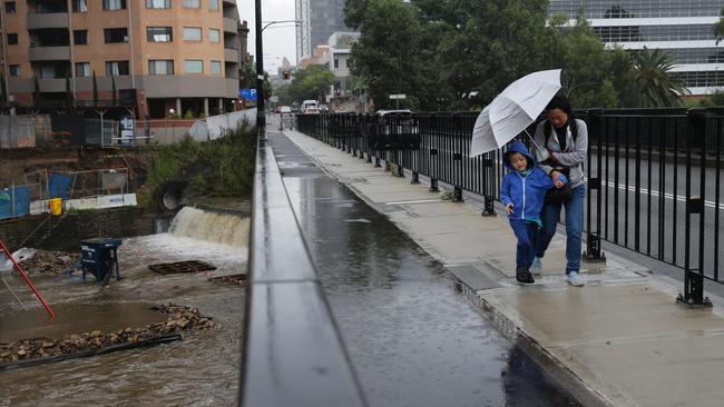
Parts of Sydney and northern parts of NSW were drenched overnight with the Macleay River catchment area worst hit copping 200mm since 9am yesterday.
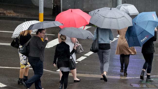
Transport is expected to be impacted later today in Sydney, although already services have been disrupted due to overnight falls including the T8 Airport and South Line between Glenfield and Campbelltown. Outside of Sydney, buses are replacing trains on the Hunter Line between Newcastle Interchange, Maitland and Dungog or Scone due to flooding.
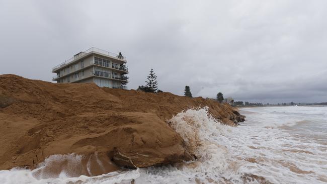
The Bureau of Meteorology (BOM) has warned heavy rainfall will be accompanied by damaging wind and hazardous surf conditions.
“We are expecting the rain to really pick up on Friday,” BOM duty meteorologist Helen Kirkup told NCA NewsWire on Thursday.
“That’s on top of what we already had before 9am, which was 15mm in most areas, and in Hornsby it was 28mm before 9am.
“Terrey Hills has already seen a lot and the CBD and south Sydney should also get a fair bit of rain, possibly some lightning as well.”
Ms Kirkup said while the rain on Friday would be heavy, Saturday could be dangerous, with some areas of greater Sydney a chance to be lashed by 200mm of rain.
“When we get to Saturday, the worst will shift to the south and we will see between 50mm and 100mm. It is not out of the question that some areas could see 200mm.
“What’s up north now in the Hunter is shifting to Sydney and it could cause quite significant problem.”
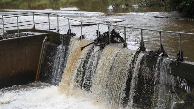
Overnight, the state’s North and Mid North Coast was drenched with the SES bombarded with calls for help and flood rescues.
The SES had responded to 11 flood rescues and 1231 calls for help since 9am on Thursday, 232 coming from the Sydney metropolitan area.
Three people had to be rescued from cars that had entered floodwaters in the Schofields, Austral and Rossmore areas.
SES Spokesman Scott Hodder said they were preparing for another busy day with conditions set to worsen.
“If anyone comes across flood water please do not attempt to drive, ride or walk through it. Floodwater is dangerous,” he said.
“You do not know what is underneath it and conditions beneath the surface can be very different to what you see,” he said.
Four NRL games, and the AFL match between GWS and St Kilda, are expected to go ahead despite the wet weather, while suburban cricket finals will likely be washed out.
Twenty three rivers in the Sydney, Hunter, Illawarra and Mid North Coast regions are on flood watch, including the Georges and Woronora Rivers in Sydney’s south and southwest and the Nepean in the city’s far west all bracing for minor flooding into the weekend.
Sydneysiders and NSW residents are urged to avoid travelling to events and to stay across weather warnings ahead of “hazardous” conditions on the roads.
BOM senior meteorologist Jordan Notara said wet conditions would remain “well into the new week”, with no clear skies in sight.
“For people moving across Sydney this weekend, there is a road weather alert advising motorists to take care and note low visibility and the potential for flash flooding, especially on Friday and Saturday,” Mr Notara said.
“It’s likely the intensity of the rain will ease off moving towards Sunday after Saturday’s persistent heavy falls but it will still be wet.
“There will be consistent wet weather across the whole state over the next seven days.”
More Coverage

Join the conversation

Sussan Ley’s mother dies days after her historic win as Liberal leader
Newly minted opposition leader Sussan Ley has tragically lost her mother Angela just days after her historic win as the first female Liberal leader.
Read more

Court tells dodgy salesman to pay $37k for not delivering orders
A notorious businessman has been forced to cough up thousands of dollars in compensation after he charged customers for furniture that never arrived — almost a decade after he was whacked for selling ‘killer’ spas.
Read more