
NSW, Sydney weather: Huge storm brings risk of hail, flooding
A storm which battered NSW on Monday is barrelling back towards the state, carrying warnings for hail, flash flooding and 90km/h winds as dangerous surf batters the coast.
NSW
Don't miss out on the headlines from NSW. Followed categories will be added to My News.
- More storms forecast as Sydney copes with downpour
- What you get as a subscriber to The Daily Telegraph
A mammoth weather system barrelling towards NSW could see golf-ball sized hail, gale force winds and flash flooding strike just a day after a storm battered the state.
The low pressure system circling above the state’s east coast is expected to develop into a thunderstorm as early as Wednesday.
Bureau of Meteorology (BOM) duty forecaster Helen Reid says the storm has the potential to be severe in the north east of NSW and along the Central Tablelands, bringing heavy rain, 4cm hail, 90km/h winds and lightning.
“There will be large hail and the risk of flash flooding. It’s such a busy system and there’s so much energy wrapped up in moisture, so we need to be on-guard tomorrow.
“It’s part of the same system as Monday – there’s still a lot of moisture in the air and the inland trough helps lift the atmosphere which is a good recipe for thunderstorms.”
The incoming storm is part of the same system which wreaked havoc across the state on Monday, forcing flood-affected residents and commuters to evacuate their homes and cars and toppling power lines.
MORE NEWS
Ex-Qld Labor premier backs NSW in border wars
PM’s right hand man accused of ‘appalling behaviour’
Hunt for mullet man: Cops reopen bank robbery case
More dangerous storms are expected to batter the state for the next few months because of La Nina.
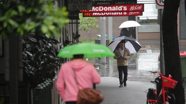
The warning comes as the mercury rises and conditions ease today ahead of a week of drizzly conditions.
“The wet weather will ease from Sunday,” she said.
Temperatures will remain crisp at around 16 degrees for the rest of the week before returning to a spring average of 23 on Saturday.
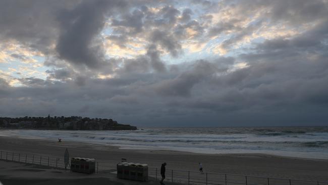
The powerful front has whipped up large and powerful surf conditions and a marine wind warning for today, making coastal activities like swimming and surfing hazardous.
Meanwhile, storm-battered residents are clinging to their beachfront homes in NSW coastal areas as wet weather hampers efforts to stabilise damaged properties.
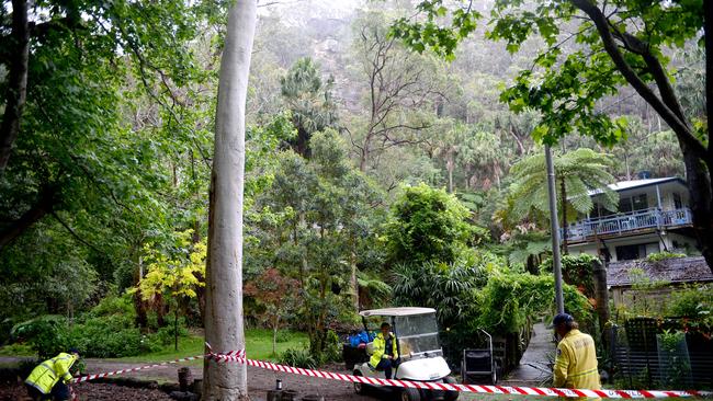
The State Emergency Service is in a race against time to shore up homes in the isolated community of Mackerel Beach before more storms hit Sydney this week.
A tiny hamlet on the western side of Pittwater across from Palm Beach, Mackerel was hit by flash flooding and a landslide on Monday just after midnight, sending mud streaming into homes and forcing residents to flee.
One house was destroyed and another damaged in the landslip, which forced the evacuation of 25 people from eight homes in the area.
One local said the residents felt lucky to have survived. “Thank goodness no one [was] hurt only the luck of being in another room saved a life,” the local posted on social media.
The SES is working to install a barge to help NSW Police establish temporary fencing to protect the 100 properties in the hamlet.
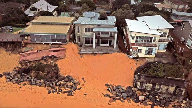
Communities across the Central Coast have also been inundated by heavy rain and strong winds, sparking renewed concerns for homeowners at Wamberal Beach.
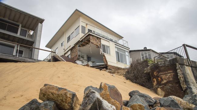
A rock barrier put in place after a major erosion event in July has been partly washed away. Some homes remain uninhabitable, teetering on the edge of collapse and at risk of further damage. “
One affected resident, Margaret Brice, said forecast storms were a worry. “This is another nightmare waiting to happen,” she said. “That place where the rocks are falling down — we have been telling them for months about it, but honestly I think the decision makers have had their attention elsewhere.”
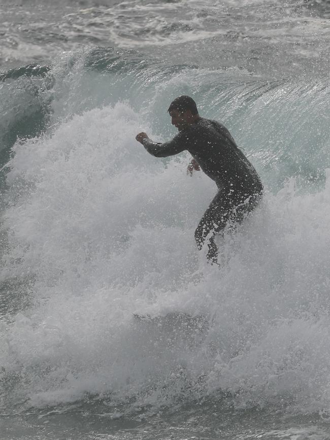
But the treacherous weather hasn’t deterred everyone from the outdoors, with ex-football player Andrew Johns spotted braving the rough surf and large swells this morning at Bronte to catch a few waves.
The former halfback reportedly didn’t spend too long in the water before retiring, with conditions significantly worsening throughout midmorning.

On Monday, parts of NSW received near-record rain with the heaviest falls in Port Stephens, where gauges recorded 297mm in just 24 hours.
“We have seen some fairly hefty, widespread rainfall. We’re copping rain we don’t normally see that often and we’ll be checking whether it hits a new record,” she said.
Yesterday’s temperature was also at least six degrees below the average for this time of year, according to forecaster David Wilkie.
“[Monday’s] winds were quite high, getting up to 87km/h at North Head and it was also a cool day, [the] max temperature was 16.2 degrees, roughly six degrees below average for this time of year.”
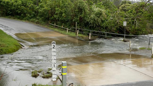
The wild weather conditions sparked landslides which sent mud streaming into houses and forced residents to evacuate.
The deluge also left motorists stranded as they waited to be rescued from flash floods, with the State Emergency Services (SES) attending hundreds of jobs.
Gale-force winds also tore down power lines, leaving hundreds of residents across Sydney without power.
Fallen trees and flooding also forced the closure of Wakehurst Parkway, Oxford Falls Rd and Falston Rd, resulting in heavy traffic for peak-hour commuters.