
NSW on high alert as storms hit Sydney, Central Coast, Hunter and SES calls climb
The NSW State Emergency Service has been inundated with calls for help as damaging winds and severe thunderstorms lash Sydney, Hunter and the state’s north east.
NSW
Don't miss out on the headlines from NSW. Followed categories will be added to My News.
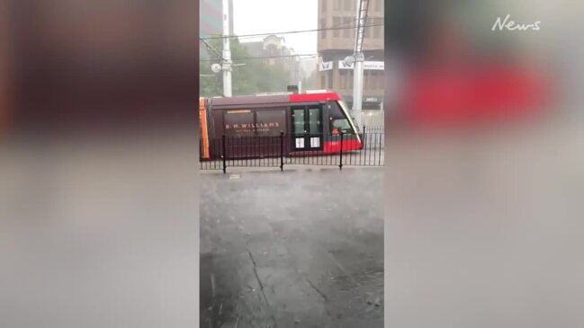
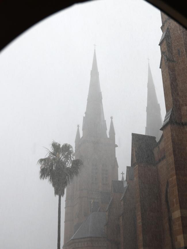
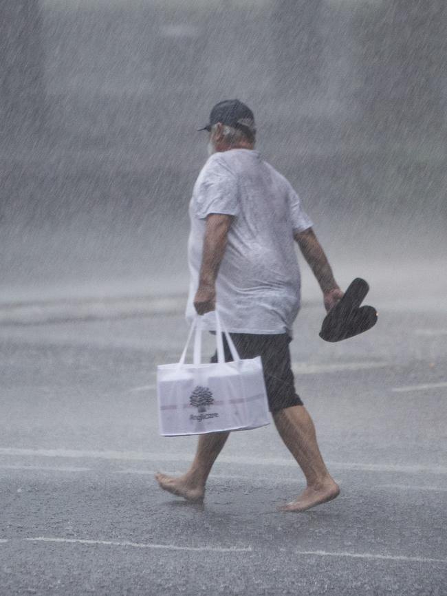
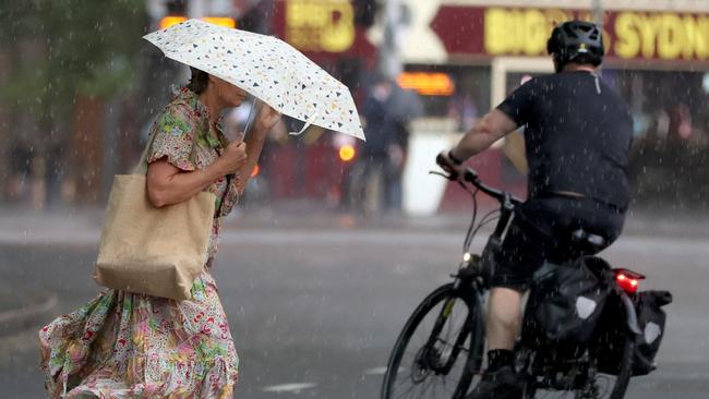
Sydney has been left with a trail of destruction after a savage thunderstorm whipped through the city causing traffic chaos.
The storm front drenched neighbourhoods as it moved across the metropolitan and Illawarra before lunchtime on Monday morning, dumping up to 22mm on the city.
The Bureau of Meteorology (BoM) said the main rain band had since moved offshore but the storm front was heading north.
“It should also be noted that the front has not quite moved through yet. We may see further storm activity into the earlier or mid parts of the afternoon,” BoM’s Miriam Bradbury said.
“The risk continues through most of the day with (the weather) not clearing until this evening.”
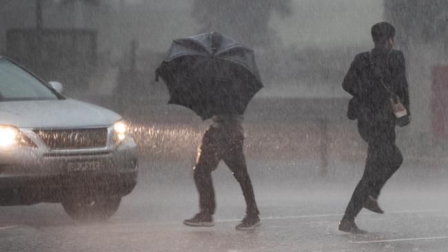
Although rain is not a major concern, the agency has issued a severe thunderstorm warning for damaging winds along the northern inland and coastal parts of NSW.
People in the Hunter, Metropolitan, Central Tablelands, North West Slopes and Plains, parts of Mid North Coast, Illawarra, Central West Slopes and Plains, Upper Western and Northern Tablelands Forecast Districts have been alerted.
“Over the next hour or so we will continue to see the thunderstorm activity,” Ms Bradbury said.
“The main risk with these thunderstorms is damaging wind gusts that covers the entire Sydney metro area and large parts of northeast NSW.
“We could see short and sharp showers but at this stage, we’re not expecting anything reaching warning thresholds for rainfall. The immediate risk is for damaging winds.”
NSW SES spokesperson Greg Nash said the agency had received 80 calls for help between 6am and 11am on Monday morning.
He said 50 of those had come from the Sydney metro area – particularly suburbs on the northern side of the Parramatta River – and most had occurred between 10am and 11am when the storm came rolling in.
“We are getting reports of roofs being removed on buildings across Sydney,” he said.
“There’s a job in Mortdale where a workshop has had its roof removed and potentially blocking the roads and (affecting) the powerlines.
“We’re expecting calls to increase as it makes it way across the coast.”
As of 1:30pm on Monday, 2116 properties across the state were experiencing blackouts and power issues due to the storms.
Holiday-makers are being urged to check the BoM app before travelling, especially if going north, and have been asked to avoid trying to remove trees on the road in case of hazards.


‘It destroyed me’: Unproven abuse claims left Sydney school in ruins
Award-winning special needs teacher Vita Williams spent more than three years on the Department of Education’s secret list of unemployable educators. She was sacked, and her school ‘lost its soul’. Now, after a win in court, she’s demanding justice.

Councils push for law to lock cats up 24/7
Cats owners who let their kitties roam free could soon be fined under proposed changes to the Companion Animal Act.