
NSW floods: Schools closed due to flooding
Torrential rain and severe flooding has closed almost 200 NSW schools. See the full list
NSW
Don't miss out on the headlines from NSW. Followed categories will be added to My News.
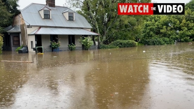
Almost 200 NSW schools will shut their gates on Tuesday as the statewide flood emergency continues.
The NSW Education Department confirmed on Monday night 194 schools, including 167 government schools and 27 non-government would be closed on Tuesday due to severe weather and flooding.
It comes as 301 were closed on Monday.
More than 50 schools have been damaged by flooding, roof leaks, strong winds, fallen trees and other debris, most on the Mid North Coast.
Telegraph Point Public School will relocate 125 students after all buildings were badly damaged by floodwaters, and Chester Hill High School remains closed for 1300 students after severe weather damaged classrooms.
STORMS BRING LIFE-THREATENING FLOODS
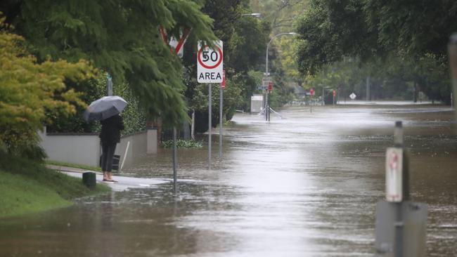
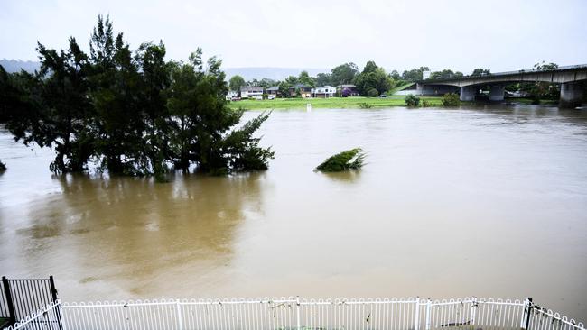
The wild weather is predicted to return with a vengeance on Tuesday as Sydney’s west braces for another downpour that threatens to push the already catastrophic floods to historic levels.
More rain and a high tide are expected to send the Hawkesbury River at Windsor to its highest point this week about 9am today while the Bureau of Meteorology warns of life-threatening flooding in parts of NSW.
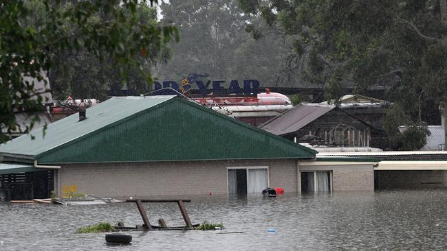
Homes at Windsor slipped beneath the swollen river yesterday morning when the water level breached the “major flood level” of 12.2m.
Thousands were evacuated as the town’s river gauge edged closer to 13m late yesterday, fed by the overflowing Warragamba Dam, and the level could rival the biggest local flood in living memory which peaked at 14.95m in 1961.
Only one terrible record stands above that — when the river reached 19.68m in 1867, claimed more than 20 lives and washed away much of the region.
Premier Gladys Berejiklian said the city may not be through the worst of the storm.
“I just want to say to everybody across the state who is currently living in fear and anxiety that all of us are thinking of you,” she said. “I know for many people, they will feel like it is a breaking point.”
Hawkesbury councillor Emma-Jane Garrow, who also lives in Windsor, said thoughts of worsening weather were too much to bear.
“We’re waiting for the peak to be announced and, at the moment, we’re just taking it half an hour at a time,” she said.
The bureau warned a strong high-pressure system would “pump” tropical moisture into NSW storms throughout today. A low-pressure system, west of the Great Dividing Range, is predicted to move east and gather strength. The bureau said it could cause even more rainfall, strong winds and abnormally high surf as Sydney could be hit with another 100mm of rain.
The Nepean-Hawkesbury, the mid-north coast and the Hunter are now nervously watching as even moderate rain could be devastating in the saturated catchments.
“Due to extensive flooding across the east, localised moderate rainfall may also bring the risk of flash flooding,” the BOM said. “In some areas, heavy rain and flooding may be life threatening.”
Windsor’s Michelle Neilsen spent the day clearing out her garage, but her fears were for her neighbours.
“They’ve got birds and pets,” she said. “Hopefully people have insurance, but it’s life now that matters, that’s what I’m concerned about.”
Relieved residents living on the banks of the Nepean River near Penrith took advantage of a break in rain yesterday to return to their homes to find floodwaters did not reach the highs they had feared.
“We got out quick because we thought it was going to get a lot higher. But coming back (Monday) morning, I think it’s a pretty good result,” Steve Wilson said.
“We might have lost a few tools along the way but … at the end of the day, we’re all alive so that’s all that matters.”
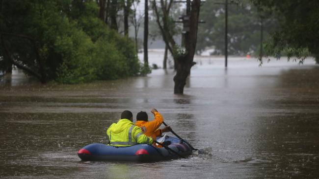
The bureau’s flood expert Justin Robinson said it was the worst flooding he had seen in his 20-year career.
A low pressure system over the east could end hopes that the water will roll back. Roads may continue to be cut, landslides are expected, and winds could topple trees from the “supersaturated” soils with ease authorities warn.
Even after the systems ease, which is expected late on Tuesday, the flood risk will continue for days afterwards as the water continues to move downstream.

Man arrested in Queensland after young dad killed in Mudgee stabbing
Tributes have begun flowing for the 22-year-old father, who was allegedly murdered in front of shocked locals late on Saturday night.

‘Is daddy home?’ Heartbreaking cost of state’s horror road stats
As frightening new data shows the NSW road toll is the worst it’s been in 15 years, a Sydney mother reveals the trauma she and her young family have gone through after her husband was left with life-threatening injuries following a shocking crash in Terrey Hills nine days ago.