
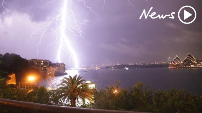
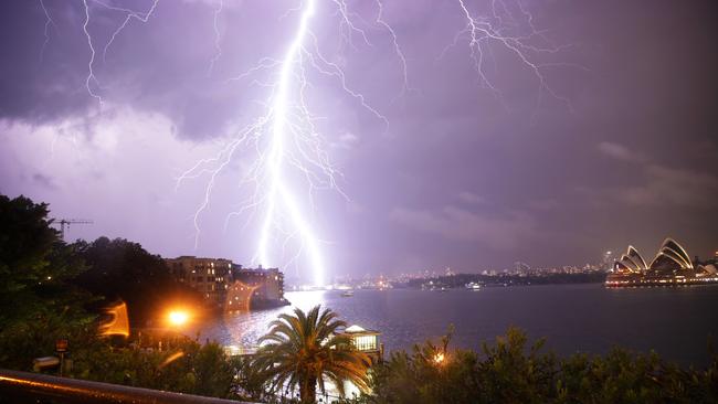
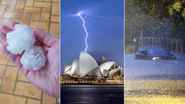
Huge clean up after 20,000 lightning strikes hit Sydney
Sydneysiders are being warned to brace for more ‘fast and furious’ storms as emergency crews continue hundreds of clean-up operations after the city was battered by hail, heavy rain and ferocious winds last night.
Sydneysiders are being warned to brace for more ‘fast and furious’ storms as emergency crews continue hundreds of clean-up operations after the city was battered by hail, heavy rain and ferocious winds last night.
The SES warned of “a very similar, really nasty short burst of fast and furious weather” later today.
“We are stressing to people - with the likelihood of this rain pattern continuing and these bursts - please stay off the roads, adjust your travel pattern, and please do no drive through flooded roadways.”
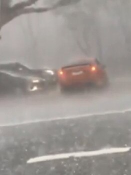
Three cells of severe thunderstorms swept across the city and surrounding suburbs last night, with the northern beaches, western suburbs and Illawarra hit hardest.
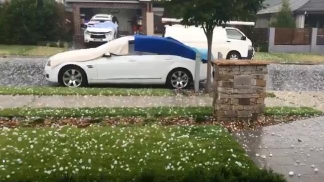
Mona Vale recorded 120mm of rain in the two hours to 10.45pm, while multiple areas were impacted by hailstones as large as golf balls - including Kellyville and Blacktown.
Almost 20,000 lightning strikes were also recorded across the greater Sydney area. Western Sydney received the worst of the hail with 2cm-5cm diameter chunks slamming into homes and cars.
“It was certainly a ferocious night for Sydney and its surrounds,” the SES’s Greg Murphy said.
“What concerns us ... is there’s potential for more storms today and into the weekend.
“We are on alert as storms will continue today and into the weekend, it is difficult to predict when they would hit as they can be stirred up very quickly.”
Sydneysiders are being urged to secure any loose items around their homes, and plan their travel around storm warnings.
Showers and thunderstorms are predicted to hit the state’s east and possibly northwestern slopes on Friday, with a chance they could extend into the weekend.
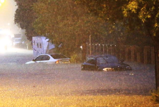
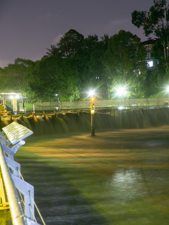
The warning came amid a huge operation to clear floodwater, remove debris and restore power to hundreds of homes hit by last night’s storm.
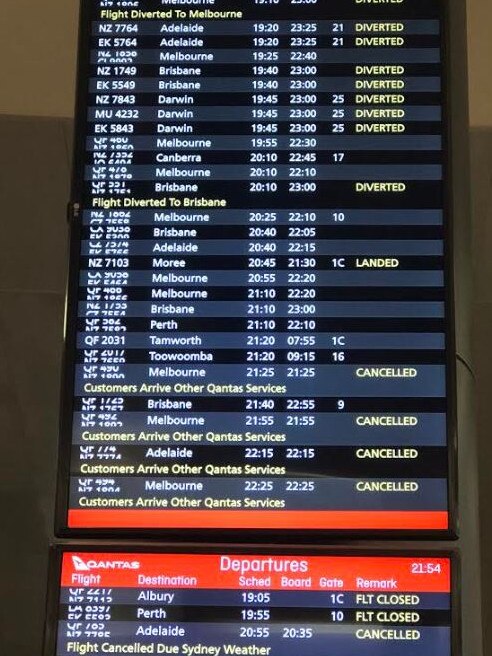
Air travellers were stranded at Sydney Airport with the federal government last night giving permission for some flights to continue leaving after the 11pm curfew as the massive weather event caused havoc all over the city.
Many planes were stuck on the tarmac without a take off slot late last night because so many planes still needed to land. Some were then frustratingly turned back to the terminal including Qantas flight 497 to Melbourne with Communications minister Mitch Fifield on board.
The extent of damage caused by giant hailstones is still unclear after a series of thunderstorm cells dumped flooding rains on Sydney.
Dangerous storms were detected near Blacktown and Riverstone, the Bureau of Meteorology said on Thursday evening.

The storms moved east with severe thunderstorms hitting the city and eastern suburbs by nightfall.
Images from the city’s west showed golf ball-sized hailstones pummelling cars while almost 20,000 lightning strikes were recorded across the greater Sydney area.
The downpour triggered flash flooding, power outages and more than 600 calls to the rescue service.
There were also delays on Sydney’s road and train network.
A Cobbitty resident in Sydney’s south west said she had been hit twice by the hailstorms - once in Surry Hills on December 20 last year and again last night.
“Our new car looks like a golf ball after the hail damaged it within minutes. Our pool equipment and Colourbond roof will both need to be repaired,” she said.
“My car is still damaged from the December hailstorm and its been backlogged to be fixed in April - what the hell are repairers going to do now?”
The wet weather isn’t slowing down and could last until early or mid next week.
Today is forecast to bring showers and thunderstorms to the state’s east possibly extending to the northwestern slopes.
Showers are forecast on Saturday extending to northern inland areas while on Sunday showers will likely reach the far northern inland with a chance of thunderstorms in the north.
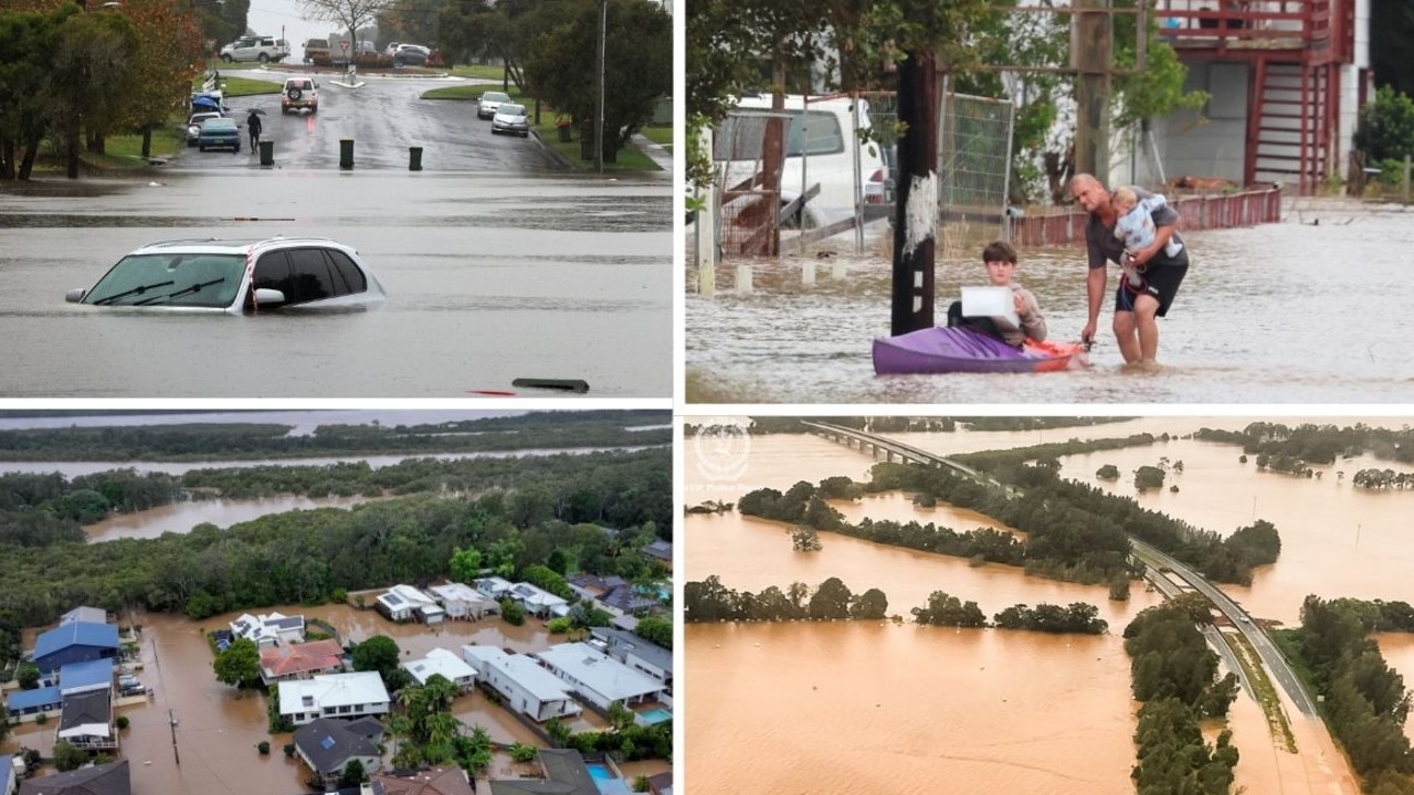
IN PHOTOS: Floods wreak havoc on northern NSW
Extreme weather conditions are lashing the NSW north coast, with 50,000 currently isolated, one person confirmed dead and three others currently missing. Here’s a look at what’s happening on the ground.

‘He deserved it’: Father brutally beat man with a bicycle pedal
A Central Coast father of two who viciously bashed a man with a bicycle pedal after accusing him of stealing his motorbike has avoided jail.