
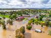
Forbes flooding: 100 evacuated but hope rises amid Forbes chaos
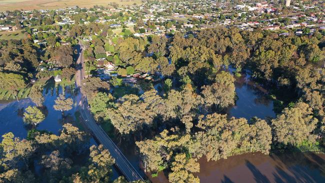
Residents in the NSW Central West have been given hope that major flood waters forecast to hit the town this afternoon are now expected to be lower than the destructive 2016 peak.
NSW
Don't miss out on the headlines from NSW. Followed categories will be added to My News.
The flood warning for the central west town of Forbes has been revised, with major flood waters forecast to hit the town this afternoon expected to be lower than the destructive 2016 peak.
The Bureau of Meteorology this morning advised that while major floods are still expected to hit the town, the Lachlan River is unlikely to hit the 10.65 metre level initially predicted.
“River levels have continued to slowly rise along the Lachlan River at Forbes Iron Bridge where river levels are likely to peak near the major flood level today,” the bureau said in a statement.
“This is just below the September 2016 flood level. Major flooding is also likely at Cottons Weir later today and at Jemalong on Thursday.”
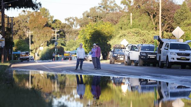
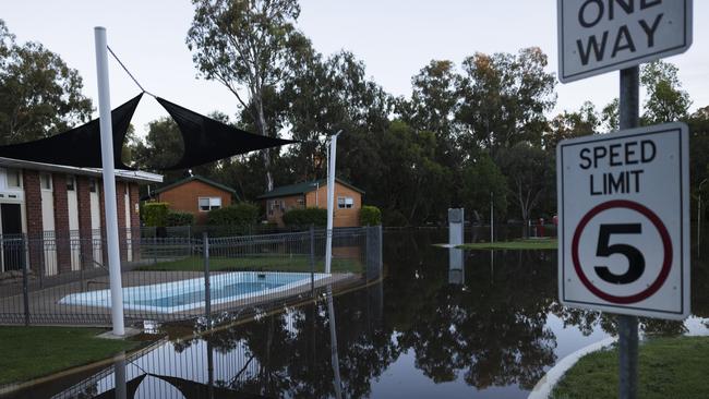
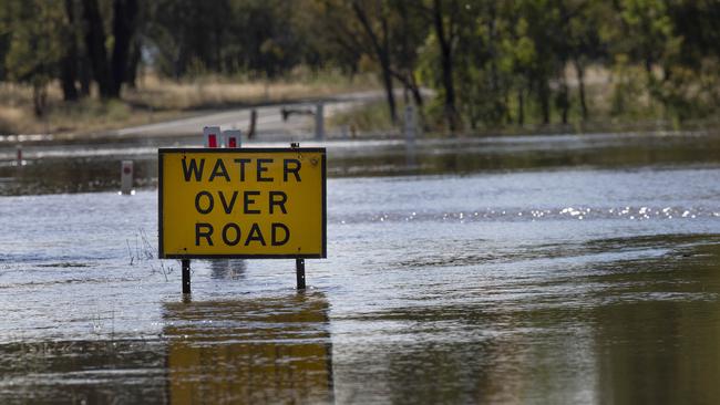
Roads in low-lying areas of the town remain closed while the NSW SES remains on standby to help.
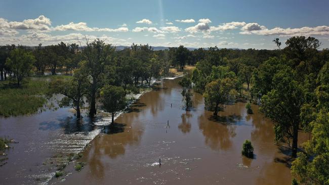
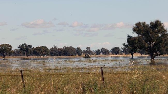
About 100 residents were evacuated from their low-lying homes on Tuesday as the Lachlan River sat at 10.40m on Wednesday morning and continued to rise.
NSW SES acting zone commander Barry Griffiths warned residents not to get complacent despite the peak of the flood being delayed.
“This is a slow moving flood … but it has also exceeded forecast heights (upstream of Forbes),” he said on Wednesday morning.
“My warning is don’t be complacent, it can still reach and exceed forecasted heights.”
He said the SES was now “watching and waiting” ahead of the planned peak later today.
Volunteers have filled more than 25,000 sandbags in the last 24 hours, with homes and businesses throughout Forbes reinforcing front doors and garages in anticipation of rising flood waters.
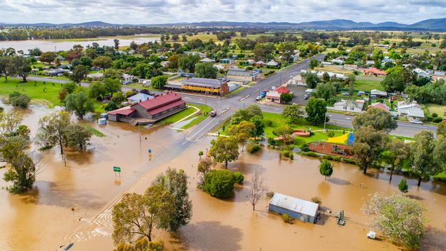
The Lachlan River hit 10.35m at Forbes overnight, below the 10.55m major flood level which is now expected to hit Wednesday afternoon.
Attention is now expected to head downstream from Forbes to the town of Bedgerabong as flood waters continue to move down the river.
Forbes’ Bathurst Street, which backs onto the Lachlan River, was covered by rising waters on Wednesday morning, while road closures are in place on Reymond Street and the Escort Way road which connects Forbes to Eugowra.
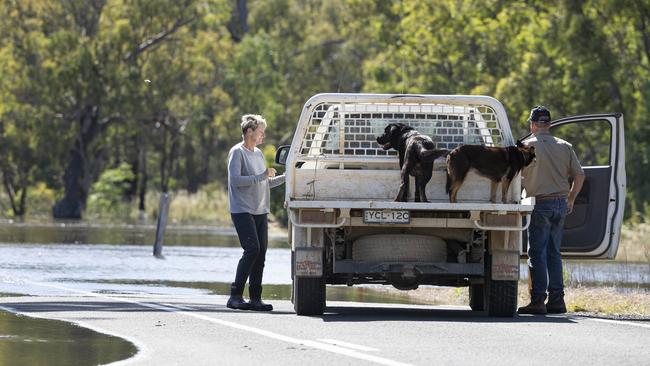
An evacuation centre has been set up at St Andrews Presbyterian Church, 11 Harold Street, Forbes.
Forbes Shire Mayor Phyllis Miller in an update on Wednesday said the town should “know what our fate is” tomorrow.
She said thick vegetation along the Lachlan River had helped slow the onslaught of water moving downstream from Nanami.
“Nanami did peak at 12.5m so we are just waiting and hoping for the very best when it gets to Iron Bridge (at Forbes),” she said.
“By tomorrow we’ll know what our fate is with this slow moving water.”
AFFECTED STREETS IN FORBES:
South of Bathurst Street: River Road, Church Street, College Road, Wambat Street, Stacey Street, Stokes Street, Reymond Street, Lachlan Valley Way, Koala Place, Wandary Lane, Muscat Street, and Claret Street
East of Ooma Street/Ferry Street: Blackwood Lane, Lower Bathurst Street, Cargo Lane, Ferry Street, Bathurst Street, Riflerange Road, The Escort Way, Twogood Lane, and Ooma Street
Between Lake Forbes and Ooma Street: Herbert Street, Hill Street, Clarke Street, Bridge Street, Bandon Street, Ferry Street, Flint Street, and Barwin Street
North Forbes and the CBD: Lachlan Street, Sherriff Street, Templar Street, Sir Frances Forbes Drive, Cross Street, Camp Street, Browne Street, Spring Street, Rankin Street, Lawler Street, Riley Street, Lower Rankin Street, and Clear Street
North East of Forbes Railway: Landacre Road, Jones Street, Sam Street (southern end of Doc Street), and Parkes Road
North of Newell Highway: Farrand Street, Press Street, Dowling Lane, Renfree Street, Farnell Street (southern end), Bedgerabong Road, Windsor Street, and Clarence Street
West Forbes (West of Wambat Street): Wambat Street, Berkley Street, Bathurst Street, Warrul Road, Newell Highway, River Road, Show Street, Marcia Street, Elizabeth Street, Linda Street, Thelma Street, Hilda Street, Forrester Street, Junction Street, Racecourse Road, Lynette Street, Young Street, Margaret Street, Oxford Street, and Mona Street

Join the conversation

Invitation only: Minns among the high-flyers
The latest ministerial disclosures revealed Premier Chris Minns to be the only pollie to receive an invite to Beyond, Virgin Australia’s invitation-only airline lounge.
Read more

How Julia Zemiro upgraded in the Southern Highlands
Popular comedian, actor and TV presenter Julia Zemiro and her partner, real estate agent Carsten Prien, have found a buyer for their Bowral home as they upgrade in the Southern Highlands.
Read more