
8 interactive maps: Carnival of Flowers competition gardens
THE Chronicle Garden Competition gardens attract tens of thousands of people. Here are 8 maps to help you navigate your way through the gardens this year.
Coffs Harbour
Don't miss out on the headlines from Coffs Harbour. Followed categories will be added to My News.
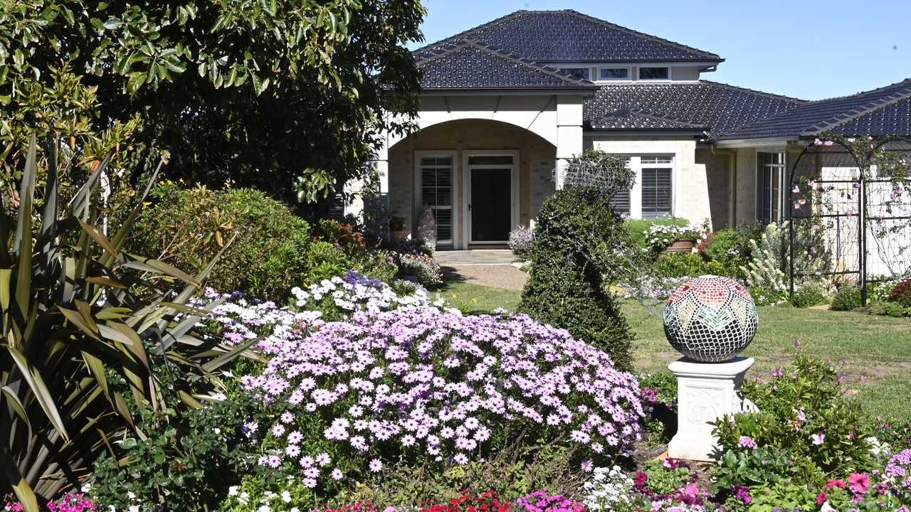
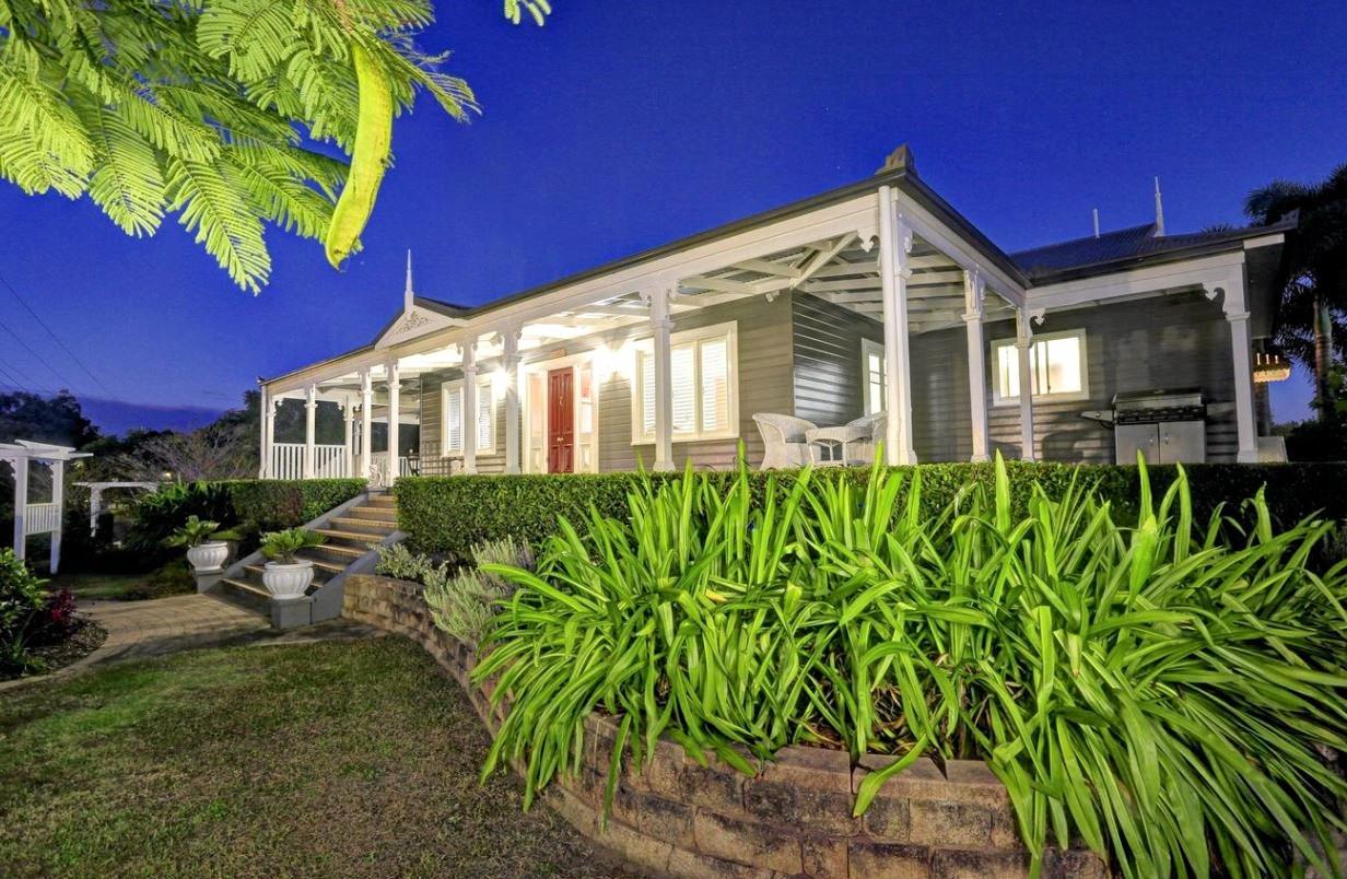
THE Chronicle Garden Competition gardens attract thousands of people each year during the Carnival of Flowers period.
Visitors and residents are able to tour the gardens and chat to home owners about the years and months of hard work that have gone into creating the award-winning gardens.
Tens of thousands of people will check out the work of our passionate green thumbs over the next 10 days.
This year they will be open to the public from Friday, September 20 to Sunday, September 29.
To make it easier for those wanting to check out the gardens The Chronicle has compiled eight interactive maps.
There is one map with all entrants across the region, as well as seven self-driving garden loop maps.
There are garden loop maps starting at Queens Park, Picnic Point, Laurel Bank Park, Crows Nest and Pittsworth as well as a driving map from Spring Bluff Railway Station to Highfields.
Click here for downloadable PDFs of the maps
Take a look at The Chronicle Garden Competition maps below.
1. The Chronicle Garden Competition overall map
2. Queens Park self-driving loop 1 (public places)
Queens Park
TAFE Southwest Horticulture
Cobb and Co Museum
Boyce Gardens
Newtown State Rose Garden
Grand Central
3. Queens Park self-driving loop 2 (competition gardens)
Queens Park
30 Rhyde St
21 Talinga St
1A Mabel St
201 North St
32 Cathro St
14 Sprott St
5 Christmas St
7 Christmas St
3 Norwood St
4. Laurel Bank self-driving loop
Laurel Bank Park
St Albans Church Hall
15 Arabian St
17 Arabian St
DownsSteam Tourist Railway
Japanese Gardens
USQ Gumbi Gumbi Gardens
5 Fern Dr
5 Kearney St
333 Spring St
295 Stenner St
254 South St
5. Picnic Point self-driving loop
Picnic Point
17 Faith St
Toowoomba Waterbird Habitat
24 Wiangaree Dr
17 Dallang Rd
255 Hume St
161 Perth St
St Paul's Church Hall
8 Burke St
19 Burke St
38A Crown St
6. Highfields self-driving loop
Spring Bluff Railway Station
2 Blue Meadow Ct
5 Horizon Ct
11 Horizon Ct
59 Goombungee Meringandan Rd
1.47 Trevean Dr
73 Wirraglen Rd
40 Smythe Dr
10522 New England Hwy
56 Kuhls Rd
17 Ward St
7. Pittsworth self-driving loop
Cafe Creame
15 Beresford St
5 Briggs St
7 Bowden St
35 Helens St
18 Short St
61 Yandilla St
8. Country self-driving loop
194 Schultz's-Haden Rd
286 Swain Rd
2 Lalor St
The Nest Cafe
3 Perseverance Rd
123 McLean Rd
8678 New England Hwy
Originally published as 8 interactive maps: Carnival of Flowers competition gardens

‘Do your job’: Ex-fire captain in court over violent outburst
A Mid-North Coast Rural Fire Service captain stood down when he was slapped with domestic violence charges has now been sentenced. Here’s what happened in court.
‘Hard to fathom’: Public speak up in hunt for Bowraville child killer
Homicide detectives are busy taking statements as they probe the suspected murder of three children from Bowraville in the 1990s, with a focus on finding the remains of 16-year-old Colleen Walker-Craig. Here’s the latest.