
7 new industrial areas flagged for Byron. Where? How?
The new strategy will effectively double the business and industrial land available in Byron Shire
Byron Shire
Don't miss out on the headlines from Byron Shire. Followed categories will be added to My News.
A NEW strategy that will inform future decision-making on industrial precincts in the Byron Shire has been approved by the state government.
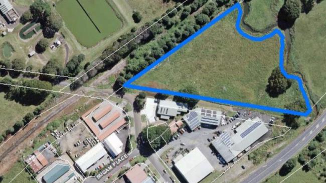
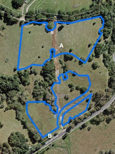
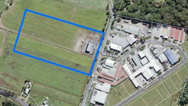
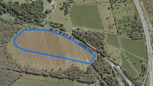
Byron Shire Council's Business and Industrial Lands Strategy includes seven "investigation areas" at Billinudgel, Mullumbimby, Byron Bay West, Bangalow and three areas near Gulgan Rd.
Those areas may be considered for planning proposals down the track.
An earlier version of the document was adopted by councillors in December last year and sent on to the NSW Department of Planning, Industry and Environment.
The department indicated conditional approval, pending some amendments, in May and a new version was adopted in a 5-3 vote by the council in August.
The council received formal word of the strategy's approval in September.
At the August planning meeting, Cr Cate Coorey argued they should not include the areas known as Gulgan East, Gulgan West and Gulgan North, given the planning department had indicated a preference for the other sites.
Matthew O'Reilly from the Saddle Ridge Local Area Management and Planning Association accused the council's staff of misrepresenting data from an expert report to increase the amount of land flagged for investigation.
Cr Alan Hunter said the currently available industrial land was "quite fragmented" and staff confirmed the available, industrial-zoned land was revised after land use constraints were taken into account.
A staff member told councillors they also had to acknowledge some landowners would keep properties "landbanked".
According to 2017 HILLPDA data relied upon in the strategy, the Byron Shire has 126ha of business and industrial-zoned land, 35 of which had not been developed.
In general terms, the areas flagged in the strategy could see the shire's business and industrial land double.
The State Government's North Coast Regional Plan has estimated the North Coast's population will grow by 76,200 by 2036.
Of those additional residents, 6,400 are expected to live in the Byron Shire.
Data used in the strategy indicates there would be "a medium to long term shortfall of business lands in some centres which will contribute to increased competition for business and space".

‘Going better than last year’: Ballina issues warning
After winning just two of their first seven games, Ballina has stormed back into form in the NRRRL. Find out what is behind the turnaround.

Wet weather footy: 30+ photos from the NRRRL
It was wet and wild as Evans Head took on Cudgen in a top-six clash in the NRRRL. Check out some of the best shots.