
Far North weather: Cyclone Jasper BOM update and emergency advice for Cairns, Port Douglas
A major flood warning is in place for areas around the Daintree Village and Mossman as waters rise around the soaked region this morning. This is what we know.
Cairns
Don't miss out on the headlines from Cairns. Followed categories will be added to My News.
The Daintree River and Mossman catchments have received record breaking rainfall, with parts of the region receiving more than 800mm of rainfall in the 48 hour period from 9am on Wednesday.
A major flood warning is in place for Daintree Village after up to 800mm of rain was dumped on parts of the region since 9am on Wednesday.
Bands of heavy rainfall recorded since 9am Friday have seen a further 70-100 mm recorded across the Daintree catchment, and at least a further 30mm across the Mossman catchment.
Renewed river rises are occurring along the Daintree River during Friday afternoon.
Rain gauges at Black Mountain and Myola logged 48 hour rainfall totals of 776mm and 708mm respectively, both breaking the record for the highest total rainfall in a 48 hour period for December.
Yandill rain station, in between Wujal Wujal and Daintree Village, recorded the largest total for the region with 803mm in the same 48 hour period.
Rainfalls of 625mm to 796mm have also been recorded along Bloomfield River in the same period.
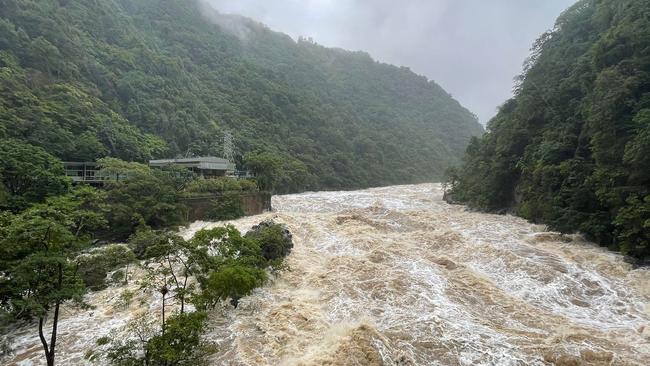
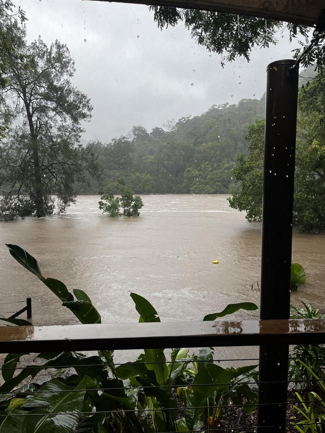
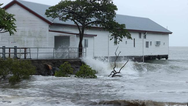
The Daintree River has been rapidly rising following heavy rain and is currently sitting at 7.95m and experiencing moderate flooding, but this could reach major flood levels of 9m sometime tonight.
The Mossman River has risen to similar levels as the major January 2019 floods overnight, with further rises possible if rainfall continues.
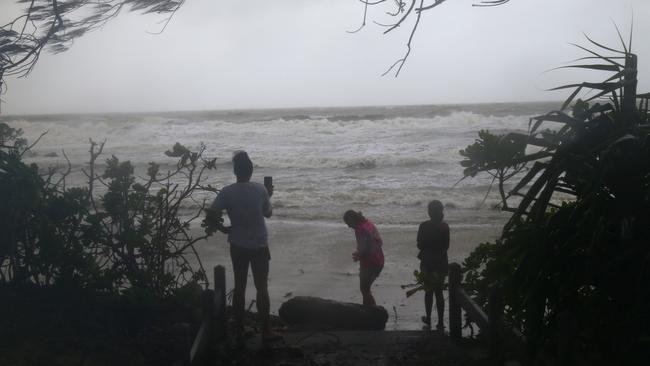
Heavy rainfall is still forecast for Port Douglas and north towards Musgrave as Ex-Tropical Cyclone Jasper moves over Palmerville and towards Kowanyama in the west while Cairns is set to experience another day of storms.
Cairns and the area south to Innisfail can expect a further day of rainfall totals between 25 and 100mm on Saturday and Sunday.
Bureau of Meteorology spokesman Patch Clapp said there was still at least 24 hours of severe weather for the Daintree and Mossman areas and a potential for heavy rainfall in coastal areas tomorrow, despite the ex-cyclone’s westward movement.
“Just because it’s in The Gulf doesn’t mean it isn’t raining on the coast,” Mr Clapp said.
According to the BOM, The storm system is expected to make it to Gulf waters by early Saturday morning, causing strong winds from later this afternoon across The Gulf of Carpentaria.
“I wouldn’t be encouraging people to go out on gulf waters this weekend,” Mr Clapp said.
“There is still a moderate chance it could redevelop into a tropical cyclone.
“It’s still that time were we encourage people to check in regularly with updates on warnings.”
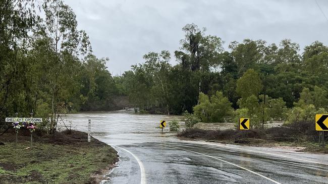
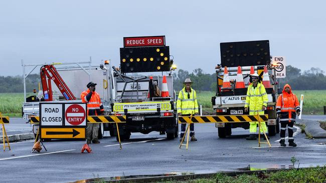
Several other flood warnings remain for the North Tropical Coast and parts of The Cape and Gulf Country, with major roads in and out of Cairns blocked off.
The Captain Cook Highway from Holloway’s Beach to Yorkey’s Knob is currently closed in both directions alongside Gillies Range Road at Peats Bridge.
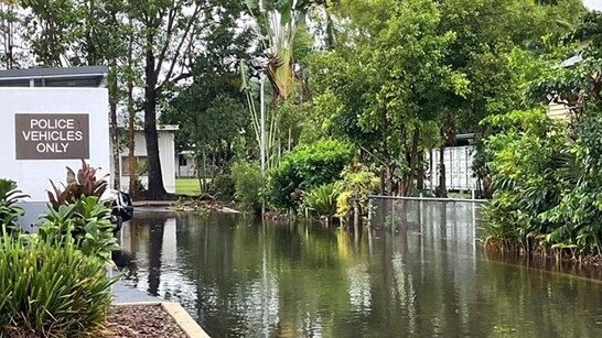
Floodwater is also over roads at Yorkeys Knob and rising, with police and traffic management officer currently monitoring the situation.
Inland from Mt Molloy to Mareeba, the Mulligan Highway has been closed due to flooding at Mitchell Flats.
Other key information and updates
• Gillies Range Road, which reopened briefly this morning, has now closed against Peets Bridge, according to an alert sent by the Department of Transport and Main Roads at 10.58am.
• Kuranda Range, Kennedy Highway is now open, according to an alert sent by the Department of Transport and Main Roads at 1.47pm.
• Carols in the Park on Sunday, December 17 has been moved from Munro Martin but still going ahead at the Cairns Performing Arts Centre.
Capacity for the event is 1300 people, combining the CPAC theatre and studio.
The live performance is in the main theatre and will be streamed into the studio.
The event is free but to manage numbers, those attending are asked to secure a spot through ticketlink.
Tickets will be available from Friday afternoon.
CPAC will open at 5pm with the main event starting at 6.30pm.
The CPAC bar will be open for drinks and light refreshments.
Friday afternoon update
While power has been restored to nearly 25,000 customers in areas affected by Tropical Cyclone Jasper, nearly 9000 customers are still without electricity.
Accessibility issues and damage over widespread area have been cited by Ergon as factors causing delays in power restoration.
According to the Ergon Outage Finder Map, 1889 customers were still impacted in White Rock, 633 in Little Mulgrave, 584 in Koah, 550 in parts of Mount Carbine, Julatten and Mt Molloy with more than 2000 customers affected in the Daintree and 3005 across Mossman, Craiglie and Port Douglas.
A spokesperson said “more than 100 boots” to offer relief were being sent to Mossman and Port Douglas on Friday.
Disaster assistance has been announced to support individuals and councils impacted by Tropical Cyclone Jasper in Cairns, Cook, Douglas, Hopevale and Wujal Wujal.
Thursday afternoon update
Floodwaters have cut the Captain Cook Highway between Holloways Beach and Yorkeys Knob this afternoon, while emergency alerts have gone out to people in Kuranda, Myola, Koah and Speewah in the Mareeba Shire Council area.
“A dangerous flood is happening now in low-lying areas near the Barron River, Clohesy River, Groves Creek and associated tributaries,” the alert said.
“Council advises residents to move to higher ground and avoid floodwater.
“Conditions are changing quickly and are very dangerous.”
A council spokeswoman said the decision was made due to the continued rainfall in the area and the rapid rising of water in some rivers.
“The few residences that is close to the (Barron) river need to keep a close watch on the rising water.”
With the risk of flooding enduring into the afternoon and evening many resident were still without power.
As of Thursday evening 16,000 homes and businesses remained in blackout with Ergon crews still working hard to reconnect communities.
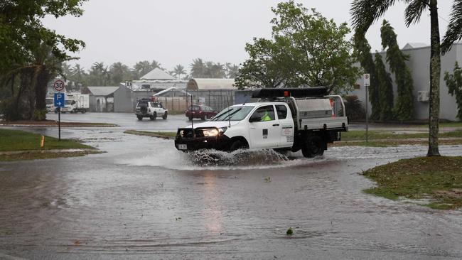
Meanwhile, floodwaters from one of the Barron River’s tributaries, Thomatis Creek, have cut the Captain Cook Highway between Holloways Beach and Yorkeys Knob.
Footage showed numerous motorists driving through the brackish floodwater before authorities officially closed the road, about 2pm on Thursday.
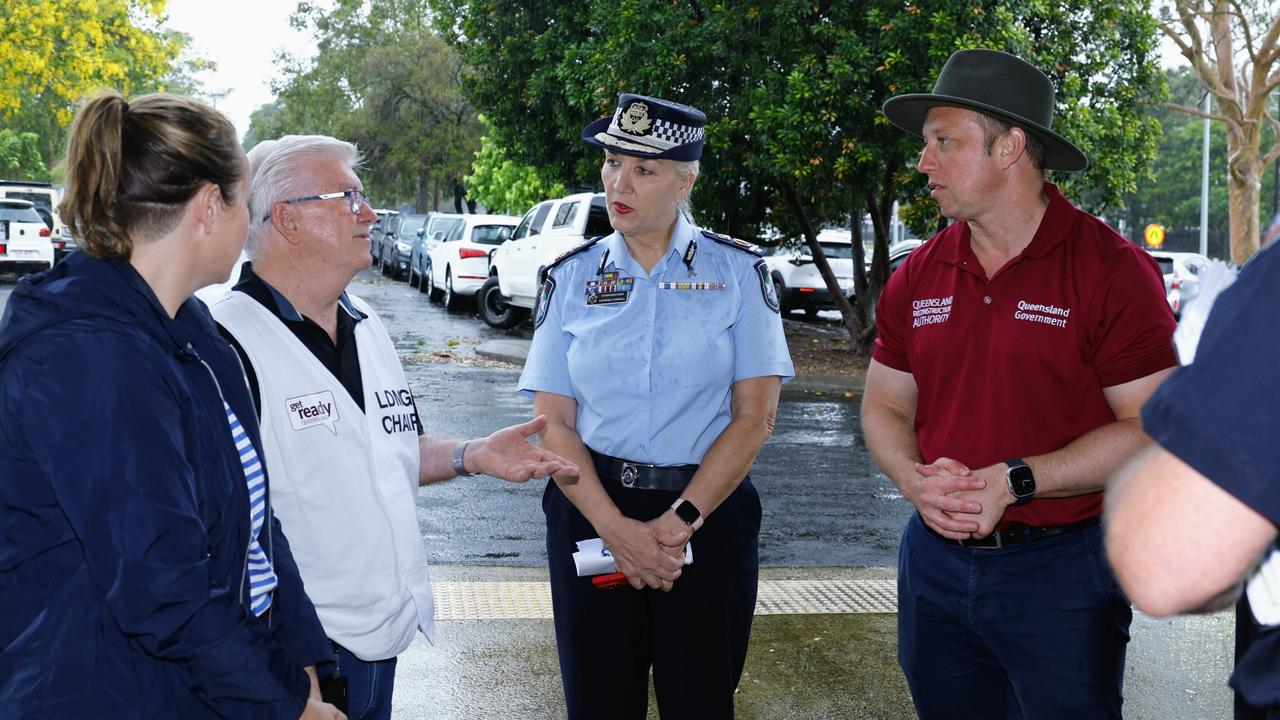
Mayor Terry James, chair of the Cairns Local Disaster Management Group, said motorists needed to take extra care with standing water being reported across the city.
“Drivers need to be extra careful at this time. Roads can become slippery with the rain and conditions may cause minor landslips and changes to road surfaces such as potholes developing,” Cr James said.
“Motorists can assist by driving carefully and slowly. This is not only for the safety of road users and pedestrians, but it also lessens the impact of bow waves, which can push water into adjacent properties.”
Cr James also urged residents to advise council of road or drain issues via the My Cairns app or customer service centre.
“As always please do not drive through flooded roads – if it’s flooded forget it,” he said.
Cr James reminded parents to keep their children away from stormwater drains.
“Fast flowing water can be dangerous, and the quality of water can deteriorate during heavy rainfall. As we have seen, the wet season can bring downpours leading to significant amounts of fast-flowing water rushing into our water systems,” he said.
“Residents, especially children, playing in or near flood waters, can be quickly swept away, be injured by debris or drown if they become trapped.
“Flood water may also be contaminated by chemicals and sewerage. Walking through floodwater can therefore present a risk to your health.”
Residents can report damage to infrastructure via the Report a Problem feature of the My Cairns app, or by ringing Customer Service on 1300 69 22 47.
Residents are urged to go to the Cairns Disaster Dashboard (disaster.cairns.qld.gov.au) to stay up-to-date.
Thomatis Creek was last recorded flooding in 2018 following Cyclone Nora.
Predictions from the Bureau of Meteorology is that the rain will ease within the next 12 hours, she said
It comes as disaster recovery funding has been made available for North Queenslanders and Cairns, Cook, Douglas, Yarrabah and Wujal Wujal regional councils.
Deputy Premier Steven Miles said residents living in Douglas and Wujal Wujal can now also access personal hardship assistance totalling $180 for individuals and up to $900 for families of five or more.
“To cover the cost of essentials like food, clothing and medicine,” he said.
“Uninsured residents may also be able to access up to $5000 to reconnect damage services like electricity, gas and water.”
Mr Miles said Queensland was “not out of the woods yet” and financial support would be expanded to other impacted areas as events continued to unfold.
“There are about 40,000 homes and businesses without power,” he said at 11:30.
“There are significant energy crews on the ground and Energy Queensland are sending additional crews from Townsville.
“Many of the traffic signals and lights are out and we just urge people to take caution on the roads.
“If you don’t need to leave your home, please stay inside.”

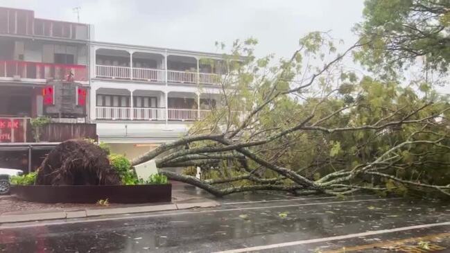
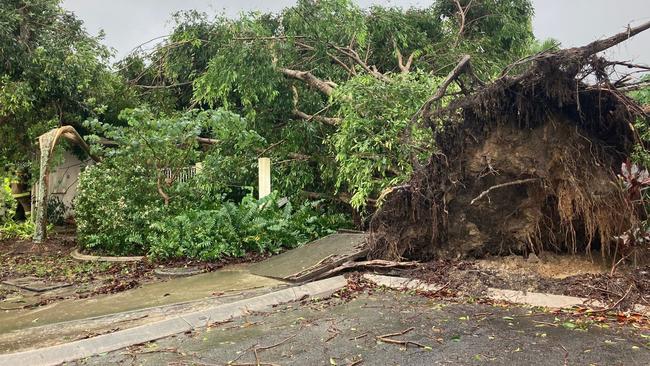
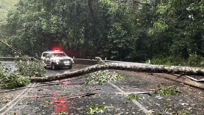
Cairns Mayor Terry James said Ex-Tropical Cyclone Jasper did not create “too much damage,” with some trees down and power outages.
“We’re used to that, we practice for that,” he said.
“Now we’re going to wait and see how much water we get.
Mayor James said the dam had filled 2.5m in just 24-hours.
“That’s a lot of water,” he said.
Queensland Fire and Emergency Service damage assessment teams had conducted 236 assessments since 6am Thursday, which identified just ten minor damage sites and eight moderate damaged sites.
7am Thursday: Power update, heavy rain, damaging winds likely throughout day
About 40,000 properties between Bloomfield and Mission Beach have been left without power, some already for almost 24 hours, with crews still unable to assess the damage.
An Ergon Energy spokeswoman said crews would begin damage assessments as soon as it was safe to do so.
“There is likely to be widespread network damage across several shires, including Cairns, Douglas, Cassowary Coast, Mareeba, Tablelands and Yarrabah,” the spokeswoman said.
“We won’t have accurate restoration time frames until then, so we appreciate everyone’s patience.
She added severe weather could impact work crews access to damaged sites and “realistic community expectations” needed to be set.
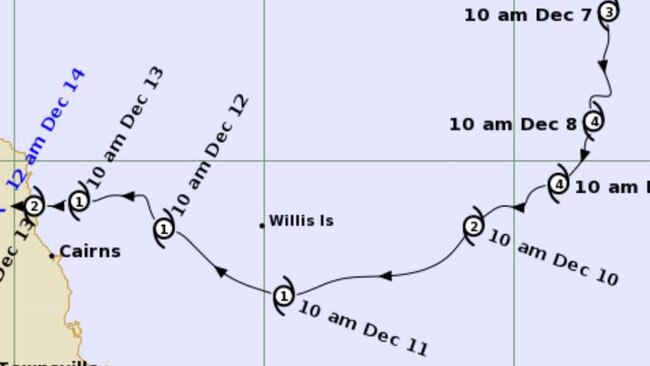
Jasper is no longer moving at a tropical cyclone intensity, according to the Bureau of Meteorology; however heavy rain, damaging winds and thunderstorms are still likely throughout the day.
At 12.35am this morning, ex-Tropical Cyclone Jasper was marked as a tropical low system within 165km northwest of Cairns moving 13km per hour to the west by the BOM.
A major flood warning for the Daintree village remains in place as the Daintree and Mossman River catchments record 390mm of rain in the 24 hour period to 5am Thursday morning.
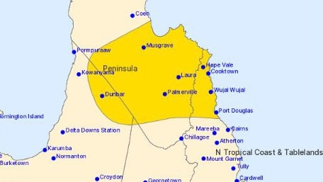
Minor and moderate flood warnings have been issued across the Far North with a severe weather warning for North Tropical Coast, Tablelands and parts of The Cape York Peninsula west of the Tablelands.
Heavy rainfall between Cooktown and Ingham, locally intense rainfall between Cooktown and Cairns leading to flash flooding is still expected today alongside damaging winds of around 90km per hour extending inland to Palmerville and Chillagoe.
The weather is expected to ease by Thursday evening depending on the movements of Ex-Cyclone Jasper.
Cape York residents between Musgrave, Palmerville, Abingdowns, Yagoonya and Kowanyama will likely experience similar rainfall and wind gusts later this afternoon as the weather system moves west.
People are reminded to stay away from fallen powerlines and report them to emergency services or Ergon on 13 16 70.
Major roads closed
Both major access roads between Cairns and the Tablelands and the highway to Port Douglas are closed.
The Gillies Range Road, Kuranda Range Road and the Captain Cook Highway remain closed this morning due to “adverse driving conditions”, according to an alerts sent by the Department of Transport and Main Roads at 7am Thursday.
Councils to residents: Conserve water
Residents and businesses in the Cairns region have been asked to conserve water, following the aftermath of ex-Tropical Cyclone Jasper, as work commenced to remove debris from water intake infrastructure.
In a statement, Cairns Regional Council said assessments of the intake at Crystal Cascades, which supplied the water treatment plant at Tunnel Hill, were being undertaken to assess the blockage
“To conserve the existing water supplies stored in reservoirs, residents and businesses are requested to use water for essential use only,” the statement read.
“Water from the reservoirs is safe to drink and does not need to be boiled.
“The notice to conserve water would likely remain in place until at least the end of the week.
“Council will advise when this notice has been lifted.”
It follows a similar statement from Tablelands Regional Council on Wednesday, urging residents to conserve water as Cyclone Jasper began to batter the North Queensland Coast.
Tablelands Regional Council issued a warning to residents connected to the Milla Milla water supply scheme around 1.20pm, Wednesday afternoon.
“Turbidity (cloudiness) at the source means we can’t adequately treat your water and we are relying on water stored in the reservoir,” the statement read.
“Please only use water for critical use and avoid hosing driveways and buildings, etc. If the reservoir drops to critical levels we will be forced to implement a boil water notice.”
Put out your bins
Kerbside waste operations will continue as per usual despite Cyclone Jasper battering the Far North Queensland coast on Wednesday.
In a statement on Wednesday afternoon, Cairns Regional Council confirmed the service would resume on Thursday morning.
Residents who had a Wednesday kerbside collection were asked to place their bins for collection tomorrow and Friday.
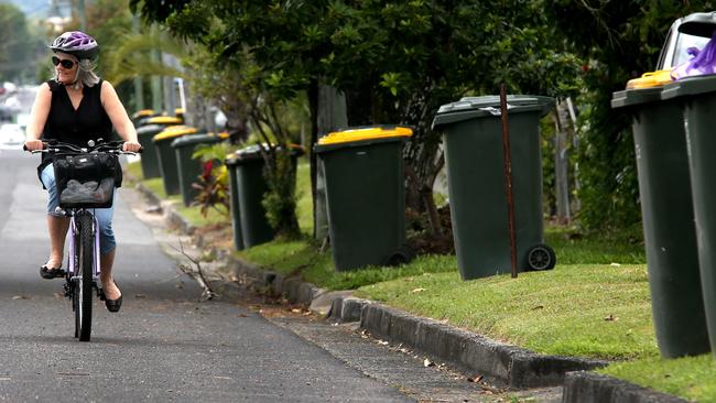
“Please have bins on the kerbside by 6am; delays may be experienced due to ongoing weather conditions and possible road closures,” the statement read.
“Waste Transfer Stations are also scheduled to reopen tomorrow (Thursday) from 8.30am.
“The Buy Back Shop will remain closed tomorrow.
“Council appreciates your patience.
“Be prepared and stay informed by visiting the Cairns Disaster Dashboard.”
More Coverage


Originally published as Far North weather: Cyclone Jasper BOM update and emergency advice for Cairns, Port Douglas

Explained: What return of birthing unit means for expecting mums
Twenty women have given birth in Weipa since it reopened a year ago, but what should mums expect of the returned maternity service?
Read more

Meth driver caught twice within 24 hours
A long-term drug user had an accident in Cairns just over 22 hours after her licence was suspended for drug driving in Mareeba.
Read more