
Bureau’s latest info on Cyclone Jasper impact zone
The Bureau has explained exactly how track maps are created as Jasper powers up in the Solomon Sea. Mackay has been flagged as a likely strike zone but the Far North copping a direct hit remains possible.

Cairns
Don't miss out on the headlines from Cairns. Followed categories will be added to My News.
Australia’s first cyclone of the season is powering up over the Solomon Sea and although modelling predicts different storm tracks, most agree the storm will impact the Queensland coast next week.
Cyclone Jasper on Wednesday had reached category 2 intensity, however remained 1300km north east of Cairns.
The system is the first December cyclone ever to be named by the Bureau of Meteorology during an El Nino weather set up.

While the NAVGEM United States navy model has Cyclone Jasper skirting the south Queensland coast and not making landfall at all, the GEM model predicts the system will cross the coast at Townsville, the GFS model has the system coming into Ayr and the ECMWF model has the system barrelling through Mission Beach.

BoM tropical cyclone team leader Andrew Burton said these predictions were part of about a 100 systems used to formulate track maps and wind speed estimations.
“We play the averages,” he said.
“And some like the NAVGEM model we don’t use in track forecasts but we use it for intensity.”
He said dozens of different simulations are run over and over using slightly different initial conditions and the published track map was created based on the results.
He said the system had an 80 per cent chance of touching down anywhere in the warning zone between Cooktown and Mackay from Monday, but the latest information issued on Wednesday had the system hitting the Whitsundays.
“I would say it’s highly likely that you’re going to get a coastal impact,” he said.
#Jasper at 75mph C1 SSHWS/C2 Aus Scale, forecast to head SSW away from the #SolomonIslands W of #Honiara, peaking at =>120mph Major C3 or even C4 SSHWS or C4 Aus Scale
— LimWx (Off Season from Hurricanes) (@LimWeather) December 6, 2023
Interests in C #Queensland, #australia should watch this closely!#wxtwitter#tropicswx#Cyclone#CycloneJasperhttps://t.co/mmpmPw7S0vpic.twitter.com/KCOM0jqCos
“I would not single out Mission Beach, pretty much anyone in North Queensland should be looking closely and impacts around Townsville and Cardwell are likely.”
From the Solomon Islands, Cyclone Jasper is expected to take a south-southwest track into the Coral Sea and was expected to reach category 4 intensity by Friday.
Mr Burton said Queenslanders in the expected impact zone should prepare for a category 3 storm.

“It does not look like it will cross the coast as a cat 5 or 4,” he said.
“It will reach cat 4 and thankfully it will weaken before it crosses the coast back to a cat 1 or 2 but could have another little burst of intensification before making landfall.”
During the weekend Tropical Cyclone Jasper is likely to weaken a little, but it will still be a tropical cyclone as it tracks towards the North Queensland coast early next week.

NEED TO KNOW DISASTER INFORMATION
Before the cyclone
As a cyclone approaches you should take these precautions to protect yourself and your family, your home and broader community.
Outdoors
Secure or remove anything that could become a missile if picked up in strong winds or swept up in storm water, such as outdoor furniture, children’s play equipment, tools, kerbside rubbish bins and barbecues.
Tie down sheds or other small structures not permanently fixed and secure caravans, boats and vehicles in your garage or tie them down to strong structures.
Indoors
•Turn off non-essential power and/or gas
•Sandbag areas at risk from flooding, where possible
•Cover windows and doors with timber sheeting or tape across the glass with masking tape. Close all doors.
•Store water – this could be in spare containers or the bath. Water for washing or flushing toilets can be stored in wheelie bins.
•Make sure you have enough large plastic bags to wrap items such as appliances in case of flooding.
•Lift items that need to be high off the ground, such as appliances and computers (this could be on a bed or bench or a higher floor in your home).
•Put important documents and items such as photo albums in plastic bags or high cupboards.
Tropical cyclone Jasper grows in strength and moves towards Australia – see where ground zero is predicted on our coastline https://t.co/2OBSa4ynTk#Australia#coastline
— WhatsNew2Day (@whatsn2day) December 6, 2023
Storm surge
Storm surge is a significant rise in the ocean level, caused by an approaching cyclone. Water can be pushed far inland over an extended period of time, or in strong, destructive waves. Not all cyclones will generate storm surge.
Know your zone
Storm surge evacuation is advised on the predicted height of the storm surge, known as zones, not by street or suburb. Storm surge can travel a significant distance in land, especially along tidal creeks. It’s therefore very important to ‘know your zone’.
You can quickly find your zone by entering your address in the search field below.
Please note, in Cairns, evacuation advice is only issued for storm surge, not the wind and rain associated with cyclones. To find out what to do if a cyclone is expected to impact Cairns, visit our cyclone page.
Zones explained
Our storm surge evacuation zones use a colour system, with red being the most at risk, followed by orange and yellow. If you are in a white zone, your property is outside the storm surge risk area.
Red zone: for areas up to 2m above AHD*
Orange zone: for areas between 2m and 3m above AHD
Yellow zone: for areas between 3m and 4.5m above AHD
White zone: your property is outside the storm surge risk area.
Search your zone at the Cairns Regional Council storm surge search
Cassowary Coast Residents are reminded that the best address in a disaster is Council’s Disaster Dashboard.
More Coverage


Originally published as Bureau’s latest info on Cyclone Jasper impact zone
Donated food sustains isolated town after 1.1m of rain in four days
Hundreds of residents are relying on donated rations at Cardwell, with the replenishment of grocery supplies at the town’s only supermarket among a number of urgent priorities following significant flooding.
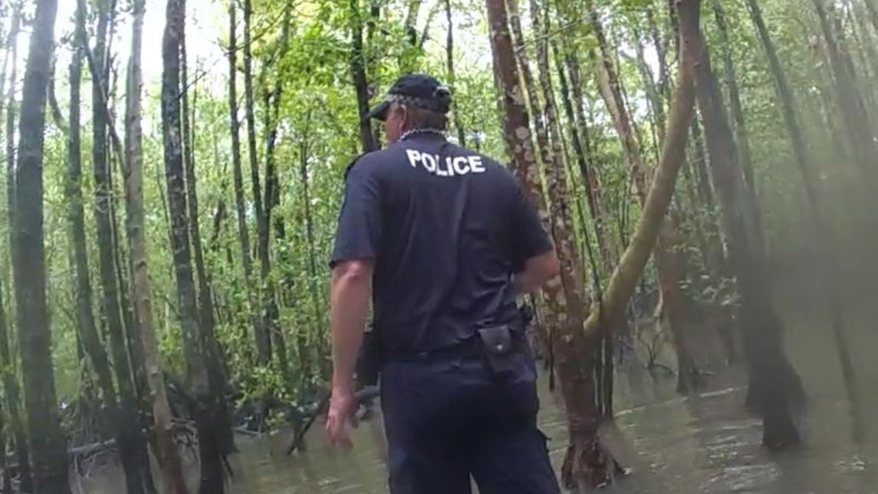
‘Sweet soul’: Fisherman still missing near croc infested waters
Locals do not believe a “skilled fisherman” was taken by a crocodile as the search for the 60-year-old enters its fourth day in remote Far North Queensland.