
‘Floodproof’ Windsor Bridge visible again after being swallowed by Hawkesbury River in mass floods
A ‘floodproof’ bridge in NSW that was swallowed by waters after torrential downpours can finally be seen again.

NewsWire
Don't miss out on the headlines from NewsWire. Followed categories will be added to My News.
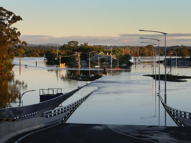
A “floodproof” bridge that was almost completely underwater in Sydney’s northwest can finally be seen again as waters begin to drop.
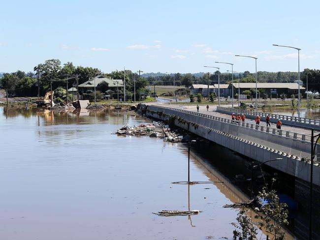
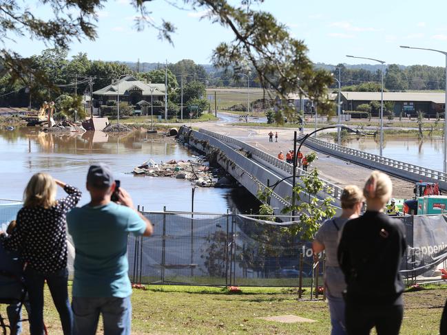
Photos of the Windsor Bridge emerged on Friday, showing water levels below the deck.
Locals were seen overlooking the bridge.
The bridge, which connects western Sydney with the Hunter Valley and Blue Mountains, was designed to be “floodproof” but closed last Sunday as weather across the state worsened.
Parts of NSW experienced a flooding event that was its worst in almost 50 years.
The Hawkesbury River region last week braced for flooding that could leave residents with disrupted utilities for months.
On Monday, locals watched on as the Windsor bridge went under water.
The state government said the new bridge, which opened for public use last year, would be better able to cope with the impacts of flooding.
The deck is three metres higher at the northern bank and six metres higher at the southern bank than the old bridge.
However, the approach to the bridge on the Thompson Square side is not higher than the ground-floor levels of nearby buildings.
The bridge replacement includes three lanes – two southbound and one northbound – as well as a shared pedestrian and cyclist path on the western side.
The state government allocated $25m for the project in June 2008, with planning approval granted in December 2013.
The bridge was originally built in 1874 with two lanes used for foot traffic and horse-drawn vehicles.
Originally published as ‘Floodproof’ Windsor Bridge visible again after being swallowed by Hawkesbury River in mass floods

AFL racism scandal claims club boss
The toll of the drawn-out racism scandal involving Hawthorn and former staff has resulted in the resignation of the club’s chief executive.
‘Tortured’ dad confessed abuse, court hears
An accused vigilante killer told police a young dad “confessed” to sexually abusing children while being tortured, a jury has heard.