
Ukraine maps show extraordinary story of Russia’s failing war
Maps show that in just seven days, vast swathes of territory were returned to Ukrainian hands. But everything might not be as it seems.

Russia’s retreat from vast tracts of northern Ukraine has drastically changed the axis of the war.
Its drive for the capital of Kyiv has been repulsed.
Now analysts are watching for signs of what Moscow will do next.
The maps appear to tell an extraordinary story.
This video shows the progress of Ukraine's gains around Northern Ukraine, as Russia has withdrawn troops from the area. pic.twitter.com/W2Ectc08k4
— Nathan Ruser (@Nrg8000) April 6, 2022
In the space of just seven days, vast swathes of territory were returned to Ukrainian hands.
The attempt to besiege Kyiv was over. Russian troops and tanks had withdrawn from its outer suburbs. The fields and highways to its north – over which the Kremlin’s forces had advanced – were empty.
But the dramatic maps depicting the change of the war between March 28 and April 4 may be misleading, military analysts and cartographers warn.
Moscow may never have controlled those territories in the first place.
It may all have been a map-induced illusion.
“Cartographic design choices over colour, layout, lettering and symbology, for example, all influence our attitudes and feelings towards the war in Ukraine,” argue cartographers Doug Specht of the UK’s University of Westminster and Alexander Kent of Canterbury Christ Church University.
“Maps are abstract representations that help us to comprehend the changing global landscape, but none can fully represent the truth.”
That’s not to detract from the startling success of the Ukrainian defenders.
Maps of Russian Federal News Agency show a massive retreat. Apparently, Russia abandoned its initial plans to capture Kyiv and take control of Ukraine. Thus political goals of Z-operation can't be achieved. Regime change and (partial?) annexation of Ukraine are not gonna happen pic.twitter.com/pDDxsx1mIr
— Kamil Galeev (@kamilkazani) April 6, 2022
Kremlin spokesman Dmitry Peskov on Friday admitted for the first time that Russia has suffered “significant losses of troops”. But he insisted the retreat from Kyiv and Chernihiv was “an act of goodwill” – despite NATO assessments of somewhere between 7000 and 15,000 dead.
“I would rather disagree with your qualification of what is going on,” he told a Sky News interview.
What is known is that some 40,000 troops and their supporting equipment have withdrawn to Belarus and Russia. And maps from the likes of the Institute for the Study of War (ISW) help detail the extent of their defeat.
Advancing in a reverse direction
The Kremlin’s “special military operation” has changed tack.
Its initial multi-pronged attack appeared to be a “thunder-run”, a race to occupy key strategic centres such as the capital Kyiv and the principal port of Odessa.
Maps of the war’s opening days show Russian red arrows thrusting deep into Ukrainian green territory. They indicated a rapid, largely unopposed advance.
Ukraine’s defenders had other ideas.
Russian President Vladimir Putin’s forces quickly bogged down. And it wasn’t just due to the muddy terrain. Ukrainian forces appear to have let the Russian military spearhead roll past before rising from their hideouts to wreak havoc on their exposed supply lines.
How could it happen? To answer this question, we'll need to figure out how did the hostilities go *before* the Russian retreat. What territory did the Russians control? Analysts mocked such "just the roads" maps of Russian-controlled territory as an obvious pro-Ukrainian copium pic.twitter.com/Yrx1wxZ6K0
— Kamil Galeev (@kamilkazani) April 6, 2022
And that’s something maps can’t convey, argue Specht and Kent.
“Depicting territorial changes in a fast-moving conflict is difficult, and is made even more so when an invading force is reliant on roads,” they write. “Although large areas of eastern Ukraine have been coloured red to signify that they are under the control of the Russian military, this generalisation – or homogenisation of space – is misleading.”
Many maps have shown vast swathes of territory under occupation. But Moscow’s tanks and trucks have been mainly tied to Ukraine’s roads because of the weather – and even deliberate flooding of vast tracts of farmland.
This means most of the ground between these significant roads is not actually under Russian control.
The cartographers warn that oversimplified maps can “make Russian achievements appear to be more advanced and certain than they are on the ground”.
Finding true north
Six weeks into the war, Moscow has found it can’t hold all the territory it wants to occupy.
The details on the maps weren’t as black-and-white as they seemed.
“The drive for clarity can result in making a complex, multi-theatre war look straightforward with an inevitable outcome,” Specht and Kent explain.
Putin has found out the hard way he doesn’t have the troops or tanks to suppress all resistance – let alone seize their objectives.
His army has bitten off more than it can chew.
ОÑÑŒ тут кацапÑької техніки було дуууууже багато. І горіла вона тут за милу душу! pic.twitter.com/5xQcw8FHdA
— Привид Ð’Ð¾Ñ€Ð·ÐµÐ»Ñ (@huvorzel1) April 5, 2022
And that’s likely because of all the little details many maps overlook – the small towns and villages, the farms, the forests and hills where Ukrainian forces find refuge.
Putin appears to have accepted this reality. So, he’s withdrawn his most exposed forces.
“I’m just telling you what we’re seeing,” a Pentagon official said Thursday. “We would assess that Russian forces near Kyiv and Chernihiv have completed their withdrawal from the area to reconsolidate and refit in Belarus and Russia. We are not showing Russian forces in or around Kyiv or to the north of Kyiv. We’re not showing Russian forces in or around Chernihiv.”
Elsewhere, Putin’s forces appear to be clinging to the territory they have gained.
Moscow initially committed some 130 battalion tactical groups (combined-arms mobile assault formations) to the invasion of Ukraine.
“Of the total that they applied to this invasion, we still assess that they have a good many inside. More than 80. So again, we don’t have a perfect picture of every single unit, but that’s roughly what we see.”
And that, the cartographers warn, is another trap maps present: “Oversimplification, while familiar to all map users, cannot adequately reflect the dynamic nature of the invasion.”
Uncertain futures
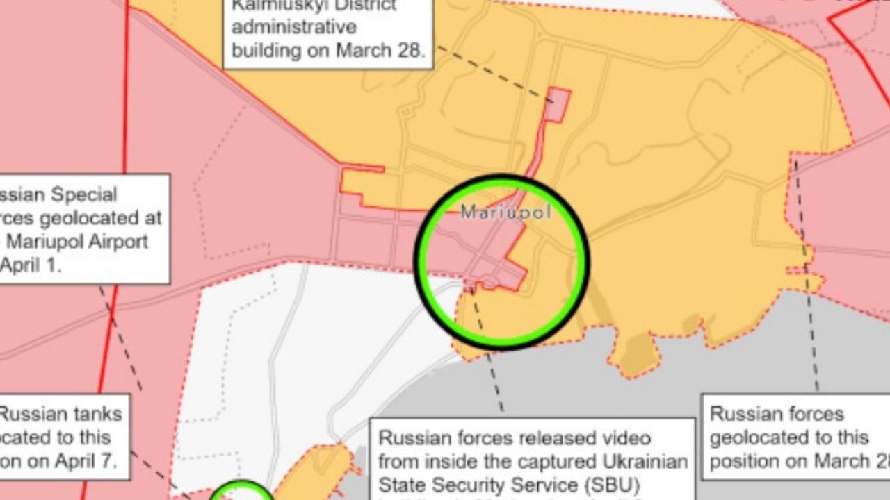
The ISW believes Russia is grouping its forces for a major new offensive in Donetsk and Luhansk regions in the coming days. It expects the city of Mariupol to fall.
The Pentagon’s not so sure.
“(There are) no real changes to speak to in east or the south of Ukraine,” the Pentagon spokesman explained. “Mariupol remains isolated, but it has not been secured by the Russians despite some open-source reporting to the contrary of Ukrainians surrendering Mariupol. We do not assess that that has happened.”
NEW #Russian Offensive Campaign Assessment: Russian forces are setting conditions for a major offensive in eastern #Ukraine in the coming days. Read today’s update from CTP and @TheStudyofWar: https://t.co/YiAbZbCNqTpic.twitter.com/gLbg1WGCzp
— Critical Threats (@criticalthreats) April 7, 2022
The ISW assess the city hangs in the balance, with no fighting observed in the city centre since April 2. And efforts continue to evacuate its civilian population.
“Russian proxy forces claimed to have captured central Mariupol on April 7, but Ukrainian forces retain positions in the southwest of the city,” the ISW states. “Russian forces will likely attempt to regroup and redeploy units withdrawn from northeastern Ukraine to support an offensive, but these units are unlikely to enable a Russian breakthrough”.
And it’s the state of these forces that the maps don’t show.
We know next to nothing about the number or condition of Ukrainian defenders. And Russia’s circumstances can only be inferred from pictures and videos of destroyed equipment.
Ideally, a battalion tactical groups consists of some 800 troops, ten tanks, six armoured personnel carriers, 40 armoured infantry fighting vehicles, 20 mobile artillery pieces, ten air defence vehicles and some 40 or so support vehicles.
Their locations are shown on maps.
But few reveal how many troops have been killed or wounded. Nor do they detail the vehicles destroyed, damaged or abandoned.
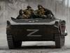
This video shows that Ukrainian troops are still able to operate armour in the very outskirts of Mariupol. Not only do they still have working BTR-4s despite a nearly month-long siege, but they still operate in large parts of the suburbs.
— Nathan Ruser (@Nrg8000) April 7, 2022
See this overlay on @Militarylandnet maps https://t.co/3Cwnfmfv7Ipic.twitter.com/G8Ip2deI2x
And the future of Russia’s evacuated forces remains unclear.
“We have now seen that the Russians have moved from the north into Belarus and to Russia for refit and resupply,” the Pentagon spokesman said. “We have seen indications that that refit and resupply is occurring, but I don’t have anything to report with respect to a redeployment of those units into Ukraine. We have not seen those units be redeployed.”
Jamie Seidel is a freelance writer | @JamieSeidel

Originally published as Ukraine maps show extraordinary story of Russia’s failing war

