
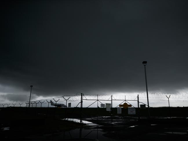
Wild storms lash east coast of NSW as Tropical Cyclone Gabrielle intensifies
Residents along the east coast of NSW are being warned to brace for wild weather as a tropical cyclone intensifies off Queensland.

Environment
Don't miss out on the headlines from Environment. Followed categories will be added to My News.
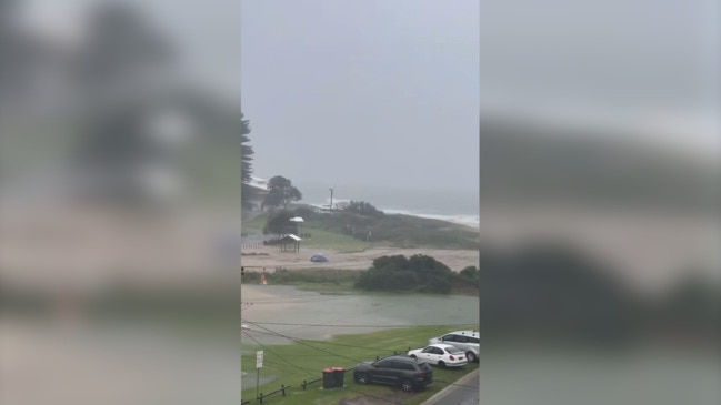
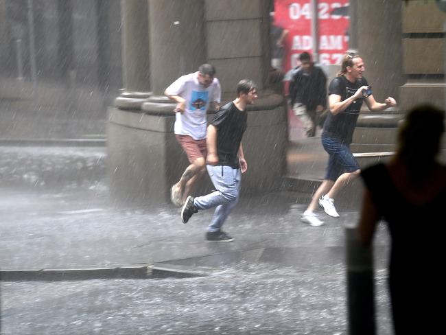
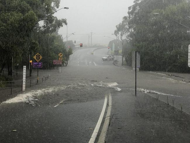
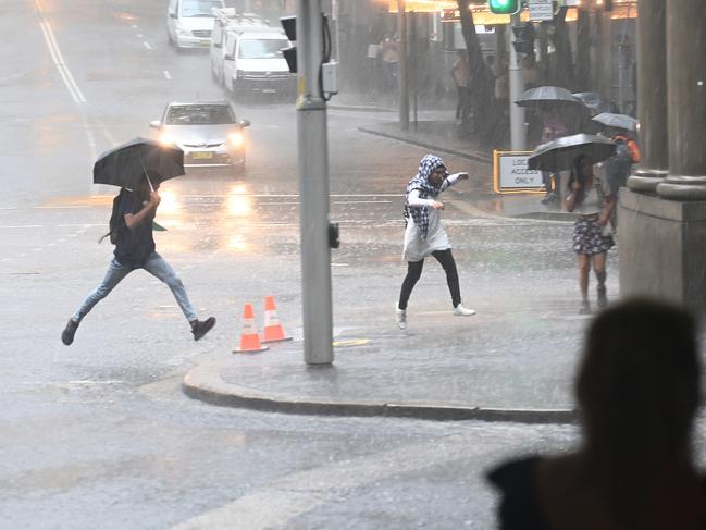
NSW residents have braced intense rain and wind as severe thunderstorms battered the east coast, with one woman watching her car wash out into the ocean as a result of the wild weather.
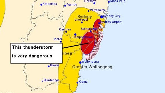
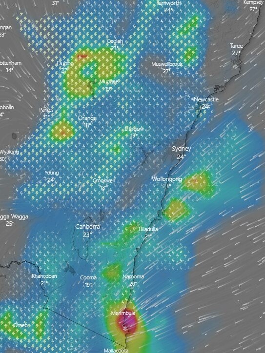
Intense rainfall as a result of severe thunderstorms have contributed to dangerous and life-threatening flooding across Sydney, Wollongong and all the way down the south coast to Huskisson.
The Bureau of Meteorology said the storm was “very dangerous” between Sydney’s south and Wollongong’s northern suburbs.
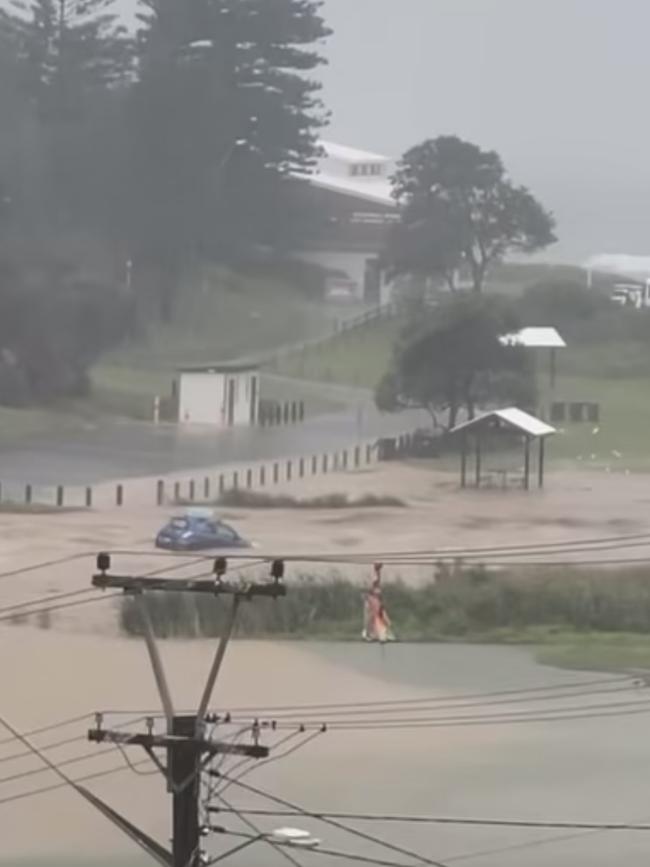
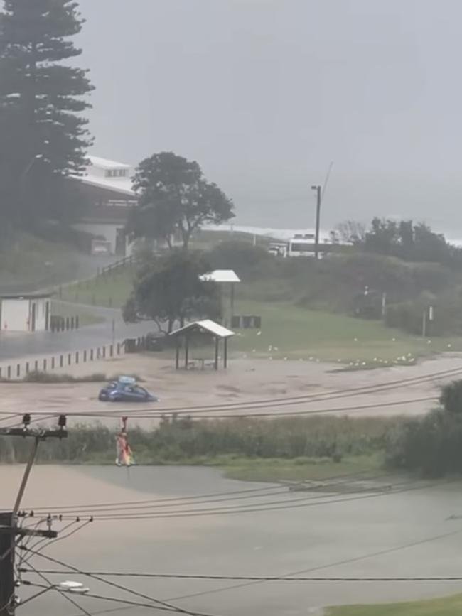
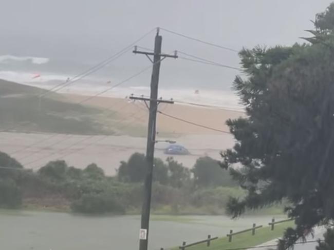
The flooding was so bad in Stanwell Park, video posted to social media shows a car floating down floodwaters towards the ocean.
In the background of the video, voices can be heard exclaiming in shock.
“That car’s going out into the ocean...oh no,” one woman can be heard saying.
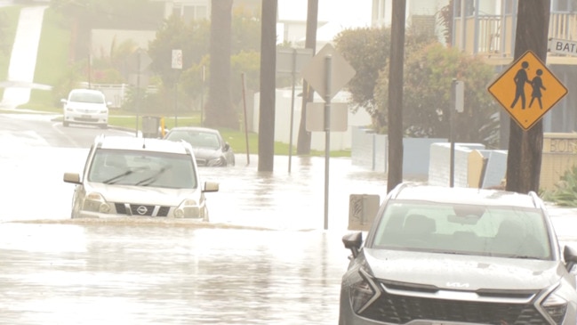
Throughout the afternoon, the NSW SES responded to more than 600 calls for help as the intense, heavy rainfall lashed the coast.
“The Illawarra region was one of the hardest hit, with over 350 incidents and 21 rescues from flood water recorded since midnight,” the SES said.
NSW SES Southern Zone Deputy Commander Sharon Fox said conditions across affected areas were still “dynamic”.
“Conditions right now are very hazardous – a number of schools have closed and school bus trips have been cancelled due to the weather,” she said.
“We’re asking parents picking their children up from school today to exercise caution and be sure to check the roads and routes they’re travelling.
“Localised flooding resulted in a number of roads being closed.”
Flood rescues were conducted from vehicles and buildings, while sandbagging assistance was provided to a childcare centre.
SES State Duty Commander Colin Malone said the rainfall is expected to continue well into Thursday evening.
“The weather system we’re monitoring has the potential to move into the metropolitan parts of Sydney and could be problematic during peak hour traffic,” Deputy Commander Fox said.
He is urging people not to try to travel through flooded roads and to seek shelter at higher ground.
The intense weather system also hit inland NSW, with flooding and heavy rainfall predicted to smash Orange, Bathurst, Yass, Blayney and Trunkey Creek.
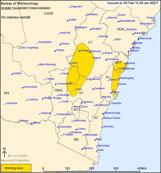
“An approaching upper trough is combining with an unstable environment to trigger severe thunderstorms across NSW,” the Bureau of Meteorology warning said early Thursday morning.
The NSW SES is urging residents to keep clear of creeks and storm drains and to avoid riding a bike or driving through floodwater.
Bexley Rd at Bexley North in Sydney’s south became flooded shortly after 1pm on Thursday, with the SES telling people to avoid the area.
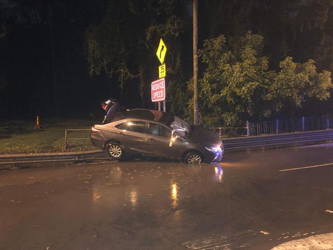
It comes after wild rain hit parts of Sydney overnight on Wednesday, with the SES called to eight flood rescues across the city.
People had to be rescued after they were trapped in their cars in Alexandra, Kogarah, Carlton, Banksia and Earlwood.
Further south, an aged care home in the Shoalhaven had to be evacuated about 1.45am on Thursday after the centre flooded due to roof leakages.
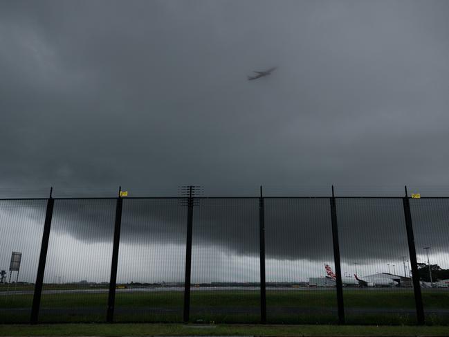
Meanwhile, Tropical Cyclone Gabrielle is intensifying off the coast of Queensland into a dangerous category 3 storm.
The system has been sitting about 800km off the coast of Cairns but is expected to produce strong winds and swells for northern Queensland later in the week.
The tropical low formed into a cyclone on Wednesday, prompting emergency services on Norfolk Island to activate their cyclone response plan.
It is currently rated a category 1 cyclone but is predicted to further strengthen throughout Thursday as it moves in a south to southwesterly direction towards northern Queensland.
The bureau predicts it will continue moving south before swinging east.
Before it moves away, the cyclone is forecast to remain offshore but bring large waves and strong winds to exposed coastal areas.
Some areas may experience “very destructive” winds of up to 159km/h.
The bureau declared Tropical Cyclone Gabrielle formed in the Coral Sea, about 690km northeast of Mackay, on Wednesday afternoon.
”Gabrielle is forecast to continue to track to the south during the rest of Wednesday and then southeast from Thursday, remaining well offshore of the Queensland east coast,” the bureau reported.
On Saturday, Gabrielle is likely to approach Norfolk Island and is forecast to pass Norfolk Island on Sunday.
The island could face sustained wind speeds of 89-117km/h and typical gusts over open flat land or seas of 125-164km/h.
“It promises to be a nervous few days for the 2200 residents of Norfolk Island, as a dangerous tropical storm develops in the Coral Sea and tracks southward,” Weatherzone meteorologist Anthony Sharwood said.
Carnival cruise ship Luminosa was forced to change direction on Wednesday following the cyclone‘s development.
The cruise ship was expected to reach Lifou, New Caledonia, on Wednesday but was instead forced to head to Brisbane.
In a letter to guests, Carnival Luminosa captain Carmelo Marino said the ship had to change course to remain at a safe distance from the tropical cyclone.
The wild weather is set to ease into the weekend, with heatwave conditions predicted across northeast NSW and South East Queensland.
Originally published as Wild storms lash east coast of NSW as Tropical Cyclone Gabrielle intensifies

Shock as two sharks die at popular zoo
Two bull sharks have died at Sydney Zoo leaving zookeepers and animal lovers shocked and saddened.
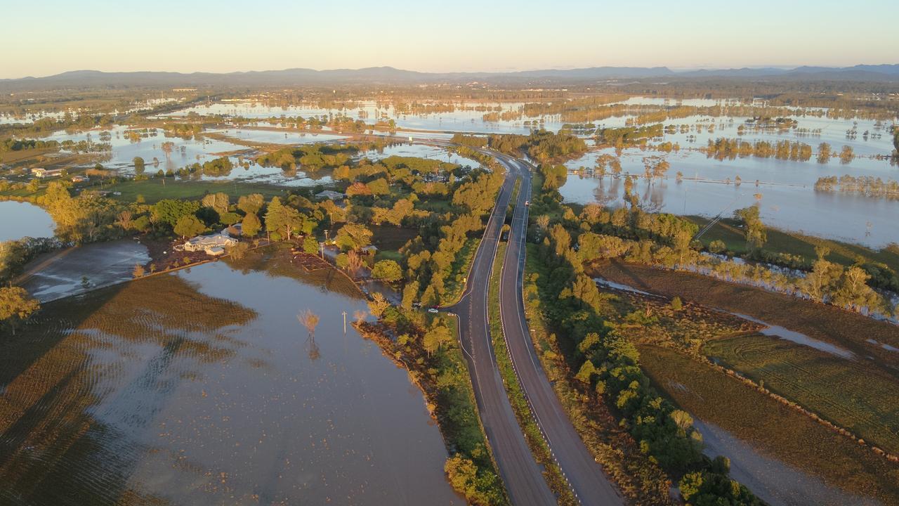
Incredible drone captures state under water
Incredible drone footage shows an unrecognisable NSW in the aftermath of flood devastation.