
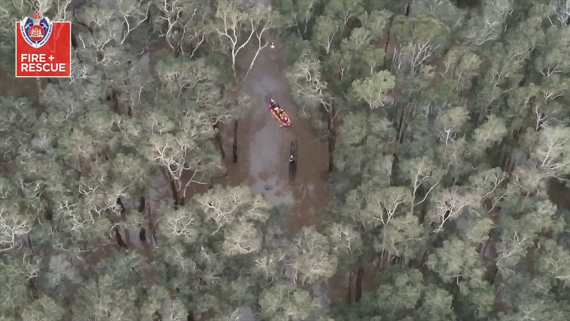
Severe weather warning in place for millions as floodwaters recede in NSW
Millions of Australians are bracing for another ‘significant weather event’, as floodwaters recede in NSW following devastating rains.
Environment
Don't miss out on the headlines from Environment. Followed categories will be added to My News.
Millions of Australians are bracing for damaging winds, wild weather and blizzard-like conditions as a powerful cold front sweeps across the southeast of the country.
Senior Meteorologist Dean Narramore said the front moved through southeastern parts of the country overnight, bringing intense conditions.
“That brought some strong and damaging winds,” he said.
Some of the highest wind gusts recorded included 113km/h at Neptune Island in South Australia and 122km/h at Mt William in western Victoria.
“Even in Tasmania we saw wind gusts of up to 93km/h at Mt Reed and Mt Thredbo,” Mr Narramore said.
He said Victoria, South Australia and elevated parts of NSW would continue experiencing strong winds today and into Tuesday as the system moved eastward.
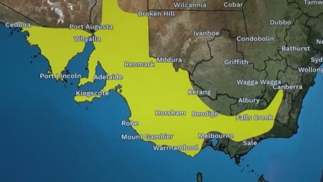
The Bureau of Meteorology has multiple severe weather warnings in place across much of southeastern Australia and parts of South Australia.
Gusts in those areas could reach up to 110km/h, particularly in elevated and coastal areas.
Mr Narramore said locally destructive wind gusts of 125km/h were possible around the coastal fringes.
Warnings are also current for abnormally high tides across the gulfs of South Australia and into Victoria, which could cause seawater flooding in the Spencer Gulf and Gulf St Vincent.
He warned beach conditions around Adelaide could be “dangerous”.
Most of Victoria is also under damaging wind warnings, with gusts expected to reach up to 100km/h in some areas.
Updated warnings issued early Monday confirmed damaging winds developing across elevated parts of the Snowy Mountains, ACT ranges, and South West Slopes.
For the Snowy Mountains and ACT ranges above 1400 metres, damaging winds averaging 60 to 70 km/h with peak gusts of around 100 km/h are expected to develop this morning, strengthening through the day.
#Floodwaters continue to recede across eastern #NSW, and no further rainfall has been observed this weekend. However, several Minor to Moderate #FloodWarnings remain in place as of Sunday afternoon.
— Bureau of Meteorology, Australia (@BOM_au) May 25, 2025
Latest warnings: https://t.co/4W35o8i7wJ or the BOM Weather App. pic.twitter.com/MJJBJrr1xz
Locations that may be affected include Mount Ginini, Perisher Valley, Charlotte Pass, Thredbo Top Station, Cabramurra and Selwyn.
Damaging winds are expected to ease into Tuesday across the warning area, but could then spread into parts of eastern NSW.
The Bureau’s Jonathon How said they are expecting “significant impacts,” from the winds coming through.
“Trees are weak across southeastern Australia due to how dry it’s been over the past autumn. So we could see high numbers of fallen trees and branches causing damage to property,” Mr How said.
He said the winds could also lead to hazardous driving conditions and disruptions to power infrastructure.
Snow falling later today and into Tuesday could also result in blizzard-like conditions across the Australian Alps.
While the cold front lashes the country’s southeast, the Bureau is also warning of unseasonal widespread rain and winds in the northeast.
Flood watch warnings remain in place across parts of northern Australia, including the West Kimberley and Fitzroy Rivers.
An initial flood watch is also current for the Sturt Creek District, Tanami, Central, and Western Desert catchments in the Northern Territory.
The northeast is forecast to experience below average temperatures and heavy rainfall over the coming days and into next week.
Final flood warnings are still active at Eyre Creek in Queensland, while a marine weather warning remains in place for Tasmania.
Originally published as Severe weather warning in place for millions as floodwaters recede in NSW

Shock as two sharks die at popular zoo
Two bull sharks have died at Sydney Zoo leaving zookeepers and animal lovers shocked and saddened.
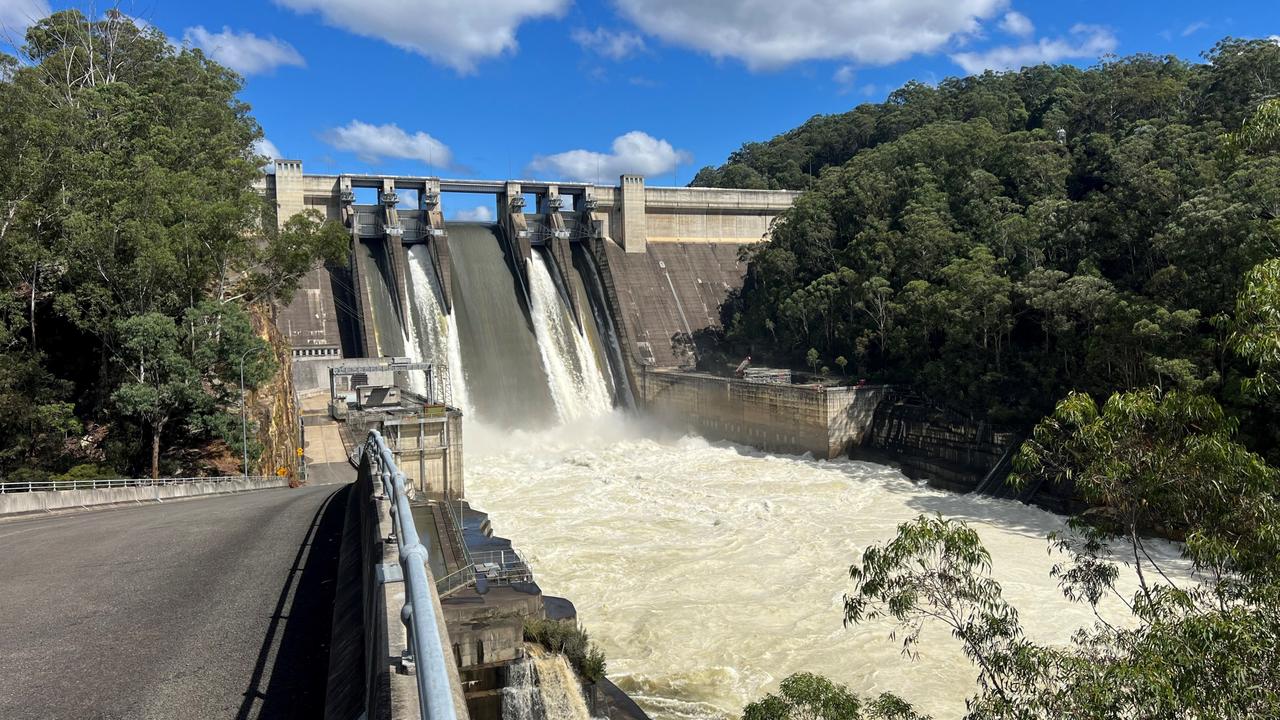
Warning to residents as major dam spills
Warragamba Dam has spilled in Sydney as the flood clean up got underway in other parts of the state.