
Powerful winds and rain forecast to smash SA, NSW and Victoria after heatwave
Another day of unseasonably high temperatures will hit one city before a wintry cold sweeps over multiple states.

Environment
Don't miss out on the headlines from Environment. Followed categories will be added to My News.
Intense heat briefly returns to Australia’s southeastern states before a harsh snap of wintry temperatures and gale-force winds.
Sydney is due to experience its sixth spring day above 30C on Tuesday.
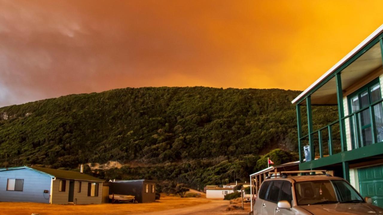
It comes after temperatures climbed to 36C in some parts of the city on Sunday, with hot winds stirring up the fire danger in large parts of NSW.
Extreme fire danger warnings are in place on Tuesday, promoted by gusty winds forecast to reach up to 40km/h.
A cold front is forecast to blast across the country from Western Australia, touching down in South Australia on Tuesday, Weatherzone reports.
It’s not unusual for spring to bring wild weather, but the seesawing temperatures are sure to be a shock to the system for east coasters after the weekend’s heat.
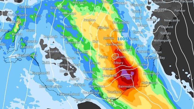
Rain and powerful winds are expected to hit inland South Australia, NSW and Victoria over the coming days, with gusts at speeds of more than 100km/h possible in the Alpine regions.
Severe thunderstorms are forecast to brew over central NSW on Wednesday and move east towards the coast by the afternoon.
Sydney and coastal parts of the state will likely be hit during the afternoon, with heavy rainfall expected from all the way down to the south coast and eastern Victoria.
More than 100mm could fall in northeast Victoria and southern NSW.
Cold southwesterly winds will push across South Australia, Victoria and western NSW, with temperatures set to plummet below the monthly average.
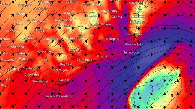
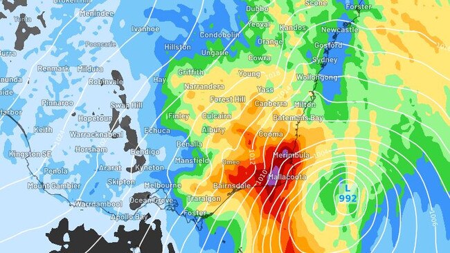
By Thursday, the weather system will deepen off East Gippsland and the NSW south coast, bringing more heavy showers and gale-force southwesterly winds.
“Storm force” winds are possible over the sea and the exposed coast, keeping temperatures low to the end of the week.
Up to 100mm of rain is forecast to fall over East Gippsland.
However, the cold snap will not last long and by the middle of next week, temperatures will climb once again to the mid-20s in NSW and South Australia.
Originally published as Powerful winds and rain forecast to smash SA, NSW and Victoria after heatwave
Community forced to self-evacuate in cyclone
A remote community in the Pilbara was forced to self-evacuate overnight as floodwaters in the wake of Cylcone Zelia threatened the town.
‘Volcanic’: Aussies battle raging fires
Residents in one state have captured startling photos showing apocalyptic scenes as they confront a complex web of bushfires.