
National forecast: expect heatwaves, damaging storms and snow
The country's east coast is bracing for its most intense heatwave in years as other parts of the country prepare for flooding and snow.
Environment
Don't miss out on the headlines from Environment. Followed categories will be added to My News.
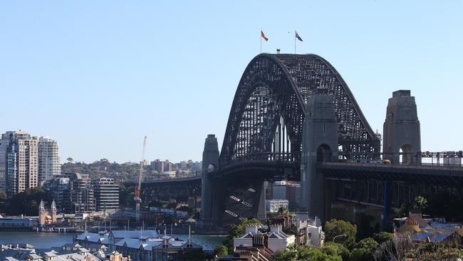
Australia’s east coast is bracing for another intense heatwave, with Sydney gearing up for its hottest March day since 2020.
Hot air will move across the country causing an autumnal heat spike, pushing Sydney’s CBD over 31C for the first time this year with a forecast 36C on Monday.
The heatwave will also impact parts of Queensland and Western Australia, while parts of Tasmania could see snow.
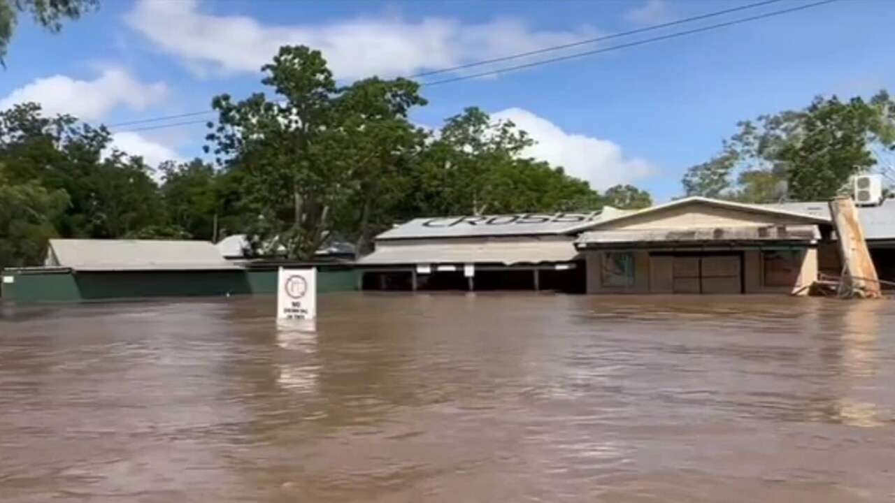
Heavy rains in the Top End continue to bring flooding risks and have blocked off a key transport route to Western Australia.
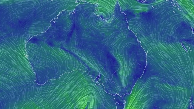
Damaging winds will batter western Victoria and southeast South Australia later on Sunday, while eastern Victoria and southeast New South Wales could see severe thunderstorms bringing large hail, damaging winds and heavy rainfall that may lead to flash flooding.
Severe thunderstorms could also threaten Tasmania on Sunday evening, bringing heavy rainfall that could lead to flash flooding, though they are expected to clear Monday morning.
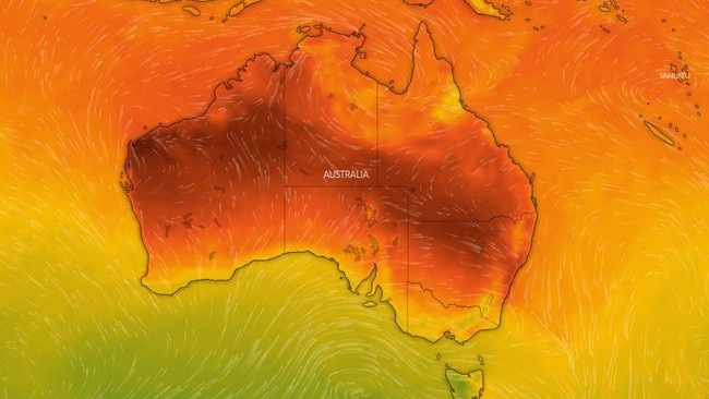
Bureau of Meteorology (BOM) senior meteorologist Sarah Scully said hot conditions on the eastern coast are due to shifting hot northerly winds moving ahead of a cold front.
“The heat is going to be peaking across much of Victoria on Sunday with a cold front on its way, and that’s forecast to move through Adelaide in the mid afternoon and Melbourne on Sunday evening,” she said.
“For much of NSW on Monday through to Wednesday it will be hot and windy, elevating fire dangers particularly about the NSW Ranges and Western Slopes.”
The BOM will issue a fire warning for these regions later on Sunday.
“We’re expecting low intensity heatwave conditions for parts of eastern NSW … while southeastern Australia will have a series of cold fronts with temperatures dropping well below average,” Ms Scully said.
“There’s even a chance of snow about elevated parts of Tasmania on Wednesday.”
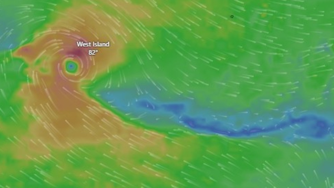
Heavy rains will continue to batter the Top End, courtesy of a monsoon trough dipping down over Cape York Peninsula over Queensland.
“That’s drawing in moisture over Northern Australia at the moment, bringing increased storm activity,” Ms Scully said.
“A number of flood warnings and watches have been issued across northern parts of the country.
“There’s a number of impacts on the community, last week very heavy rainfalls across the Top End resulted in a number of communities being evacuated – it’s actually eased, however that large body of water that created those flooding conditions last week is moving downstream.
“This has caused flooding over the Victoria River crossing, the main route for transport between the NT and WA, and it’s expected to remain impassable until Thursday.”
Western Australia has had some heatwave relief, with some very isolated patches of low intensity heatwave conditions to occur over the next week.
Sydney will sweat through maximum temperatures of 36C on Monday and 34C on Tuesday, with weather remaining in the high 20s for the rest of the week and some possible showers on Saturday.
Melbourne can expect a cool week after its steamy weekend, with maximum temperatures ranging from 17C to 24C and possible showers on Wednesday.
Brisbane is set to swelter through a week of hot temperatures with the mercury poised to tip over 30C every day, peaking at 34C on Wednesday and Thursday. It will be partly cloudy towards the end of the week with showers expected on Friday and Saturday.
Perth is in for another hot week, with maximum temperatures ranging from 27C to 34C, peaking on Tuesday. Weather will be sunny early in the week, with possible showers on Wednesday before skies clear up again on Friday.
Adelaide will be cloudy, with possible showers on Monday and Wednesday. Temperatures will remain relatively cool, hovering in the low 20s before climbing to a maximum temperature of 25C on Friday and Saturday.
It will be a dreary week for Hobart with rain expected Monday through to Wednesday. Cooler temperatures will reach a maximum of 23C on Monday before dropping to 15C on Wednesday.
Canberra is set for a week of beautiful weather following a weekend of storms, with partly cloudy skies and maximum temperatures ranging from 29C on Monday to 20C on Wednesday.
It will be a very wet week for Darwin, with showers and possible storms expected every day except for Friday. Maximum temperatures will hover in the low 30s all week with minimum temperatures of 25C.
Originally published as National forecast: expect heatwaves, damaging storms and snow

Shock support for controversial koala park
A controversial project that could transform swathes of one Australian state forever has “overwhelming support”, new polling has revealed.
Australia on verge of unwanted milestone
Aussies could experience the most cyclones in nearly two decades, with a new tropical low expected to develop into cyclone intensity.