
Fear ex-Tropical Cyclone Jasper could redevelop and strengthen over Gulf of Carpentaria
Despite losing its tropical cyclone status less than 12 hours ago, there are fears the storm system formerly known as Cyclone Jasper could return with a vengeance.
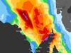
Authorities are warning that ex-Tropical Cyclone Jasper could redevelop and strengthen as it moves west across the country.
The cyclone which has wrecked havoc across the Far-North Coast of Queensland was downgraded on Thursday morning.
However, meteorologists have warned it is expected to move into the Gulf of Carpentaria on Friday or Saturday where it could strengthen, the bureau said.
“There is a low chance that Jasper could redevelop in the Gulf of Carpentaria later in the weekend, increasing to moderate from Monday,’ the bureau said in a statement about 11.30am.
“Later next week if could move to over waters to the north of the Top End, where there is still a Moderate chance of it being at tropical cyclone strength.”
From Sunday there is a chance it moves over land in the Top End, where it is less likely to strengthen into a tropical cyclone.

Sky News weather meteorologist Bradlyn Oakes said flash flooding could come as soon as 9.30am on Thursday when a high tide is expected to be exacerbated by a storm surge.
“This could lead to large amounts of flooding especially when we have this storm surge.
“And 24-hour totals of rain could be up to half a metre, so we’re watching a large amount of wet weather that could cause life-threatening flash flooding.”
A storm surge is when coastal waters rise above the highest tide levels because of a cyclone. The tsunami-like waves can go some way inland.
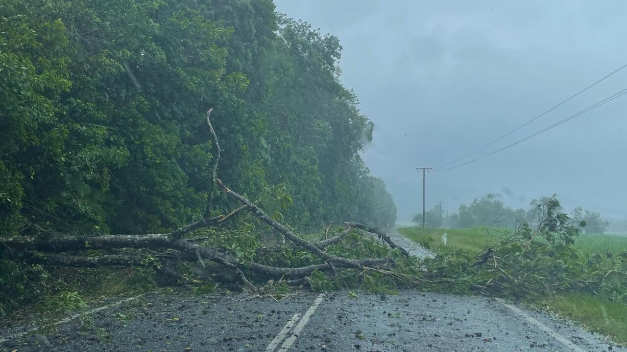
Authorities are already dealing with the fallout from the cyclone, with Queensland Fire and Emergency Services rescuing 18 people from rising floods near Mossman overnight.
Queensland’s State Emergency Service (SES) responded to 50 calls overnight and are expecting more throughout the day.
“There is still a lot of water moving through, so the flood risk and I suppose people’s visibility of what is going on around them needs to be retained,” an SES spokesperson said.
“Please don’t drive through water, don’t drive into water, don’t walk into water, it’s incredibly dangerous.
“It puts not just their lives at risk but the lives of responders at risk.”
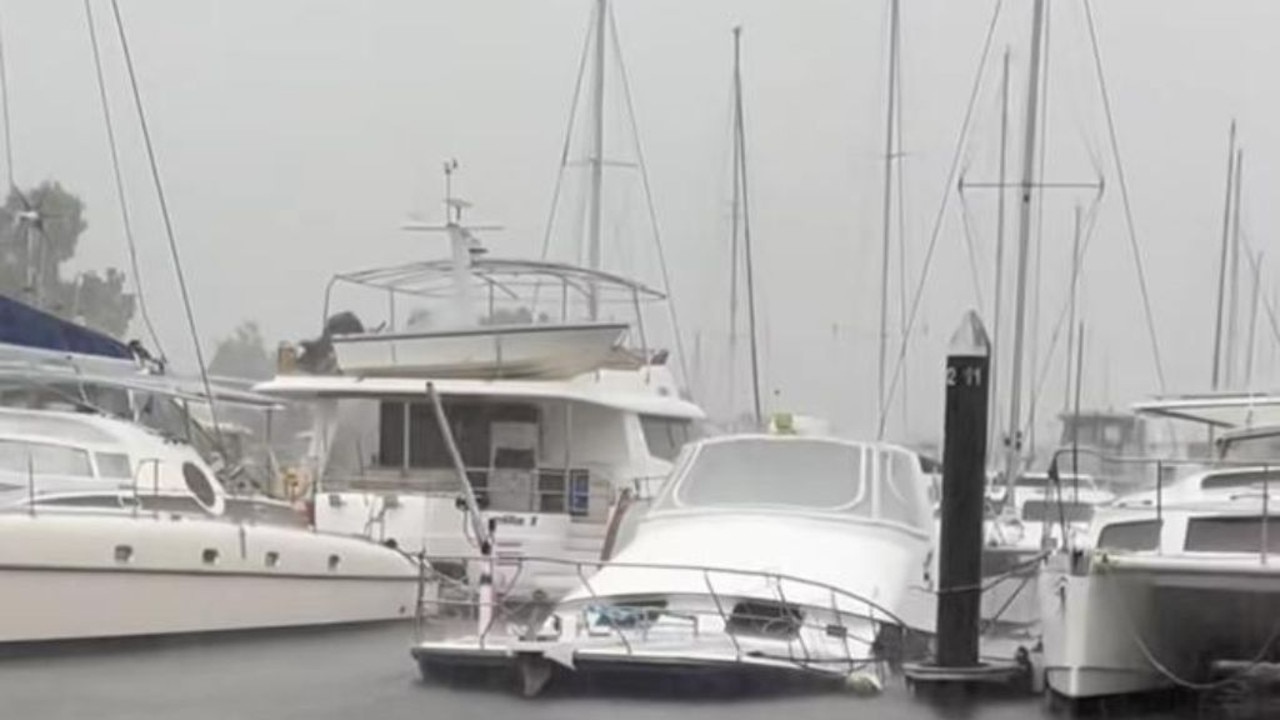
The torrential rain has sunk one boat in Cairns, with footage showing the vessel half underwater at the marina.
“Looks like the cyclone has claimed its first victim,” Karen Moody said in a video of the sinking.
“You can smell the diesel.”
Jasper made landfall about 3pm on Wednesday, south of Wujal Wujal near Cape Tribulation.
It remained at category 2 strength until about 9pm and is now, without the sea to feed it, an ex-tropical cyclone
More than 40,000 people are without electricity.
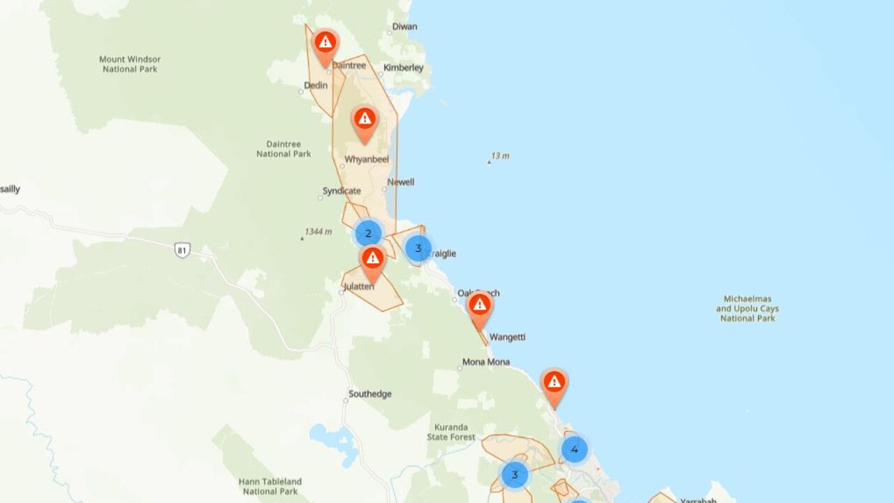
In the early hours of Thursday morning, the Bureau of Meteorology issued a severe weather warning covering more than a quarter of a million people from Cooktown to Cardwell, including Cairns and Port Douglas and as far west as Dunbar encompassing Mareeba and Atherton.
Tropical Cyclone Jasper has weakened to a category 1 system, producing damaging wind gusts near the far north Queensland coast.
— Bureau of Meteorology, Australia (@BOM_au) December 13, 2023
Heavy rain and flooding to continue for the north tropical coast. Flood warnings current for numerous rivers
Latest warnings https://t.co/zfHGPwcAwHpic.twitter.com/XZBqYACr7i
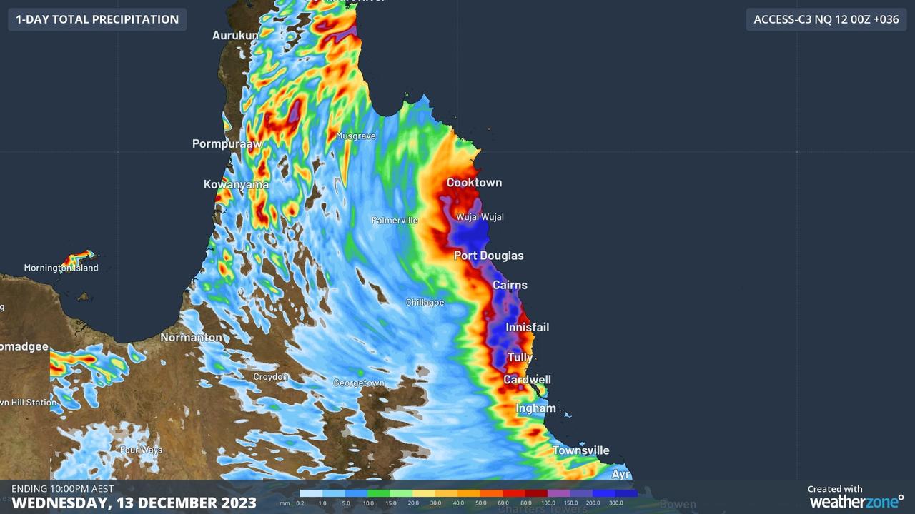
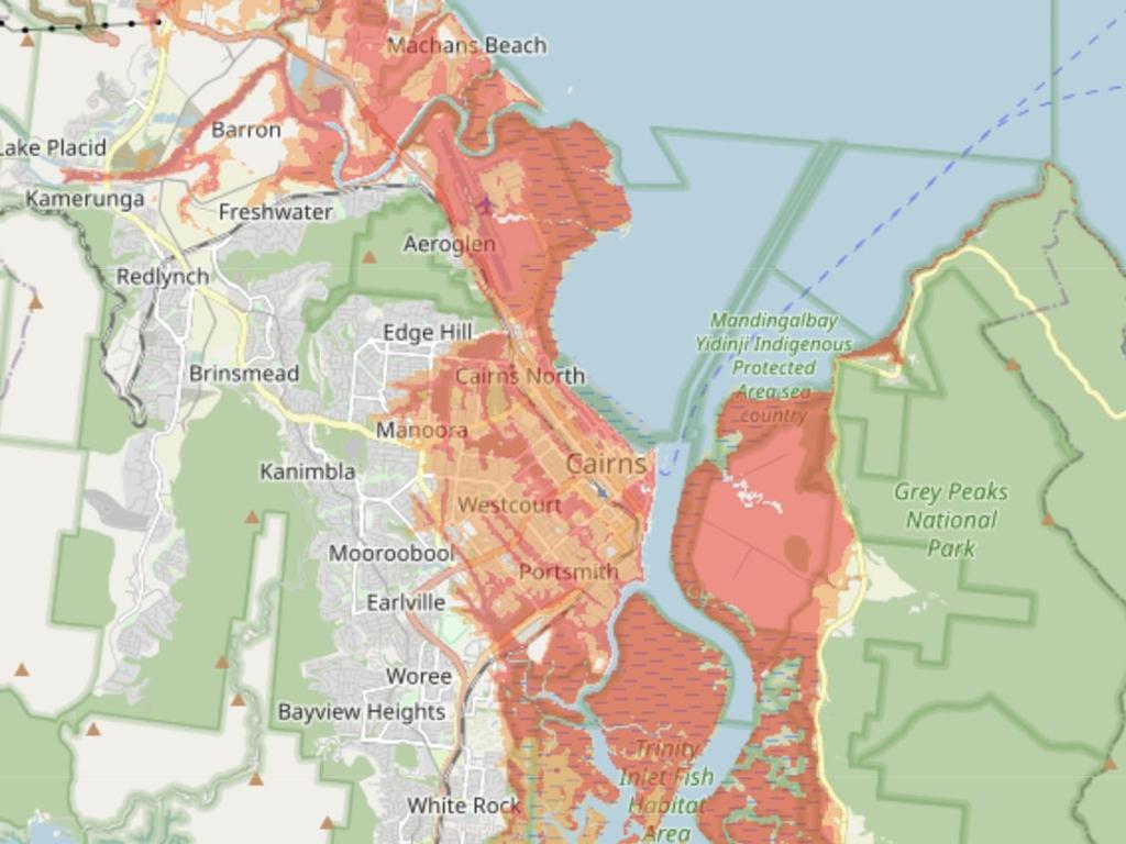
The bureau has warned of torrential rain potentially leading to flash flooding along the affected coast, with six hourly rainfall totals of up to 150mm being standard and pockets of 250mm. Isolated falls of up to 350mm in 24 hours are possible.
But between Cooktown and Cairns it could be particularly bad, the bureau has stated, with “dangerous and life-threatening flash flooding” as rivers swell due to up to 500mm of rain falling in some areas in a single day.
FLOOD WARNING
In at least one area, that’s already occurred.
Clarke Range, to the west of Mackay, received 467mm of rain in the 48 hours to 9am on Wednesday, before the cyclone officially hit. Cairns has been hit with 120mm of rain up to 4am on Thursday; the Low Isles off the coast of Port Douglas have been drenched with 150mm over the same period.
There are also warnings of damaging winds gusts of about 90km/h along the coast and extending inland to the Atherton Tablelands and as far as Palmerville and Chillagoe from late Thursday morning.
A major flood warning was issued for the Daintree River and a flood watch for the Mossman, with rainfall totals of up to 200mm recorded in both catchments in the 24 hours to 7pm on Wednesday.
“Heavy rainfall is forecast to continue overnight Wednesday and into Thursday,” the bureau said in its warning. “Based on forecast rainfall, major flooding is possible from Thursday morning.”
A moderate flood warning was also issued for the Mulgrave River and minor warnings for the Barron and Tully rivers.
ELECTRICITY OUT
As Jasper hit it took power away from thousands.
As of Thursday morning, about 41,000 Ergon customers are without electricity.
While Cairns CBD retains power, suburbs around the city, up to the Daintree and down to Tully are in the dark.
An Ergon Energy Network spokesman said its crews had been told to take cover and wait until it was safe enough to assess the damage.
Damaging wind gusts of up to 120km/h were recorded along the south coast of Cooktown, including at Cairns, according to the bureau. Wind gusts of up to 140km/h are anticipated at Wujal Wujal and Port Douglas, where the cyclone landed.
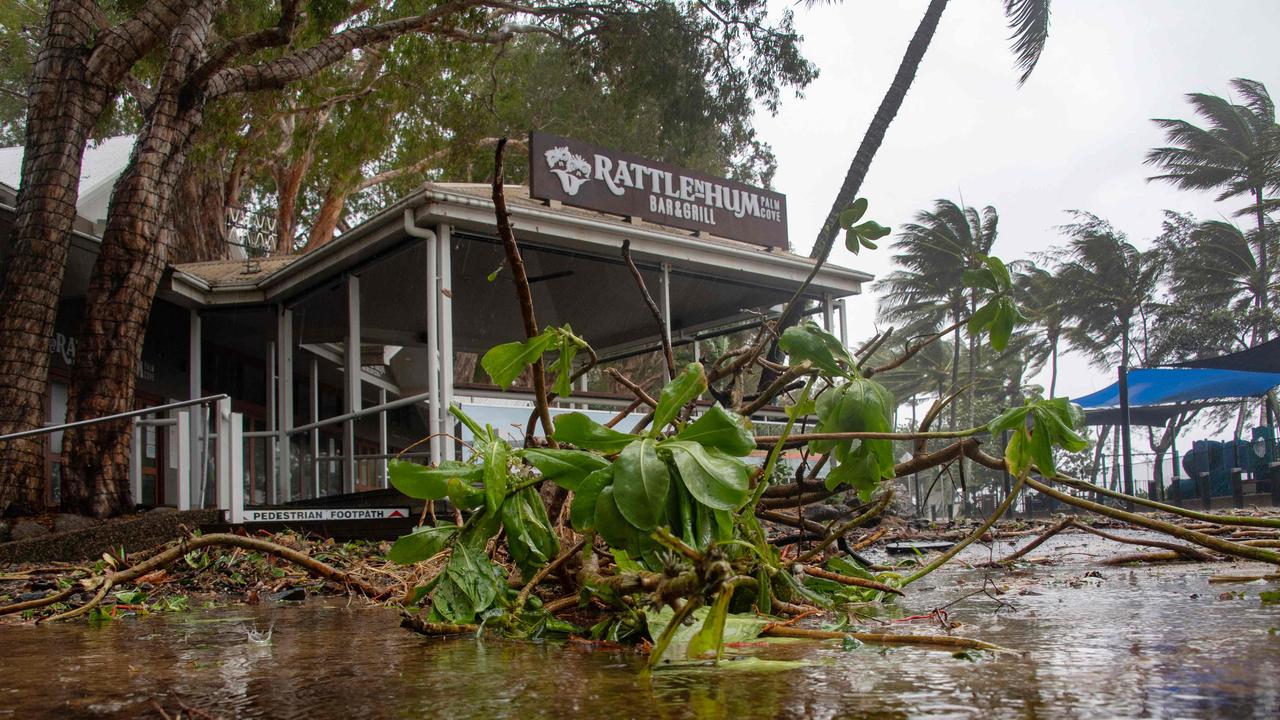
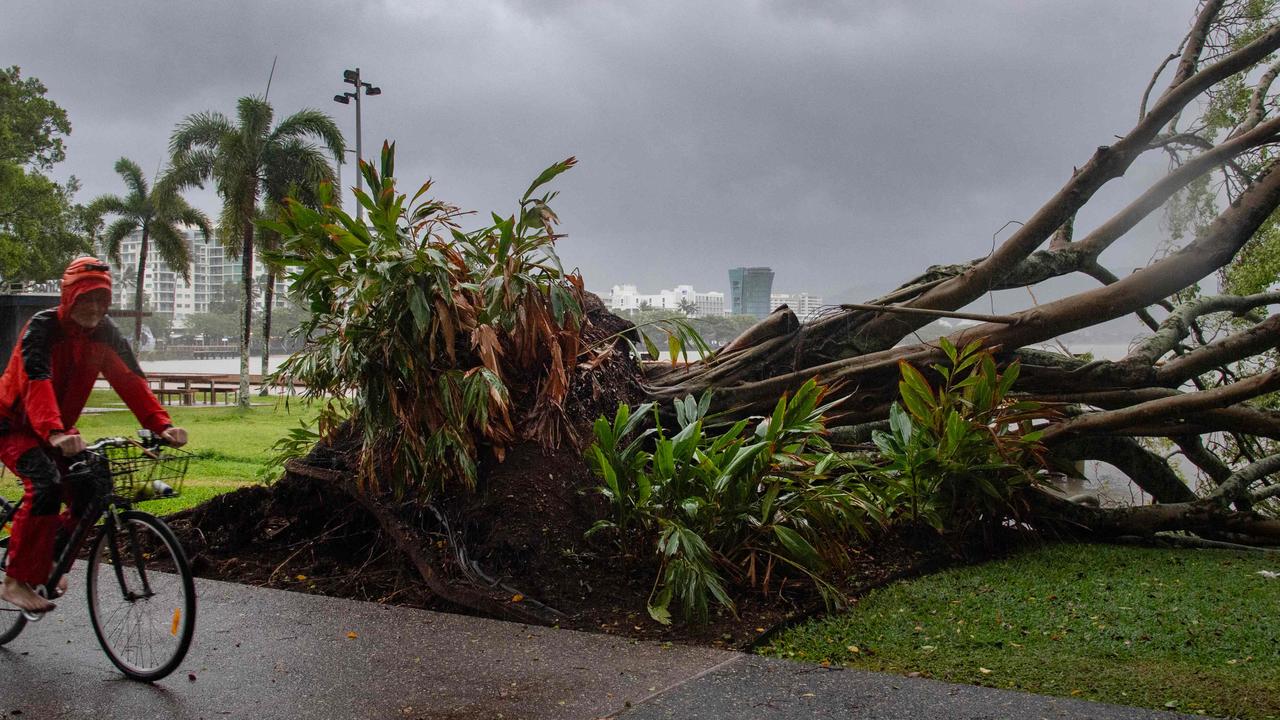
Incredible footage from Port Douglas showed torrential rain and ferocious winds battering the tourist town.
Trees whipped back and forth as branches fell. At Cairns, the tides flooded walkways by the ocean.
Other images taken at Port Douglas showed a massive tree knocked down in severe wind gusts.
The Australian Defence Force is poised to assist.
“We stand ready to support Far North Queensland, the Queensland government and local governments in any way needed in the days ahead,” said federal Emergency Management Minister Murray Watt.
Tropical #CycloneJasper making landfall between Port Douglas and Cooktown. pic.twitter.com/RlxW3qQ5jb
— Andrew Miskelly (@andrewmiskelly) December 13, 2023
Speaking alongside incoming Queensland premier Steven Miles, a bureau spokesman described the event as an “evolving situation”.
“There’s also a risk of riverine flooding as well as storm surge as we see the high tide at 10am,” they said.
“In terms of riverine flooding, we’re still going to watch the current, with some warnings likely to be issued later today as we see more rainfall throughout the day.”
The SES had already responded to 80 calls for assistance, Mr Miles said.
Cairns Hospital has reminded residents that medical assistance will be offered throughout the cyclone, with the emergency department sandbagged as a precaution.
“We don’t expect the storm surges or the water to come over and affect the emergency department, but cyclones are unpredictable so that is purely precautionary to protect the emergency department. We are open and ready to receive anyone we need to,” a spokesman said.
Storm tide shelters are open at the PCYC on Walker Rd and at Redlynch State College. These are only available to residents in red and orange zones.
Authorities are warning residents not to drive or walk through floodwaters due to the dangers they pose.
Originally published as Fear ex-Tropical Cyclone Jasper could redevelop and strengthen over Gulf of Carpentaria

