
East coast warned to prepare for bizarre weather forecast
Several states are being urged to prepare as forecasters warn a surprising weather event is preparing to strike Australia’s east coast.

Environment
Don't miss out on the headlines from Environment. Followed categories will be added to My News.
Antarctic winds are to bring unseasonable snow not seen in 14 years as Australia’s southeast gears up to start November with a near-record late spring cold snap.
The week will be cold enough for rare November snow along parts of the Great Dividing Range as far north as central New South Wales with temperatures dropping as much as 15 degrees below average.

A weakening of the polar vortex will allow very cold air to escape from Antarctica and move towards Australia this weekend, causing the unseasonable chill.
Chilly polar air will reach the South Australian coast on Monday morning, then sweep across the southeast by Tuesday night.
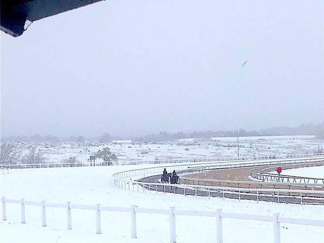
Victoria is looking at a cold and occasionally wet Melbourne Cup Day, the Antarctic blast hitting just in time, with a wind chill close to only 5 degrees Celsius through the afternoon.
The spell of wintry weather will extend until at least Friday as a second pulse of cold air follows on Thursday.
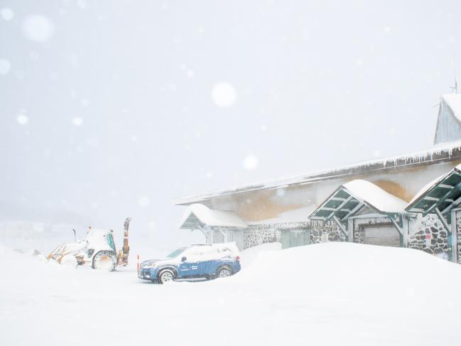
The Alps will see snow all across Monday night and should be falling below 1,000 metres on the Victorian ranges and across highland Tasmania by Tuesday morning.
Tuesday night is set to be even colder with snow likely to extend briefly north to the New South Wales central ranges to Oberon, the higher cities of Orange and the Blue Mountains.
The Alps will continue to see snow through Wednesday and Thursday, taking the total snowfall to around 50 centimetres.
The weakening polar vortex will also lead to thunderstorms and small hail across parts of southeast Australia.
Widespread showers and thunderstorms across central and eastern Australia will result from the initial front from Sunday through to Tuesday, triggering renewed flooding from southern Queensland down to Tasmania.
The upcoming showers may also cause major flooding in pockets of inland New South Wales and Victoria but the severity is unlikely to match October’s levels.
Originally published as East coast warned to prepare for bizarre weather forecast

‘Big’: Wild weather warning to Aussies
Aussies in several states have been warned to brace for a weekend of wild weather, with the risk of floods and damaging winds.

Aussie miner drops F-bomb 10 times in rant
An Australian miner’s expletive-laden rant about the future of coal-burning has caught the attention of the world’s richest man.