
Waterfalls run down soaked Uluru as record-breaking rainfall smashes country, ‘monster’ system dumps 100mm+ falls
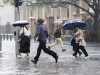
A rare sight has emerged at one of Australia’s most iconic landmarks as record-breaking rain smashes parts of the country.
Environment
Don't miss out on the headlines from Environment. Followed categories will be added to My News.
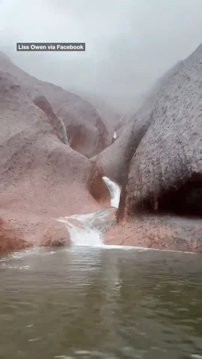
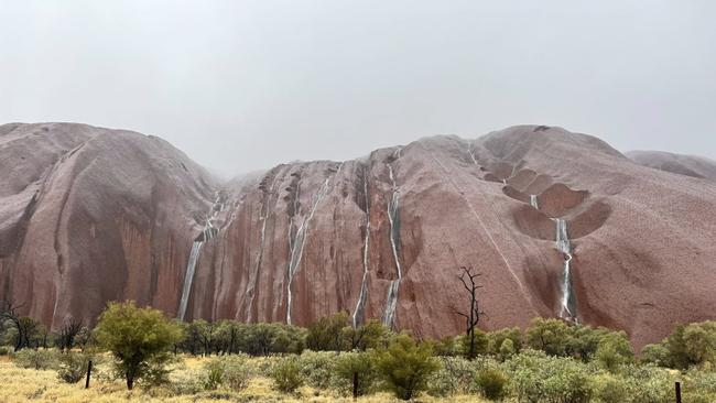
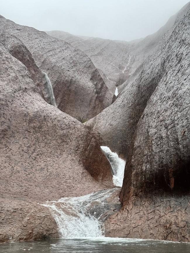
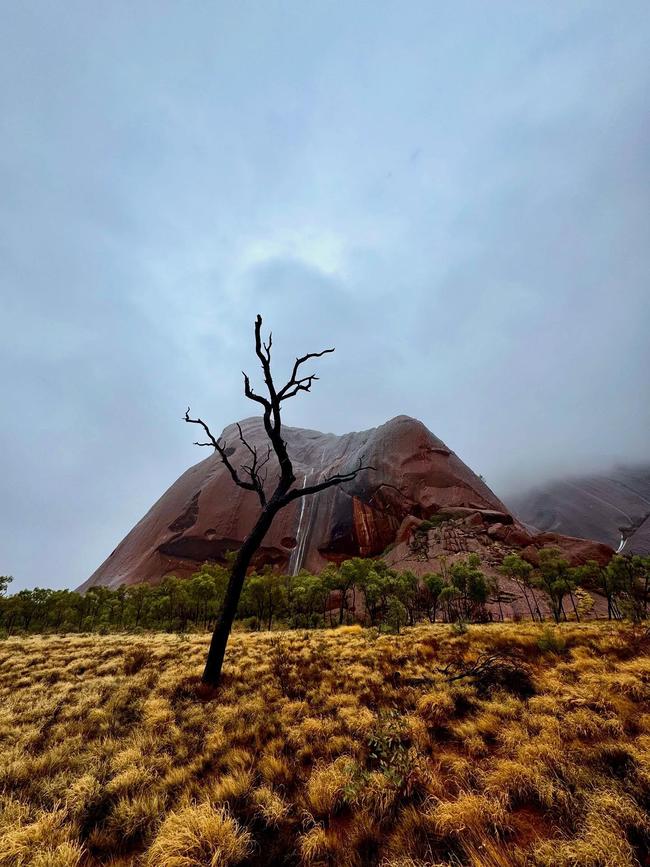
Unseasonal heavy rainfall has produced a majestic sight at one of Australia’s iconic landmarks.
Tourists visiting the Red Centre have captured the rare occurrence of water cascading off Uluru – which only happens a few times a year – as record-breaking rainfall smashes the country.
Just last year, Uluru experienced its wettest September on record.
The stunning display comes off the back of a week of wet and wild weather in the country’s east, and as flood-stricken communities are being urged to prepare for record-breaking rainfall that is making its way across the country.
Satellite images show the cloud band stretches 3600km, almost the length of Australia, from Western Australia’s Kimberley Region to the Queensland and NSW borders.
The “monster” wet-weather system has already dumped record-breaking rainfall over some parts of WA and the Northern Territory, bringing with it flash flooding and abnormally chilly temperatures throughout the red centre.
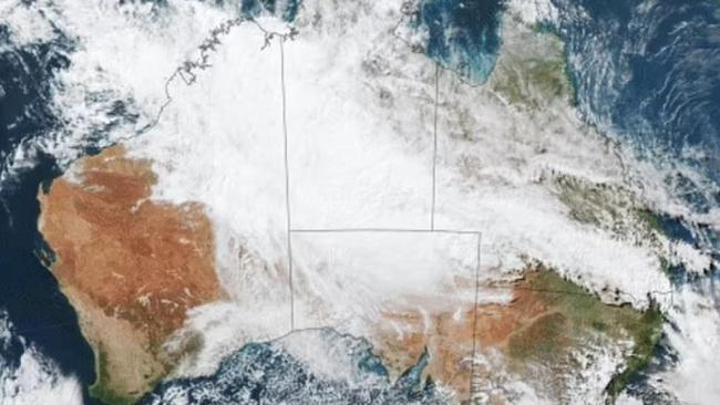
Sky News meteorologist Alison Osborne said the system “has been feeding off moisture laden air in the tropics, stretching from WA, through to the red centre and pushing into western Queensland”, and the rainfall was “uncharacteristically heavy” for this time of year – especially with the dry season in the region beginning more than a month ago.
“The forecast shows showers likely to continue across central parts of the Northern Territory with wet weather pushing through central western Queensland in the early hours of Thursday morning,” Ms Osborne said.
This week alone, Broome received 100.6mm of rain in 24 hours – the heaviest May daily rainfall in 20 years.
New monthly records were set at Kalumburu and Wyndham, hit with 111.6mm and 54.6mm respectively.
In the NT, Katherine received 179.8mm of rain in the 24 hours to 9am on Tuesday, the wettest dry season day the town has experienced since records begun in the 1800s.
Tindal was soaked with 179.8mm, with its average May daily rainfall sitting at 2mm, while Rabbit Flat received 77.6mm.
Alice Springs recorded its heaviest May rainfall daily total since 1993, with a rainfall of 40.4mm.
The BOM has issued flood watches for significant portions of Central Australia with flash flooding has already cut off numerous rural towns across the NT.
The weather system is set to hit Queensland by the weekend.
“Cloudy, cool and wet describes the weather for a lot of areas along the east coast (on Friday),” the BOM’s Angus Hines said.
“Most of the rain will be between Bundaberg and Townsville, we could actually see some moderate falls around the likes of Mackay and Rockhampton, and it will be pretty wet there through most of the day.
Much of the west coast is also in for a soaking, he added.
“When it comes to rain though, there is something a bit more significant to talk about here, and this is bands of showers and storms moving onto the west coast,” Mr Hines said.
“(It) really could affect anyone from the Pilbara, right down through the central west, through Perth and down to the very far south west.
“When it comes to stormy conditions, storms are most likely south of Geraldton.”
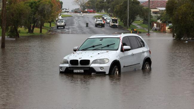
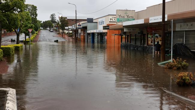
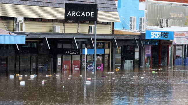
It comes as NSW communities are still reeling from devastating floods that has left five people dead, more than 1000 buildings inhabitable and a further 10,000 properties damaged.
A massive clean-up blitz has begun, even as showers are expected to continue into the weekend.
More Coverage

Originally published as Waterfalls run down soaked Uluru as record-breaking rainfall smashes country, ‘monster’ system dumps 100mm+ falls
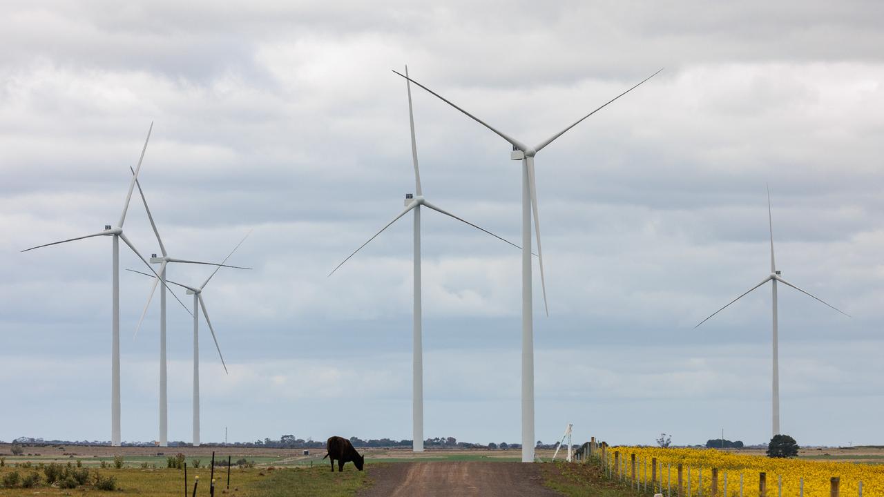
Australia’s first wind farm to be shut down
The energy company behind Australia’s first commercial wind farm has announced it will be shutting down the operation that has come to the end of its technical life.

‘Slap in the face’: Nations erupt at Australia
Two nations are furious with Australia after the first major decision from the Albanese government.