
Brisbane’s west facing isolation as major roads cut, huge sandbag queues, schools shut
UPDATED: Much of Brisbane’s westside faces being cut off, possibly for days, with a swag of major arterial roads closed. Residents are evacuating in at least four suburbs and residents report waiting for four hours for sandbags at SES depots.

South West
Don't miss out on the headlines from South West. Followed categories will be added to My News.
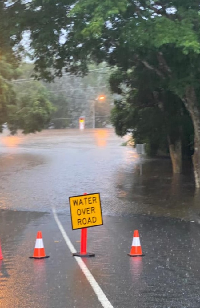
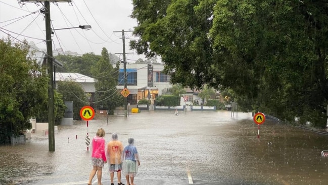
Large swathes of Brisbane’s heavily populated westside face being cut off, possibly for days, as major arterial roads have been closed late this afternoon.
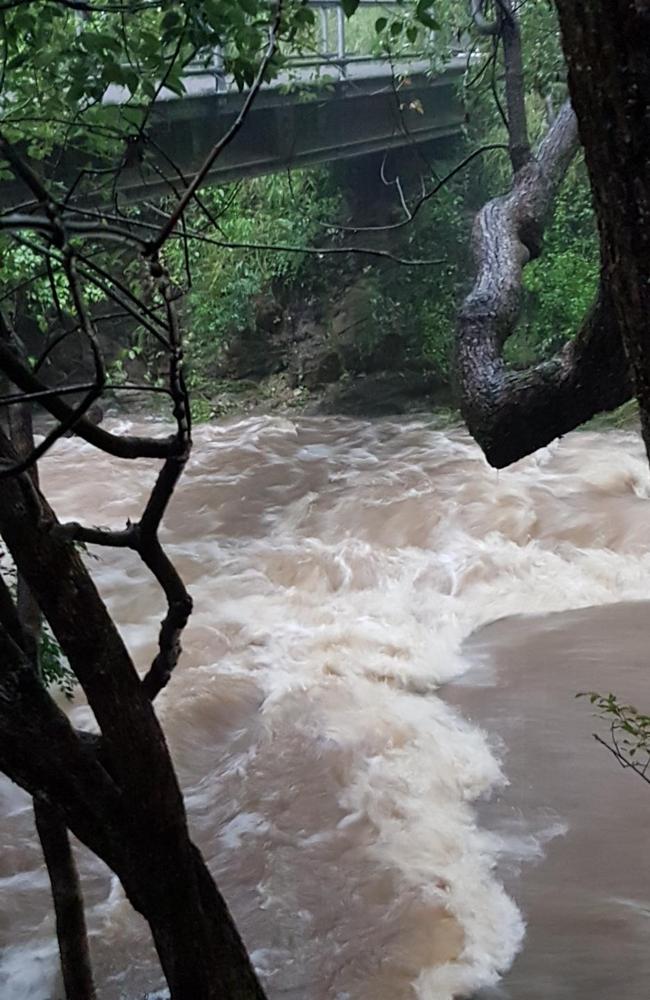
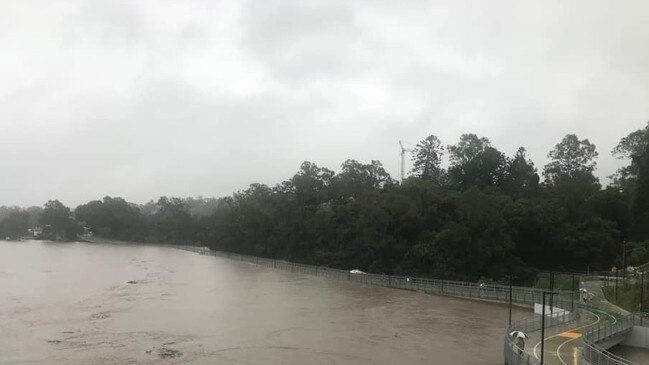
Coronation Drive in Milton, one of the city’s vital routes, was close to becoming impassable at 4pm with the Brisbane River close to breaking its banks in that area.
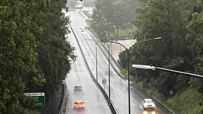
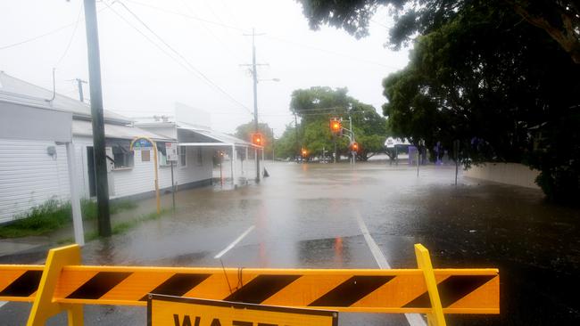
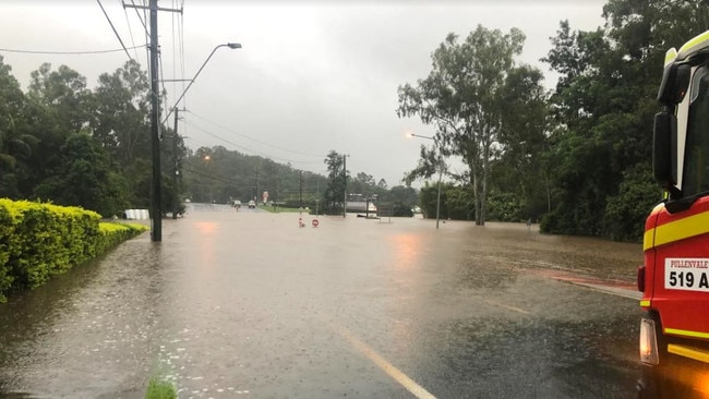
Nearby Milton Rd, another extremely busy route, was cut earlier and Moggill Rd is closed in at at least three places, isolating more than 20,000 people.
The Western Fwy, including the Centenary Bridge, and Legacy Way Tunnel were still open this afternoon.
The Gap, St John’s Wood and Ashgrove are close to total isolation with Settlement Rd closed by mud, rock and water flows, Gap Creek Rd blocked for days and large amounts of water across Waterworks Rd at Ashgrove, where a controversial $15 million bridge at Gresham St — still being constructed — has gone under despite being built to keep St John’s Wood open during flood events.
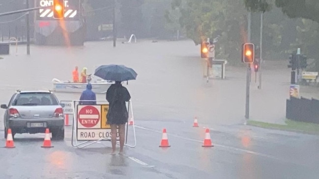
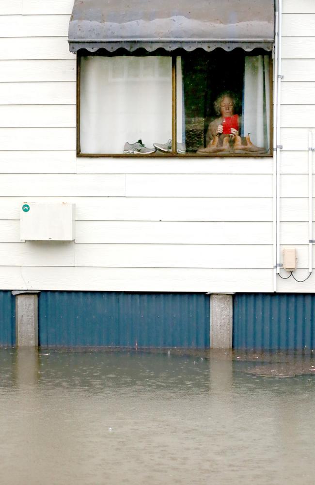
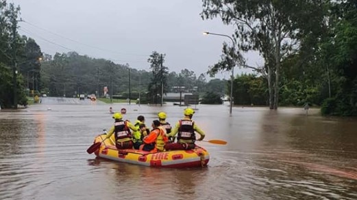
It comes as residents have evacuated in parts of Milton, Torwood, Herston, Newmarket, St Lucia, Indooroopilly and Fig Tree Pocket.
Queues of up to four hours for sandbags were reported at SES depots at Darra and Newmarket, prompting some to hit social media with workarounds including stuffing shopping bags with sand.
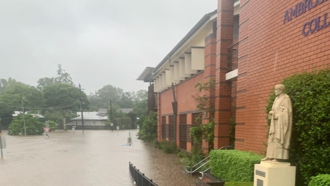
At least 11 westside schools will be closed on Monday and possibly for longer: The Gap State High; Milton, Kenmore South, Sherwood, Brookfield, The Gap and Upper Brookfield state schools; Ambrose Treacy and Brigidine colleges, Indooroopilly; Queensland Academy for Creative Industries and Kelvin Grove State College, Herston.
Water pressure dropped significantly earlier this afternoon or was cut entirely in some suburbs including parts of The Gap as Seqwater struggled to get the Mt Crosby treatment plant — Brisbane’s main water treatment facility — back online after debris and sediment from the flooded Brisbane River and its tributaries clogged it.
Council bus services were stopped at 4pm, until further notice.
2PM UPDATE
Supplies have run low at some outlets. Pullenvale Marketplace IGA has been closed today as staff can’t get through.
The new Coles at Moggill is open but has been running on limited staff numbers and did not receive overnight resupplies.
Ampol at Bellbowrie has run of out gas cylinders, milk and bread.
Bellbowrie Shopping Plaza is not flooded despite going under in 2011.
Ambrose Treacy College in Indooroopilly has contacted parents to confirm it will be closed on Monday, possibly longer, after Witton Rd flooded and a motorist died early this morning.
The Mcintyre Centre has been closed.
Moggill Community Emergency Management Group has been activated and is operating out of the Moggill School Hall to prepare for whatever scenario may arise.
The Moggill SES will also be operating from this centre with generator back-up.
Mt Crosby water treatment plant is still offline and residents are asked to conserve water.
It went offline early this morning due to soil and debris washing into creeks, which end up in the treatment plant. Water cloudiness is 100 times normal.
The Gold Coast Desalination Plant is being used to help supplement supplies.
Ugly Gully is over the bridge on Mt Crosby Rd, Rafting Ground Rd is closed near Huntington Estate.
Other road closures include Indooroopilly Rd at Lambert Rd, Jesmond Rd, Fig Tree Pocket, Sherwood Rd at Oxley Common.
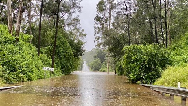
Colleges Crossing is likely to be closed for days, the Karalee Crossing is closed as is the Kholo Crossing.
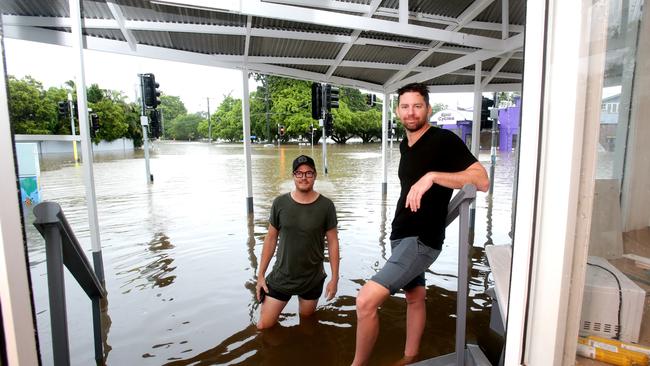
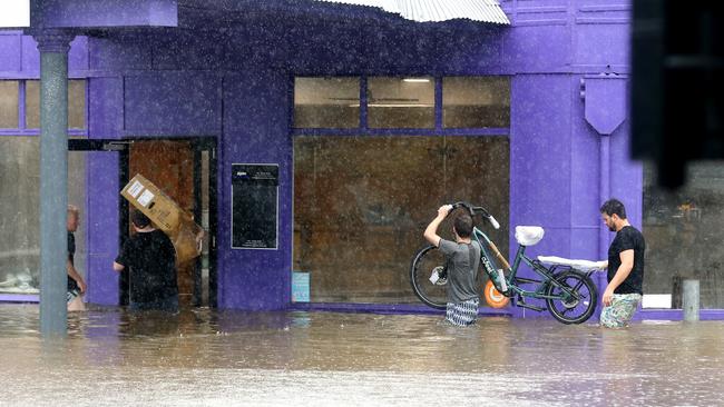
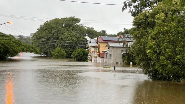
Businesses along Baroona Rd, Milton, and residents and business in Torwood and Rosalie faced more heartbreak today after being flooded for days in the 2011 event.
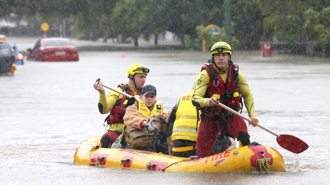
Epic Hair and an architecture business which had just opened on Baronna Rd were among many to spend the day moving out equipment and fittings, while some residents were evacuated by SES boats.
EMERGENCY EVACUATION CENTRES
Grace Bible Church, 75 Hassall St, Corinda -- open tonight for local evacuations
Sleeman Sports Complex, Old Cleveland Rd &, Tilley Rd, Chandler -- residents can bring pets
COMMUNITY SUPPORT CENTRES
Corinda Bowls Club, 58 Hall Ave, Corinda -- BYO bedding if possible
Graceville State School Hall, 23 Acacia Ave, Graceville -- open for school families for light refreshments
Christ Church, Central Ave, St Lucia
ROAD CLOSURES SOUTH OF THE RIVER
Chelmer
Harte St, Leybourne St
Corinda
Pratten St, Cliveden Ave, Deniven St
Fairfield
Fairfield Rd, Fairfield at Fairfield Gardens
Brisbane Corso
Graceville
Pamphlett Bridge, some water across road at Bert St Clair Oval and large pothole after the bridge crossing into Graceville
Faulkner Park. Long St E, Graceville Ave, Haldane St, Coleman St
Oxley
Rocklea to Oxley Blunder Rd service Rd, Ipswich Mwy exit 25 to Oxley, Oxley Rd at golf course, Englefield Rd, Gladstone Rd into Oxley Rd, Oxley Station Rd, Logan Ave, Oxley homemaker area under Slip Rd
Sherwood
Sherwood Rd/Muriel Ave underpass off Ipswich Rd, Hall St, Egmont St, McCollough St,
Thomas St Park, Oxley Creek Common, Sherwood Arboretum, Sherwood Rd west of the Markets
Rocklea
Numerous Rds around the showgrounds, Marshall Rd, Ipswich Rd, Muriel Ave, Sherwood Rd,
Boundary Rd
EARLIER TODAY
More than 20,000 people in Brisbane’s westside from Pullenvale to Mt Crosby are cut off and could be isolated for days, with planning for possible food drops.
Moggill Rd, the only land access, was this afternoon cut in three places, at Pullenvale Rd, at Ironpot Creek Bridge and a 300m section near the McIntyre Centre.
It is unlikely to reopen tomorrow and could be cut for several days, SES coordinator for Bellbowrie-Moggill Community-led Disaster Management Group, Mark Kerle said.
He said it was hard to say how long the road would be out of action, but the Moggill Ferry would not be able to resume services for at least a week due to debris in the Brisbane River, cutting the only other exit route.
Mr Kerle said a child stranded without their insulin pump was ferried by SES boat across
Moggill Rd, at Pullenvale Rd, this morning and taken to Royal Childrens Hospital by ambulance.
Onlookers had to push an elderly man’s car out of floodwater after he tried to cross Moggill Rd this morning near Bellbowrie.
At this stage no houses were flooded or at risk of evacuation.
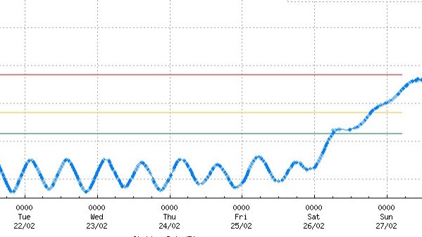
“The river rose 1m from midnight to 5am and another 0.5m until (about 12.30pm),’’ he said.
There were enough sandbags at the SES Hawkesbury Rd depot, at least yesterday, and several local doctors and a nurse had volunteered their services if needed.
The area was “forgotten’’ in the 2011 floods, with Bellbowrie residents left to fend for themselves for days before supplies were helicoptered in.
Local state MP Christian Rowan said a community-led disaster management plan had been activated and he had been in touch with both local LNP MP Julian Simmonds and local councillor Greg Adermann.
In an effort to stop history repeating itself, also in Karana Downs and Mt Crosby which had similar issues, he had been on the phone to the local Labor federal MP, Shayne Neumann, who forwarded his concerns to state emergency services minister Mark Ryan.
A respite centre has meanwhile been set up at Christ Church, Indooroopilly, for people evacuated from homes in Sandford St in St Lucia and other lowlying areas.
“Please feel free to use the kind services of the church,’’ local Councillor James Mackay said.
“Be careful on the roads of course. Jesmond Rd at Fig Tree Pocket is now closed behind the state school, with Fig Tree Pocket Rd now the only way in and out.
“Indooroopilly Rd at Lambert Rd is also closed now after Sandy Creek brke its banks.’’
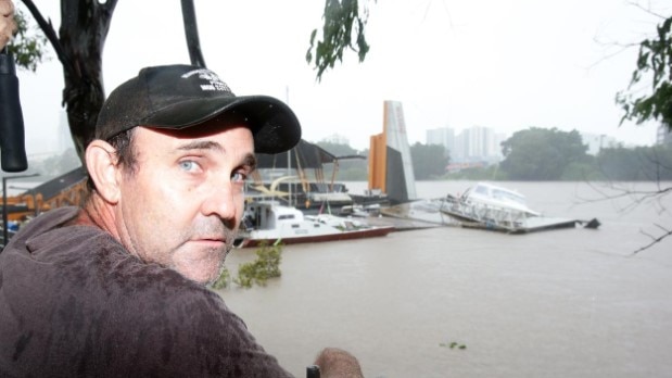
At least half a dozen private pontoons have been ripped from their moorings this morning and floated down river.

Cr Adermann said some residents were also unable to get back home and an elderly couple spent the night on a bench inside Kenmore Village Shopping Centre.
He said the nearest evacuation centre was at Chandler.
“They are saying the river height this time is moderate whereas it was high during the 2011 floods,’’ he said.
“That time we had people isolated for days at Moggill and Bellbowrie and another pocket at Karana downs and Mt Crosby.
“It is impossible to say how long they will be cut off this time.’’
A Moorooka man, 34, meanwhile died early this morning after reportedly trying to drive across flooded Witton Rd at Indooroopilly. The road is now closed.
Police said the man managed to free himself from his car which had become submerged about 2.30am.
He tried to swim to safety but nearby residents raised the alarm when he failed to surface from the water.
Emergency services found his body soon after.
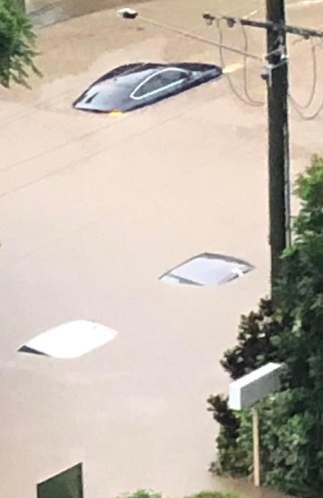
Sandford St in St Lucia is currently being sandbagged to try to protect homes and units after multiple cars were fully submerged earlier today.
Some residents are now being evacuated, local Councillor James Mackay said.
Cr Mackay, who was helping them with sandbagging, said the Toowong SES depot appeared to now be accessible only by SES boat. It flooded in the 2011 event as well.
He said a caravan was stuck between the riverbank and Indooroopilly Riverwalk, where a motorist was spotted driving there car on the pedestrian riverwalk despite the Brisbane River lapping its deck.
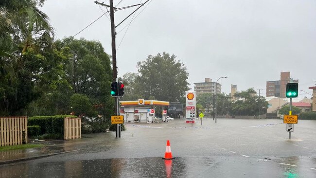
“Boundary Rd, Indooroopilly will require evacuation. Sir Fred Schonell Drive in St Lucia is cut at Guyatt Park and the service station at (nearby) Gailey Rd is underwater,’’ he said.
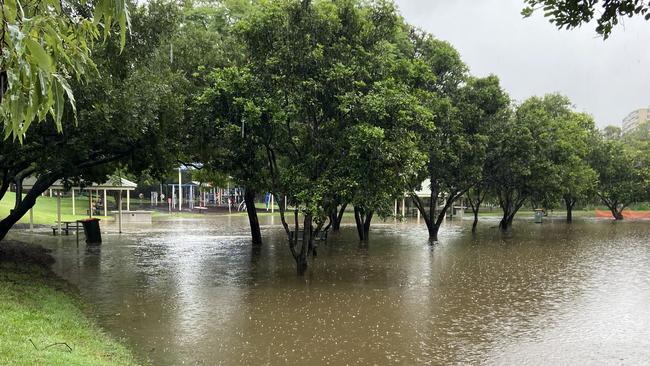
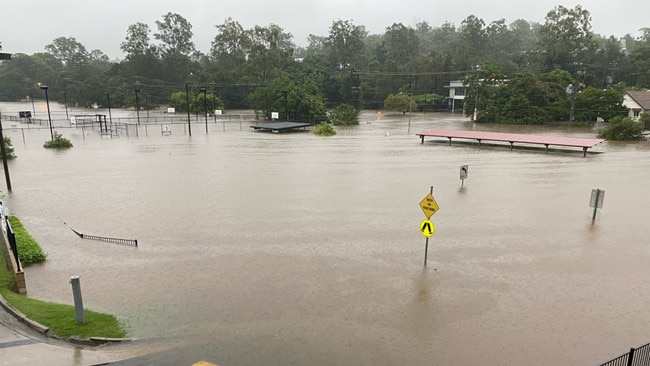
Perrin Park, Toowong, where the State Government will build a controversial new school at the adjacent disused bowls club, was under more than 2m of water this morning and well under by yesterday afternoon.
“We were talking about what a great place it is for a new school,’’ one onlooker said yesterday afternoon.
Residents in Graceville say it’s getting “serious” and have issued calls for help, while there are reports of evacuations at Corella St in Rocklea.
Brisbane residents are being asked to conserve water after problems at the Mt Crosby treatment plant.
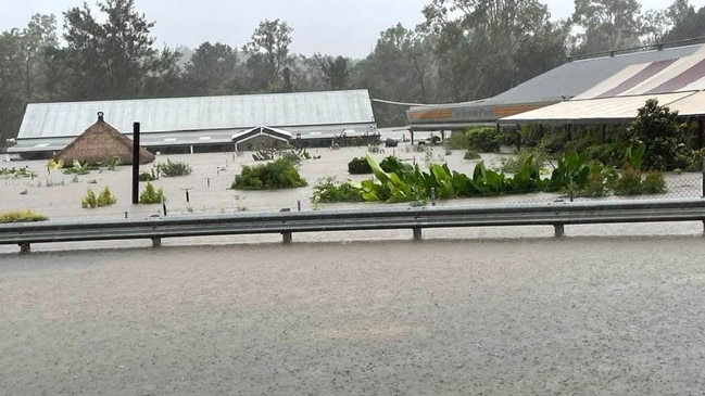
Properties in nearly 100 Brisbane suburbs are under threat today.
They include 32 inner-west suburbs.
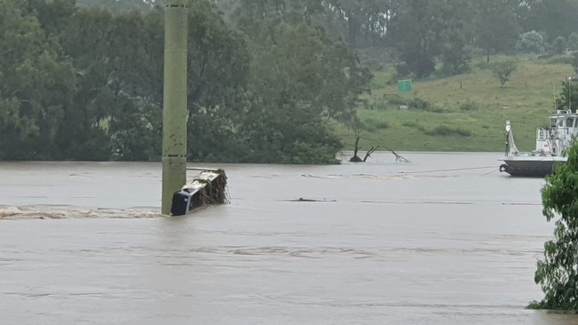
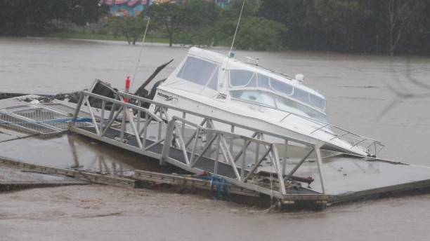
Russell Ryans’ 9m boat Power Gel was washed from the back of his property at Jindalee this morning and ended up at the Park Rd Milton CityCat terminal, which is now almost completely destroyed.
“There was no saving it, it just came up so quick,” he said.
“It came up too high, it unhitched itself.
Mr Ryans has owned the boat for about eight years.
“I don’t know (about the damage) until I get out there, it’s probably salvageable,” he said.
“Nothing looks too serious at the moment.
Milton resident Heather Ann went back to her Baroona Rd property this morning to help her tenants who had already left.
“I just got in, it is probably knee deep in water,” she said.
“We’ve lifted everything, we’ve tried to get everything on to crates and benches.
“But we might have to go back in and lift things even higher.
Ms Ann said the 2011 floods went to the top of her windows.
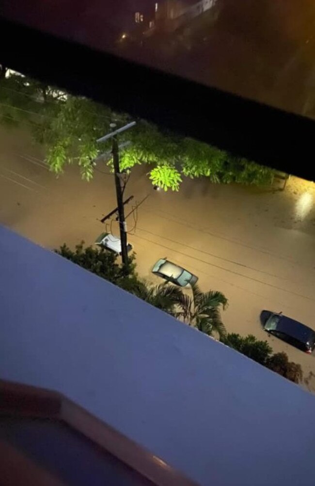
High tide was reached about 8am on the river in the inner-west with residents scrambling to escape or to protect pets and belongings.
The Bureau of Meteorology warned the river level was above the 2013 flood peak of 2.3m and (as of 11am) was expected to peak about 3-3.2m.
In comparison, it reached 4.46m in the 2011 floods and 5.45m in 1974.
Rain is expected to contract south to northern NSW later today.
Westside suburbs facing immediate threat include: Anstead; Auchenflower; Bellbowrie; Brookfield; Chapel Hill; Chelmer; Corinda; Fig Tree Pocket; Graceville; Herston; Indooroopilly; Jindalee; Karana Downs; Kelvin Grove; Kenmore; Kholo; Lake Manchester; Milton; Moggill; Mt Crosby; Newmarket; Paddington; Pinjarra Hills; Pullenvale; Red Hill; Sherwood; Seventeen Mile Rocks; Sinnamon Park; St Lucia; Taringa; Toowong.


IF YOU NEED HELP
- The Bellbowrie-Moggill Community Led Management Plan also continues to be actively followed, and further updates can be found via the Moggill Group SES Facebook page.
- Local road closures are continuing to be put in effect across the electorate of Moggill.
This includes significant local crossings, access points and roads including Colleges Crossing the Mount Crosby Weir, and sections of Moggill Road and Mount Crosby Road. 🚧
- If you are in an emergency and need immediate assistance please call triple-0
- For non-life threatening emergency and disaster assistance, please call the SES Hotline on 132 500
- RACQ Statewide Road Closures - https://roadconditions.racq.com.au/
- QLD Traffic: Current Closures - https://qldtraffic.qld.gov.au
- Bureau of Meteorology Weather & Warnings - http://www.bom.gov.au/qld/index.shtml

Twins’ dramatic entrance for island couple as TC Alfred looms
As South East Queensland braces for Cyclone Alfred, a North Stradbroke Island couple has welcomed twins who made a thrilling entrance overnight.
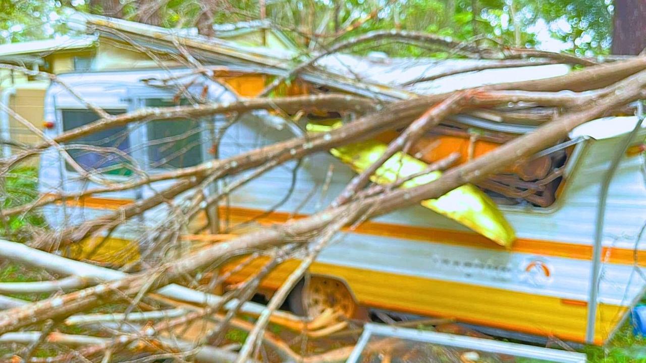
Miracle escape: Boy survives after caravan crushed by tree
A sleeping boy escaped injury when a tree crushed his caravan on Russell Island, missing him by millimetres, during Cyclone Alfred.