
Smoke across Brisbane westside as planned burn starts
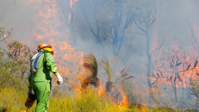
Thick smoke is cloaking suburbs in Brisbane’s inner west after a planned burn this afternoon in Mt Coot-tha Forest.
HyperLocal
Don't miss out on the headlines from HyperLocal. Followed categories will be added to My News.
Thick smoke is cloaking suburbs in Brisbane’s inner west after a planned burn this afternoon, July 23, in Mt Coot-tha Forest.
The planned burn was scheduled between Sir Samuel Griffith Drive, the Powerful Owl Trail and the Pinnacle Trail.
Billowing smoke appeared, from several vantage points, to be coming from Stuartholme School in Toowong but was in fact well inside the nature reserve and at least 1km away.
Parts of Sir Samuel Griffith Drive were closed to traffic at time of publication.
Brisbane City Council said the burn would continue into the early evening.
The council said smoke might also affect the Western Fwy/M5 and settle in low-lying areas in surrounding suburbs.
Staff were on site for the duration to ensure the safety of the area.
The council said the planned burns were conducted so as to minimise impacts on wildlife and only in suitable weather conditions.
The two walking trails were closed during the burn and might be closed for up to two weeks for public safety.

Here’s what you can expect with tomorrow’s Brisbane Southwest weather
As we move into winter what can locals expect tomorrow? We have the latest word from the Weather Bureau.
Here’s what you can expect with tomorrow’s Brisbane Southwest weather
As we move into winter what can locals expect tomorrow? We have the latest word from the Weather Bureau.