
Development approvals turn bushland into ‘Disneyland’
Developers have moved into an area planned for conservation as part of approvals, building a sales office, and are now applying for the building to be a permanent structure.
Southeast
Don't miss out on the headlines from Southeast. Followed categories will be added to My News.
LAND originally set aside as an environmental offset for cleared bushland at a major residential estate has become “Disneyland” according to conservationists.
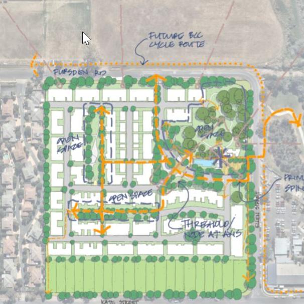
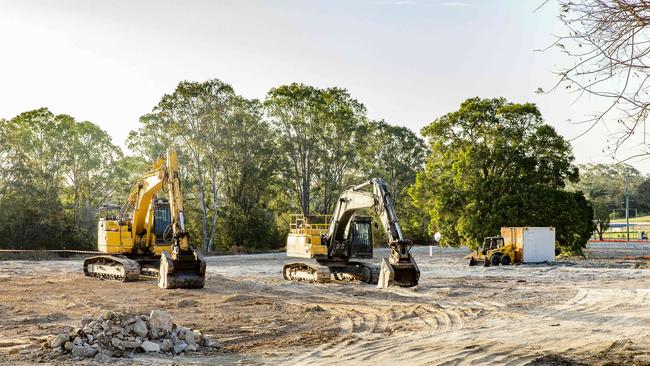
Frasers Property received council approval in June to develop 197 units and 20 residential lots at the former bakery site at 179-193 Fursden Rd, Carina.
Under the development plans, a bush corridor from Fursden Rd to Kate St, which was a buffer between the bakery and residential areas, will be cleared.
The bakery buildings have been demolished and a sales office constructed in the north-east corner.
In December Frasers told the South-East Advertiserthe highest value vegetation was in the north-east corner which would be retained and revegetated rather than the buffer area.
That end of the site is opposite Minnippi Parklands.
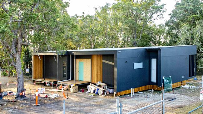
Frasers has since lodged changes to include the sales centre as a permanent community centre.
The building is shown in marketing brochures as “private recreation facilities” in a “recreation area”.
■ COUNCIL RAISES CONCERNS ON LOST KOALA HABITAT
■ RESIDENTS FIGHT TO SAVE BUSHLAND
Frasers General Manager - Residential Cameron Leggatt said recreation facilities were always designed for the north-east corner.
Mr Leggatt said the facilities included pools and barbecue areas.
“The recent minor change has seen the north-east corner planting modified to comply with best practice bushfire management outcomes in consultation with Council,” Mr Leggatt said. “The overall area and retained trees has not changed.”
Frasers has said the development exceeded the council’s 5 per cent communal open green space requirement by more than four times.
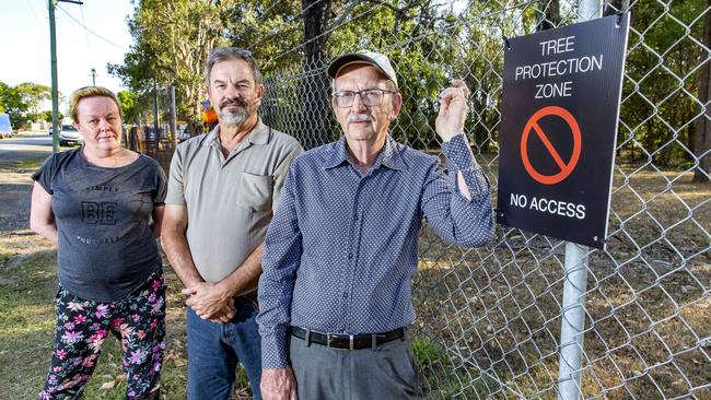
Bulimba Creek Catchment Coordinating Committee (B4C) catchment manager Wayne Cameron said the approved plans for the north-east corner was not compensation for lost habitat.
“In their latest plan they’ve turned the ecological site into Disneyland for the new residents,” he said.
“You are losing one big paddock of trees and habitat and they were going to save the north-east corner and now that corner has a swimming pool, boardwalks and through traffic ... great for the residents who are going to buy there but we can’t pretend it is restoring the environmental values of the site that are lost.”
Mr Cameron said the group’s main concern was the effect of filling in the floodplain.
“The top third of the whole development is in a floodway and they have still built houses right up on to Fursden Rd. They haven’t even pulled back one row of houses,” he said.
“For every one of these floodplains we fill we create problems somewhere else.
“Council doesn’t seem to be able to assess the cumulative impacts of filling on our floodplains. If we keep filling these floodplains we are going to end up with issues along the line; catchment issues, flooding issues and water quality issues.”
Mr Leggatt said the filling and flooding considerations had been extensively modelled and discussed in the development application approved in June.
Councillor Lisa Atwood (Doboy), who lives nearby, said she had met with residents on the concerns following the approval.
She said the buffer zone was never protected as conservation area but acted as a buffer between the industrial land and residential areas. She said the changes would deliver a better outcome for the community.
“The changes include an improved design of the communal facilities, minor changes to the car parking, building design and an amended rehabilitation plan to ensure the retention of trees as part of the proposal,” she said.
Battle of Brisbane: 40 years of wild radio wars
From shock slumps to dramatic sackings, these are the stories of more than four decades of fighting for bragging rights in Brisbane’s radio wars.

Bringing soldiers home alive: Defence’s safety revolution unfolds
Former Special Forces soldier’s lifesaving creation to lead revolutionary safety technology trials at Australia’s largest military exercise.