Straddie sinkhole reopens off Amity | VIDEO
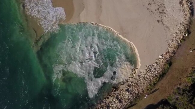
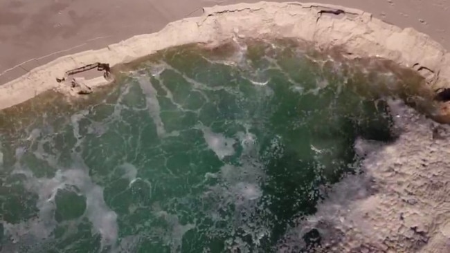
North Stradbroke Island videographer Chris Polson shot this dramatic video of a huge sinkhole at the township of Amity.
Redlands Coast
Don't miss out on the headlines from Redlands Coast. Followed categories will be added to My News.
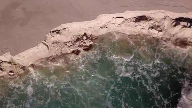
A massive sinkhole has opened up on North Stradbroke Island, reigniting residents’ calls for stabilisation works along the island rockwall in front of the township of Amity.
The hole, about 100m wide, reopened this week in waters near Amity in a part of the Rainbow Channel, which gushes past the island’s western side fronting Moreton Bay.

The hole opened near Toompany St, at the end of a rockwall built to protect the township’s houses from erosion and falling into the Rainbow Channel, which drains Moreton Bay out South Passage.
It is in the same vicinity to where a woman was killed in a shark attack in 2006.
Residents have urged the local Redland City Council to fortify and extend the revetment wall after emergency works were needed in 2017 when 5m of land along 30m of the township’s waterfront tipped into the channel.

Cricket legend Matthew Hayden owns property along the waterfront at Amity and has played a major role in ensuring the rockwall is stabilised, and is believed to have footed the bill for some of the works.

Houses at Amity were moved back from the water’s edge in 2014 and the area was declared erosion prone under the Coastal Protection and Management Act 1995.
Residents said they believed an underwater spring was partly to blame for the reopening of the sinkhole at the site, which has a long history of erosion and loss of property.

Fishermen with depth sounders and fish finders have also reported spots at Myora Springs, south of Amity with “bottomless holes”.
The Amity spot was where the popular Amity Bush Races were run on a sand racecourse in the 1920s.
That track is now under water and hundreds of metres offshore, at the bottom of the Rainbow Channel.
Redland council endorsed a 20-year strategy for dealing with erosion at Amity Point in 2019 after years of bickering over jurisdiction.
A Redland City Council spokesperson said Council several years ago constructed a fully engineered rock wall in the area, which is adjacent to Council land, and that it was acting as intended to prevent the sinkhole moving further inland.
The spokesperson said Council also regularly inspected and maintained the Council-owned portions of the rock wall (also known as a flow side barrier) adjacent to Council property.
“The rock wall is also designed and meant to slump into the sinkhole to protect the foreshore should the sinkhole become larger. That is how it works and the sinkhole is not unexpected or unusual in this area,” they said.
“Council has been working closely with residents at Amity Point to help them protect their properties from shoreline erosion.
“It is the residents’ responsibility to undertake mitigations to protect their own properties.
“Council has been assisting property owners to gain approvals and has allowed property owners to acce”ss rock from a Council quarry on the island for emergency works.
Council is also providing funding to University of Queensland to undertake further research on sinkholes at Amity Point.
The spokesperson said shoreline erosion is a naturally occurring process at Amity Point. The sinkhole often develops and just as quickly disappears.


