
Secret land deal unlocks hundreds of blocks for Indigenous development on North Stradbroke Is
Plans to unlock some of the state’s most exclusive waterfront blocks of land have been unveiled after a secret land deal was done between the state government and Indigenous landholders on North Stradbroke Island.

Redlands Coast
Don't miss out on the headlines from Redlands Coast. Followed categories will be added to My News.
Plans to unlock some of the state’s most exclusive waterfront blocks of land have been unveiled after a secret land deal was done between the state government and Indigenous landholders on North Stradbroke Island.
Under the deal, Stradbroke Island’s Indigenous community will be able to develop some of the island’s most spectacular blocks of land after new state government laws were introduced on Monday.
Under the new laws, 25 parcels of land will be able to be developed for purposes including a tourist centre, waterfront and marine industries, community facilities, conservation and residential.
‘GO F**K YOURSELF, WHITE C***S: INSIDE TENSIONS TEARING STRADDIE APART
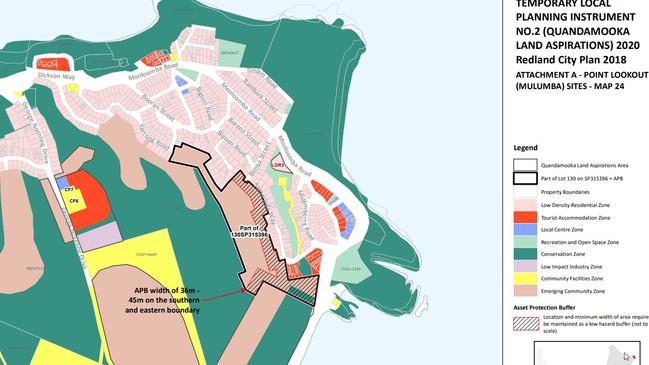
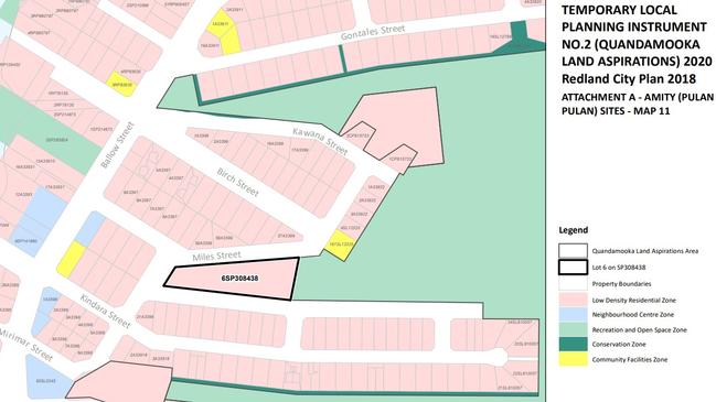
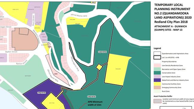
A series of maps show blocks of land in the newly created Quandamooka Land Aspirations Area stretching from Dunwich in the island’s east, north to Amity Point and then to the tourist mecca at Point Lookout.
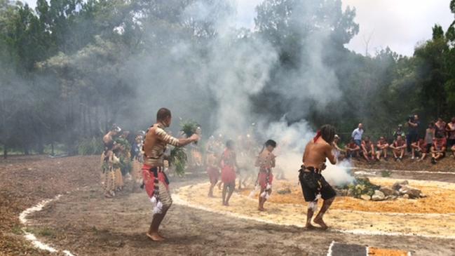
The new laws will allow the Indigenous Quandamooka Yoolooburrabee Aboriginal Corporation, QYAC, to develop and sell land, which has been locked away since the historic watershed Native Title ruling in 2011.
Redland City Council will still take the lead role in assessing all development applications but assessment for the special parcels of land will be done under the new laws for the Land Aspirations Area.
The maps, published in this week’s Government Gazette, reveal a large parcel of land on George Nothling Dr at Point Lookout, earmarked for a tourism zone, accommodation and community facilities.
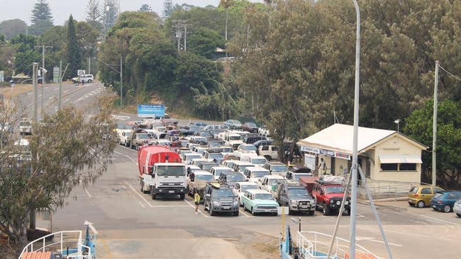
Plans have been afoot for the tourism precinct to grow as a world class eco resort after sand mining ceased in December.
More than 50 low residential blocks will be created along George Nothling Dr at Point Lookout along Yaroong Rd and Boorong St with eight tourism accommodation sites also mapped out.
The maps also show plans for 34 low-density residential blocks high on the hill overlooking Dunwich at Alfred Martin Way near Rainbow Crescent and more planned for land between Barton, Mallon and Finnegan streets in Mitchell Cres.
A marine and conservation area is earmarked for land off Ballow Rd, behind Adams Beach
campsite at Dunwich.
The township of Amity has also been earmarked for massive amounts of residential development with low density blocks planned to be created at Gonzales, Birch, Miles, Kindara Mirimar and Llewellyn streets.
QYAC chief executive Cameron Costello said there was still planning consent required before Quandamooka people would be building new homes on the island.

He said the state government, Redland City Council and QYAC had been developing appropriate land use policies for the island’s Indigenous since 2012.
“Regrettably, the council chose not to include these in their draft Redlands City Plan but the state government’s action will now require the council to address these shortfalls in their planning scheme,” he said.
“The next step is for Quandamooka people to develop a land allocation policy and that will be a thorough consultative process that will require native title holder consent.
“Any proposals by Quandamooka people for infrastructure, such as new housing or community facilities, will still have to comply with the state government’s planning laws and be assessed against the council’s planning rules.”
The land use policy will be in effect for the next two years.
Island Chamber of Commerce president Colin Battersby said the gazetted maps were a relief as residents were finally given an insight into what was planned for the island after mining.
“We’ve been waiting to find out what was in store since July 4, 2011 when Native Title was granted signalling an end for mining,” he said.
“We can now start planning and have a good idea of what to expect which bodes well for enticing investors.
“Once they open up the land and start selling blocks, it will make the island a bit more affordable but also create a critical mass of people which helps local businesses.”
Landowner Mark Dibble said he had mixed feelings.
“It is great news for the struggling businesses on the island but I am concerned about what it will do to our property prices and we don’t have the infrastructure,” he said.
“I don't mind having more people over here as we will get more infrastructure.
“If there is going to be a tonne of low residential land lots flooding the market that could push down our property prices, which have been skyrocketing recently.”
Federal MP Andrew Laming said the land deal was another priority development area, known as a PDA, which was dropped on to North Stradbroke Island. “Noone, outside the government, QYAC and their cronies was consulted.”
Calls to QYAC went unanswered but Oodgeroo MP Mark Robinson, whose electorate covers North Stradbroke Island, said the land announcement on the eve of an election had raised concerns among some people on North Stradbroke Island.
“Locals are raising concerns about the lack of consultation and awareness about such a wide-ranging decision that potentially impacts hundreds of blocks across the whole island,” Mr Robinson said.
“Labor’s land announcement was cloaked in secrecy, with no wider community input, including from the broader traditional Quandamooka elders, and is all based on the still secret ILUA negotiations of the past Bligh Labor Government.
“As a conservationist, I am deeply concerned that land on the island zoned for conservation and potentially strategic koala habitat could be bulldozed or cleared, as was the case recently at Point Lookout.
“Many parcels of land are affected by bushfire, koala and protected vegetation overlays which need much more consideration.”