Flooding to hit Brisbane this week
As coastal areas brace for cyclonic conditions, king tides will cause some of Brisbane’s creeks to brim over this week.
North
Don't miss out on the headlines from North. Followed categories will be added to My News.
FORECASTERS at the Bureau of Meteorology are anticipating severe conditions along the southeast Queensland coast from tomorrow, with a combination of high tides and a tropical cyclone expected to close beaches and erode coastlines.
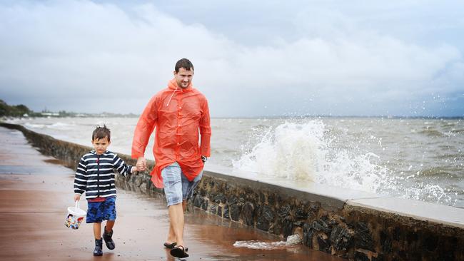
Waves of up to 5m – combined with a king tide a metre above the usual high watermark – means some coastal communities risk being swamped by seawater from Thursday.
The Bureau of Meteorology has issued a warning for the Queensland coast to the Capricornia region, but even areas of Brisbane are expected to receive localised flooding.
BOM meteorologist Lauren Pattie said the bureau would likely issue a severe marine weather warning tomorrow afternoon as Cyclone Oma inches closer to the east coast.
“From tomorrow, we will start to see an increase in the swell,” she said.
“The other thing that is exacerbating this condition is that we’re expecting the highest tides of the year.”
Ms Pattie said the king tides would take effect on Wednesday.
Oma’s effects would be worst between Friday and Sunday, increasing the chance of coastal erosion.
“It does depend on exactly how close Oma comes.”
“Either way, it’s going to be quite dangerous out there on the water.”
Ms Pattie urged boaties and beachgoers to heed the warnings of authorities and pay attention to BOM weather forecasts.
While coastal areas of southeast Queensland batten down the hatches against a possible Tropical Cyclone Oma, residents living and driving near Brisbane’s creeks and rivers are being warned to be prepared for localised flooding.
$1 FOR 28 DAYS: SUBSCRIBE TO CITY NORTH NEWS & THE COURIER MAIL
The king tide will hit from tomorrow and last until Thursday, prompting Brisbane City Council to issue warnings of tide heights of between 2.72-2.76 meters, peaking between about 9.30-11am.
However, there is a caveat: “Please note that due to current meteorological conditions a tidal anomaly may cause these tide peaks to be higher than predicted,” the council notice states.
“These high tides are expected to be similar to the high tides experienced on 20-22 August 2017.
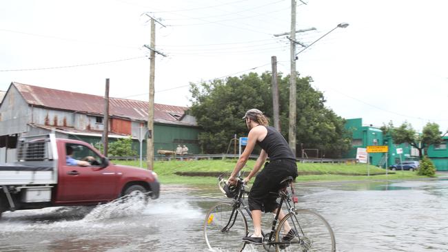
“Minor localised flooding may be experienced in bayside, riverside and low-lying parts of nearby suburbs. Areas connected to foreshore, and tide-affected areas of the river, creeks and other waterways may also be affected.
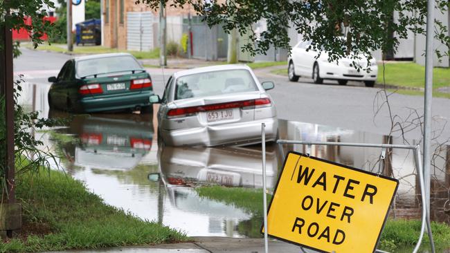
“Residents in areas prone to localised flooding due to high tides are advised to avoid parking their cars on the street during these times.”
A tidal gauge located on Breakfast Creek near the Bowen Hills Railway Workshops shows a steady rise in water height since Friday.
Gauges at the Port Office and Brisbane city have also had high tide rises, and are nearing the “minor flood” levels.
A Bureau of Meteorology spokesman said, thankfully, the effects of Tropical Cyclone Oma — which is sitting 1600km northeast of Brisbane as a category two storm — would probably be restricted to the exposed coastal areas of the southeast. The storm would cause swells to lash the beaches, leading to erosion.
MORE LOCAL NEWS:
Ferals get foxy after dark at city golf course
Do you know the difference between a path and a road?
Sneak peek at northside’s newest revamped shopping centre
The call no small business owner wants to get at 2am
“That’s not so much of a factor inside Moreton Bay,” he said.
“The king times happen twice a year, and we see creeks fill up. Areas like Breakfast Creek through Windsor and other parts of the northern suburbs, water comes up through the drainage network, and so the streets will have water on them. It’s pretty predictable.”
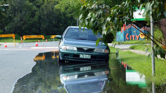
Northey St at Windsor and areas around Breakfast Creek are prone to regular flooding, but properties included in council’s Creek Flooding Alerts system are found in: Albion, Archerfield, Bardon, Boondall, Brookfield, Coorparoo, Corinda, Deagon, Doolandella, East Brisbane, Forest Lake, Greenslopes, Hemmant, Herston, Kenmore, Moorooka, Northgate, Nundah. Oxley, Rocklea, Salisbury, Windsor, Woolloongabba, Wynnum, Wynnum West and Zillmere.
Maritime Safety Queensland plots the highest tide so far this year on the Brisbane Bar to be 2.77 at 10.31am on January 22. Last year, the highest tide there was 2.75 on January 3 at 10.30am.
This week’s king tides are predicted to peak at the Brisbane Bar:
TUESDAY: 2.73 metres (1.49m AHD) about 9.26am on Tuesday.
WEDNESDAY: 2.76 metres (1.52m AHD) about 10.13am.
THURSDAY: 2.72 metres (1.48m AHD) about 10.57am on Thursday.
Source: Queensland Tide Tables by Bureau of Meteorology.
The council notice states: “If required, sandbags are available for collection from the following locations:
Darra — 38 Shamrock Road, Darra
Morningside — 9 Redfern Street, Morningside
Newmarket — 66 Wilston Road (in carpark off Erneton Street), Newmarket
Zillmere — 33 Jennings Street, Zillmere
Lota — Herbert Street, Lota.
Council also has an weather event early warning system, here.
KEEP TRACK OF CREEK LEVELS:
Included in the list of BoM-recorded gauges are (link here):
Brookfield: Fortrose Street
Corinda: Corinda State High School
Deagon: Braun Street, Deagon
East Brisbane: Caswell Street at Norman Creek
Hemmant: Doughboy Parade at Bulimba Creek and Hemmant drain
Herston: Bowen Hills Railway Workshops
Northgate: Crockford Street, Northgate and Pound Street, Hendra
Rocklea: Marshall Road at Stable Swamp Creek and Muriel Avenue at Rocky Waterholes Creek
Windsor: Breakfast Creek, railway yard, Bowen Hills
Wynnum: Byrneside Terrace
Wynnum West: Byrneside Terrace
WHAT IS A KING TIDE:
Maritime Safety Queensland explains king tides:
“In a lunar month the highest tides occur at the time of the new moon and full moon (when the gravitational forces of the sun and moon are in line). These are called spring tides and they occur about every 14 days.
“In any one year there will be two spring tides that are the highest, one during summer and one during winter. These are referred to as king tides. The king tides occur because of the combined influence of a number of astronomical factors related to the Sun and the Moon (and their alignments) and the gravitational attraction they each have on the water surface of the Earth.
“The earth moves around the sun in an elliptical orbit that takes a little over 365 days to complete. The sun has an influence on the tides. Its gravitational force is greatest when the earth is closest to the sun (perihelion — early January) and least when the sun is furthest from earth (aphelion — early July).
“The moon has a larger effect on the tides than the sun. The moon moves around the earth in an elliptical orbit that takes about 29 days to complete. The gravitational force is greatest when the moon is closest to the earth (perigee) and least when it is furthest from the earth (apogee — about 2 weeks after perigee).
“The king tides occur when the earth, moon and sun are aligned at perigee and perihelion.
“The combined effect of the moon’s phase and the varying gravitational forces of the sun and moon result in the highest of the spring tides occurring during the summer months of December, January and February and also in the winter months of June, July and August.
“During normal weather conditions, the height of the king tides will be similar from year to year. However in abnormal weather conditions (severe storms or cyclones) the low air pressures and strong winds at these times can elevate the sea level above the expected height.”

