
Daisy Hill and Mt Cotton bush seen as fire risk
Logan’s top fire officer has warned residents to be prepared after the fire season started early.
Logan
Don't miss out on the headlines from Logan. Followed categories will be added to My News.
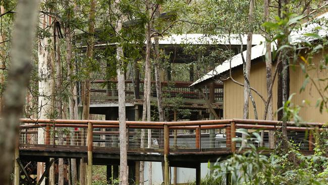
THERE were no plans for burn-offs in Daisy Hill Conservation Park and parts of Mount Cotton this week.
Queensland Fire and Emergency Services said it was “well past” the time for any backburning in the area, which stretches across 1500 hectares of land from Daisy Hill in Logan to Venman Bushland in Redland.
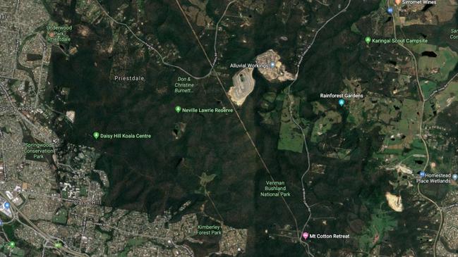
It links Daisy Hill Conservation Park, Venman Bushland National Park and local council areas of Neville Lawrie Reserve, Don and Christine Burnett Conservation Area and Ford Road Conservation Area.
QFES Logan Commander Inspector Robert Bloss said Daisy Hill was notoriously a big risk area as it was heavily forested.
However, he said QFES worked with the Logan City Council to conduct hazard reduction burns throughout the year.
“The council has a burns team which manages the area plus QFES has an I-Zone officer who liaises between permanent firefighters and the rural fire brigades to do risk mapping,” Inspector Bloss said.
“We have conducted prepare, act, survive letterbox drops in the area to notify and prepare residents, plus regular information on local radio stations.
“However, if a member of the public sees any sign of fire please dial triple-0.
“Under fire conditions, residents may get notification if there is any danger pending, but prior planning of your home is paramount and more details can be found on the QFES web page.
“As the fire season has come early, residents in newly created communities (such as Yarrabilba and Flagstone), should be aware of their surroundings and update their bush fire survival plans.
“There are other areas which we see as a risk due to the lack of rain, current weather conditions and vegetation load.”
Logan City Council said it was responsible for parts of bushland at Daisy Hill but said it was the state government’s responsibility.
“Council conducts prescribed burns across Logan in conjunction with multiple stakeholders including QPWS and QFES,” the council said.
“There are multiple agencies involved not just council.”
There are 11 prescribed burn sites on Logan City Council’s website with four tracks and trail sites which would have to be closed for two weeks when there is a burn-off, according to the council’s website.
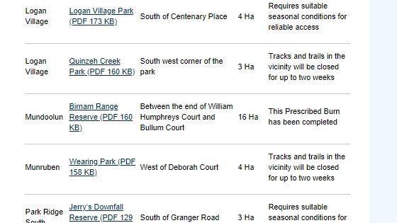
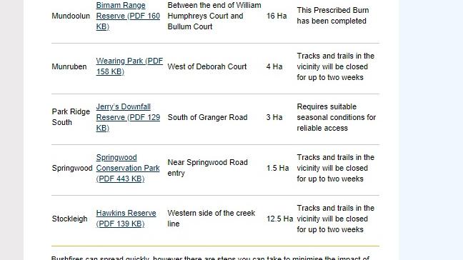
The website said tracks and trails in the southwest corner of Quinzeh Creek Park would be closed for two weeks if there were burn-offs as would tracks at Munruben’s Wearing Park west of Deborah Court.
Tracks at Springwood Conservation Park, near Springwood Road will also be closed for up to two weeks if there is a burn-off along with those at Stockleigh’s Hawkins Reserve on the west side of the creek line.
Logan Village was a site listed on the council’s prescribed burn-off list.
The council said the area south of Centenary Place required suitable seasonal conditions for reliable access.
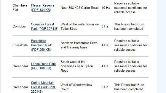
Council said Flesser Reserve at Chambers Flat near 308-408 Carter Rd, needed suitable seasonal conditions for reliable access as did Forestdale Bushland Park, between Forestdale Drive and the army base.
Park Ridge South at Jerry’s Downfall Reserve near Granger Road also required suitable seasonal conditions for reliable access before any burn-offs could be done.
Council was also waiting for suitable conditions to burn at Greenbank’s Lance Road Park, south west of the powerlines near Tyson Road.
Burn-offs have been completed at Cornubia Forest Park west of the water tower on Telfer St and at Greenbank’s Spring Mountain Forest Park west of Woodswallow Court.
Prescribed burns had also been done at Mundoolun at Birnam Range Reserve, between the end of William Humphreys Court and Bullum Court.

Southside study reveals real cost of ignoring mental health
Taxpayers could save $482 million over the next decade if governments tackle root causes of mental distress in Brisbane’s southern suburbs and Logan, a groundbreaking study has found.

‘Do something now’: Fire ants blamed for river banks collapse
Logan River residents want the state to investigate possible links between deadly fire ants and accelerating river bank erosion as property owners live in fear of landslips.