
Townsville weather: Suburbs under water, roads closed and more rain to come
Townsville continues to be lashed with rainfall as the Herbert and Lower Burdekin region are issued a severe thunderstorm warning. LATEST UPDATES.
Townsville
Don't miss out on the headlines from Townsville. Followed categories will be added to My News.
A severe thunderstorm warning has been issued for parts of Herbert and the Lower Burdekin as heavy rainfall continues across North Queensland.
The Bureau of Meteorology issued the thunderstorm warning Wednesday night and warned heavy rainfall was developing west and north of Townsville which may lead to flash flooding in Rollingstone.
Emergency services have advised people to park their car undercover away from trees, close doors and windows, keep asthma medications close by, charge mobiles and power banks, put pets in a safe place, don’t drive in dangerous conditions, inform friends and neighbours stay inside a strong building.
EARLIER: Bohle River major flood warning
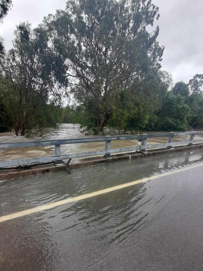
A major flood warning for the Bohle River has been issued by BOM as rainfall from overnight moves southeast.
It comes after the heavy rainfall and flash flooding warnings were cancelled with meteorologist Sarah Scully saying rain had eased across the region but was expected to continue into this weekend, just not as heavy or widespread as seen overnight and this morning.
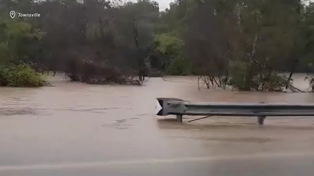
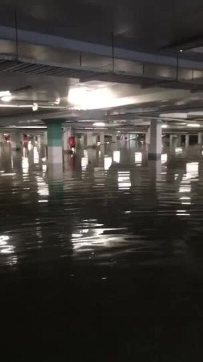
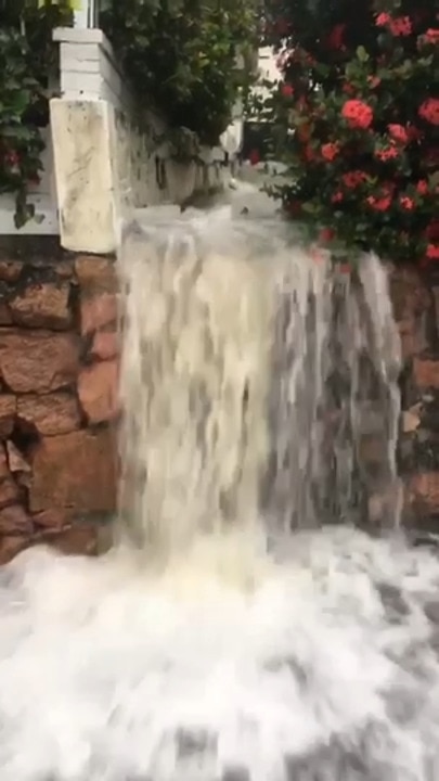
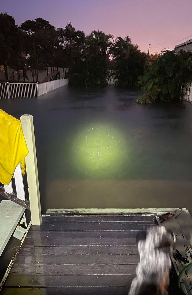
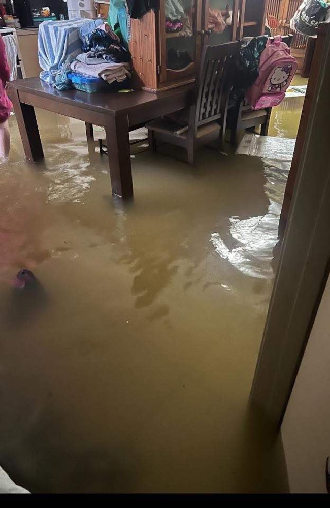
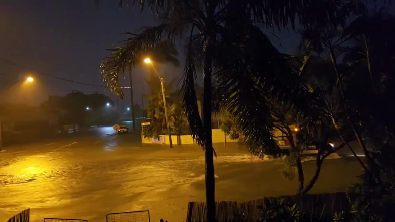
Townsville has been lashed with huge rainfall totals overnight, with many North Queenslanders waking up to water surrounding their homes.
Many of the streets and homes that were impacted in the floods earlier this year are again underwater.
Emergency services were involved in the dramatic rescue of two elderly motorists, one aged in her 90s, from floodwaters in the Hinchinbrook.
Senior meteorologist Daniel Hayes said a severe weather warning was still in place for the Townsville area however it was expected to ease throughout the day as the rain moves offshore.
He said rain has begun to move away from Townsville towards Ayr and expected to move towards Bowen by the afternoon and there was a likelihood the heavy rainfall would weaken, cancelling the severe weather warning.
He said Townsville was not likely to see the rain stop in upcoming days but it would be moderate rainfall to isolated heavy rainfalls.
The latest severe weather warning for the Burdekin has been cancelled, but showers are expected to continue.
The Bureau of Meteorology says a convergence between a very humid north-easterly flow from the Coral Sea and a south-easterly wind surge pushing up the central Queensland coast will lead to a continuation of heavy showers and a few thunderstorms about the coast and ranges of the Herbert and Lower Burdekin district.
“The immediate threat of severe weather has passed, but the situation will continue to be monitored and further warnings will be issued if necessary,” the BOM’s weather warning cancellation says.
Overnight the region saw 200mm to 300mm of rainfall with the highest area Horseshoe Bay receiving 352mm.
Townsville City Council has warned the sewerage system is at capacity due to heavy rainfall.
They have asked people to delay washing their clothes, take shorter showers and only flush the toilet when it is necessary.
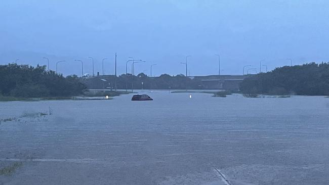
Closed roads include Railway Ave between Boundary Street and Putt Street, Bayswater Road and Banfield Drive, Townsend Street, Hugh Street between Bayswater Road and Woolcock Street, Pilkington Street between Bayswater Road and Woolcock Street in Garbutt and Civil Road.
FULL LIST OF ROAD AND SCHOOL CLOSURES
There were reports this morning that the airport was almost inaccessible, but the Halifax St gate has been opened.
Kinetic has suspended all school buses and many schools are only opening for supervision.
There was a landslide on Stanley Street in Townsville City, with a large rock and dirt across the road.
Police said there were also reports of water was entering some houses in the area.
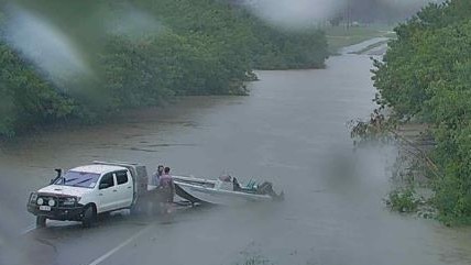
Emergency services were called to rescue a vehicle that drove into floodwaters and became stuck at around 5am in Cranbrook.
There was significant flooding along Hugh Street in Belgium Gardens and water across the road at Vincent on Charles Street, requiring traffic control early this morning.
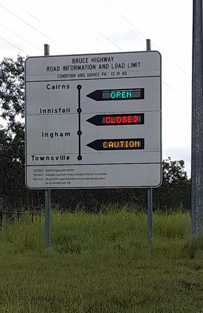
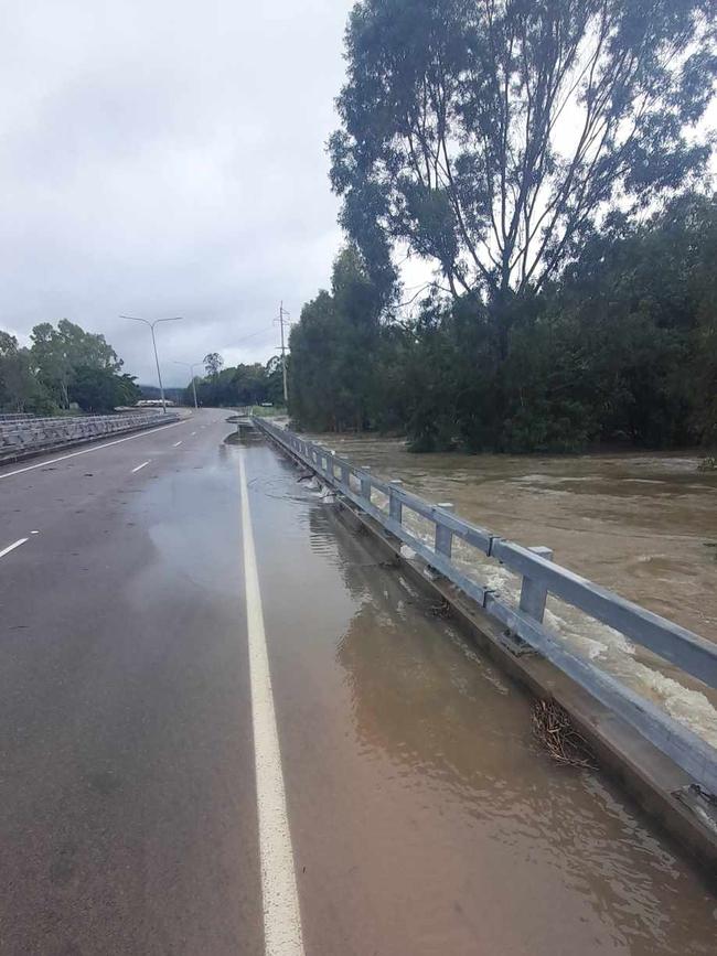
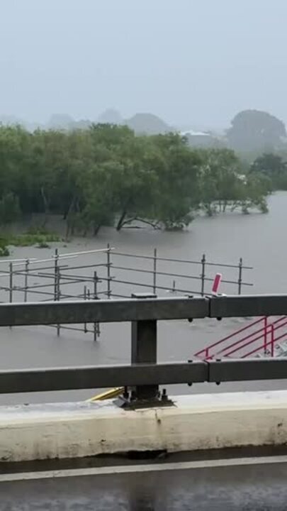
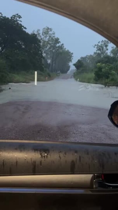
In Ingham, the Bruce Highway north of the town was still closed due to flooding as of 4.30am.
There was also water over the Seymour Bridge, located between Ingham and Cardwell, after they recorded around 200mm of rain.
The situation is being monitored closely.
A Flood Watch is current for the North Tropical Coast and parts of the Central Coast.
The Ross River at Aplin Weir was at 1.01 metres but may reach the minor flood level (1.10m) Wednesday morning, with further rises possible from forecast rainfall.
Moderate flooding is expected to be occurring along the Bohle River at Mt Bohle.
“No recent observations are available at Mt Bohle, however the river level is expected to be around 6.40 metres and rising Wednesday morning, above the moderate flood level,” the BOM said.
“The Bohle River at Mt Bohle is expected to remain above the moderate flood level (5.50m) Wednesday morning, with further rises possible with forecast rainfall.”
Minor flooding is also occurring along the Black River and flooding has eased along Bluewater Creek. Further rises are possible with forecast rainfall.
Six-hourly rainfall totals of 120 to 160 mm are likely, with isolated totals to 240 mm possible.
Conditions should ease during Wednesday afternoon as the south-easterly wind surge weakens.
Locations which may be affected include Townsville, Palm Island, Ingham, Ayr, Giru and Lucinda.
197 mm was recorded at South Townsville in the 6 hours to 8:26 am
223 mm was recorded at Apjohn Street Horseshoe Bay in the 6 hours to 8:18 am
208 mm was recorded at Garbutt in the 6 hours to 7:25 am
194 mm was recorded at Louisa Creek in the 6 hours to 6:40 am
196 mm was recorded at Vincent in the 6 hours to 6:31 am
204 mm was recorded at Pallarenda in the 6 hours to 6:01 am
203 mm was recorded at Townsville Airport in the 6 hours to 5:33 am
173 mm was recorded at Mill Rd Black River the 6 hours to 1:30 am
211 mm was recorded at Bluewater in the 6 hours to 1:26 am
197 mm was recorded at Toolakea in the 6 hours to 1:25 am
Originally published as Townsville weather: Suburbs under water, roads closed and more rain to come
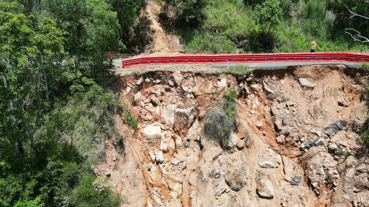
Paluma cut off again as fresh land slips wreak havoc
Isolated residents in Paluma have been dealt another blow, with fresh landslips cutting off their main access road just as it was on the verge of being cleared from last month’s floods.

‘Why would we want to go against that’: Fluoride petition labelled waste of time
A controversial e-petition with more than 200 signatures calling for Townsville City Council to review it’s fluoride in drinking water policy has been rejected with one councillor saying he didn’t want to waste any more staff time on the issue.