
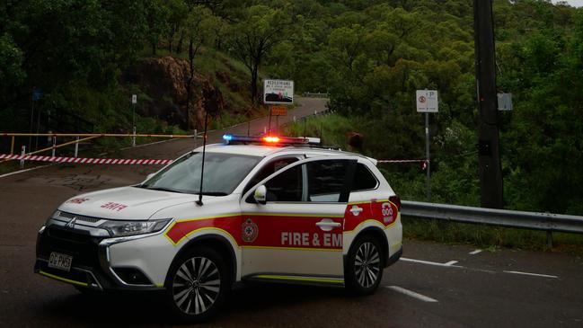
Road closures after Tropical Cyclone Kirrily
Full list of road closures in Townsville as residents wake after Cyclone Kirrily.

Townsville
Don't miss out on the headlines from Townsville. Followed categories will be added to My News.
North Queenslands have woken to assess the damage after Tropical Cyclone Kirrily hit the region on Thursday night.
While much of the city remains unscathed, there are trees down, damage to properties and thousands of people are without power.
Road closures/changes
Cranbrook / Garbutt - Nathan Street
Annandale - University Road, no blockage, reduced speed limit (60km/h)
South Townsville - Dean Street, lanes affected
Stuart - Townsville Port Road, lanes affected
Aitkenvale / Garbutt - Nathan Street, lanes affected
Woodstock - Flinders Highway, lanes affected
Woodstock - Flinders Highway, lanes affected, reduced speed limit (40km/h)
Condon - Beck Drive, lanes affected
North Ward - Warburton Street, lanes affected
Julago / Nome - Bruce Highway, lanes affected
Hyde Park / Mysterton - Charters Towers Road, lanes affected, reduced speed limit (60km/h)
Cranbrook - Ross River Road, lanes affected
Bohle Plains / Condon - The Ring Road, lanes affected
Bohle Plains - Hervey Range Road, lanes affected
Roseneath - Flinders Highway, lanes affected
Aitkenvale - Ross River Road, lanes affected
Annandale / Cluden / Idalia - Stuart Drive, lanes affected, use alternative route.
Kirwan - Ross River Road, no blockage, reduced speed limit (40km/h)
Cluden / Stuart - Bruce Highway, lanes affected
Mysterton - Ross River Road, lanes affected, reduced speed limit (40km/h)
Castle Hill - Castle Hill Road closed
Originally published as Road closures after Tropical Cyclone Kirrily

Katter calls out ‘unfair’ and ‘flawed’ charter school flight model
Calling out a “fundamentally flawed and unfair” agreement, Robbie Katter says action is needed to help remote and rural families and students access school charter flights.

Serial groomer back in court for disgusting act on young girl
A handyman had only been released from prison for a short time before he began preying on another child and gaining her trust through a twisted plan.