
Hinchinbrook cops massive rainfall totals, more storms expected in North Queensland
North Queensland is on alert again after significant rainfall totals were recorded in parts of the region overnight. DETAILS.

Townsville
Don't miss out on the headlines from Townsville. Followed categories will be added to My News.
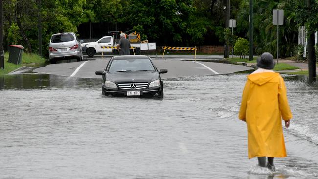
North Queensland has been lashed with rain again overnight with some parts of the region copping more than 340mm.
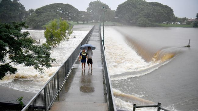
On Wednesday, the region experienced isolated flooding with many roads going under and homes inundated.
The Bureau of Meteorology cancelled severe weather warnings for the region midafternoon on Wednesday, but the storms returned later in the evenings
Senior meteorologist Miriam Bradbury said persistent storms had impacted the North Tropical Coast, Herbert and Lower Burdekin.
“It has been another day of triple digit rainfall totals with rivers rising in response,” she said.
“Broadly speaking, we’ve seen another 1-200mm between Townsville and Innisfail and around Port Douglas.
“Much of the coast around Ingham, Cardwell and north Townsville saw totals in excess of 200mm.
“But the standout total to 5am was 450mm at Cardwell Gap, where persistent storm activity brought rainfall to the area over the past day.”
The BOM also recorded 348mm at Trebonne, 267mm at Ingham, 226mm at Halifax, 221mm at Innisfail wharf, and 215mm at Ingham depot.
In Townsville in the past 24 hours, Pallarenda recorded 344mm, Horseshoe Bay 352mm, Garbutt 311mm, and Vincent 298mm.
Ms Bradbury said rain was also impacting North West Queensland, with 54mm recorded at Cloncurry.
She said that there was still a risk of higher rainfalls today, with thunderstorms expected to come across the coast from the ocean.
“We’re likely to see severe thunderstorm warnings continue through the next day or so, but they may come and go and shift areas depending on where the severe storms are likely to have an immediate impact,” Ms Bradbury said.
“Wherever we see those storms developing, we could see flash flooding.
“This wet period has persisted longer than expected as convergence hasn’t yet weakened about the coast and significant moisture has continued to stream into the area and push against those coast areas.”
Ms Bradbury said as of 5am on Thursday, a major flood warning was in place for the Herbert River, with major flooding possible in the next few hours.
A moderate flood warning was in place for the Bohle and a minor flood warning was in place for the Ross River.
A flood watch is in place for the Burdekin River in anticipation of the ongoing risk associated with persistent storms.
Originally published as Hinchinbrook cops massive rainfall totals, more storms expected in North Queensland
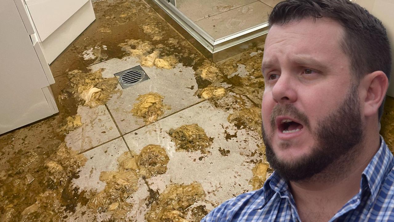
Sewage shambles: MP blasts council as poonami crisis rages on
A furious federal MP has slammed Townsville City Council for neglecting basic infrastructure, particularly its failing sewage system, after yet another flood left residents wading through raw waste.
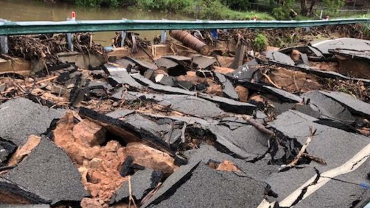
‘It’s disgusting’: Fury as destroyed bridge still a wreck
Outraged locals on Magnetic Island are demanding answers as the shattered remains of a bridge in Nelly Bay sit untouched more than a month after February’s floods. Why the delay? We grilled council and the local MP, and here’s what they had to say.