
Mapped: Areas of Adelaide most at risk from flooding
Large parts of Adelaide are at risk of flooding – and it’s only going to get worse with a third year of La Nina weather forecast. See the map of which areas are most at risk.
SA News
Don't miss out on the headlines from SA News. Followed categories will be added to My News.
Large areas of Adelaide are at risk of flood damage and have been earmarked for “very high priority” flood-prevention works.
The state’s Stormwater Management Authority has mapped the entire Adelaide plains and raised fears for urgent works to protect large areas of Adelaide’s northern suburbs as well as the lower Onkaparinga River catchment and Christies catchment in the south.
Stormwater Management Authority general manager David Trebilcock said the plan would guide future home and business development and flood protection and prevention works.
“Adelaide is built on a flood-plain, and floods can cause damage anywhere and anytime,’’ he said.
“The plan is based on existing flood mapping and information about the population and buildings.”
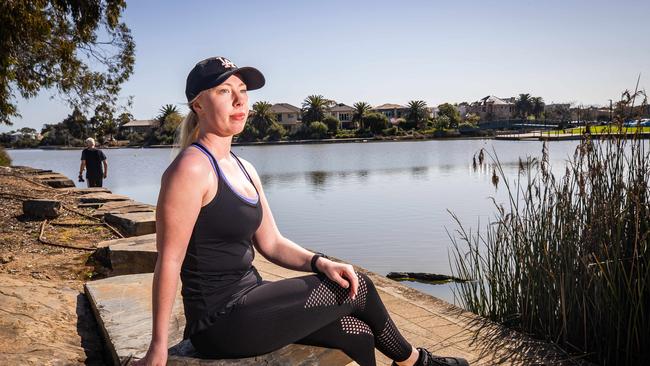
One of the residents concerned about flood damage is Zandra Ramsden of Mawson Lakes, who said she had often lived on Adelaide waterway and channel areas.
“At Mawson Lakes we are in a flood plain area and I have seen the creek in front of my house go up and down a bit,’’ she said.
“I haven’t been here long but I think it is definitely something to work out for with the third consecutive La Niña on the way.”
The BOM recently officially declared a rare triple La Niña has returned to Australia this spring, lasting until the beginning of next year.
The 2022 Stormwater Management Planning Priorities report maps low- and high-risk areas.
In the highest risk areas, properties are “more likely to realise financial damage, health impacts or mortality”.
Other than human damage from flooding there are other priority areas identified in which the sensitive environment is under threat from toxic stormwater run-off, where more needs to be done to recycle stormwater, areas where more trees need to be planted to help reduce climate change threats, areas where high-density development is creating excess flood run-off, and areas where there are poor plans in place to prevent flooding.
Adelaide is divided into around 30 catchments based on drainage creeks and rivers flowing into Gulf St Vincent.
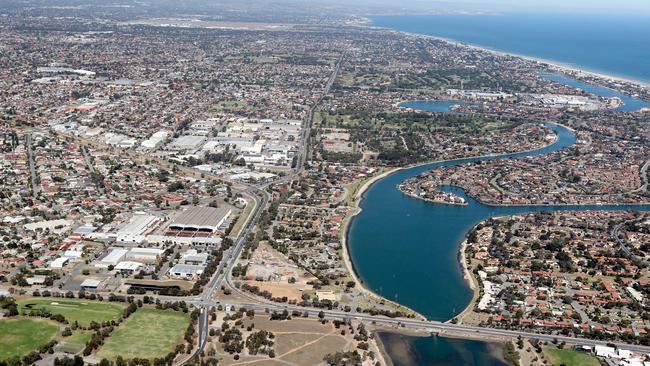
The maps show high-risk catchment areas in Adelaide are Torrens Road, Christies catchment, Barker Inlet, Dry Creek, Port River/Le Fevre Peninsula, West Lakes, Lower Onkaparinga River and the River Torrens urban northeast area.
There is also a “very high” priority alert for low-lying parts of regional centres such as Ceduna, Tumby Bay, Kadina, Whyalla, Peterborough, Murray Bridge, Renmark, Loxton and Bordertown.
Mr Trebilcock said better reuse of stormwater was important for preventing flooding and saving the environment.
The report warns “pollutants in urban stormwater may impact on a critical water supply”.
“There are already a number of stormwater-harvesting schemes in operation across Adelaide, but there are still opportunities in growth areas to make better use of stormwater,’’ Mr Trebilcock said.
“Highly developed areas like Adelaide are a priority for reducing the amount of stormwater and improving the quality of stormwater entering the natural environment rivers, streams and the sea.”
The entire northwest of Adelaide suburbs throughout the Port Adelaide region has been earmarked for very high priority climate change action.
But the northeast and furthest south areas need to do better with water recycling initiatives.
Inner-northern suburbs and the Seaford catchment are under the most pressure to turn land into developments, so worsening flooding problems.
Originally published as Mapped: Areas of Adelaide most at risk from flooding
Join the conversation

‘Mass strike action’: SA public hospital doctors set to walk off the job
Hundreds of public hospital doctors are set to walk off the job as their pay dispute with the state government reaches a stalemate.
Read more

‘Inspiring’: SA child’s sweet wish after life-saving surgery
An Adelaide boy who lost his mother, has lived in foster care, and is now facing the toughest fight of his life is holding onto one sweet dream he hopes to fulfil once he leaves hospital.
Read more