
Severe thunderstorm warning issued for parts of South West Qld
Parts of South West Queensland have woken to a wet weekend, with the Bureau of Meteorology issuing a severe thunderstorm warning for the region. Here’s the latest.
News
Don't miss out on the headlines from News. Followed categories will be added to My News.
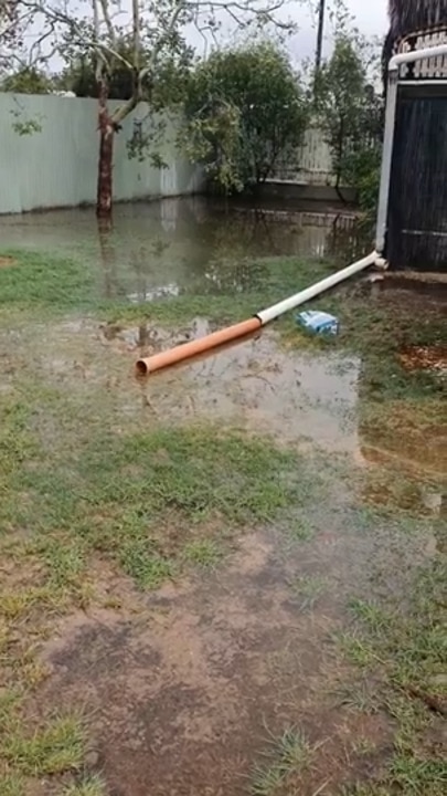
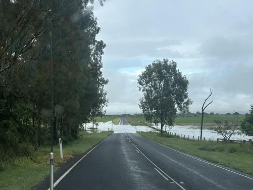
South East Queensland has received a lashing of rain overnight, causing widespread flash flooding.
Flood warnings are in place for the Bremer River south of Gatton, Warrill Creek, Bulloo River, Moonie River, Paroo River, Warrego River, lower Barcoo River, Upper Balonne River and Weir River.
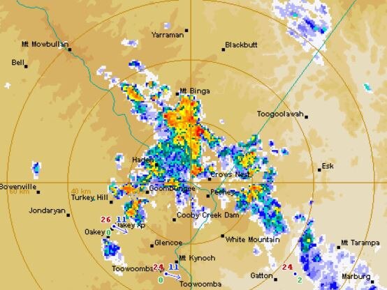
The Bureau of Meteorology’s Brooke Pagel said the highest overnight rainfall recorded in the South East was 127mm at Wilsons Peak east of Warwick.
Ms Pagel said the intensive rainfall had occurred quite quickly as a result of a severe storm.
“Between that 3pm-6pm window most of the that area to the east of Warwick recorded up to 65mm of rain,” she said.
Across to the South West, the upper Claude River east of Blackall recorded 78mm overnight, while Homebush near Charleville recorded 47mm.
Ms Pagel said broad parts of the Darling Downs recorded around 35mm overnight.
“We’re expecting to see the water move downstream and expect those affected areas to expand,” she said.
Both South East and South West residents can expect to see more rain on the way with showers and a possible storm likely.
“A cloud band will move into the west on Monday afternoon, but won’t bring the heavy falls of this current rain band which has hung around for the past week,” Ms Pagel said.
Showers will begin to ease across the Darling Downs mid week, with daytime temperatures expected to increase by three to four degrees on Monday.
EARLIER
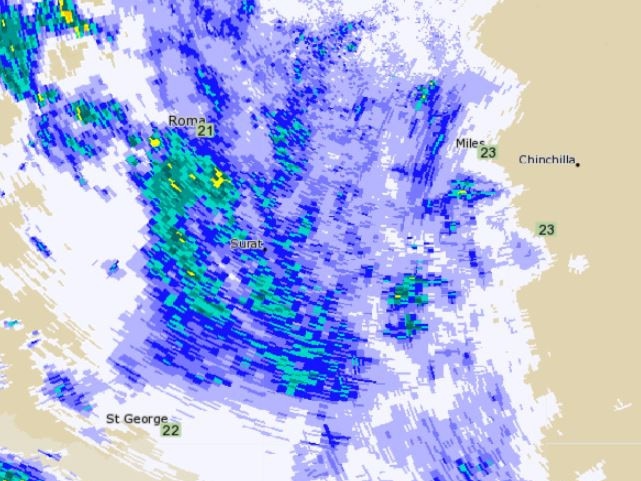
In less than a fortnight parts of South West Queensland has again been lashed by heavy rainfall, with a severe thunderstorm warning now in place.
Southern parts of the Maranoa and Warrego areas copped significant rainfall overnight, with widespread recordings between 50-60mm.
The Bureau of Meteorology’s Daniel Hayes said the region could expect continued showers and possibly severe thunderstorms on Saturday.
“We’re looking at continued rain through the Maranoa, Warrego and into parts of the Darling Downs today,” he said.
“Storms will likely be active in the Darling Downs region from Sunday which will bring widespread rainfall with most areas seeing between 10-15mm.
“Rain is expected to clear through western Queensland on Sunday.”
Mr Hayes said minor to moderate flooding had been recorded through inland rivers around Moonie, Warrego and Paroo catchments, with some flooding extending across the border into New South Wales.
Isolated thunderstorms are also expected across parts of the Darling Downs region, which will see cooler temperatures across the weekend.
Toowoomba and Warwick are expected to reach a top of 26C, Stanthorpe 23C, Goondiwindi 25C and 29C in Dalby.
More Coverage

Originally published as Severe thunderstorm warning issued for parts of South West Qld

‘Blood will spurt’: Thug holds ex-partner captive with sword
A Toowoomba woman endured a night of terror while her ex-partner “effectively” held her “captive” and threatened to chop her up with a samurai sword, a court heard.

Qld cop speaks of “heartbreaking” flood aftermath
A resilient and longstanding police officer who put his life on the line to support his western Queensland community through the devastating floods is now helping frontline services with the clean-up.