
Warning issued as thick fog descends on Brisbane
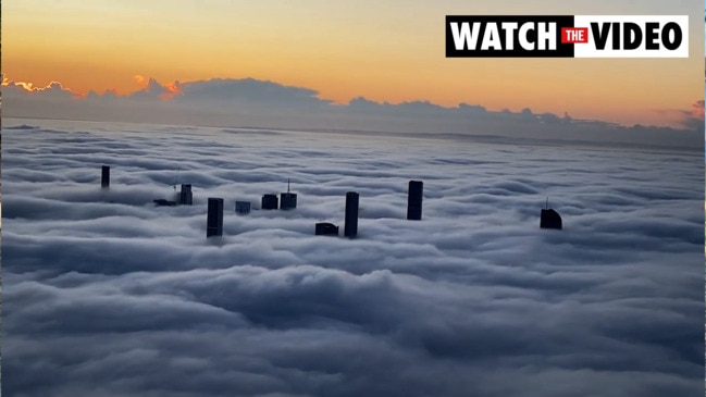
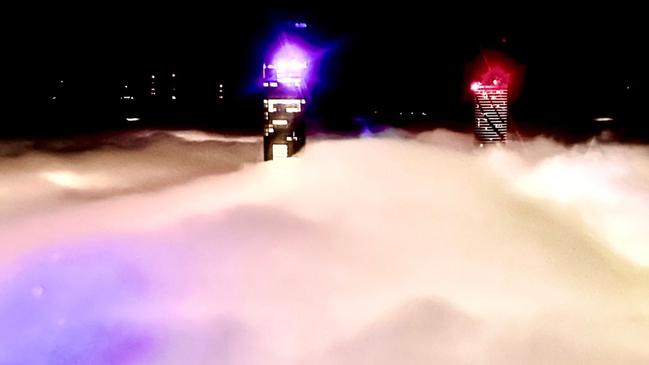
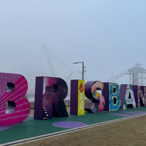
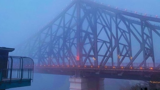
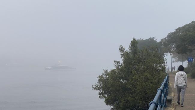
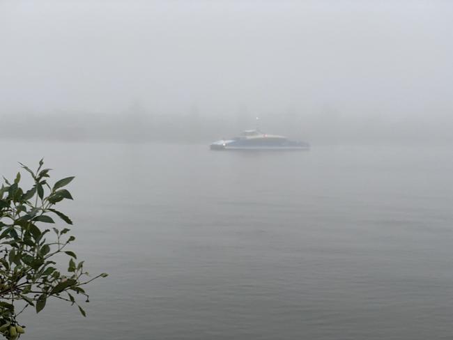
The thick blanket of fog that covered Brisbane for much of the morning has finally lifted, but not before causing disruption to commuters and air passengers, with flights diverted and delayed.
QLD weather news
Don't miss out on the headlines from QLD weather news. Followed categories will be added to My News.
The thick blanket of fog that covered Brisbane for much of the morning has finally lifted, but not before causing disruption to commuters and air passengers, with flights diverted and delayed.
A warning issued by the Bureau of Meteorology at 5.15am said “reduced visibility in fog would make road conditions dangerous during Tuesday in the Brisbane Area”.
A Brisbane Airport spokesman said that by 8am, very few planes were landing at the airport.
At its peak, visibility on the ground at Brisbane airport had decreased from 450m at 6.30am to around 350m at 7.15am.
Shortly after 9am, the fog had cleared in the area and flights had begun to land.
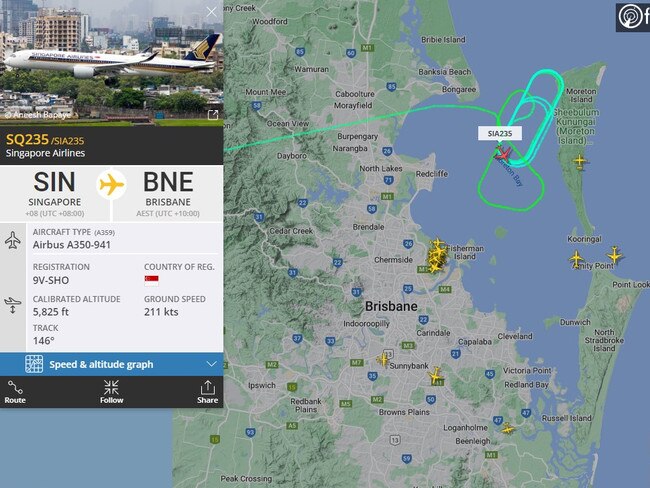
The spokesman said two international flights – one from Singapore and another from New Zealand – were among those diverted to Coolangatta.
He said they would refuel there and then make their way back to Brisbane within the coming hours.
Residual delays were expected throughout the day as airlines reposition their fleets to accommodate for this morning’s diversions.
The widespread fog over #SEQ is seen clearly from space. It's expected to lift by late morning. Other parts of the state are also experiencing a foggy morning. The day will be warm with partly cloudy skies. https://t.co/l3kCoJ1bPDpic.twitter.com/uw3JlKSBsU
— Bureau of Meteorology, Queensland (@BOM_Qld) August 1, 2022
For the full list of impacted flights, visit the Brisbane Airport website and check with your airline.
Helen Reid from the Bureau said the fog was widespread.
“It isn’t just Brisbane, it is also popping up further inland across to the Darling Downs and up to the north as well,” she said.
High-level cloud north of the city was making it hard for forecasters to identify the specific location of pockets of fog between Brisbane and the Sunshine Coast, but meteorologists expected it to be widespread.
“Because it is quite thick as well we likely won’t see it clear as early as we usually would either, so it could take a few hours to burn off throughout the morning,” Ms Reid said.
She said that while some areas might be experiencing more heavy pockets of fog than others, it was difficult to confirm where the fog would be heaviest.
“Looking at the satellite loop, it is moving about a bit so I wouldn’t want to say that anywhere has more fog than another, because that will change throughout the morning,” she said.
“But certainly, those in city high rises will have a great view as the sun comes up this morning.”
Foggy conditions are expected again on Wednesday and Thursday, before becoming less likely on Friday, when temperatures will climb to 27C in Brisbane before dropping back to 23C on Saturday for the start of the Ekka.
On Tuesday, Brisbane was expected to reach a top temperature of 23C, 22C for the Gold and Sunshine Coast and 19C further inland at Toowoomba.
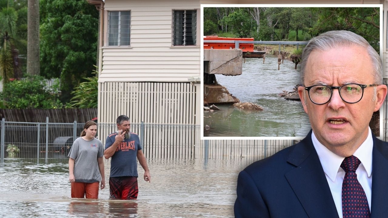
PM slams Bruce Hwy, as military might unleashed on flood clean-up
The Prime Minister hasn’t pulled any punches in his assessment of a critical part of the Bruce Highway as he visits flood-ragaved North Queensland, vowing to provide “whatever support is necessary”.
‘Big impacts’: New 300mm rain bomb, cyclone threat for NQ
Flood-soaked NQ communities have been warned of more heavy rain that could lead to life-threatening flash flooding in coming days – and even the slight chance of a tropical cyclone developing off the coast.