
Trough to return south after dumping 300mm on Queensland towns
Parts of Queensland are in for another huge deluge after 300mm was dumped in parts of the state overnight. SEE THE FORECAST
QLD weather news
Don't miss out on the headlines from QLD weather news. Followed categories will be added to My News.
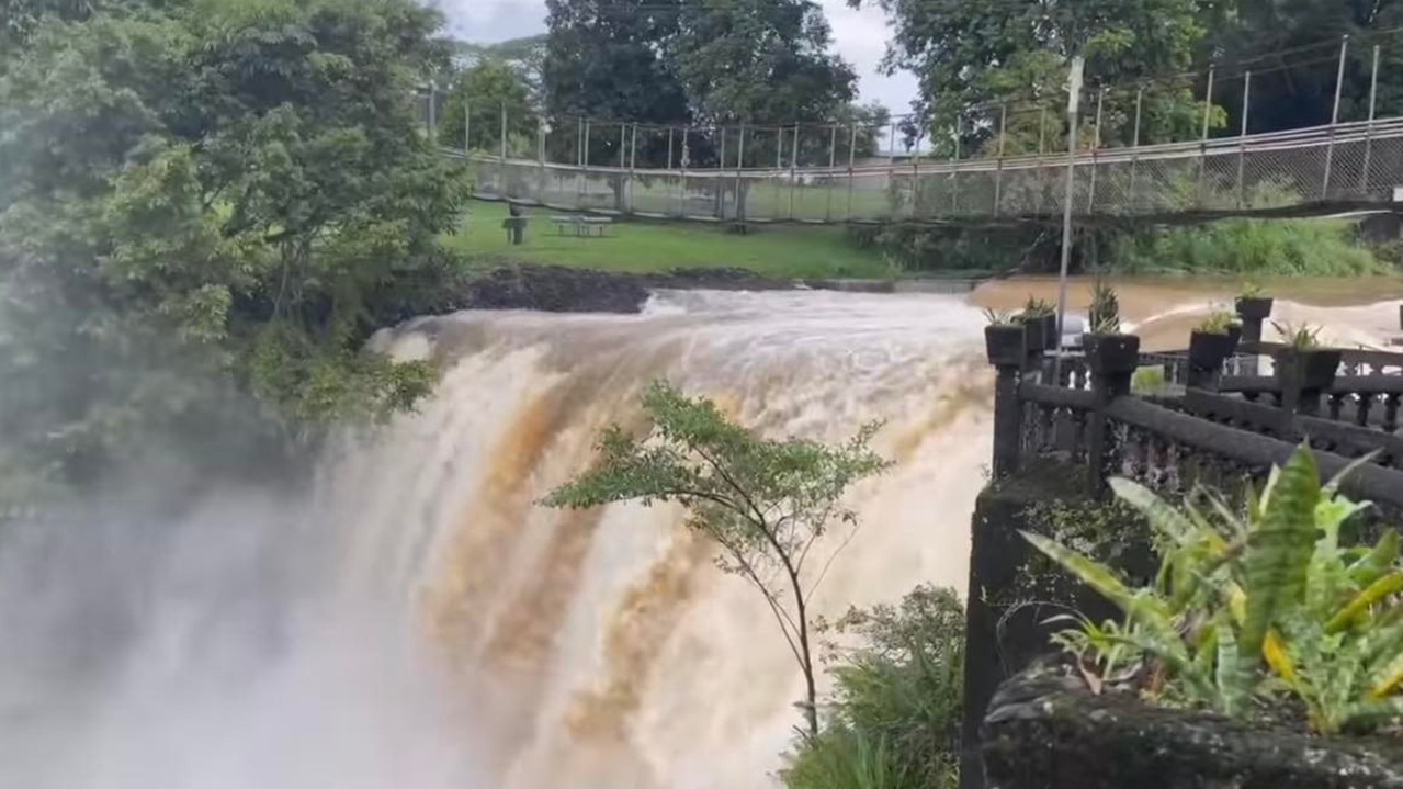
A trough which dumped more than 300mm of rain on parts of north Queensland overnight could move back south, bringing more rain for saturated areas.
The trough which has now shifted up to the far Northern Cape York Peninsula dumped 334mm on Russell River, near Innisfail, in the 24 hours to 9am while 288mm fell on Boulders and 104mm at Cairns Airport.
Paronella Park, south of Cairns, reported 180mm in 24 hours but assured people no damage had been caused to the tourist attraction.
Shane Kennedy from the Bureau of Meteorology said the weather system was likely to linger around the Torres Strait on Sunday before moving back south on Monday and Tuesday.
“The heavier falls should be north of Cooktown on Sunday but then shift back towards the North Tropical Coast,” Mr Kennedy said.
“It shouldn’t be as heavy as we saw over the past couple of days but we could certainly see some isolated falls in that 100mm to 200mm range and more broadly in that 50mm to 100mm range.”
Mr Kennedy said the North Tropical Coast region was spared from the most intense rainfall as the trough remained offshore.
It’s likely the trough will weaken, and remain offshore, as it heads back south.
The wet weather is likely to clear by Thursday for North Queensland as well as parts of Western Queensland where deep tropical moisture is being drawn from the tropics.
Mr Kennedy said the rain west of Longreach, through Mt Isa and down to Birdsville, was expected to ramp on Sunday.
Scattered falls of up to 20mm are expected broadly with the potential for storms to drop up to 100mm on Monday.
Dreary weather is expected to continue for the state’s southeast as well but showers should be lighter than elsewhere.
“It will mostly likely be less than 5mm but we could see some isolated falls in that 5mm to 10mm range,”
“And the chance of rain should reduce on ANZAC Day itself.”
The focus will be for coastal parts of the eastern corner but showers could extend to the Lockyer Valley.
The bureau has issued a flood watch for coastal catchments from Ingham to the Daintree as well as areas of western Queensland.


Storm shield: How AI will protect our state of disaster
Queensland has secured world-first AI storm detection technology in a $3m partnership between Suncorp and the state government to revolutionise natural disaster response.

Hail, rain, wind, SNOW: Winter storm on Qld collision course
A rare winter storm threatens to dump 15cm of snow on Queensland's Granite Belt this weekend as forecasters warn of an incoming polar air mass.