
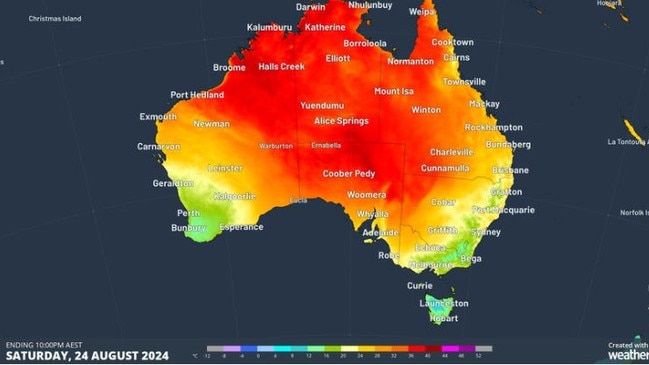
Temps to soar as high as 36C in blast of winter warmth
The mercury is expected to rise across Queensland this week, with the weather bureau tipping above-average temperatures and an elevated fire risk.

QLD weather news
Don't miss out on the headlines from QLD weather news. Followed categories will be added to My News.
The mercury is expected to creep up across Queensland this week, with the weather bureau tipping above-average temperatures for the pointy end of winter.
Southwest Queenslanders are bound to be hit with heat in the high 30s by Thursday, with Birdsville expecting 36C on Friday and Bedourie rising to 35C by Thursday.
Further east, Charleville is looking to reach 31C by Friday.
In Longreach, residents are likely to see 34C by Sunday, and Isisford residents 33C by Friday.
Bureau of Meteorology’s Felim Hanniffy said the temperatures heading to interior and western parts of Queensland were well-above average.
“The highest (temperature) anomalies will be in southwest, with temperatures getting into the high 30s by the latter part of the week and into the weekend,” the senior meteorologist said.
“The key driver is a combination of a high pressure system setting up around the Tasman and then extending out along the east coast.
“The combination of these two systems will help to draw down a very warm northerly airflow across much of interior Queensland.
“These systems will focus mostly across the southern states, which really allows that heat to build up across western interior Queensland with no real flush out. So they don’t really come through and flush out that heat. They just pass to the south and allow that heat to just build and sit there as well.
“So that is going to bring well above average temperatures.”
Mr Hanniffy said there could be an elevated fire risk inland, with western Queensland likely to be placed on fire watch later in the week.
“As we get those well above average temperatures and gusty northerly winds and then swing around to a more southerly direction through the latter part of the week ... it is when you get those little wind changes coming through with those temperatures then there will tend to be a risk of some elevated fire danger,” he said.
“The outlook across interior Queensland is for dry conditions really, for the next at least seven to ten days, so there’s no real significant rainfall on the forecast. And with these very warm conditions, your elevated fire days will be the watch factor when it combines with gusty winds.”
While Brisbane and southeast Queensland won’t see temperatures quite as high, Mr Hanniffy did say above average heat was still expected.
“In the southeast we’re not expecting significant rainfall, but certainly there are some showers around today, and probably some showers around again through the latter parts of the week. But overall we are in for a warm week,” he said.
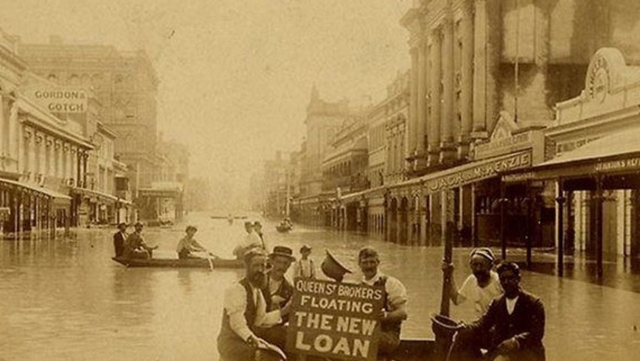
Freak ‘wall of water’: Inside Brisbane’s battle of 1893
In a freakish turn of weather Brisbane flooded three times in February 1893, leaving a third of the population homeless and claiming the lives of 35.
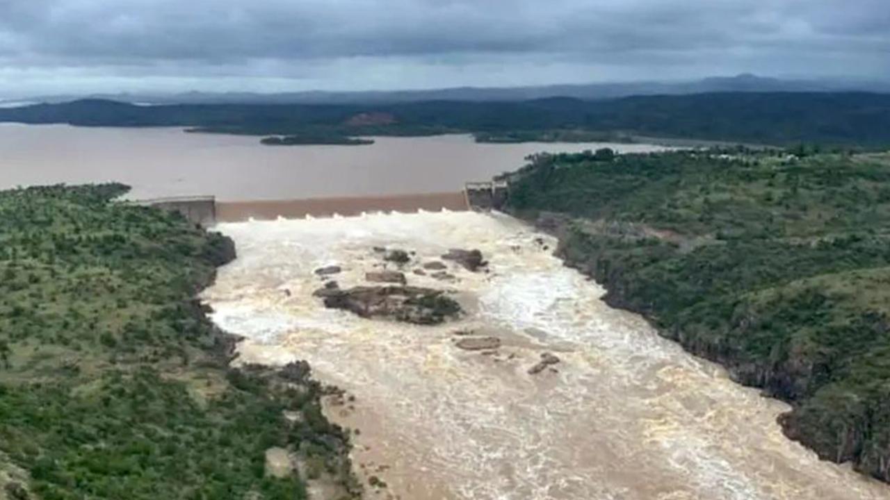
Far north in line for second coming of biblical flood
A second deluge is set to pound Far North Queensland on Monday and Tuesday, with flood warnings for half a dozen rivers and more than 140mm of rain recorded overnight in some parts.