
‘Summer-like’ storms building out west to slam the southeast
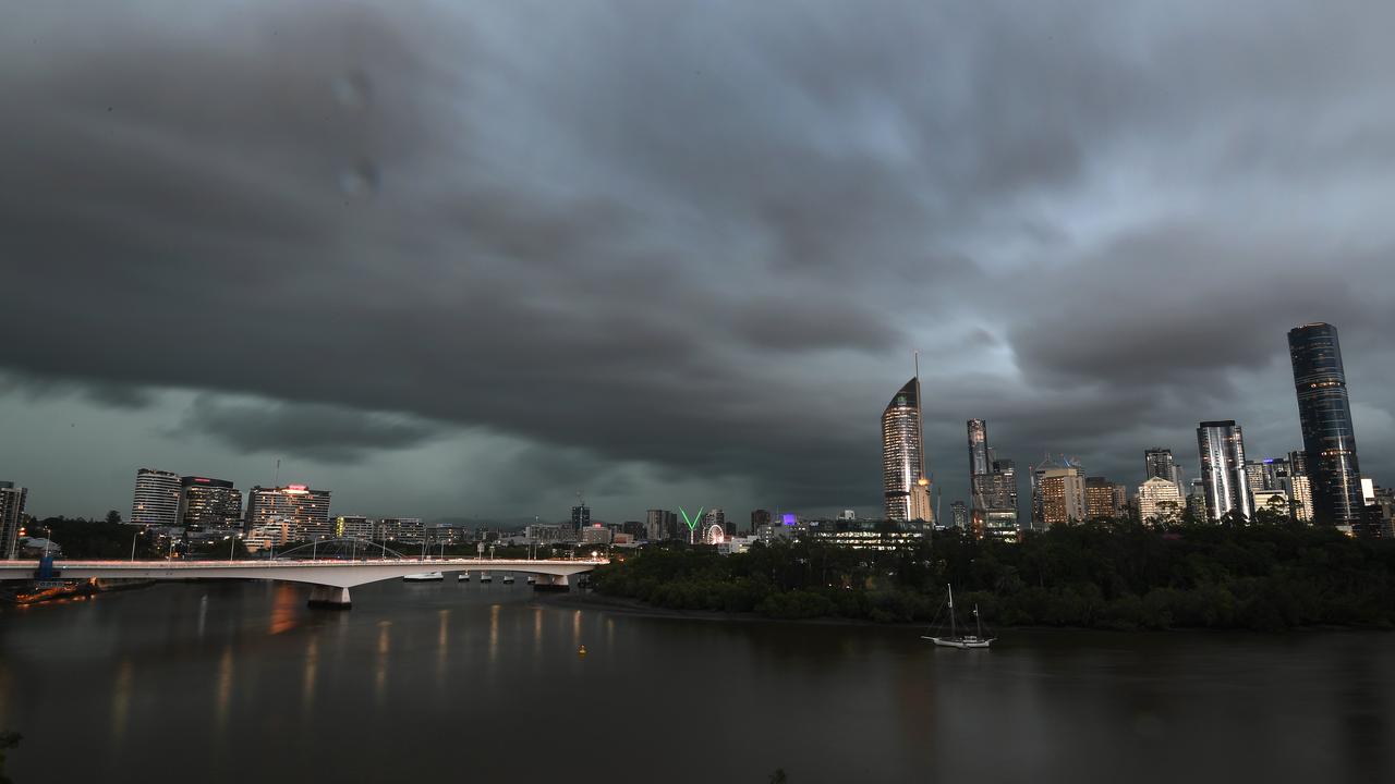
Southeast Queensland is expected to be hit by storms that have begun to form out west, with large hail, damaging winds and heavy rain on the cards, with the worst to come on Thursday.

QLD weather news
Don't miss out on the headlines from QLD weather news. Followed categories will be added to My News.
Southeast Queensland is expected to be slammed by storms that have begun to form out west, with heavy rain possible on Wednesday and the worst to come on Thursday or Friday.
Damaging wind gusts, large hail and heavy rain are possible for pockets of Queensland as a summer-like storm system makes its way east.
BOM meteorologist Helen Reid said thunderstorms had started forming in western parts of Queensland on Tuesday morning and could stretch as far north as Emerald.
“We could expect to see some good thunderstorm activity west of Roma, that’s going all the way back to the West and South Australian border as well so there’s quite a big area where we could see some action today,” she said.
BOM has forecast rain and thunderstorms for a broad area of western Queensland on Wednesday as well with the possibility of a downpour for the southeast.
The worst of the weather could reach Brisbane by Thursday, when the western parts of the state are expected to clear.
“On Thursday we are expecting there will be pockets where we could have some damaging wind gusts, heavy rain and large hail,” Ms Reid said.
“That would even be a possibility for the Brisbane region on Friday as well.”
Ms Reid said severe storms for the southeast hadn’t been ruled out for Thursday but they were more likely on Friday as he trough system pushes to the coast.
Up to 40mm of rain could fall on “a lot of places.
“Then if you get a thunderstorm on top of that, it could be quite a lot more. But that’s over a couple of days,” Ms Reid said.
Cloud coverage means temperatures are expected to remain in the low 20s over the coming days but a clear and warm weekend is on the cards as the storms move out to sea.
Ms Reid said the trough wouldn’t bring a cold blast as experienced last week thanks to moisture feeding into the weather system.
“It’s kind of a summer set up coming through,” she said.
“We’ve got a couple of days of winds coming in off the water which is helping that humidity build for a couple of days and then that trough will come in from the west,” she said.
“It’s helped by what is happening higher in the atmosphere as well and it’s all lining up for it to be conducive to a thunderstorm.”
Ms Reid said the storms could “get a little more interesting” with the right combination of wind strength and changes in wind direction.

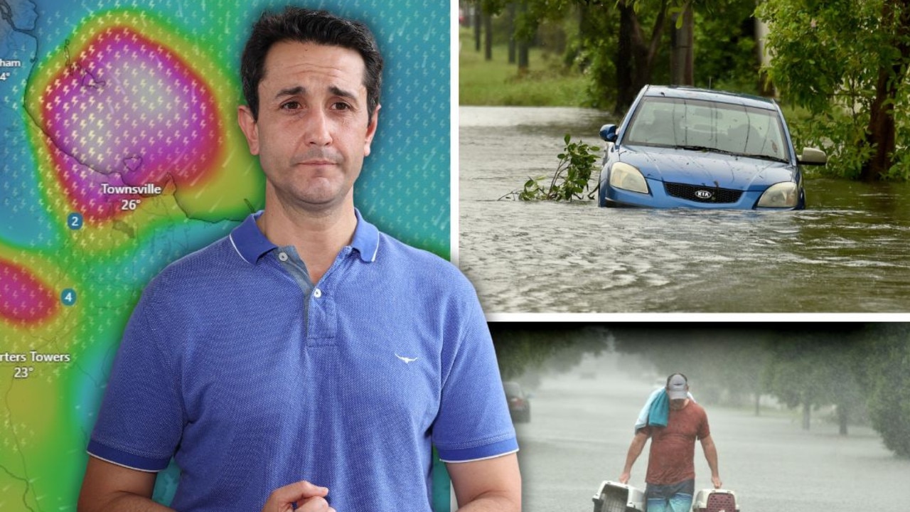
‘Testing NQ’s resilience’: Life-threatening flood warning, 250mm weekend forecast
Extra swiftwater rescue crews, police and boats are being sent north from SEQ ahead of what the Premier has warned will be another severe weekend of devastation for an already-saturated and “hurting” region.

Airport ‘evacuated’ and shut down amid fresh flood fears
A North Queensland airport has been closed with reports waiting passengers were being evacuated from the building amid flooding concerns as the region is battered by rain.