
Queensland set to swelter after winter storms leave thousands without power
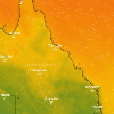
After a week of cold conditions and a wild winter storm on Tuesday morning, Queensland’s temperatures are set to climb by up to 15C over the next few days.
QLD weather news
Don't miss out on the headlines from QLD weather news. Followed categories will be added to My News.
Some parts of Queensland are set to “swelter” through warm winter nights as week-on-week temperatures fluctuate by up to 15C.
It comes after a week of temperatures 6-8C below average and wild winter storms that left 3300 homes without power on Tuesday morning.
The Bureau of Meteorology is now warning warm nights will make a reappearance before the next cold front moves through later in the week.
Meteorologist Rosa Hoff said temperatures would be 1-4C above average in the east and between 4-7C warmer inland.
“The temperatures will likely peak tomorrow morning,” Ms Hoff said on Tuesday.
“We could have temperatures 8C above average, which will certainly make for a sweltering night in June.
“We’ll feel the warmer temperatures a lot more than we would have normally because it was so cold last week.
“To go from being below average to above … We’re seeing some locations have a week-by-week temperature fluctuation of between 10-15C.”
Ms Hoff said the warm weather would be felt “acutely” for anyone inland and around the coast but would not stick around for long.
“Temperatures will drop back below average from Friday onwards, as a cold front tracks over southern Queensland,” she said.
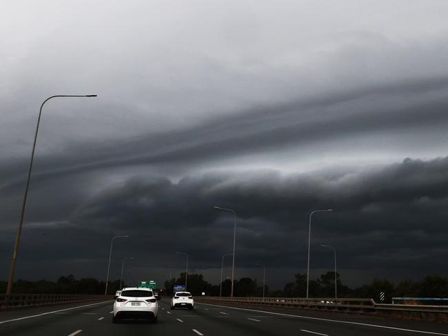
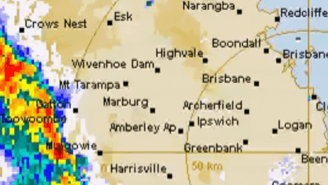
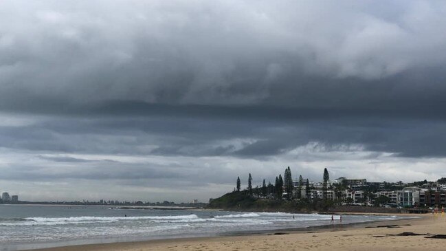
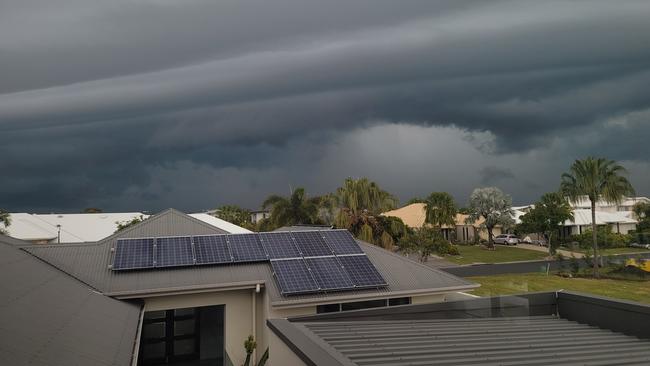
Earlier Tuesday, BOM said severe storms with damaging winds, large hail and large accumulations of small hail are possible in parts of southeast Queensland between Caboolture, Gladstone and Biloela and in the state’s north between Sarina and Townsville.
Morning thunderstorm activity has been recorded as far north as Blackbutt, west of Kilcoy, and as far south as Springbrook.
The storms are expected to reach Brisbane by early afternoon.
BOM Meteorologist Rosa Hoff said hail was possible across southeast Queensland but large hailstones, more than 2cm in diameter, were only likely where severe storms were forecast around the Wide Bay and Burnett, and between Charters Towers and Sarina.
“We’re most likely to see the severe storms this afternoon and into the evening,” Ms Hoff said.
“Regular storms could roll past midnight.”
Flooding wasn’t expected as the line of thunderstorms moving east is likely to bring smaller amounts of rain to larger areas.
Ms Hoff said the return of moisture after a few cold days and instability in the air had triggered the storms.
Thunderstorms are possible from the North Tropical Coast right through to the Darling Downs.
An Energex spokesman said a lightning strike at Brassall was responsible for an outage which left more than 1,360 customers without power across Ipswich.
The suburbs most affected are Brassall, Karrabin and Wulkuraka.
Meanwhile, more than 1900 customers in the Moreton Bay Regional Council area are also without power.
Monsoon unleashed: 500mm possible for flood-ravaged FNQ
Parts of Far North Queensland are bracing for a 500mm deluge with major flood warnings active as the long-awaited monsoon looks set to finally arrive.
‘Testing NQ’s resilience’: Life-threatening flood warning, 250mm weekend forecast
Extra swiftwater rescue crews, police and boats are being sent north from SEQ ahead of what the Premier has warned will be another severe weekend of devastation for an already-saturated and “hurting” region.