
Southeast lashed as wild storm front brings large hail, flash flooding
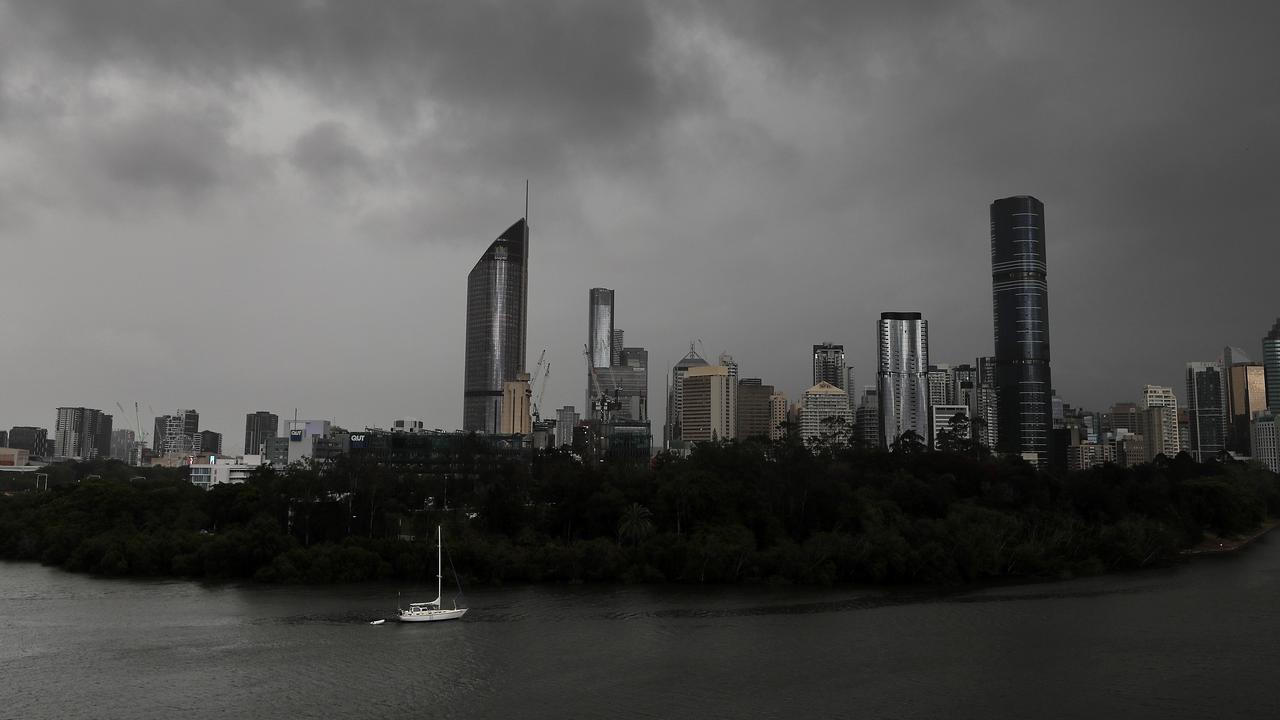
Brisbane, the Sunshine Coast and the Gold Coast were lashed by a monster storm front on Thursday night – and the state’s southeast can expect more heavy rain, large hail and damaging winds well into Friday. WATCH THE VIDEO
QLD weather news
Don't miss out on the headlines from QLD weather news. Followed categories will be added to My News.
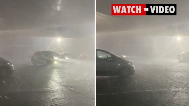
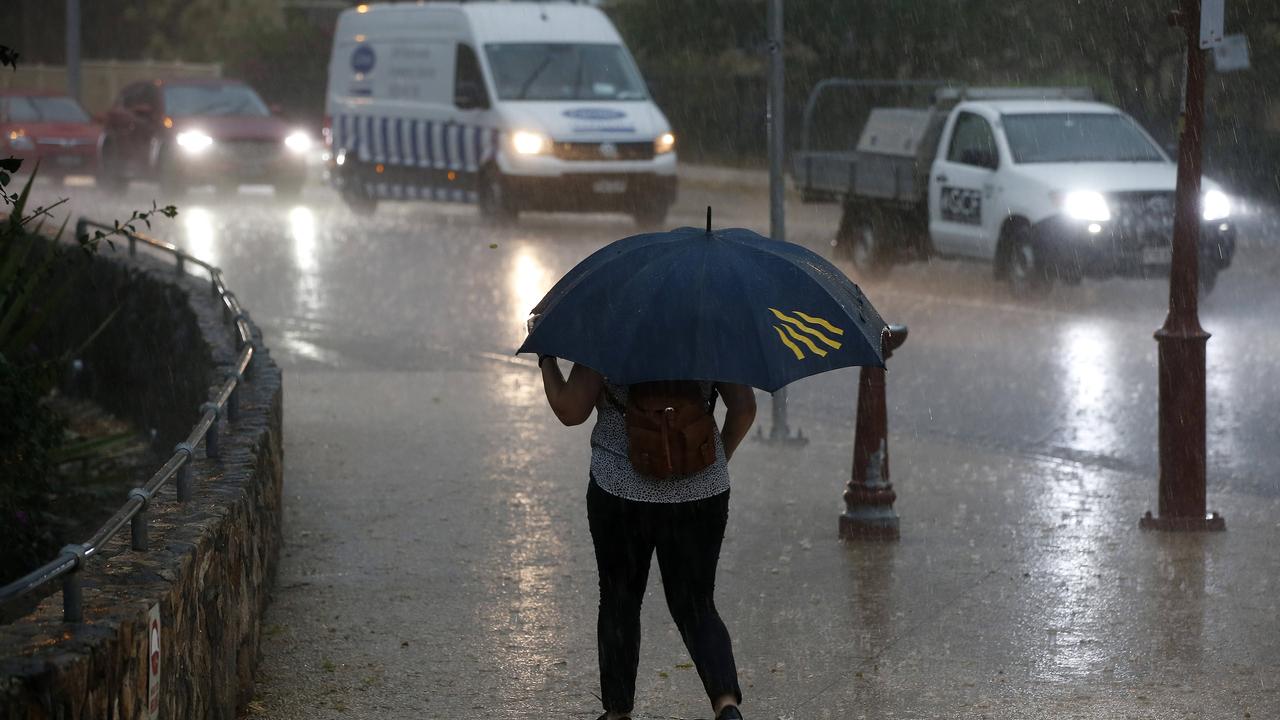
Brisbane, the Sunshine Coast and Gold Coast were lashed by a series of severe stormson Thursday night, which brought “giant hailstones and flash flooding” along with the heavy rain and wild winds.
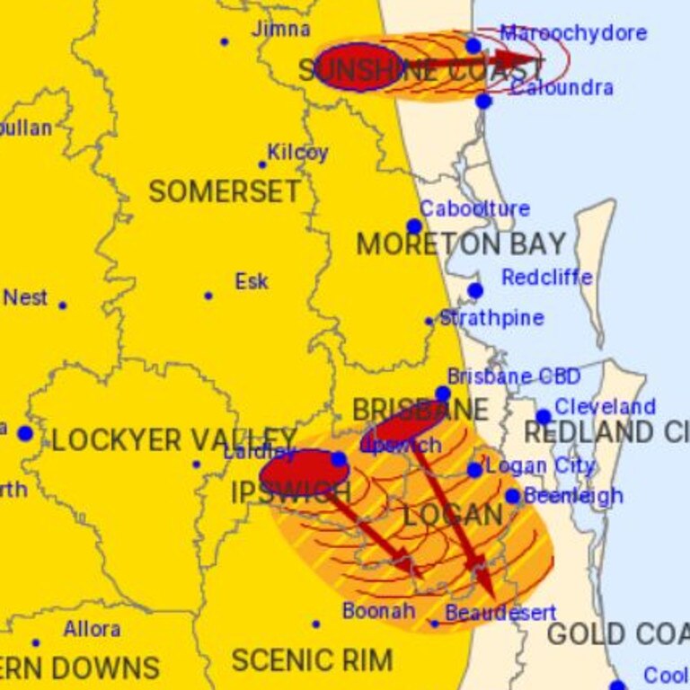
Although the threat in much of the southeast had temporarily eased, it is likely there will be a redevelopment of severe thunderstorms in the Scenic Rim, Gold Coast, Somerset and Ipswich council areas overnight, the Bureau of Meteorology said.
Unstable conditions remain about the Gold Coast and hinterland and BOM will issue further warnings if required.

A more general warning remains in place for the Central Highlands and Coalfields and Central West districts. Locations which may be affected include Mantuan Downs, Alpha and Carnarvon National Park.
Earlier warnings for the Capricornia, Wide Bay and Burnett, Darling Downs and Granite Belt
regions have been cancelled.
The system has dumped 2cm+ hail in Sherwood, power outages also reported in the Samford Valley. @9NewsQueenslandpic.twitter.com/23zNLpPn0f
— Reece D'Alessandro (@R_DAlessandro9) September 30, 2021
BOM spokesman Matthew Bass said “there’s some pretty active cells moving towards Kingaroy and Gayndah, another cell just out near Emerald, so there will potentially be large hail and strong wind gusts”.
“This activity should continue till the early hours of Friday morning,” Mr Bass said.
“Most activity will clear off before dawn, but the instability will persist across the east.”
These storms are developing due to multiple days of warm humid air mass moving over east Australia interacting with a large low pressure system.
The places which are at most risk for severe thunderstorms on Friday are Wide Bay and Capricornia and Sunshine Coast.
A triple threat of damaging winds, heavy rain and large hail will also threaten the Darling Downs, Brisbane and the Gold Coast on Friday.
Once the storms move offshore a warm and sunny weekend is still expected.
First storm of the season and we get hail! And tomorrow’s supposed to bring worse! â„ï¸ðŸ˜¬ #Brisbane#bnestorm#wildweather#qldstorm#bneweatherpic.twitter.com/JjzDP6zD7G
— Anne Stubbs (@annestubbs) September 30, 2021
It comes after parts of the state’s southwest have been hammered by supercell storms over the past 48 hours.
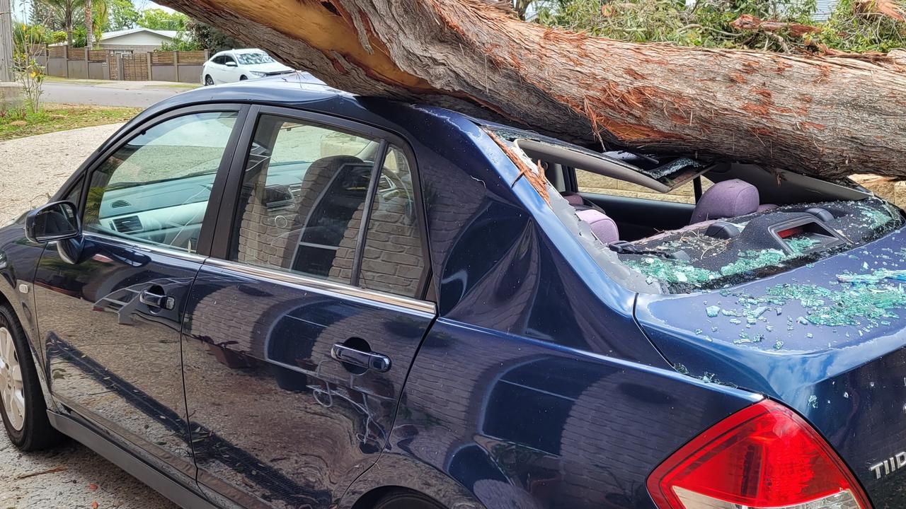
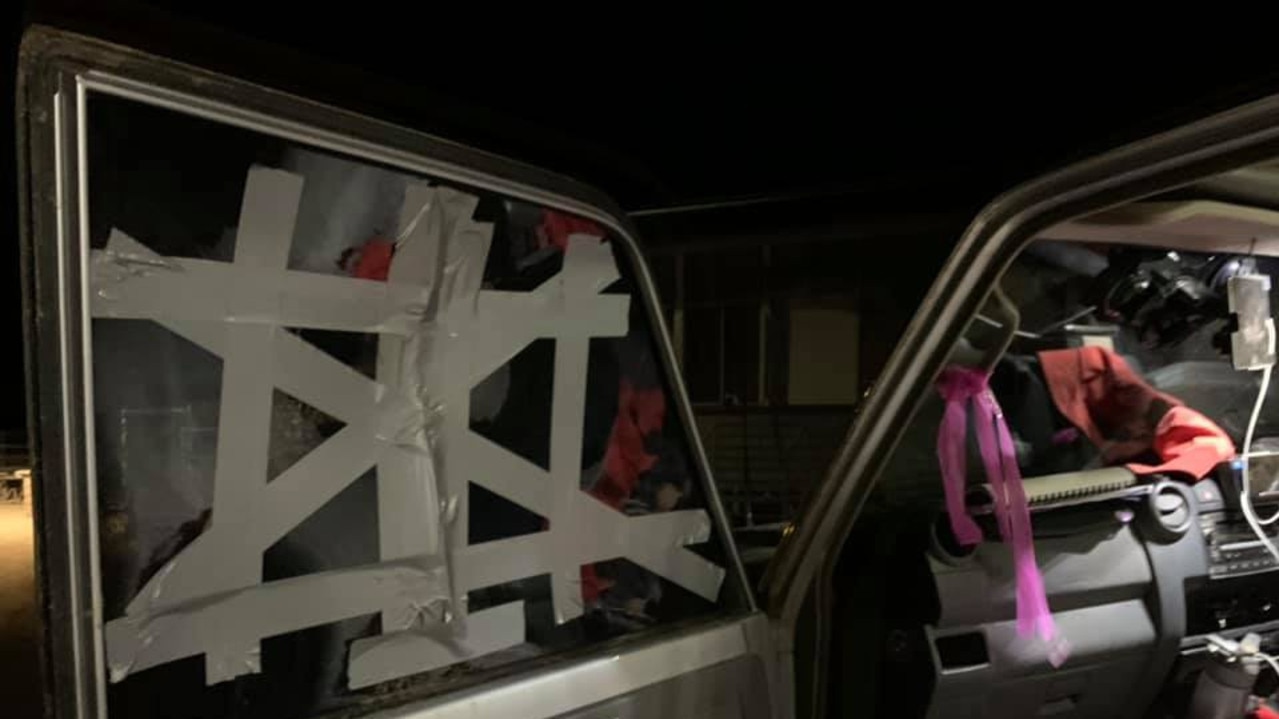
On Tuesday night, Avadale in western Queensland was slammed by a violent storm that ripped off offs and blew out car windows.
Those who witnessed the storm described it as being like a “sand and hail hurricane”.
The storm front wreaked havoc on parts of western Queensland on Wednesday.
Meanwhile, a Sunshine Coast woman says she’s lucky to be alive after being struck by a flying piece of timber that crashed through her bedroom window after a “freak” lightning strike “exploded” a tree in her neighbour’s front yard.
Nambour resident Tracey Robertson had not been able to sleep but was miraculously uninjured by the debris which hurtled through her window about 1.15am on Thursday.

Western Queensland got a taste of what was to come for southeast on Tuesday night and Wednesday when severe storms delivered shocking winds, hail and up to 50mm of rain.
About 50mm fell on Tooloombilla, 90km north of Mitchell, on Wednesday while residents recorded 46mm at Abbieglassie and 44mm at Silverleaf Creek.
BOM recorded 8mm for the Gold Coast, 3.4mm for Brisbane and 1mm for the Sunshine Coast to 9am on Thursday.

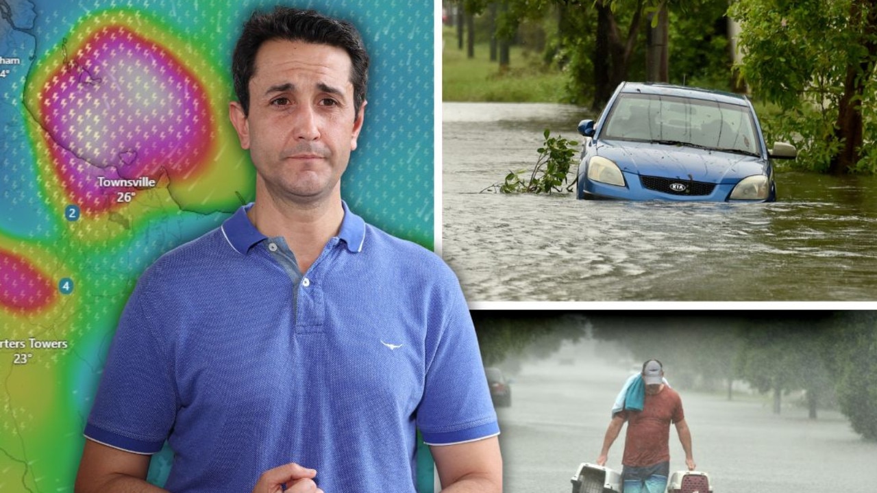
‘Testing NQ’s resilience’: Life-threatening flood warning, 250mm weekend forecast
Extra swiftwater rescue crews, police and boats are being sent north from SEQ ahead of what the Premier has warned will be another severe weekend of devastation for an already-saturated and “hurting” region.
Read more
Airport ‘evacuated’ and shut down amid fresh flood fears
A North Queensland airport has been closed with reports waiting passengers were being evacuated from the building amid flooding concerns as the region is battered by rain.
Read more