
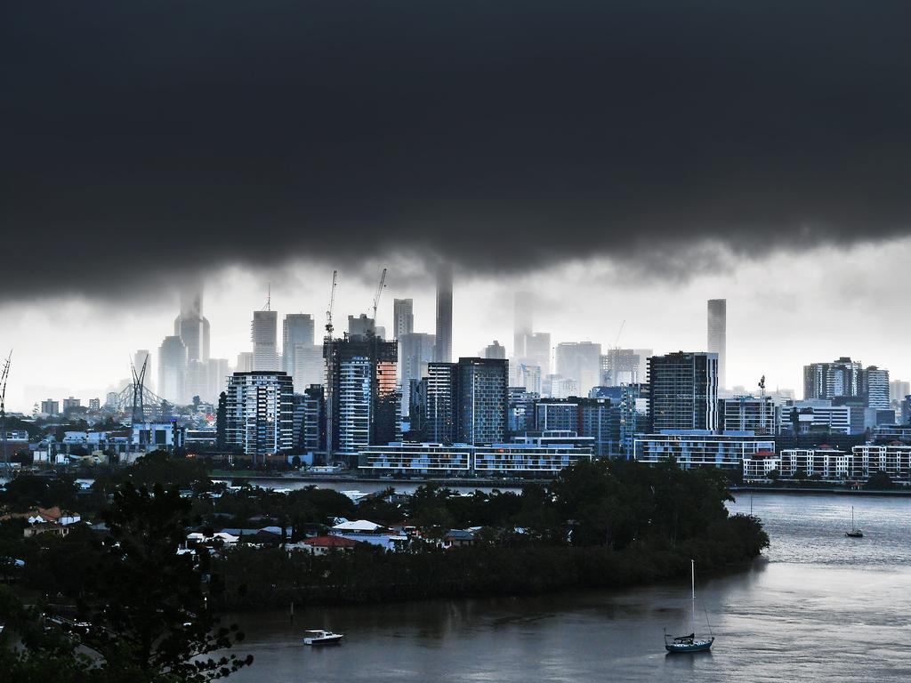
Severe thunderstorms dump 200mm on central Queensland overnight
Parts of central Queensland were drenched overnight with more than 200mm recorded at Gladstone while severe thunderstorms dumped 100mm in just an hour at Calliope.

QLD weather news
Don't miss out on the headlines from QLD weather news. Followed categories will be added to My News.
More than 200mm has fallen on the coast of central Queensland as severe thunderstorms lashed the region.
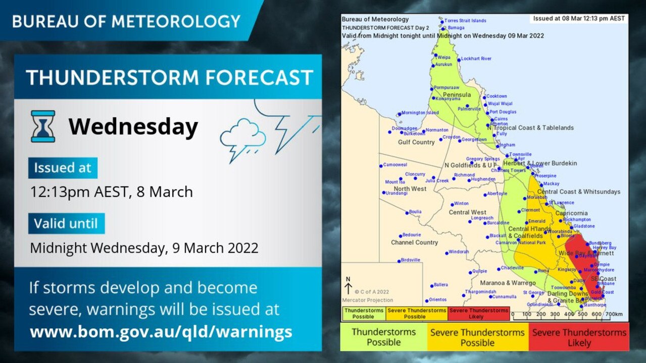
A severe thunderstorm warning was issued by the Bureau of Meteorology just before midnight last night for parts of the Capricornia and Wide Bay coasts as intense rain reached tops of 115mm in an hour to 11pm in Calliope.
Gladstone recorded 216mm on Wednesday, including 120mm in just two hours to midnight. There were heavy falls on the Fraser Coast as well, with 89mm at Magnolia.
BOM was predicting severe thunderstorms to persist on Thursday morning, but cancelled its severe storm warning at 2.20am.
In earlier storms further north, Pomona recorded 49mm of rain in 30 minutes to 2pm, Dagun Pocket recorded 72mm in one hour to 2pm and the Magnolia Alert, in the Fraser Coast region, recorded 86mm in the two hours to 1.30pm.
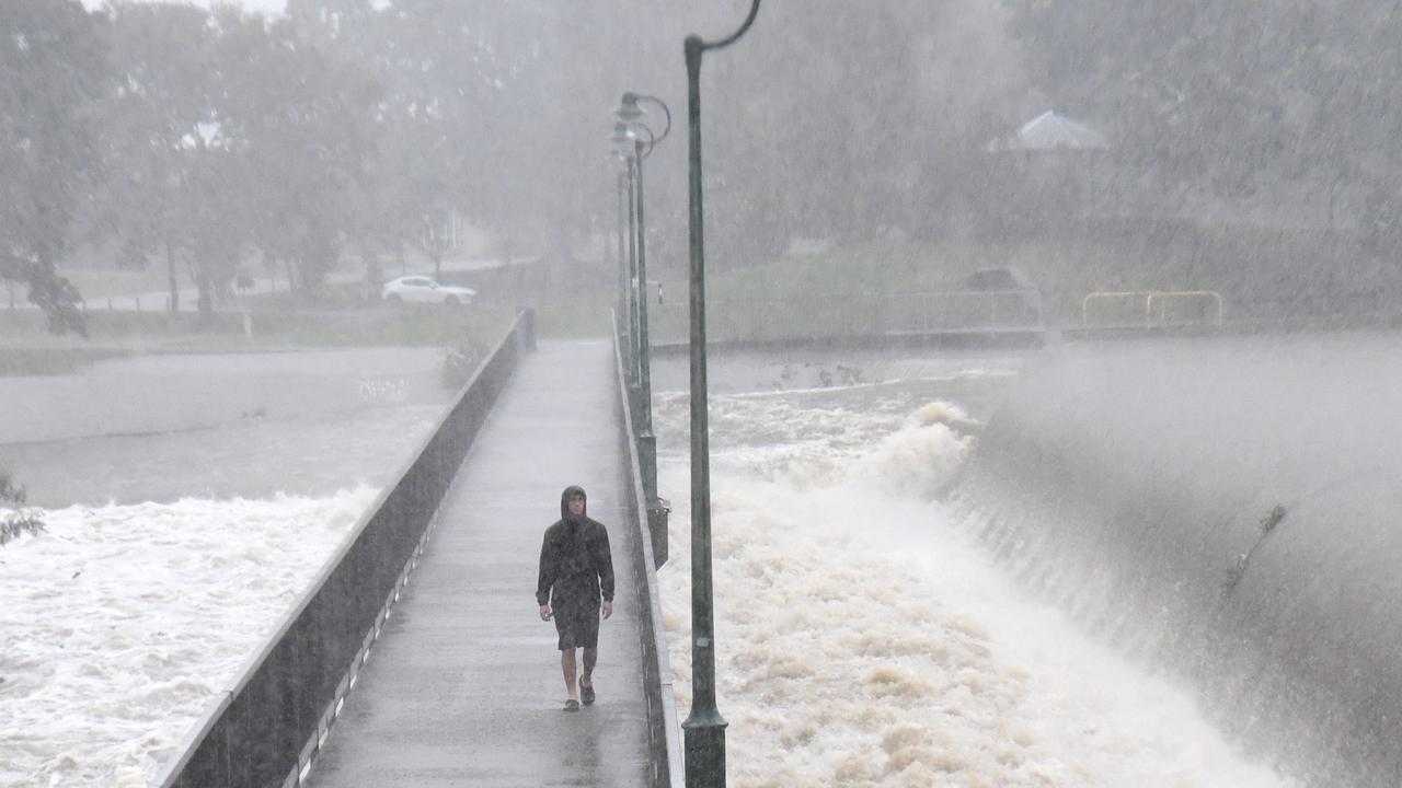
Brisbane experienced a short burst of rain early on Monday ahead of predicted severe thunderstorms.
The Bureau says a “moist air mass with moderate to strong instability” is in place over southeast Queensland, and strong wind flow and dry air will support “scattered severe thunderstorms” over the next few hours.
Earlier, meteorologist Harry Clarke said he couldn’t rule out some storms developing into “high-end, very dangerous thunderstorms” during the afternoon and evening.
But that will depend on a potential wind change.
âš ï¸â›ˆï¸Severe thunderstorm #warning issued for damaging winds in #SEQLD, including Esk, Kilcoy, and Nanango. Details and updates: https://t.co/FBmpsInT9opic.twitter.com/3NoiWX3mC8
— Bureau of Meteorology, Queensland (@BOM_Qld) March 8, 2022
“The atmosphere is broadly unstable across southeast Queensland and that’s due to an upper trough,”
“The south-easterly wind change is essentially going to be the trigger for the storms.
“So it’s unstable and the south-easterly change will come through and kick off a lot of that activity.”
Mr Clarke said totals of 50mm could fall on some areas during “hit and miss” storms.
He said there was a broad threat area and parts of in Brisbane, the Gold Coast, Sunshine Coast and Wide Bay could be hit with heavy rain.
“It’s not just the rainfall with these storms, there’s also the chance of damaging wind and large hail as well,” he said.
There’s also a chance of severe storms for areas south of Mackay and east of Emerald.
Mr Clarke said storm activity is expected to shift north on Wednesday night but some showers could remain for the south east towards the end of the week.
“There will be a few showers in the southeast corner but the thunderstorm activity should be more around Capricornia, Central Queensland and across the Darling Downs by the time we get to Thursday,” he said.
“In saying that, there could still be a couple showers around coastal parts but nothing too extraordinary at this point and really quite cooler as well.
“That south-easterly change will be a cool change.”
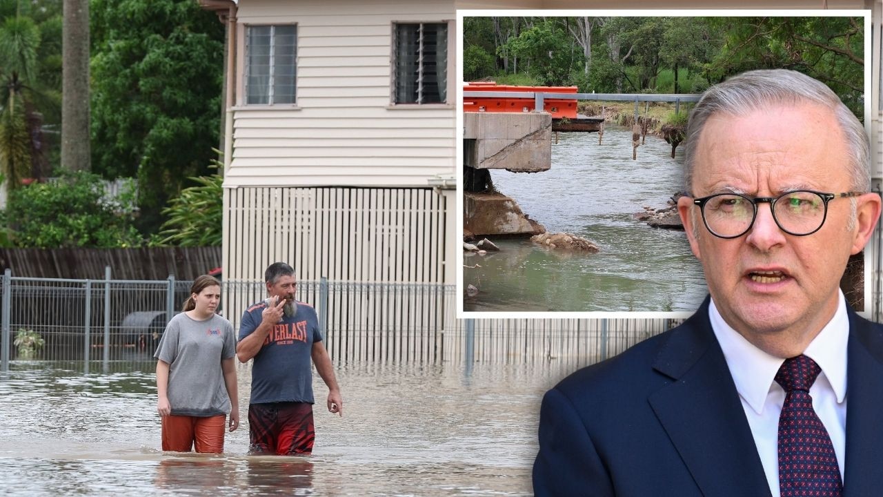
Meanwhile, flood-affected taxpayers and small businesses will have GST refunds fast tracked and allowed to defer pay-as-you-go instalments under federal government disaster relief.
Treasurer Josh Frydenberg announced the immediate tax relief on Wednesday evening to help alleviate cash flow pressure and assist communities with the recovery effort.
Taxpayers in flood-affected areas will be given any additional time they need to meet upcoming business activity statement obligations.
GST refunds will also be fast tracked to free up cash flow.
People needing urgent assistance with tax affairs due to the floods should contact the ATO’s Emergency Support Infoline on 1800 806 218.

PM slams Bruce Hwy, as military might unleashed on flood clean-up
The Prime Minister hasn’t pulled any punches in his assessment of a critical part of the Bruce Highway as he visits flood-ragaved North Queensland, vowing to provide “whatever support is necessary”.
Read more
‘Big impacts’: New 300mm rain bomb, cyclone threat for NQ
Flood-soaked NQ communities have been warned of more heavy rain that could lead to life-threatening flash flooding in coming days – and even the slight chance of a tropical cyclone developing off the coast.
Read more