
Severe storms and high humidity for Qld across Christmas weekend
South East Queensland has been lashed by storms, initially termed a “once in 10-year event”, with a water spout even spotted in one location.
QLD weather news
Don't miss out on the headlines from QLD weather news. Followed categories will be added to My News.
The monster supercell sweeping across Queensland’s southeast has caused widespread flash flooding in Toowoomba and torrential rainfall in Brisbane, with the Bureau of Meteorology earlier warning it could be a a one in 10 year event.
Onlookers were also shocked to see a water spout form off the coast of Bribie Island late this afternoon.
A weather bureau spokesperson said the system would drop at least 70mm in under an hour in some areas and cause life-threatening flash flooding.
“The main threat currently is that it is incredibly slow moving and is sticking over one spot for a fairly long amount of time,” he said.
“With this category of rainfall that the Bureau has forecast, it means that in any given year there is a two per cent chance that we will see something like this.
“It could mean that the city gets 70mms per hour, and people should be watching the rivers for flash flooding over the coming hours especially through the metro regions.”

The system will sit over Brisbane through the night before moving north up to the Sunshine Coast and Wide Bay regions.
The Bureau says huge areas of the Brisbane City, Ipswich, Logan, Gold Coast, Moreton Bay, Redland City, Toowoomba, Somerset, Scenic Rim, Gympie and South Burnett council areas are in the firing line.
The Bureau warns that, at 7.58pm, severe thunderstorms likely to produce heavy rainfall that may lead to flash flooding were detected near Montville and Palmwoods.
These thunderstorms are slow moving and are forecast to affect is forecast to affect Nambour and Mapleton by 8:50pm.
Heavy rain was recorded all over the state’s southeast, with 61mm recorded in one hour to 5.50pm at Wacol, 48mm in the 30 minutes to 5.18pm at Moggill, 59mm in 30 minutes to 3:44pm at Mt Petersen and 69mm in the one hour to 3.29pm at Boonah.
A separate more broad severe thunderstorm warning is in place for parts of the Central Highlands and Coalfields, Capricornia, Wide Bay and Burnett, Southeast Coast, Central West and Darling Downs and Granite Belt forecast districts.
Slow moving severe thunderstorms are ongoing in a very humid airmass through South-East Queensland this evening and are expected to persist tonight.
Intense rainfall has eased for now, but localised intense falls may redevelop tonight through the Wide Bay and Burnett, Capricornia and Central Highlands and Coalfields.
Severe thunderstorms are likely to produce heavy rainfall that may lead to flash flooding in the warning area over the next several hours.
Locations which may be affected include Gympie, Emerald, Clermont, Caboolture, Cooroy and Nambour.
Severe thunderstorms are no longer occurring in the Northern Goldfields and Upper Flinders district and the warning for this district is cancelled.
Earlier today, 76mm of rainfall was recorded in the hour to 3.07pm at Gormans Gap, south of Toowoomba, while 54mm was recorded in the hour to 3.01pm at Millbook.
Upper Bracker Creek, west of Stanthorpe, recorded 79mm in the hour to 12.09pm and 43mm was recorded in the hour to 12.40pm at Dalcouth.
Emergency services have urged residents living in the affected areas to stay indoors, not to drive unless necessary and close doors and windows.
It’s the start of a stormy few days for Southeast Queenslanders with humidity expected to spike over the weekend.
As Far North Queensland continues the clean-up from floods kicked off by ex-tropical cyclone Jasper, heavy rain has already started falling in other parts of the state.

Moogerah Dam in the Scenic Rim received 102mm overnight, while nearby Mt Barney got 95mm.
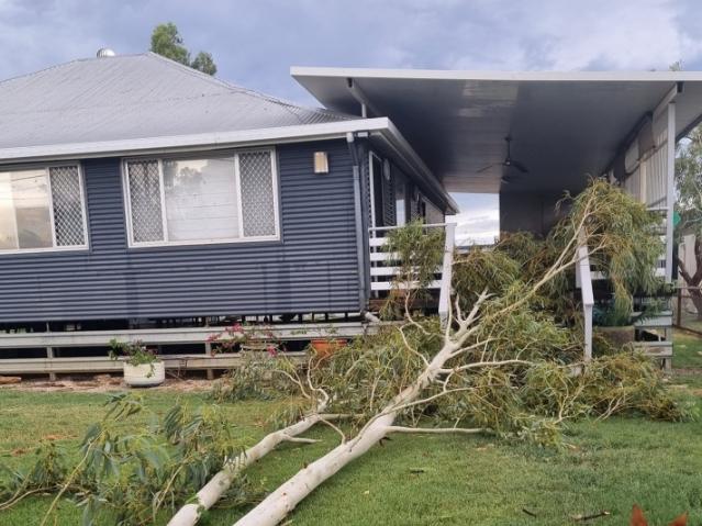
Storms damaged other parts of the state overnight, with Julia Creek smashed by large hail and devastating winds over 98km/hr, which caved in garage doors and sent water tanks flying.
Damaging winds, large hail and heavy rainfall are possible for Brisbane and the wider South East over the next 48 hours, with predictions of up to 25mm rainfall for the river city both today and tomorrow, with more rain and storms possible across the weekend and into Christmas Day on Monday.

The wet weather predictions have already put a dampener on some Christmas festivities, with old Petrie Town north of Brisbane cancelling its Christmas night markets cancelling the event due to the forecast.
Senior meteorologist Daniel Hayes said anyone travelling to central or southern Queensland should keep an eye on severe thunderstorm and flood warnings.
“The possibility of those severe thunderstorms does persist across large parts of the central and southern Queensland and into the southeast Queensland area right through into the early part of next week,” Mr Hayes said.
“There might be floodwaters coming on for some of the river beds, we do have a minor flood warning for the Paroo River.”
While there will be a dip in the temperature across the weekend, it will still feel sticky with humidity to sit between 80-90 per cent.
While the mercury is forecast to reach just 25C on Friday in Brisbane, it will climb to 29C on Saturday, 30C on Sunday, before hitting 33C on Christmas Day.


‘Can’t be ruled out’: Potential for freak Qld snowfall this week
Queensland could see snow this week with weather models predicting up to 14cm falling on the Granite Belt.

Monster weather system brings storm, heavy rain to Qld
Brisbane and surrounding parts of the southeast have been hit by storms and heavy rainfall this afternoon as a 3000km-long monster low moves across the state.