
Deluge makes for wettest July day in 15 years
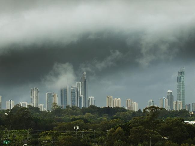
Strong winds and thunderstorms have hammered southeast Queensland this afternoon, adding to what was already the wettest July day in 15 years for some areas.
QLD weather news
Don't miss out on the headlines from QLD weather news. Followed categories will be added to My News.
Strong winds and thunderstorms have hammered southeast Queensland, adding to what was already the wettest July day in 15 years for some areas.
A band of strong winds and rain stretching from the Sunshine Coast to beyond the NSW border - more than 200km - hit in the afternoon. The wild snap was quick to pass over Brisbane about 4pm but the Gold Coast copped strong winds and showers for about 10 minutes just before 5pm.
Wind gusts were recorded up to 76kmh.
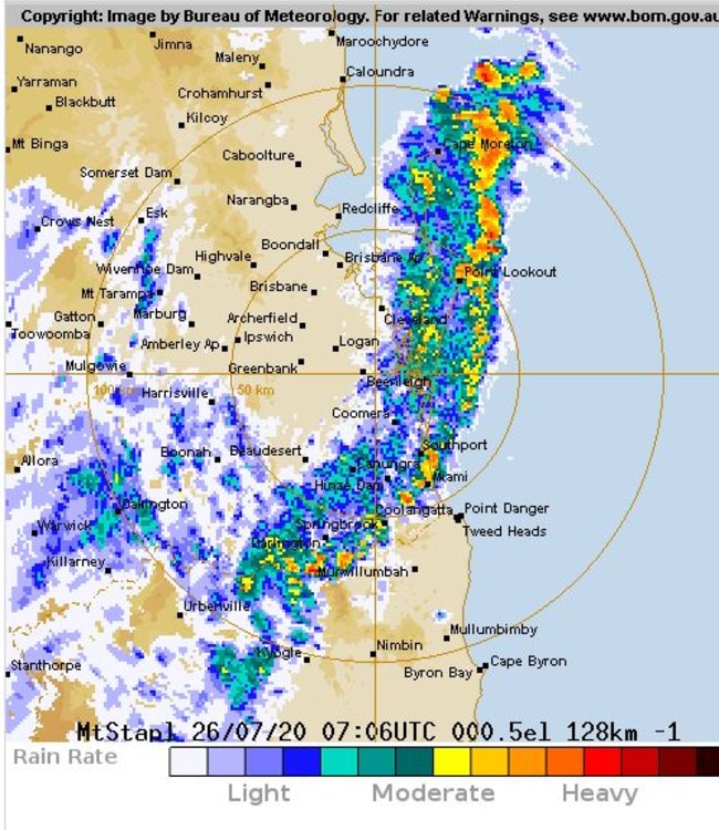
By 5.40pm the band was moving off Moreton Island and had just passed off the Gold Coast.
Bureau of Meteorology (BoM) forecaster Lauren Pattie said the powerful storm front was quickly clearing the coast.
“A line of showers and thunderstorms moved east across southeast Queensland and started in the early afternoon over the eastern downs,” Ms Pattie said.
“We haven’t seen too much in the way of rainfall and we didn’t expect much with this system, there was about 5mm in a couple of places and up to 6mm or 7mm on both coasts.
“There were some wind gusts up to 76kmh, the airport had 69kmh so nothing severe but a bit gusty and that was probably the main thing people would’ve noticed.”
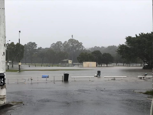
The afternoon storms came after southeast Queensland woke to a drenching Sunday morning, with 184mm of falls recorded in some areas of the state, smashing predicted totals.
The 24 hours to Sunday morning saw heavy falls and flooding south of Brisbane as an east coast low sat off the Gold Coast. Totals of up to 80mm were expected.
The Gold Coast recorded its wettest July day in 15 years, with 184mm recorded in Monterey Keys, smashing the 46mm monthly average.
Roads around Mudgeeraba were covered in a sheet of water as the showgrounds and Firth Park sporting complex experience flooding.
Bureau of Meteorology recorded falls as high as 130mm at Coomera Shores and 123mm at North Stradbroke Island.
🌧ï¸Showers for the #GoldCoast continuing for the next few hours then easing as the coastal trough & low move south off the NSW coast. ⛈ï¸A chance of afternoon showers & thunderstorms for #SEQld esp. the interior as an inland trough pushes east. Radar: https://t.co/CocrScN4dU pic.twitter.com/nPoLmTT5Mo
— Bureau of Meteorology, Queensland (@BOM_Qld) July 25, 2020
The Bureau earlier said the rain would begin to ease as the day passes and the east coast low and coastal trough head south.
A chance of afternoon thunderstorms and showers were said to be likely for the southeast Queensland interior as an inland trough pushes east.
Strong Wind Warnings are also in place for Monday for the South East Gulf of Carpentaria and Gold Coast Waters.
Brisbane’s forecast was a chance of showers this morning before the weather system pushes south, with a top of 24C.
The Gold and Sunshine Coast were to expect a top of 24C with the Gold Coast experiencing light winds this morning.
Monterey Keys – 184mm
Kerkin Rd – 133mm
Coomera Shores – 130mm
Biggera Ck – 129mm
Couran Point – 128mm
Evandale – 128mm
Steiglitz Wharf – 125mm
North Stradbroke Island – 123mm
Bonogin – 122mm
Boobegan Ck – 122mm
Carrara – 122mm
South Stradbroke – 113mm
Mudgeeraba – 112mm
Carbrook – 110mm
Neranwood – 109mm
Clearview – 108mm
Herring Lagoon Rd – 106mm
Upper Springbrook – 106mm
Mt Nimmel – 105mm
Gold Coast Seaway – 96mm