Queensland weather: Winter heatwave to see temperatures almost 15C above average
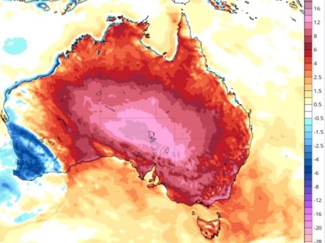
Winter records could be obliterated over coming days as a winter heatwave blasts Queensland, sending temperatures soaring towards 40C – up to 15C above average.

QLD weather news
Don't miss out on the headlines from QLD weather news. Followed categories will be added to My News.
Temperatures could soar to 37C in southwest Queensland this weekend while Brisbane is set to reach 32C next week as a winter heatwave blasts the state.
The southeast is already feeling the effects of the summer-like conditions with Thursday’s overnight minimum of 17C in Brisbane 6C about the August average.
Birdsville and Bedourie are forecast to reach 37C between Friday and Sunday, falling just short of the state’s winter record which currently stands at 38.5C from Bedourie on August 29, 2009.

Brisbane is forecast to reach 30C on Monday, Tuesday and Wednesday, before climbing to 32C on Thursday, while Gatton and Ipswich could get to 33C on Monday.
“The next seven days look well above average for Brisbane and much of Queensland and indeed most of Australia, really,” Bureau of Meteorology’s Harry Clark said.
“In Brisbane, 23C is the average maximum in August. So we’re sitting about 7C above average here.
“Quite significant but not quite record-breaking – the record in August sits back in 2009 where we got to 35.4C in Brisbane that year.”
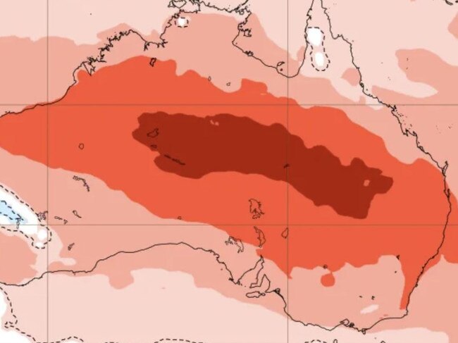
Mr Clark warned that Queensland could be in for a scorching summer based on the latest climate outlook.
“ (There is) certainly a strong signal for above-average maximum temperatures over the next few months,” the senior meteorologist said.
“A lot of the oceans have a lot of heat in them at the moment, and that heat is translating onto land.”
Mr Clark said southwest Queensland communities were experiencing the biggest anomalies in temperature.
“By the time we’re in Saturday and Sunday, parts of southwestern Queensland will be 10C-14C above average. It’s a huge anomaly,” he said.
Meanwhile, much of eastern Queensland has experienced isolated fog for much of this week, with southeast and central areas most affected.
“This morning was quite foggy in Rockhampton, Gladstone, Bundaberg, and Hervey Bay,” Mr Clark said.
“It has been a little bit in Brisbane and Ipswich – certainly the last few mornings have seen repeated foggy starts.
“And the reason for that is the same reason for the heat.
“So basically, we’ve had these northerly winds that have been dragging down the warm air from the north and have also been dragging down a bit of moisture from the Coral Sea.
“We get those northerly winds during the day that pump a lot of moisture into the air, and then we get the clear skies overnight, and the cooling down turns into fog.
“Until we see the winds change, we’ll continue to see foggy mornings.
“It probably won’t be as foggy (in Brisbane) tomorrow, but for other parts of eastern Queensland, certainly another foggy morning tomorrow.”


