
Brisbane weather: Severe storm warning issued
SEVERE storms brought heavy rainfalls and fierce winds to several southeast Queensland centres on Sunday night.
QLD weather news
Don't miss out on the headlines from QLD weather news. Followed categories will be added to My News.
SEVERE storms brought heavy rainfalls and fierce winds to several southeast Queensland centres on Sunday night.
A thunderstorm warning for the southeast was cancelled about 8.13pm.
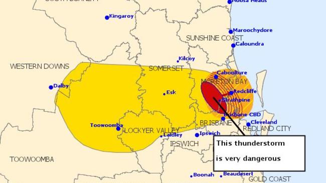
Earlier the slow-moving storms moved from west of Brisbane into northside suburbs and then Sunshine Coast regions, bringing with them torrential rains.
The weather bureau reports 99mm of rain was recorded at Mt Mee in one hour.
WEST BRACING FOR FLOODS
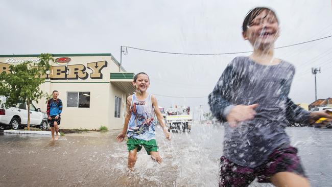
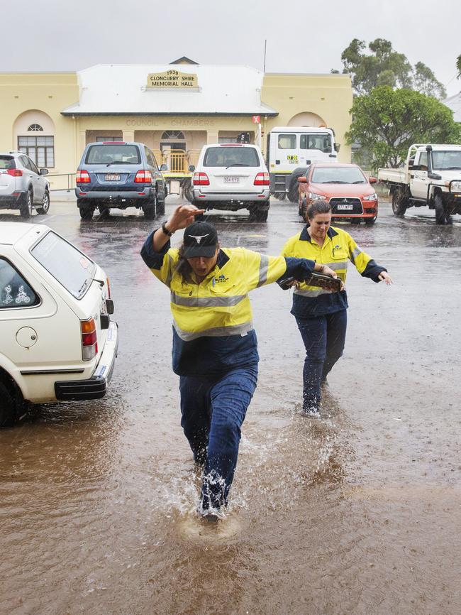
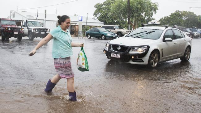
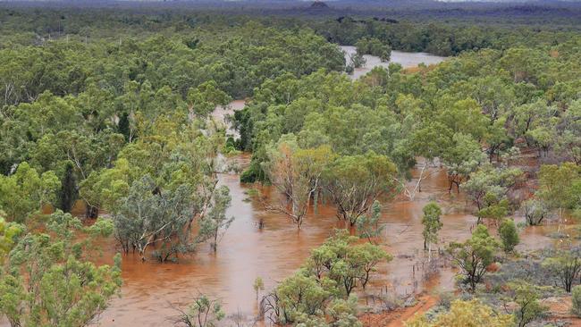
RESCUE crews are being deployed around the state as concern about flooding rises.
The low pressure system, which caused last week’s flooding in Townsville, is now hovering over the state’s north-west and Fire and Rescue swift water rescue crews, as well as SES flood boat crews, are being deployed.
Fire and Emergency Services Minister Craig Crawford said a Queensland Fire and Emergency Services (QFES) swift water rescue crew (four people) had been deployed to Winton, and a second crew (four people) to Longreach.
Mr Crawford said an SES flood boat (four in crew, and an Operational Capability Officer) had been also sent to Winton, and a second boat (six in crew with SES Controller) to Longreach.
“QFES is working closely with other agencies, including local governments, to ensure local personnel are ready to respond to the severe weather forecast in
parts of inland Queensland,’’ Mr Crawford said.
“Additional QFES crews have been deployed to the affected areas to bolster the response capability.
“There has already been heavy rainfall in some areas, and with predictions of isolated falls of up to 300mm, QFES personnel are monitoring the situation
closely.
“Certainly, this rain is welcome and while there has been no major impact at this stage, plans and personnel are in pace to support local communities if
required.’’
Queensland Fire and Emergency Services advises that people should:
* Move your car under cover or away from trees.
* Secure loose outdoor items.
* Seek shelter, preferably indoors and never under trees.
* Beware of fallen trees and powerlines.
* Keep clear of creeks and storm drains.
ends.
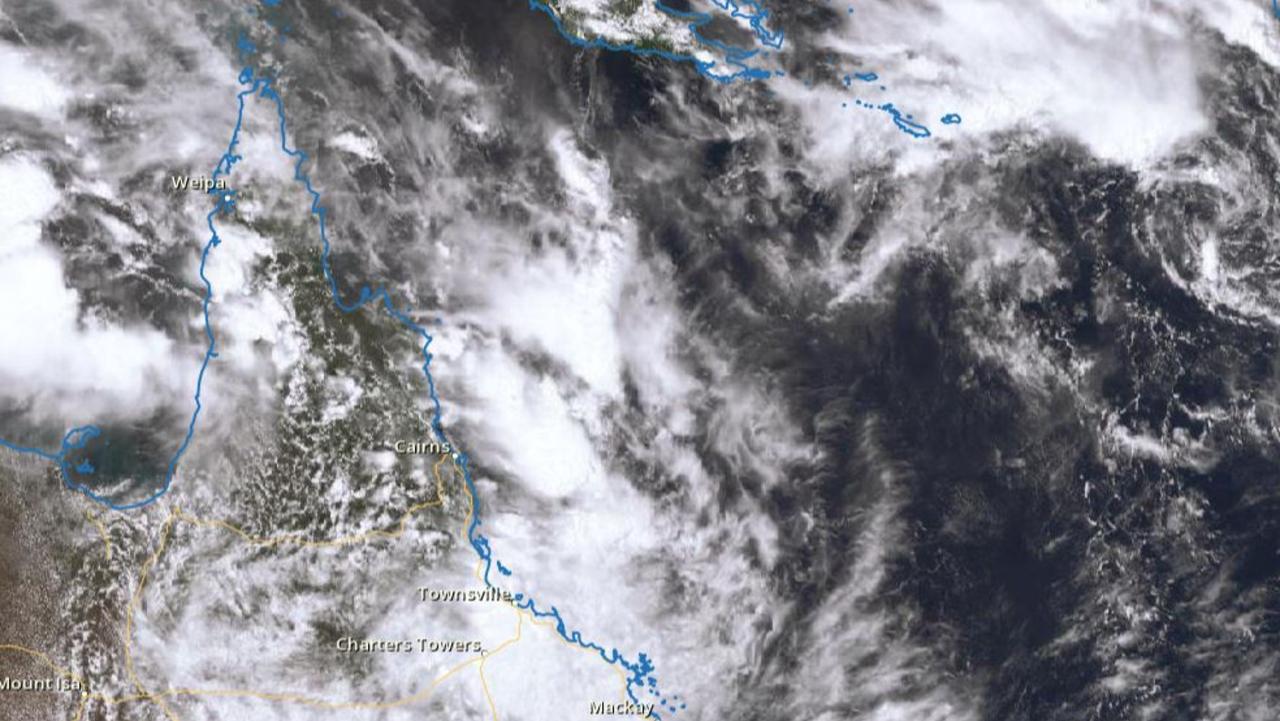
WHAT’S BEHIND ALL THE RAIN?
The low pressure system was 180km southeast of Mount Isa at noon and expected to move northward this afternoon.
Southeast Queensland, including Brisbane, the Gold Coast and the Sunshine Coast hinterland, can also expect rain on Sunday afternoon, courtesy of that moist air mass extending across much of the state.
A spokesman from the Bureau of Meteorology said the low pressure system which has brought flooding rain to North Queensland in recent days was about 50km southeast of the Monument Airport near Mount Isa at noon.
“It is currently moving eastwards and we are expecting it to move north this afternoon, meaning areas such as Cloncurry could be receiving more rainfall,’’ the spokesman said.
The highest falls are expected around Brighton Downs, a 420,000ha cattle station near Winton forecast to receive around 90mm over a six-hour period.
But the BOM spokesman said the system carried with it the potential for heavier falls reaching up to 300mm over 24 hours.
In areas further south, graziers around the town of Barcaldine might have reason to smile after 38mm of rain was recorded since 9am, while Isisford in the Longreach region received 27mm in the same period.
However, Longreach itself, which has struggled with drought for much of the past decade, received just 0.2mm.
The state’s southeast remain on track to experience some unsettled weather this afternoon as the moist air mass brings storms to the area.
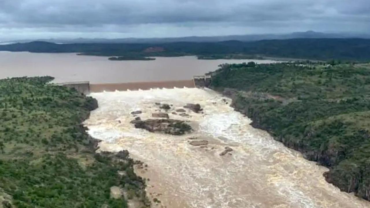
Search for man missing in flood waters as NQ faces another 300mm monster
A search and rescue mission is underway in NQ for a man who drove into flood waters while the region braces for an active monsoon trough expected to dump falls of up to 300mm.
New emergency alert as Far North braces for second coming of biblical flood
A second deluge of up to 300mm is set to pound Far North Queensland, with flood warnings for half a dozen rivers and more than 140mm of rain recorded overnight in some parts.