
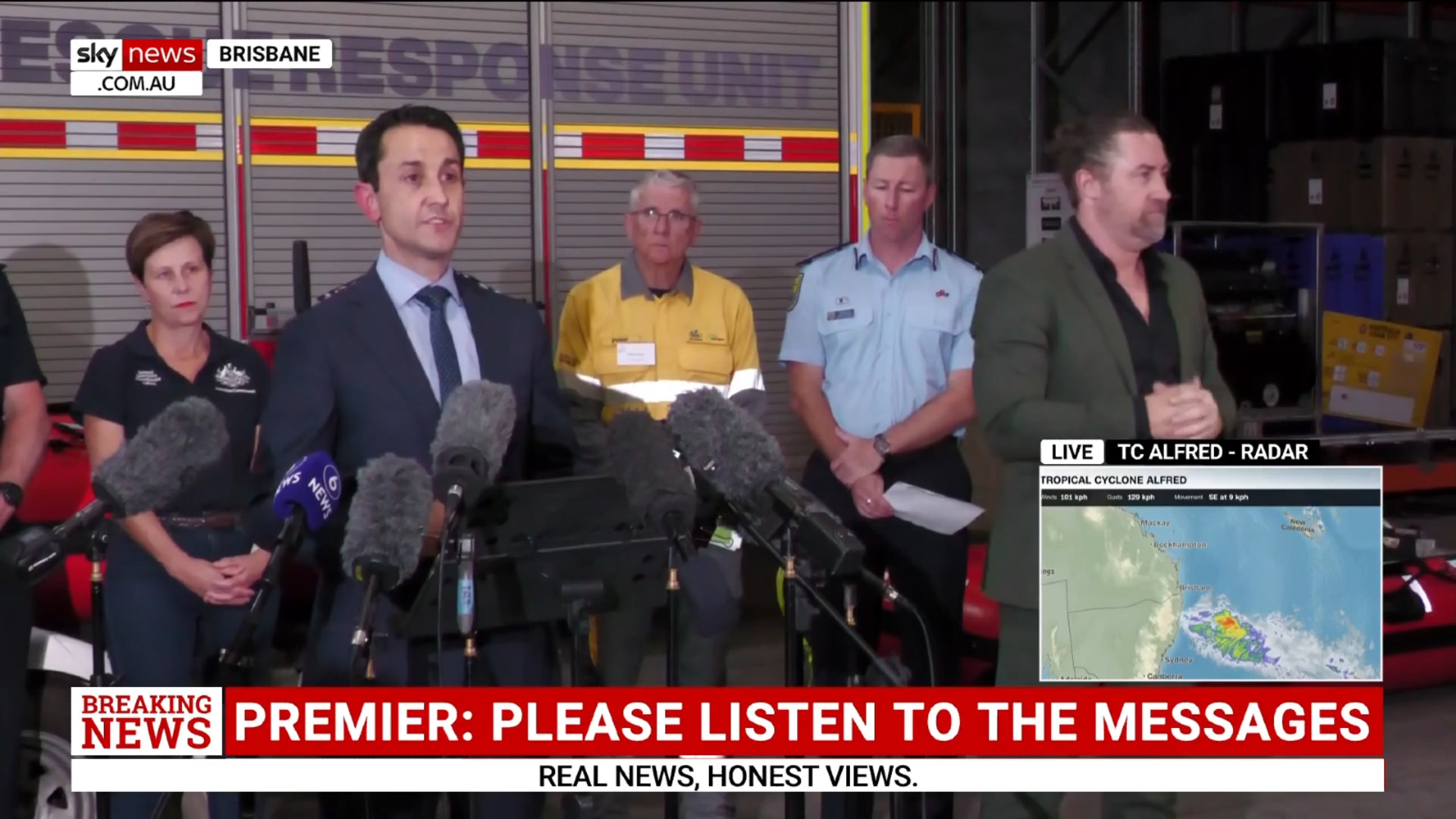
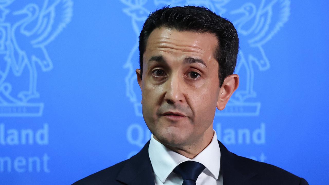
Queensland Premier’s, Bureau’s Cyclone Alfred update in full
Premier David Crisafulli joined the Bureau of Meteorology, emergency services and service providers to update Queenslanders on Tropical Cyclone Alfred. Here’s what was said word for word.
QLD weather news
Don't miss out on the headlines from QLD weather news. Followed categories will be added to My News.
Premier David Crisafulli joined Bureau of Meteorology meteorologist Sue Oates and emergency services and service providers to give an update on Tropical Cyclone Alfred on Tuesday.
Here’s what was said:
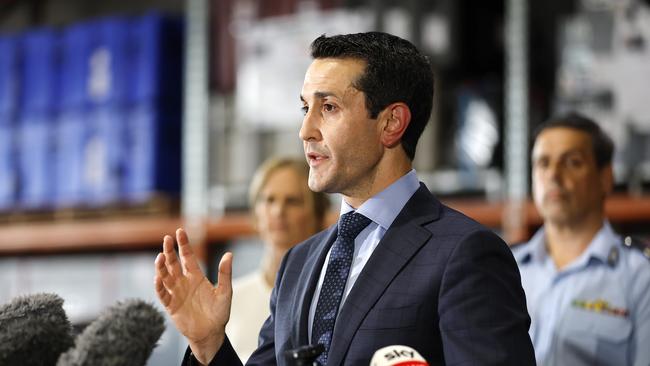
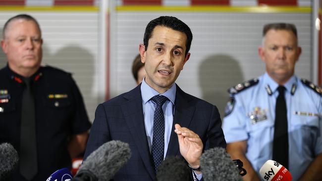
David Crisafulli
Hi everybody, in the coming hours, the cyclone watch for South East Queensland is expected to become a cyclone warning.
So what we are advising to Queenslanders today and a largely populated area of Queensland.
It’s very important information and I want Queenslanders to know that we are prepared, and today we’re joined by strong support to show how seriously we are taking this.
The models do vary on a number of things in terms of when and exactly where, but the system has intensified to a category two overnight, and all of the modelling at the moment from the Bureau of Meteorology does show it taking a turn back into the coast overnight and continuing to cross the coast.
The area of interest has narrowed, as we said yesterday, it would, and it’s now just north of Noosa to just south of the border, so a largely populated area.
And we’re asking Queensland to stay on their guard.
Flood Watch remains from the Mary River through all those catchments all the way down to the border and beyond.
The overnight modelling shows that the cyclone has firmed, and all of the information does show that this is something we need to take seriously.
We are prepared. We’re asking Queenslanders to do the same. It is a really rare event for South East Queensland, but it is serious and it is happening, and we want Queenslanders to be prepared.
We are, and we want Queenslanders to know we’ll get through this if you do the preparation and the little things that you do now make a big difference at the back end of the system in whatever that looks like, wherever it crosses at whatever intensity.
We’re asking a large part of the population in a pretty big area, in a large population, to be ready.
And it’s important that you do the little things and at work, cross the back fence, talk to your neighbours, there is still an element of the population that hasn’t yet fully understood the magnitude of this system, and that’s completely understandable because it’s been many decades since Queensland has been here in this part of the state.
But one thing I know about Queenslanders is they handle disasters better than anywhere else, and we’ve proven that time and time again.
And I know people in the south east may not have experienced a cyclone before, but they’ve been tested with floods, and they’ve come through with flying colours every time.
And whilst this is a different kind of event, the preparations you put in place make a world of difference.
And you’ve proven before that you can do it, and I’m sure that you will again, there are three stages of the expected weather event.
The first is big surf and significant erosion. The second are those damaging winds, and in many cases, destructive winds.
And the third is significant rain flooding and the potential for a dangerous storm surge.
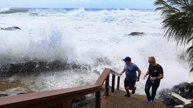
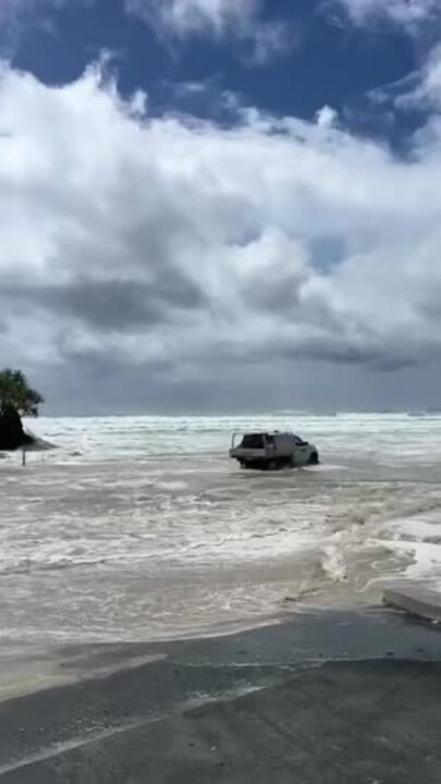
We are well and truly in the first phase right now. Overnight, we had a reading of a wave over seven metres off North Stradbroke Island.
So that should give you an indication that this is a serious system, and those reports will continue.
I’ve spoken about the breakthrough of the Pumicestone Passage through the northern part of Bribie and the impact on Caloundra, the Deputy Premier is actually there on the ground at the moment, and we want the residents of that area to also heed the warnings and take it seriously, particularly those islands.
They will be the first Queenslanders to experience this event in the days ahead.
So we’re asking a few things, people who live on those islands, people who might live on house boats, please absorb the message.
Make a decision about your welfare and do everything you can to stay connected.
Passenger ferry services will cease today. There is a staged approach for vehicle barges.
But one thing’s for certain, the window to make a decision if you live on those islands, is closing really quickly.
Once you make the decision to go or to stay, we will support you, but you’ve got to make the decision, and you have to plan for that, and you have to make sure that you’ve got all of those logistics in place, and we will support you in that.
We’ve used that window to get ready, so we’ve pre-deployed generators to those Island areas. We’ve put some state government staff on those islands, for example, extra health staff.
So I want you to know we’re taking this seriously, and we’re asking Queenslanders to do the same.
A number of evacuations are occurring for those islands for vulnerable people.
So door knocking is taking place at the moment, and that information will be led by councils. We’ll certainly be supporting them in there.
I have a message for people in low lying coastal areas, so that’s everything from people who might be on a canal in a low lying area, someone on a waterfront.
Areas that have you have seen before that have been impacted by storm surges.
One of our major focuses is asking people to prepare on that coastal fringe.
Modelling works continuing, we’re doing a lot of work with the local governments to do that, but there’s no doubt that there is a potential impact that comes with a storm surge.
I want to explain what that risk is, and explain to Queenslanders what that means and why modelling in the days ahead is so important, and why it’s so important to stay connected. Ultimately, the severity of the system, when it crosses and where it crosses are all really important factors.
If it is to cross at high tide, it makes it a far more challenging prospect.
So the modelling that councils are doing at the moment is to factor in a storm surge over and above what that high tide is now, as the system gets closer, that will be communicated, and councils will lead that, as I said, will assist if extra horsepower is needed on the ground that’ll be led by councils to communicate to their residents.
They’ll do the modelling. But if somebody knocks on your door in the days ahead and explains the kind of area that you’re in and what is expected.
Please listen to their advice. Likewise, as information is made available, I’ll go through those websites in a moment. But as information is made available, council will provide those maps as well, and you will see what is predicted in terms of that storm surge, if it was to occur over and above that high tide.
So most people are familiar in their local area what that means, but we’ll articulate that as well.
We’re continuing to direct emergency services to provide any assistance that is available. Today, you’re going to hear from the acting commissioner, the chief officer from the SES, the chief officer for Marine Rescue Queensland, the Commissioner of the Queensland Fire Department, Peter Scott from Energex, we are taking this seriously.
We are preparing the SES as well as the Commissioner, will speak about sandbagging and how we’re working and helping with local government.
But I want to give a couple examples about how seriously we’re taking this but also why I’m so proud to be a Queenslander.
I just met a couple of people, people like Jack, who I met in Ingham, people like Bryce, who I saw at the airport in Townsville.
It was only a few days ago that they were helping mates at the other end of the state. Now they’re back in there.
We’ll see staff from an array of state government and community groups come from the other end of the state to help South East Queenslanders, and that tells you everything you need to know.
It tells you everything you need to know about the kind of people that go into these organisations, but also the challenge that lies ahead. There are 463 police recruits who are going to get a first taste of helping their community.
They’re going to be out and about helping with some of the door knocking activity in the days ahead as well.
I’m going to turn to telecommunications, power, utilities, the important things that people will see in the days ahead.
There’s been an assessment done of all major transmission sites right up and down the coast. Generators have been fuelled. Pumps are ready to go. We’ve pre positioned a lot of those assets.
Energex also have a number of extra generators, those capacities, we’re working with councils to determine where else they can be, pre positioned. I mentioned yesterday about a dozen of them being put onto the islands, but there’s a number of communities that, as we model this close up, we’ll look to pre position those generators,
But there is a quite an element of those as well.
Schools will be open tomorrow, and tomorrow we’ll be back to articulate to people what that will look like for Thursday, but tomorrow, schools are open.
Now turning to transport. The Port of Brisbane is now closed to freight. The airport, all of the airports are working together, they have set procedures based on wind, velocity, and they’ll be communicating that directly to people.
So passengers considering changing their flight. They should go directly to their airline. I’m told that the airlines will also be reaching out to some of those passengers.
That’s handled by them. That’s their call. They have the procedures in place that they follow, and it’s important that people do all they can to stay connected.
Likewise, with some of the other public transport. We’ll be talking a little bit more about that in the days ahead, but there are guidelines that they will follow in that regard,
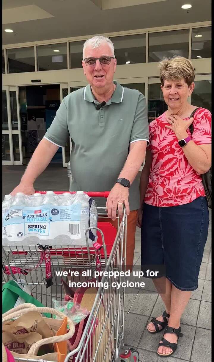
I want to turn to food, because I know that supermarket supply is something that is front and centre.
Today, I can announce that we have amended regulations to allow resupply in 21 local government areas to be conducted 24/7, that’s never happened before in a disaster.
I want to thank the Deputy Premier, I mentioned to you yesterday that he’s been leading in.
He has spoken directly with the supermarkets. And as I said, the connectivity issue that we experienced in North and Far North Queensland, where there was no way of getting through the Bruce and we had to look at aerial routes. That’s not an issue here.
There’s access north and south. And by lifting those restrictions, it’ll be two weeks from tonight.
By lifting those restrictions, it will enable more supply to get there. And then it’s up to the supermarkets to continue to do all they can to meet the demand, meet the resupply and have adequate staffing to do so.
I just want to touch quickly on some of the homelessness issues, I want to thank the Department of Housing with their critical response teams working together with councils, but also the service providers on the ground.
There are a number of community organisations who do a world of good work here.
We’re going to do all we can to offer that immediate assistance to those people who accept those offers, and that offer will be made and will be made multiple times as well anyone needing help. We do have a 24/7 homeless hotline. 1-800-474-753 turning to dams.
We are continuing to get briefings from SEQ water. I’ve just spoken to the minister this morning, as well as moments ago, the minister has instructed SEQ water to make a public statement so that Queenslanders can see the timings and the strategy behind those releases.
And I’m told that is happening this afternoon in about an hour’s time, I want to look back to the websites that I mentioned yesterday.
So disaster.qld.gov.au that will be all of the information as it’s happening. As we get it, we’ll be sharing it on those platforms.
For example, there’s information like sandbagging locations on there. There’s the local disaster dashboard.
If this is the first time that you have prepared for an event, you might be new to Queensland, or it might be the first time that you have had this kind of lead time to get ready.
We’ve got a website which is get ready, and it’s important that you look on, look on that website to get that information and there’s a lot of helpful hints there about the things that you should consider doing before an event, and starts with doing the little things around your house.
That’s the difference between a flood and a potential cyclone. With a cyclone there is that added complexity with the wind system and loose items in the yard, things that can really provide challenges. Overhanging branches can then mean the difference between your home being breached.
Now, obviously the flooding that comes after a system, particularly on the southern end, is very, very, very difficult, and in fact, in many cases, it can be the biggest complexity for us to handle,
That is the difference, and if people do those little things around their house, it’s very important.
Finally, my final message, this is a very rare event for South East Queensland, but it’s not unprecedented, and we are asking you to take it seriously. I want you to know we are and I have every faith that we’ll get through it, and I want to thank Queenslanders for the way they have responded in getting ready today.
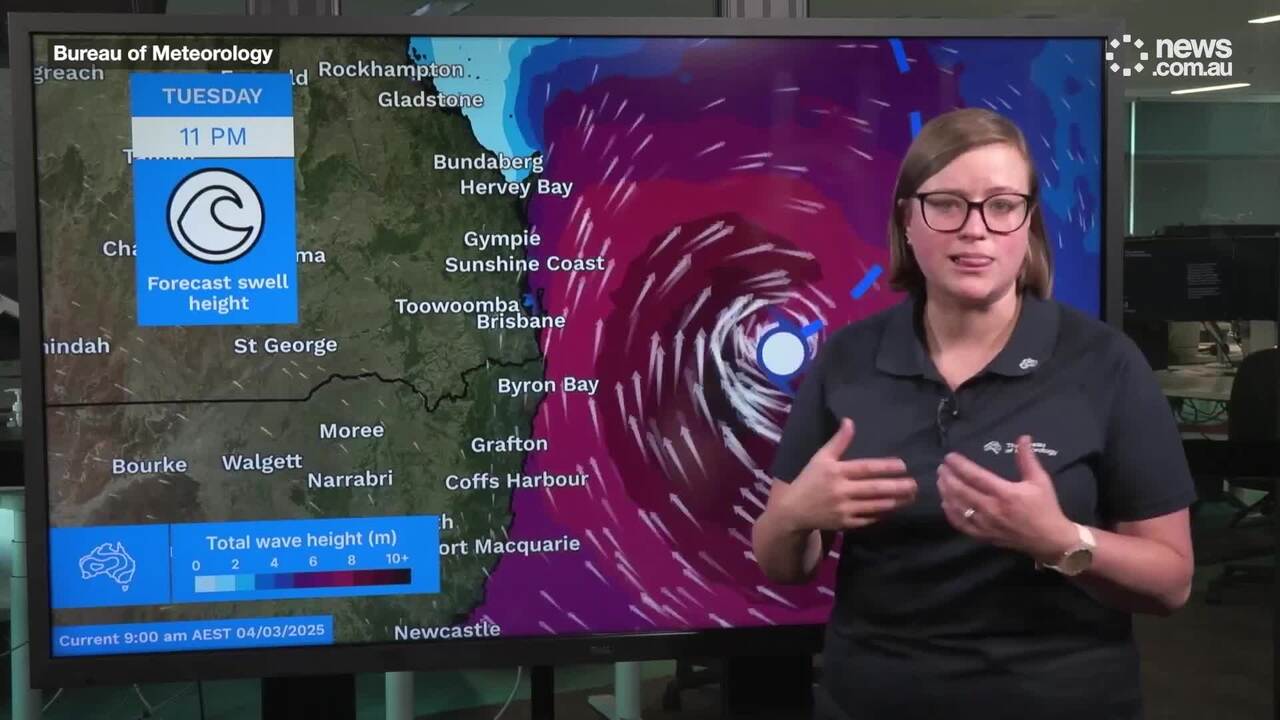
Bureau of Meteorology meteorologist Sue Oates
Thank you, Premier, and good afternoon, as you’ve just heard from the Premier, South East Queensland is under tropical cyclone watch.
That is, we have a tropical cyclone watch from Sandy Cape to the Queensland, New South Wales border, and we’re going to take you through what that means for South East Queenslanders.
But let’s first understand what Alfred has done in the last 24 hours and where it’s located.
Currently tropical cyclone Alfred is a category two system, so it has re-intensified to the category two overnight.
It’s currently located 600 kilometers to the east of Brisbane, and still continuing to move somewhat slowly away from the coast.
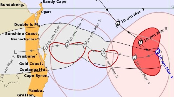
However, this should change in the next 24 hours, and we will start to see tropical cyclone Alfred stall and then turn on a westward track towards South East Queensland coast.
So what does this mean in regards to impacts on the coast?
And I’m going to talk you through each of those hazards that we can expect in the next couple of days.
So firstly, in regards to the winds, with the category two system, we can expect destructive winds, and that is winds in excess of 95 kilometers an hour, mean wind and gusting up and above 130 kilometers an hour, the mean winds will be confined close to the system centre.
So not everywhere in South East Queensland will receive destructive winds, and they will be confined close to the system centre.
Now where that system centre is, there is still a broad area of uncertainty, but within the region from Sandy Cape through to the Queensland border, so we need to maintain an awareness of what the current warnings are telling us, in regards to winds, though, and why we are heading into a tropical cyclone warning this afternoon is because we are expecting gale force winds with gusts in excess of 90 kilometers an hour on our exposed coastal areas by later Wednesday.
So that’s within the 24 hour period. So later Wednesday, those gusts appearing on the coast, as the system moves closer towards the coast, and at this time, looks to be approaching the coast late Thursday into early Friday morning, those winds will continue to increase to, as I said, within the tropical cyclone centre destructive force winds.
Let’s move on to what’s happening in regards to the coastal impacts. So we’ve seen since late last week and into the weekend, tropical cyclone Alfred generating large swells and bringing powerful waves onto the Queensland coast, and this is causing wide areas of erosion and inundation, flood inundation in some coastal areas.
These conditions will continue, and as Cyclone Alfred tracks further towards the Queensland coast, these waves are likely to be significantly higher than what we’re currently seeing.
The highest recorded wave we’ve had to this point is seven metres off the southern Queensland coast.
What adds complexity to this situation is that this is combined with elevated sea levels, so abnormally high tides associated with the low pressure of the tropical cyclone system, where we will see this impact at its greatest is where is on the highest tide for the day, which is in the early morning.
So by tomorrow night, early Thursday morning, we are expecting exceeding some of the highest tides we will see within the year.
Now let’s move on to rainfall.
The system is expected to bring several days of heavy rainfall which will at times, be locally intense.
When do we expect this rainfall to continue to commence? Most likely, later in the day, tomorrow, but only to exposed coastal parts.
And the totals that we could probably expect during Wednesday in a 24 hour period is some isolated totals to 100 millimeters, which does not seem like a lot, but as tropical cyclone Alfred continues to move closer to the coast, that rainfall will move further inland and become more intense, and we’re likely to see daily rainfall totals of around 200 millimeters plus, with isolated totals even higher than that, and up around 400 millimeters is not out of the question. This will continue into Friday, and it looks like at this stage, Saturday will still be significantly wet for South East Queensland.
So if we accumulate those rainfall totals over that three day period, it is highly likely that we will see isolated areas of 700 millimeters or so, as you can imagine, this is likely to cause riverine flooding through South East Queensland.
We currently have a flood watch for areas from the Mary river the Sunshine Coast and Gold Coast rivers and creeks, the Brisbane River catchment and the Logan and Albert River catchments, where we are expecting minor to major flooding over the next couple of days.
I just would like to finish by emphasising this continues to be an evolving situation, and residents of South East Queensland are urged to monitor the warnings and heed the advice of local authorities.
Minister for Emergency Management of Australia Jenny McAllister
I’ll keep my remarks quite brief, as you’ve heard from the Bureau and also from the premier we are in for some difficult days, and I am very conscious that there are communities in South East Queensland and communities in northern New South Wales who know all too well the perils of flood hazards and who will be finding this an anxious time.
My message to those communities is that the Australian government stands ready to work, hand in glove with the government led by Premier Minns and the government led by Premier Crisafulli.
Indeed, we are most grateful for the collaborative way that both of those premiers and their ministerial teams have approached the work that they are doing with us, our agency, the National Emergency Management Agency, is embedded in the operational teams that are responding to this event led by each of the New South Wales and Queensland governments. We are pre deploying our aerial assets so that they will be in place should they be required. And we are working closely with each government to understand the ways that we may be able to support them.
You’ve heard from the premier about the power of work that is underway here in Queensland to prepare and that work is being done by energy workers, by council workers, by water utility workers, by telecommunication workers.
It’s being done by the emergency services personnel, some of whom are with us this morning. It is done by council workers.
And I want to say to all of those people who are out on the front line working to support their communities, thank you.
I want to say this final thing to community. We are getting ready. All of us are getting ready, but we need you to play your part as well.
What that means is understanding your own risk, being in possession of good sources of information.
It means taking the steps that are necessary to prepare yourself, your family and your home for the kinds of events that the Bureau has described just now.
And there is good information online available for people who are getting ready in their own households.
It does mean talking to your neighbours. This is a time to reach out to the people around you who might need that extra little bit of help.
We’ve got time to prepare, and that also means we have time to look out for people who might find this just a little bit more difficult because of their own personal circumstances, and finally, it does mean heeding the advice from authorities.
We’ve got amazing personnel, and they will put themselves at risk during this event. We want you to make their job easier, and that means listening to what they say, observing their advice, and taking every step that you can to keep yourself safe. Thank you.
Queensland Police Acting Commissioner Shane Chelepy
Good afternoon. My priority today is ensuring that our residents and our at risk areas such as our islands, our coastal areas, our low lying areas, decide today if they’re going to stay in place or leave.
And if you do choose to stay in place, to have a plan in place, if you decide to leave, you need to leave before the event starts impacting you.
Go and stay with family and friends. The worst time to make the decision to leave is when we’re in the middle of the event, because it not only puts you at risk, but it puts the emergency services at risk who need to come and assist you.
As we’ve heard, voluntary evacuations already occurring on South Stradbroke island as a precaution, our emergency crews are also door knocking the at risk areas across Sunshine Coast, Moreton and the Brisbane Bay Areas today.
So my message to you is, if someone door knocks your home, please listen to their advice and act accordingly.
Anyone who chooses to stay, please ensure that you have prepared your properties and have a plan in place to prepare you, your family, your neighbours and your friends, to make sure that everyone stays safe during the event.

The Queensland Police have the pre-deployed staff to the islands, because we know those islands will become isolated.
First, as the premier indicated, we have 463 new recruits who are ready from the Academy to assist Queenslanders, and a further 156 sworn police today, and of those numbers, we’ve already pre deployed 255 of those police today to the Sunshine Coast and the Gold Coast to assist with those door knocking activities.
And we’ll have more officers available, more SES officers available to deploy as needed. What we will see over the coming days is heavy and intense rainfall, and that will bring flash flooding to the areas of the Sunshine Coast, greater Brisbane area, Logan and Gold Coast.
We will also see that riverine flooding, but we will see that intense rainfall, where I urge people please, to be prepared and stay out of any areas that are in flash flooding so that our emergency services workers can continue to deploy to the areas that are needed most residents need to know their flood risk and make the necessary preparations.
Now, you’ve still got time. You’ve still got time to secure those loose items around your home, to clear your gutters, to make sure your valuables, your important documents, your family heirlooms, your photos are in a box that you can take with you.
You’ve still got time to stock up on those perishable items, to enact your emergency plan for yourself and your home.
And really importantly, you’ve got time to have this conversation with your family, your friends, your neighbours, those are in your street that you might know is vulnerable, and by working together, we can make it easy for everyone.
I just want to talk about sandbags and how we’re supporting local government with sandbags. So right now, we have more than 100,000 sandbags across South East Queensland ready to be distributed to support our local government at their sandbagging stations, and I have more coming tomorrow.
Today, I’ve engaged with the National Emergency Management Agency and our other federal partners, and we’re arranging for a further 250,000 sandbags that have been requested to arrive within the next 24 hours to restock and continue to support the council with their sandbagging activity.
Right now, there’s a further 134,000 sandbags that we’ve identified that are at Richlands, and a further 200,000 sandbags on order from our suppliers, and we have a further 40,000 sandbags across our South East Queensland areas now that we are providing to councils so that they can have those sandbags available at the sandbag filling stations.
So the reason I speak about those numbers is because my message of the community is this, if you need sandbagging, go through to your councils advertised sandbagging locations.
We are working hard in the background to make sure those sandbags will be available to support Council in those activities, and not only today, but tomorrow and right through the event as this becomes a prolonged flooding event, finally, thank you for the support that we’ve seen so far.
We have seen people heeding our advice. We have seen people filling their cars with fuel, getting those emergency supplies at the shops, and as late as today, I know some areas have deployed police to assist with the traffic management around those areas, and can I just ask to be safe but also respectful to either Queenslanders as you’re going around these preparation activities.
Queensland Fire Department Acting Commissioner Kevin Walsh
I’m here to share the information - that the plans within the Queensland Fire Department are very well advanced, and our plans include requesting a lot of resources from North Queensland.
Ironically, we normally send resources up to North Queensland when they experience this type of event, but our good colleagues are sending lots of logistical resources and also people who will be able to assist.
So we’ve got a semi trailer coming down from Cairns stocked with motorised rescue equipment that you see here behind me.
We’ve also got a large cohort of fine rescue swift water technicians who will be arriving sometime today and also tomorrow. So we will have lots of swift water technicians strategically from Maryborough right through to the boarder. In the event someone is trapped in this event.
Out planning also includes what it means to the Queensland Fire Department in terms of recovery, and already we’ve got recovery plans in place and how our Rural Fire Service can also assist with that.
Our operational centres are already coordinating resources at our major centres at Brisbane, Toowoomba and also we are receiving logistics as of this afternoon.
Can I just leave you with a message. I know that many Queenslanders have heard the warning about, if it’s flooded, forget it, and that’s still relevant today, as it is when it was first released, but we still get people on the roads, even though they plan and do their research, who get caught and in addition to people on the roads, we also experience young people who see flooded causeways and creeks and see this enticing environment or what they believe is an enticing environment and a bit of fun.
These areas where there is swift water, where there’s moving water, are not safe, and it’s very important, either from a vehicle perspective or for young people with a sense of adventure, that they stay out of these areas of water.
But if anyone is caught in these unaware and caught in these types of situations, please call triple zero as a matter of urgency, and we’ll have resources to as a matter of urgent response.
SES Chief Officer Mark Armstrong
Good afternoon. The Queensland SES continues its preparations for a major weather event. We’re moving people, equipment and resources to areas where we think they’ll be needed. That includes 70 volunteers will be arriving from other parts of the state from tomorrow, and that particularly got specialist skills like flood boat operation, storm damage repair, working in heights.
We’re expecting will be needed in significant quantities over the coming days, we are supporting local government with the sandbagging operations.
So local government is providing the sand, the location.
We are working with them to provide more empty sandbags. And as the acting commissioner said, we’ve got a large number available now that will be distributing to local government, and also several 100,000 arriving over the over the coming days.
The State Emergency Service whilst we’re moving people around now, we’re already being tasked, and yesterday, we saw a significant uplift in tasks.
In the last 24 hours, there’s been over 800 requests for assistance from the SES, which was up from 70 in the previous 24 hour period.
So that’s good that the message is getting through. If you need help, particularly vulnerable people, ask early, ask now, before the rain starts falling and the wind starts blowing, and our SES resources, we want to focus on the people in need, as well as supporting individuals and local governments in their in their preparation,
An important number for requesting SES assistance is 132 500 to request SES assistance, or you can download the Queensland SES app the from the app stores to also request assistance, To give you that points of connection for SES.
We commend Queenslanders that are taking action to prepare, there was well over 100,000 probably more like 150,000 sandbags issued around by local government around the region yesterday, and we’re working hard to make sure that we can replenish resupply and keep those supply available as people continue their preparations.
Marine Rescue Queensland Chief Officer Tony Wulff
The next 48 hours is critical for maritime support in South East Queensland, the Citycat services have ceased operations so those vessels can be stored safely.
Ferries and barges in Moreton Bay will start to cease services over the next 24 hours.
Please monitor their websites for up to date live information. Marine Rescue Services will continue to be operational, and while it is safe to do so.
Vulnerable members of the community that need medical transport or disability support, please reach out early.
We urge you to make your decision and leave in the next 24 hours, we are here to support you with specialised transport vessels on the bay and in the Broadwater, to members of the public that live on vessels.
Please make your decisions about what you want to do. Make sure you stay safe and you assess the risk appropriately.
If your life is in danger, call triple zero. If you need maritime support, call 131MRQ.
To all the boaties in South East Queensland.
Stay at home, secure your vessels, look after each other and make sure you stay safe and prepared for the cyclone to come.
Energex QLD Chief Executive Peter Scott
We’ve currently got 1000 Energex field staff and all their resources ready to deploy into this event over the coming days, we’ll only do so when it’s safe to do so.
We’ve also forward deployed Ergon staff into the outskirts of SEQ to be able to roll them into the state and corner the state as we require.
And we have suitable resources to do so. The other message, I’d like to get out there. If there’s powerlines down, please dial triple O. If you don’t think there’s electricity they still might be so dial to below
QUESTIONS FOR THE BUREAU
Reporter: Obviously tropical cyclones can be unpredictable. How certain are you that it is going to turn west and is there still any likelihood that it could continue going south or back at the sea?
Sue Oates: Based on all the guidance that we have available to us. At the moment, there’s total consensus in that the system will recur in the overnight periods or through Wednesday and make a steady track towards South East Queensland coast and that’s consistent across all the guidance that we’re looking at, which is over probably seven global models.
We’ve had further satellite imagery passover this morning, which was a fantastic piece of data that demonstrated to us what the wind profile looked like around the system, and it absolutely confirms that we’ve got a category two system out there.
Reporter: We’ve had abnormally high tides. How high are those tides?
Sue Oates: Well, when we talk about abnormally high tides, we use the reference point of the highest astronomical tide.
So that’s the highest tidal level that a location can expect. So with the category two system coming in, and based on the best modelling guidance available to us, appreciating that the highest tides. So the highest anomaly on the tide, so that additional layer on the tides will be closer to the city.
At this stage, we’re anticipating at least half a metre above the highest astronomical tide, with slightly higher values around that area of coastal crossing, wherever that might be.
So when I say higher values, they’re looking like up to point eight of metre at this point in time.
You can never be absolutely certain of what a tropical cyclones path is. And still, there’ll be perturbations in the forecast track that we have currently, based on the guidance that we receive several times throughout the day.
The fact that we do have a consensus in the guidance, and that’s across, as I said, a number of pieces of guidance.
When you have consensus, your certainty increases. So we’re dealing with high certainty with this system.
Reporter: What is the likelihood based on projection that the cyclone can cross higher than a category two.
Sue Oates: At this stage we’re anticipating, and we’re forecasting a category two system to cross the coast, appreciating you can’t rule out a more intense system, but the risk of that is very low.
We’re not seeing that in our modelling and based on the current structure that we have identified through this morning, with this additional piece of information, it would have a significantly long way to go in its development to get to a category three.
So at this stage, we’re forecasting a category two system on the coast.
Reporter: How long is the system expected to cross over?
Sue Oates: The impacts will be felt, as I said home tomorrow afternoon, through to coastal crossing, and how long we get those impacts will depend on when we get that coastal crossing, which at the moment we’re anticipating that that will be later in the day, Thursday, if not Friday morning.
Once the system does cross the coast, in regards to the sea conditions and the wind conditions, they should ease fairly rapidly, but what remains is the rainfall risk, and that will continue for a couple of days.
So we will continue to have a flooding risk right into the weekend,
Reporter: How far south are we expected to see that intense storm?
Sue Oates: The reasoning for the most intense winds and the greater storm surge happening to the southern side of the system, there’s a couple of factors that come into play here.
Firstly, the winds on the southern side of the system are in easterly wind, so they’re an onshore wind, and that’s why the coastal conditions in the sea levels will be higher on the southern side, as opposed to the northern side, where the winds are an offshore wind.
In regards to how far do we expect these damaging winds to extend? Well, currently, the tropical cyclone watch extends down into northern New South Wales, just to the north of Grafton.
So we are expecting those gale force winds to extend that far down the coast.
Now the reasoning for that is because it’s sitting in an environment such that the pressure difference between the centre of the system and the system that’s cradling it below, which is a high pressure system, is the greatest.
So if you look at a weather map, and you see the isobars, where the isobars are the closest together is where you’re going to get the strongest wind.
QUESTIONS FOR PREMIER
Reporter: On the storm surge, when will that occur?
Crisafulli: that councils are working on it. Right now, the local government ministry is speaking with councils. The Acting Commissioner, I got a meeting at 2.30 and so we have got ahead of it, so we’ve got time to communicate that message.
But it’s important that councils model that at different storm surge levels.
So Sue mentioned about what their ceiling is, but it’s important that residents are given visibility of what impact is on an individual property at each level, and if we do that, residents can get ready.
So we’re hopeful that council will continue to refine that data and we have a meeting literally in an hour’s time.
The door knocking will move up a gear, so the moment councils have a more certain barometer of what that looks like, as the system tracks towards the coast, and as the likelihood of that crossing becomes known, councils will increase their effort to give people that information.
Reporter: Will there be a map?
Crisafulli: As saw in Townsville, Council will release the map, but in conjunction with that, there will be door knocking as well, and we’re happy to assist in that regard.
It’s led by councils. It’s their data, it’s their communities, but we’ve got a role to play as well.
That will be dependent on the modelling, and that will be dependent on where the system is and when it crosses.
If the system crosses at high tide, it’s a far more complex situation than if it crosses at low tide.
And an added layer of complexity is high tides in the middle of the night, which is why the work’s got to be done. And what I’m saying to Queenslanders, prepare, because we are certainly preparing for the worst and I’m sure Queenslanders, if you do your bit, we’ll get through
Reporter: How many people are estimated to evacuate?
Crisafulli: Let’s have a look at the data. Let’s continue to see what the data presents and it is important that residents are given the information in a timely way, so we do have time, and it’s important that residents absorb that information and then make an informed decision.
And when somebody’s at your door, listen to them
Reporters: With residents being evacuated or from the islands or being told to leave. Is there any evacuation centres set up?
Crisafulli: Yeah, councils are working through the process, and when they open, those evacuation centres will be communicated.
We’ve already begun discussions with the local government. Now, many of these local government areas have unique and distinct communities across them, so it won’t be enough, for example, to have just one in a large area, that information will flow in the days ahead. That’s not that. It’s not at that stage, at this point, on a wide scale, but I know all councils are considering that as we look at the modelling in the days ahead.
Reporter: It seems unconventional for the minister to advise SEQ to provide a statement? Is that out of frustration of the government?
Crisafulli: It’s important that they communicate with people. So if you have look post flood inquiry, there’s an emergency an EAP put in place, an emergency plan. And coupled with that, is the manual that’s operated by that flood engineer.
So they’ve got a system in place, but they have to explain that to Queenslanders, and if they do that, that’s the best way that people can genuinely see why decisions are being made.
I’m a big believer in that, if you if you give people information, people can make an informed decision.
Reporter: We sometimes see people from SEQ water at these press conferences. Why aren’t they here today?
Crisafulli: They will be addressing you in an hour. They’ll be addressing you and so they should. And I applaud the Minister for making that direction.
Reporter: Referring to the manual, we haven’t had a cyclone in 50 years.
Crisafulli: That manual was adopted in was updated. I think it’s September from memory. What I want is for SEQ water to take Queenslanders into their trust. That’s what we’re doing. And all agencies have systems in place. That’s that’s how it should be.
So in a disaster You can respond. I think I spoke to you before about the airports. They have a system that had a certain wind rating, no more.
So everybody has a system in place. You can refine those systems outside of disaster setting, of course.
But the greatest thing you can do is be upfront with people and communicate your decision on
the water.
Reporter: The new water Minister signed off on that manual in November, and that manual has no pre-emptive Is that correct?
Premier: That manual was signed off in September, the manual I looked at. But to be clear, the most important thing is that post commission of inquiry, there is an EAP and there is a manual, and the person who must make that decision is the flood operation management. It’s no different to the procedure. For example, when it comes to the claims that I mentioned, that’s important.
There is a set figure that it has to be, and it’s in that manual, and the SEQ water will conduct it according to that manual, and that is the fit and proper way to do it.
And coupled with that is the SEQ water has to make that information public.
They have to explain to Queenslanders what percentage is there and when there are releases, and what the trigger points are.
And in the end, that is in the manual, and there is an EAP, and it was signed off prior to the election.
And of course, that as part of any review of the of an event, and those things should be looked at. But the most important thing is, whatever the agency, whatever they’re responding that they have to have, they have to have that system in place.
The EAP was put in place post the commission of inquiry. So the EAP is the document that’s done.
That manual has been signed off almost every year for the better part of 15 years, now that there is determination that have been made, and it’s been in place across governments of all political persuasions, going back to the commission of inquiry.
With respect, you’ll have a chance to talk to SEQ water about it. I’m telling you about the position that’s been in place, and it has been for a long time now, it’s important that SEQ communicate that.
You don’t make decisions on the run. SEQ water have to communicate that, and it’s the flood operations engineer who’ll make that call.
And when you speak to the flood operation engineer, they tell you that they believe that the system they have in place is the right one.
Now that’s their call, and it should be their call, how a future EAP looks.
The EAP has been in place since 2011 since 2011 it’s been
signed off. It’s been the well, there’s an EAP and a manual. So each have been signed off at different times.
I want to be clear about something so the person who is in charge of administering that is the flood operations engineer has to make that call that’s in the manual. And I think that person is the best person placed to do two things, to make the decision and then to explain that decision to Queenslanders, that person is the best person because they are qualified and they are operating on a system that’s been in place across the political divide, and I might suggest, including to the people who are giving the information to journalists about it.
It’s important that politics doesn’t play a part in disasters. That’s why you’ve got a system in place.
And I want Queenslanders to know that those decisions will be made according to the rules have been set in place, but most importantly, they’ll be explained to Queenslanders.
And the minister’s role was to make sure that SEQ water does answer those questions.
Reporter: Have you spoken to the NRL about the Dolphins game on Friday?
Premier: I’ve spoken with the NRL as well as the AFL. We’re giving them information, and like all Queenslanders, we want them to make the call, and we’re giving them the most up to date information.
And I’m mindful that there are moving parts. We’ve got two AFL games and an NRL game. They’re important events for everybody.
We give the information, and we’re asking them to make the call and communicate that directly with their fans.
And we’ll continue to provide information. I spoke with the CEO of the Dolphins and the CEO of the lions again today, and we’ll do it again as more information comes.
Reporter: Have more SES resources been sent to the Gold Coast:
Premier: The complexity of getting messages out to such a large population does bring with it one benefit, and that is, you have a large population that can respond. And ultimately, wherever this crosses, we will see that system and the challenges that are there and predominant to the south. And you’ve got a big family when it comes to emergency services responders, and they will mobilize and they will help the community in need. And you’ve also got a few North Queenslanders coming here to repay the favour.
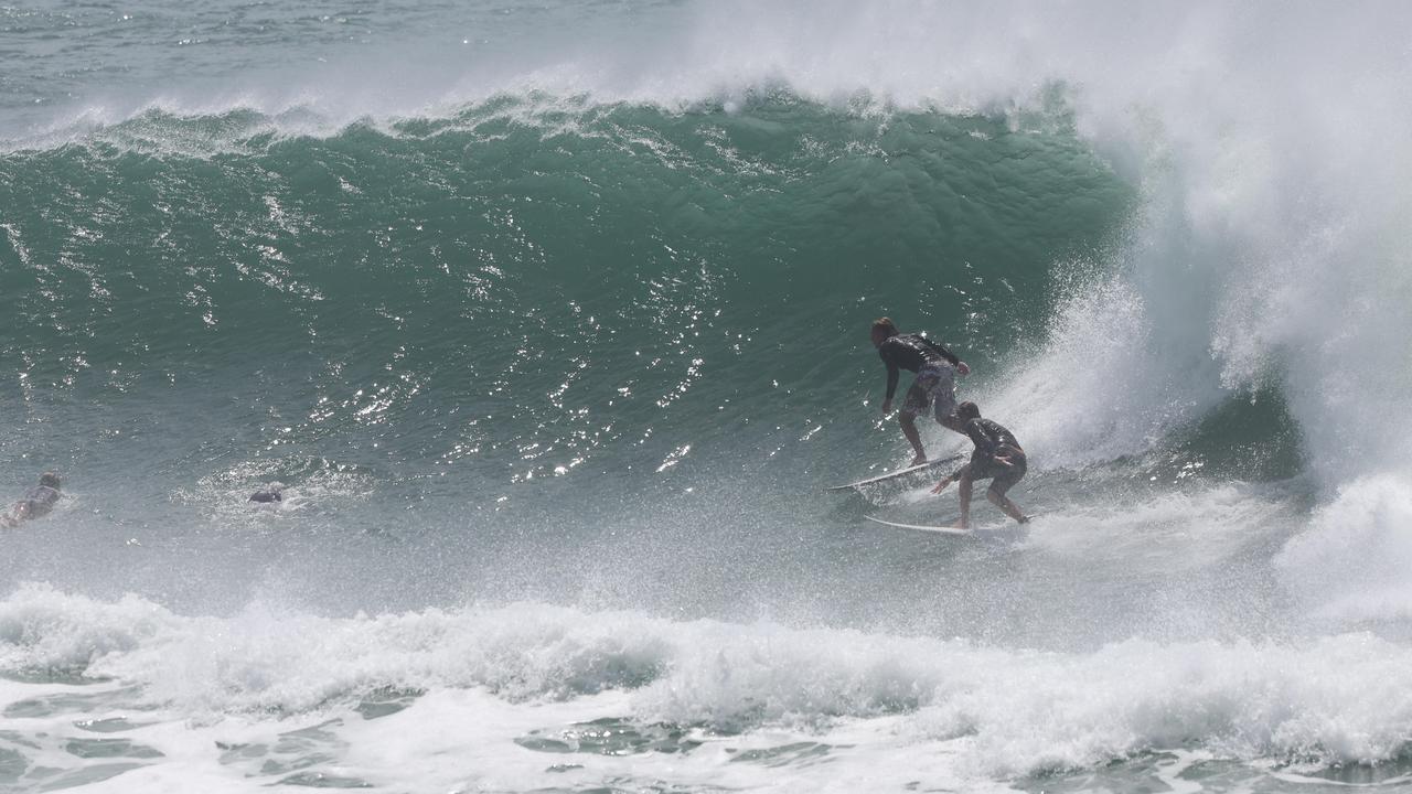
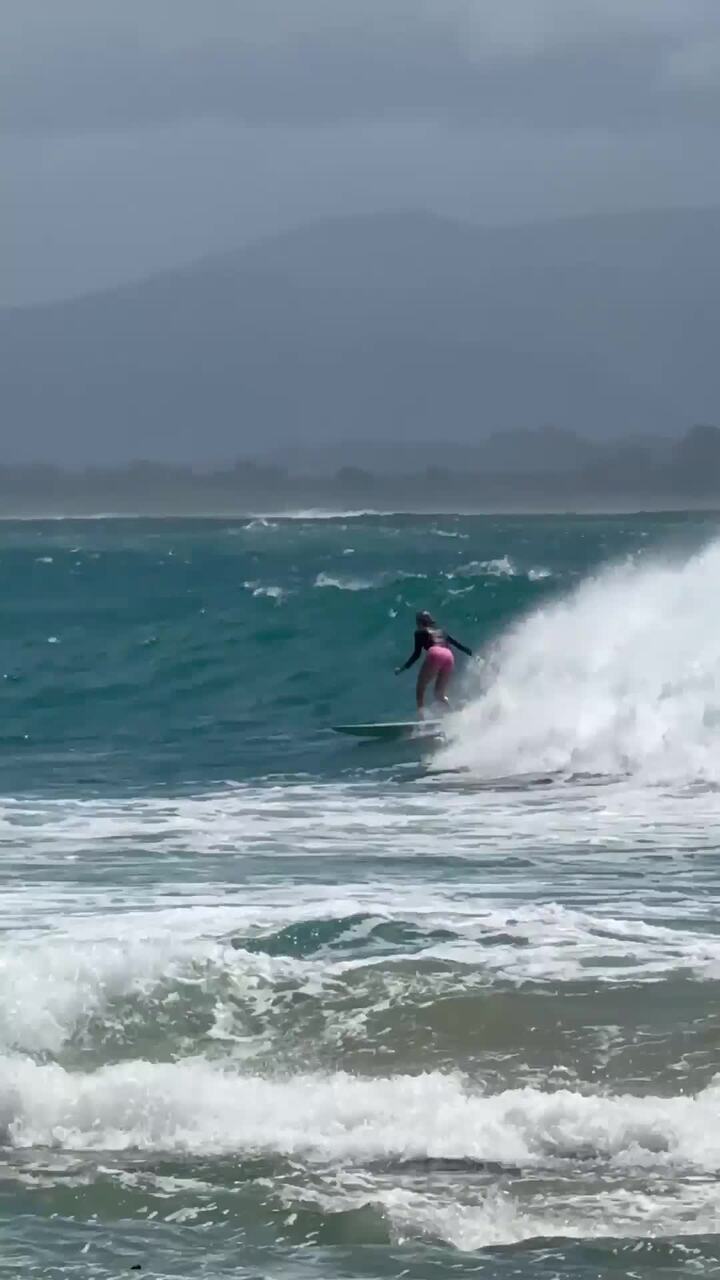
IN PHOTOS: Surfers flood Gold Coast as Alfred supercharges swell
Top surfers from around the country have made a beeline for the Gold Coast’s famed southern breaks as Cyclone Alfred stirs up huge swell.
The 7 key points from Crisafulli’s latest address on cyclone Alfred
David Crisafulli, Anthony Albanese and other have addressed the media 48 hours out from Alfred’s arrival. Here’s everything you need to know.